|
Milner, British Columbia
Milner is a rural village (small town) and locality in the Township of Langley in the Fraser Valley of British Columbia, Canada. It is located along the British Columbia Electric Railway line (now the Southern Railway of B.C.) northeast of the City of Langley and just southwest of Fort Langley. An agricultural hall and fairground were built in Milner in 1918. The village had a stop on the Fraser Valley Branch (New Westminster–Chilliwack) of the British Columbia Electric Railway The British Columbia Electric Railway (BCER) was an historic railway which operated in southwestern British Columbia, Canada. Originally the parent company for, and later a division of, BC Electric Company (now BC Hydro), the BCER assumed cont ... inter-urban line until 1950. Milner Chapel Milner Methodist Church was founded in 1885 and the church was dedicated in April, 1886, as Langley Prairie Methodist Church, but it soon became known as Milner Methodist Church. With church union in 1925, it ... [...More Info...] [...Related Items...] OR: [Wikipedia] [Google] [Baidu] |
Neighbourhood
A neighbourhood (Commonwealth English) or neighborhood (American English) is a geographically localized community within a larger town, city, suburb or rural area, sometimes consisting of a single street and the buildings lining it. Neighbourhoods are often social communities with considerable face-to-face interaction among members. Researchers have not agreed on an exact definition, but the following may serve as a starting point: "Neighbourhood is generally defined spatially as a specific geographic area and functionally as a set of social networks. Neighbourhoods, then, are the Neighbourhood unit, spatial units in which face-to-face social interactions occur—the personal settings and situations where residents seek to realise common values, socialise youth, and maintain effective social control." Preindustrial cities In the words of the urban scholar Lewis Mumford, "Neighborhoods, in some annoying, inchoate fashion exist wherever human beings congregate, in permanent famil ... [...More Info...] [...Related Items...] OR: [Wikipedia] [Google] [Baidu] |
Area Code 604
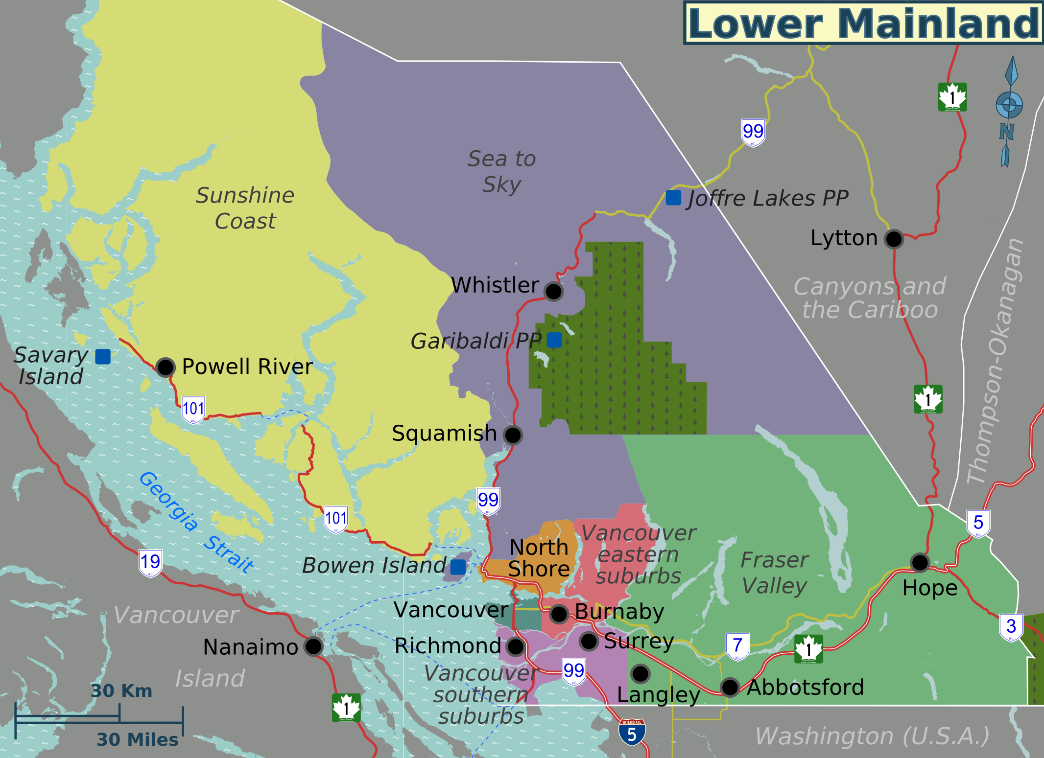
Area code 604 is a telephone area code in the North American Numbering Plan for the southwestern corner of British Columbia, Canada. The numbering plan area comprises Metro Vancouver, the Sunshine Coast (British Columbia), Sunshine Coast, Howe Sound / Sea-to-Sky Corridor, Fraser Valley, and the lower Fraser Canyon regions. The area code is one of the nine original North American area codes assigned to Canada in 1947. The numbering plan area is also served by area codes Area codes 778, 236, 672, and 257, 236, 257, 672, and 778 in an overlay complex that extends to the entire province. History Area code 604 is one of the original 86 area codes assigned in 1947 in the contiguous United States and Canada. It designated the province of British Columbia. 604 also served Point Roberts, Washington, a pene-enclave of the United States until 1968, when the area was reassigned to area code 206; since 1995, it is served by area code 360. Despite British Columbia's growth in the second half ... [...More Info...] [...Related Items...] OR: [Wikipedia] [Google] [Baidu] |
Fort Langley, British Columbia
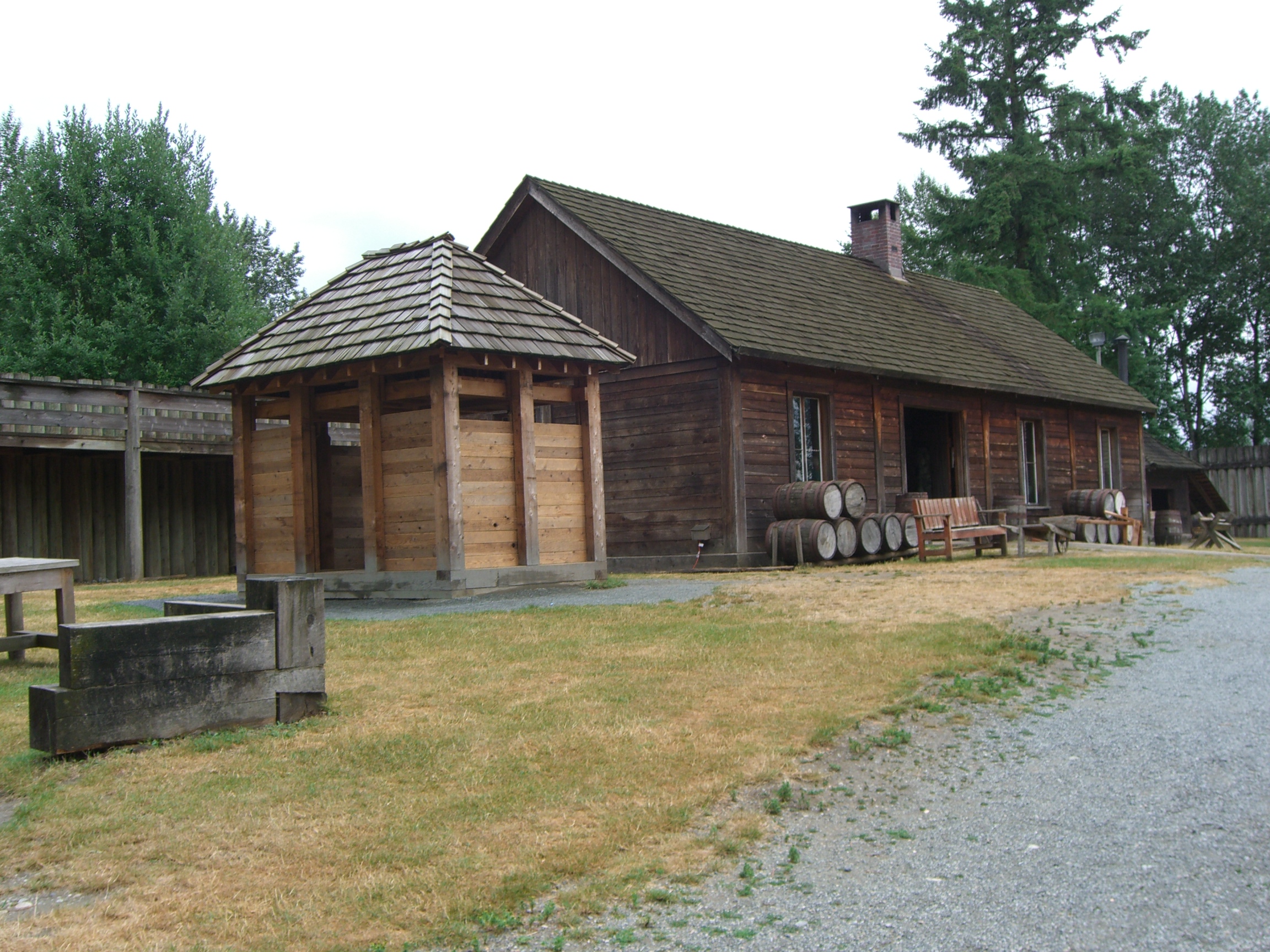
Fort Langley is a village community in Township of Langley, British Columbia, Canada. It has a population of approximately 3,400 people. It is the home of Fort Langley National Historic Site, a former fur trade post of the Hudson's Bay Company. Lying on the Fraser River, Fort Langley is at the northern edge of the Township of Langley. History Fort Langley was named after Thomas Langley, a director with HBC. and dates from a time when the boundary between British and American possession of the trans-mountain west, known as the Columbia District to the British and Oregon Country to Americans, had not yet been decided. Sir George Simpson, Governor of the Hudson's Bay Company, realized that Fort Vancouver opposite of present-day Portland, Oregon might be lost to the Americans if the border did not follow the Columbia River. Fearing the 49th parallel north could become the demarcation line, Simpson ordered the Hudson's Bay Company to construct the original Fort Langley in 1827 at ... [...More Info...] [...Related Items...] OR: [Wikipedia] [Google] [Baidu] |
Langley, British Columbia (city)
The City of Langley, commonly referred to as Langley City, or just Langley, is a municipality in the Metro Vancouver Regional District in British Columbia, Canada. It lies directly east of Surrey, adjacent to the Cloverdale area, and is surrounded elsewhere by the Township of Langley, bordered by its neighbourhoods of Willowbrook to the north, Murrayville to the east, and Brookswood and Fern Ridge to the south. History Early European settlement in the area was known as "Innes Corners" (after homesteader Adam Innes); in 1911, the area became known as "Langley Prairie", part of the Township of Langley a.k.a. Langley Township since 1873. Twentieth-century improvements in transportation access, including the construction of the British Columbia Electric Railway in 1910, Fraser Highway in the 1920s, and Pattullo Bridge in 1937, profoundly impacted the area, transforming it from rural into the main urban and commercial core of the Township. In turn, this birthed the need for upg ... [...More Info...] [...Related Items...] OR: [Wikipedia] [Google] [Baidu] |
Southern Railway Of British Columbia
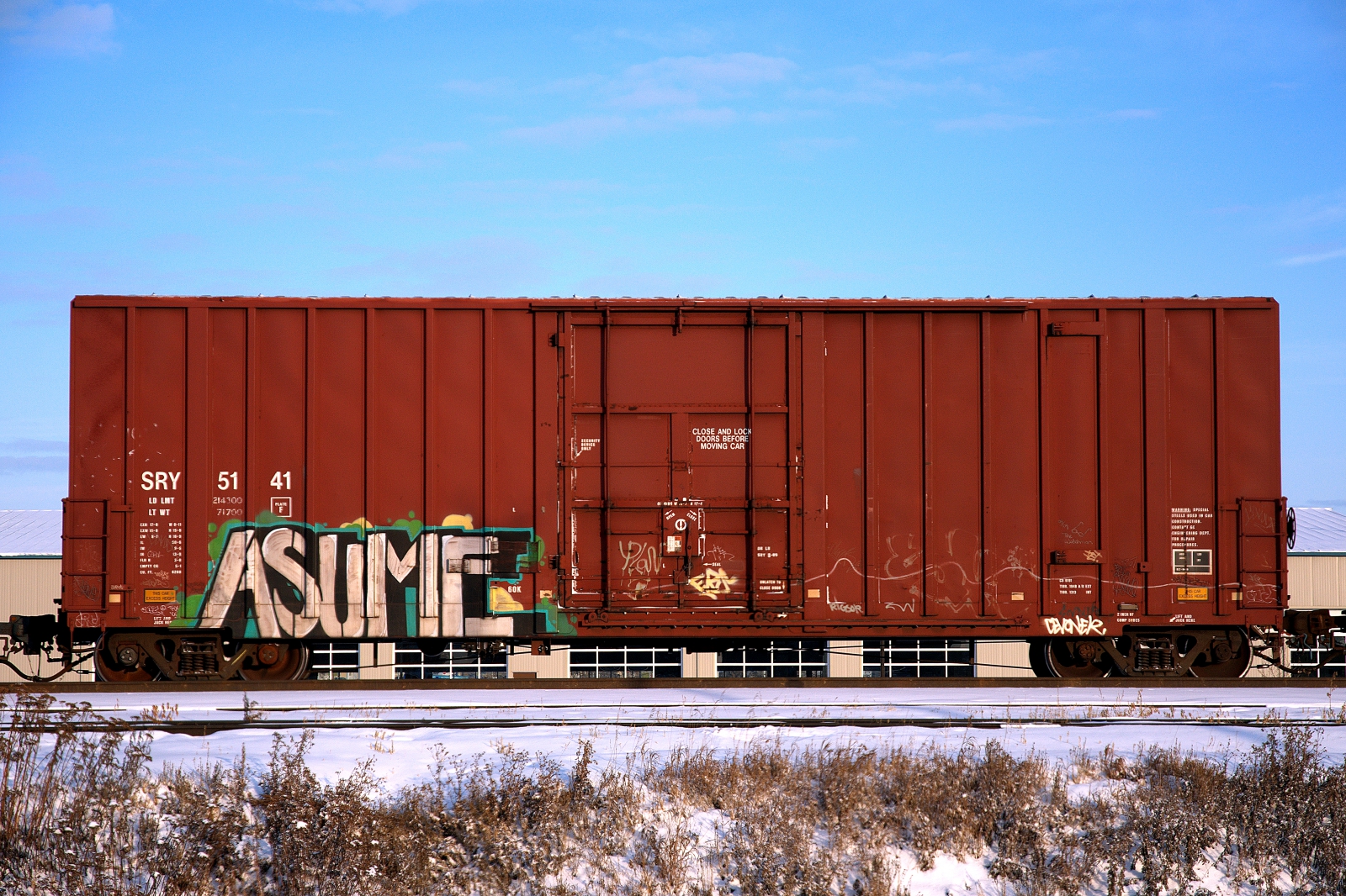
The Southern Railway of British Columbia, branded as SRY Rail Link is a Canadian short line railway operating in southwestern British Columbia. The main facility is the port at Annacis Island with major import of cars, export of forestry products, and other shipments. The railway has interconnections with three Class I railroads, including Canadian Pacific Kansas City (CPKC), Canadian National (CN) and Burlington Northern Santa Fe ( BNSF). SRY operates 29 locomotives, mostly consisting of EMD (8) GP-9 locomotives, (3) MP15 locomotives, and (12) SW900 locomotives. SRY also currently rosters 2 SD38-2s, 1 SD38AC and 1 SD35. Additionally, SRY formerly rostered 4 GMD1s. The railroad also operates a fleet 2,000 rail cars, hauling approximately 65,000 carloads annually. SRY operates around of track, of which is mainline track. SRY operates in New Westminster, British Columbia, and runs on the Fraser Valley Subdivision to Chilliwack, British Columbia. History The Provin ... [...More Info...] [...Related Items...] OR: [Wikipedia] [Google] [Baidu] |
British Columbia Electric Railway
The British Columbia Electric Railway (BCER) was an historic railway which operated in southwestern British Columbia, Canada. Originally the parent company for, and later a division of, BC Electric Company (now BC Hydro), the BCER assumed control of existing streetcar and interurban lines in southwestern British Columbia in 1897, and operated the electric railway systems in the region until the last interurban service was discontinued in 1958. During and after the streetcar era, BC Electric also ran bus and trolleybus systems in Greater Vancouver and bus service in Greater Victoria; these systems subsequently became part of BC Transit, and the routes in Greater Vancouver eventually came under the control of TransLink. Trolley buses still run in the City of Vancouver with one line extending into Burnaby. History Streetcar and interurban services were inaugurated in southwestern British Columbia between 1890 and 1891, operated by the following companies: * National Electric ... [...More Info...] [...Related Items...] OR: [Wikipedia] [Google] [Baidu] |
British Columbia
British Columbia is the westernmost Provinces and territories of Canada, province of Canada. Situated in the Pacific Northwest between the Pacific Ocean and the Rocky Mountains, the province has a diverse geography, with rugged landscapes that include rocky coastlines, sandy beaches, forests, lakes, mountains, inland deserts and grassy plains. British Columbia borders the province of Alberta to the east; the territories of Yukon and Northwest Territories to the north; the U.S. states of Washington (state), Washington, Idaho and Montana to the south, and Alaska to the northwest. With an estimated population of over 5.7million as of 2025, it is Canada's Population of Canada by province and territory, third-most populous province. The capital of British Columbia is Victoria, British Columbia, Victoria, while the province's largest city is Vancouver. Vancouver and its suburbs together make up List of census metropolitan areas and agglomerations in Canada, the third-largest metropolit ... [...More Info...] [...Related Items...] OR: [Wikipedia] [Google] [Baidu] |
Fraser Valley
The Fraser Valley is a geographical region in southwestern British Columbia, Canada and northwestern Washington State. It starts just west of Hope in a narrow valley encompassing the Fraser River and ends at the Pacific Ocean stretching from the North Shore Mountains, opposite the city of Vancouver BC, to just south of Bellingham, Washington. In casual usage it typically describes the Fraser River basin downstream of the Fraser Canyon. The term is sometimes used outside British Columbia to refer to the entire Fraser River sections including the Fraser Canyon and up from there to its headwaters, but in general British Columbian usage the term refers to the stretch of Lower Mainland west of the Coquihalla River mouth at the inland town of Hope, and includes all of the Canadian portion of the Fraser Lowland as well as the valleys and upland areas flanking it. It is divided into the Upper Fraser Valley and Lower Fraser Valley by the Vedder River mouth at the eastern foothills o ... [...More Info...] [...Related Items...] OR: [Wikipedia] [Google] [Baidu] |
Pacific Time Zone
The Pacific Time Zone (PT) is a time zone encompassing parts of western Canada, the western United States, and western Mexico. Places in this zone observe standard time by subtracting eight hours from Coordinated Universal Time ( UTC−08:00). During daylight saving time, a time offset of UTC−07:00 is used. In the United States and Canada, this time zone is generically called the Pacific Time Zone. Specifically, time in this zone is referred to as Pacific Standard Time (PST) when standard time is being observed (early November to mid-March), and Pacific Daylight Time (PDT) when daylight saving time (mid-March to early November) is being observed. In Mexico, the corresponding time zone is known as the ''Zona Noroeste'' (Northwest Zone) and observes the same daylight saving schedule as the United States and Canada. The largest city in the Pacific Time Zone is Los Angeles, whose metropolitan area is also the largest in the time zone. The zone is two hours ahead of the Ha ... [...More Info...] [...Related Items...] OR: [Wikipedia] [Google] [Baidu] |
Provinces And Territories Of Canada
Canada has ten provinces and three territories that are sub-national administrative divisions under the jurisdiction of the Constitution of Canada, Canadian Constitution. In the 1867 Canadian Confederation, three provinces of British North America—New Brunswick, Nova Scotia, and the Province of Canada (which upon Confederation was divided into Ontario and Quebec)—united to form a federation, becoming a fully Independence, independent country over the next century. Over its history, Canada's international borders have changed several times as it has added territories and provinces, making it the List of countries and dependencies by area, world's second-largest country by area. The major difference between a Canadian province and a territory is that provinces receive their power and authority from the ''Constitution Act, 1867'' (formerly called the ''British North America Acts, British North America Act, 1867''), whereas territories are federal territories whose governments a ... [...More Info...] [...Related Items...] OR: [Wikipedia] [Google] [Baidu] |
Langley, British Columbia (district Municipality)
The Township of Langley is a district municipality immediately east of the Surrey, British Columbia, City of Surrey in southwestern British Columbia, Canada. It extends south from the Fraser River to the Canada–United States border, and west of the City of Abbotsford. Langley Township is not to be confused with the City of Langley, which is adjacent to the township but politically is a separate entity. Langley is located in the eastern part of Metro Vancouver. History First Nations Throughout the last several millennia, the area that is now Langley Township was inhabited by various Stó꞉lō nations, including the Katzie and Kwantlen First Nation, Kwantlen. There is limited recorded history from this time, as much was passed down through oral tradition rather than written documents. The Kwantlen were a major factor in the salmon trade that later operated out of the Fort Langley. Simon Fraser, while traveling through the Sto:lo territory in 1808 recorded the image of a Kwa ... [...More Info...] [...Related Items...] OR: [Wikipedia] [Google] [Baidu] |
District Municipality
A district municipality is a designation for a class of municipalities found in several locations, including Canada, Lithuania, and South Africa. Canada British Columbia Under provincial law, municipalities in British Columbia are to be designated "district municipalities" on incorporation if the area to be incorporated is greater than and has an average population density of less than . Municipalities may be incorporated under different classifications under the direction of the province's lieutenant governor, as is the case with the District of North Vancouver. Nova Scotia A district municipality, also called a rural municipality, is one of three municipal types, along with towns and regional municipalities. District municipalities and county municipalities are further considered rural municipalities. The province's twelve district municipalities are referred to as municipal districts by Statistics Canada. Ontario Currently, only one district municipality exists i ... [...More Info...] [...Related Items...] OR: [Wikipedia] [Google] [Baidu] |


