|
Milecastle 36
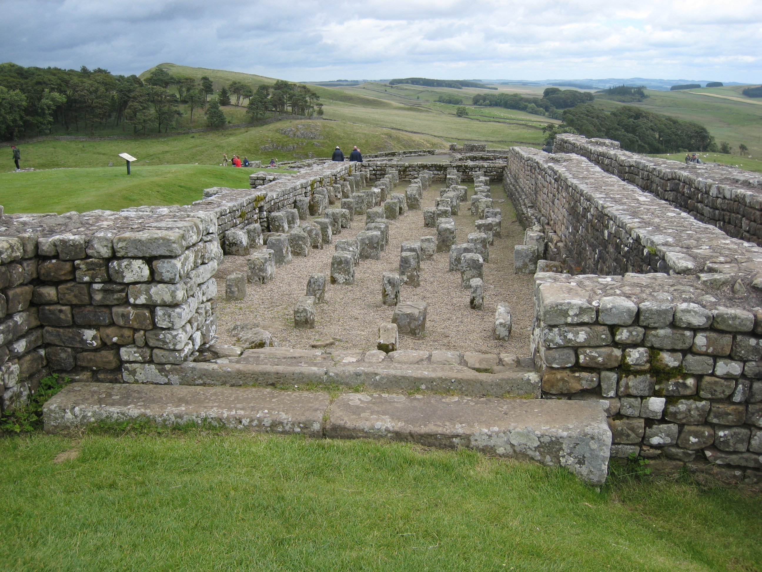
Milecastle 36 (King's Hill) was one of the milecastles on Hadrian's Wall (). There is little to see on the ground as most of the walls have been robbed and quarried away. Description The site of Milecastle 36 is located on King's Hill, 800 metres northeast of Housesteads Roman Fort.MILECASTLE 36 Pastscape, retrieved 3 December 2013 The milecastle was robbed of most of its remaining stone in 1831. Part of the east and west walls are indicated by robber-trenches. The remainder of the milecastle has been destroyed by surface quarrying, and the featureless interior is overlain by Wall tumble. Excavations Milecastle 36 was excavated in 1946. It was found to have a[...More Info...] [...Related Items...] OR: [Wikipedia] [Google] [Baidu] |
Milecastle
A milecastle was a small fort (fortlet), a rectangular fortification built during the period of the Roman Empire. They were placed at intervals of approximately one Roman mile along several major frontiers, for example Hadrian's Wall in Great Britain (Britannia in the Roman period), hence the name. Along Hadrian's Wall, milecastles were initially constructed of stone in the eastern two thirds, and stacked turf with a wooden palisade in the western third, though the turf milecastles were later rebuilt in stone. Size varied, but in general they were about 15m by 18m (50 feet by 65 feet) internally, with stone walls as much as 3m (10 feet) thick and probably 5m to 6m (17 to 20 feet) high, to match the height of the adjacent wall. There were 80 milecastles and 158 turrets. On Hadrian's Wall, a milecastle (there are a few exceptions) guarded a gateway through the Wall with a corresponding causeway across the Wall ditch to the north, and had a garrison of perhaps 20–30 auxi ... [...More Info...] [...Related Items...] OR: [Wikipedia] [Google] [Baidu] |
Hadrian's Wall
Hadrian's Wall ( la, Vallum Aelium), also known as the Roman Wall, Picts' Wall, or ''Vallum Hadriani'' in Latin, is a former defensive fortification of the Roman province of Britannia, begun in AD 122 in the reign of the Emperor Hadrian. Running from Wallsend on the River Tyne in the east to Bowness-on-Solway in the west of what is now northern England, it was a stone wall with large ditches in front of it and behind it that crossed the whole width of the island. Soldiers were garrisoned along the line of the wall in large forts, smaller milecastles and intervening turrets. In addition to the wall's defensive military role, its gates may have been customs posts. A significant portion of the wall still stands and can be followed on foot along the adjoining Hadrian's Wall Path. The largest Roman archaeological feature in Britain, it runs a total of in northern England. Regarded as a British cultural icon, Hadrian's Wall is one of Britain's major ancient tourist attra ... [...More Info...] [...Related Items...] OR: [Wikipedia] [Google] [Baidu] |
Housesteads Roman Fort
Housesteads Roman Fort is the remains of an auxiliary fort on Hadrian's Wall, at Housesteads, Northumberland, England, south of Broomlee Lough. The fort was built in stone around AD 124, soon after the construction of the wall began in AD 122 when the area was part of the Roman province of Britannia. Its name has been variously given as Vercovicium, Borcovicus, Borcovicium, and Velurtion. The 18th-century farmhouse Housesteads gives the modern name. The site is owned by the National Trust and is in the care of English Heritage. Finds can be seen at the site, in the museum at Chesters, and in the Great North Museum: Hancock in Newcastle upon Tyne. History Hadrian's Wall was begun in AD 122. A fort was built in stone at the Housesteads Roman Fort site around AD 124 overlying the original Broad Wall foundation and Turret 36B, about two miles north east of an existing fort at Vindolanda. The fort was repaired and rebuilt several times, its northern defences being particular ... [...More Info...] [...Related Items...] OR: [Wikipedia] [Google] [Baidu] |
Milecastle
A milecastle was a small fort (fortlet), a rectangular fortification built during the period of the Roman Empire. They were placed at intervals of approximately one Roman mile along several major frontiers, for example Hadrian's Wall in Great Britain (Britannia in the Roman period), hence the name. Along Hadrian's Wall, milecastles were initially constructed of stone in the eastern two thirds, and stacked turf with a wooden palisade in the western third, though the turf milecastles were later rebuilt in stone. Size varied, but in general they were about 15m by 18m (50 feet by 65 feet) internally, with stone walls as much as 3m (10 feet) thick and probably 5m to 6m (17 to 20 feet) high, to match the height of the adjacent wall. There were 80 milecastles and 158 turrets. On Hadrian's Wall, a milecastle (there are a few exceptions) guarded a gateway through the Wall with a corresponding causeway across the Wall ditch to the north, and had a garrison of perhaps 20–30 auxi ... [...More Info...] [...Related Items...] OR: [Wikipedia] [Google] [Baidu] |
Hadrian
Hadrian (; la, Caesar Trâiānus Hadriānus ; 24 January 76 – 10 July 138) was Roman emperor from 117 to 138. He was born in Italica (close to modern Santiponce in Spain), a Roman '' municipium'' founded by Italic settlers in Hispania Baetica and he came from a branch of the gens Aelia that originated in the Picenean town of Hadria, the ''Aeli Hadriani''. His father was of senatorial rank and was a first cousin of Emperor Trajan. Hadrian married Trajan's grand-niece Vibia Sabina early in his career before Trajan became emperor and possibly at the behest of Trajan's wife Pompeia Plotina. Plotina and Trajan's close friend and adviser Lucius Licinius Sura were well disposed towards Hadrian. When Trajan died, his widow claimed that he had nominated Hadrian as emperor immediately before his death. Rome's military and Senate approved Hadrian's succession, but four leading senators were unlawfully put to death soon after. They had opposed Hadrian or seemed to threat ... [...More Info...] [...Related Items...] OR: [Wikipedia] [Google] [Baidu] |
Turret (Hadrian's Wall)
A turret was a small watch tower, incorporated into the curtain wall of Hadrian's Wall. The turrets were normally spaced at intervals of one third of a Roman mile (equivalent to ) between Milecastles, giving two Turrets between each Milecastle. Numbering system and naming In the numbering system introduced by John Collingwood Bruce in 1930, Turrets were numbered after the Milecastle located to the east of the turret. The nearest turret to the milecastle is suffixed by 'A', and the other turret by 'B'. For example, travelling west from Milecastle 33, the first Turret encountered would be Turret 33A, and the second would be Turret 33B. Both lower and upper case 'A' and 'B' suffixes are in widespread use, and the full name is often abbreviated to (for example) 'T33a'. Many turrets also have a name, which is often shown in brackets following the number. For example, Brunton Turret is often referred to as 'Turret 26B (Brunton)'. Turf Wall Where the Turf Wall and Stone Walls diver ... [...More Info...] [...Related Items...] OR: [Wikipedia] [Google] [Baidu] |
Roman Mile
The mile, sometimes the international mile or statute mile to distinguish it from other miles, is a British imperial unit and United States customary unit of distance; both are based on the older English unit of length equal to 5,280 English feet, or 1,760 yards. The statute mile was standardised between the British Commonwealth and the United States by an international agreement in 1959, when it was formally redefined with respect to SI units as exactly . With qualifiers, ''mile'' is also used to describe or translate a wide range of units derived from or roughly equivalent to the Roman mile, such as the nautical mile (now exactly), the Italian mile (roughly ), and the Chinese mile (now exactly). The Romans divided their mile into 5,000 Roman feet but the greater importance of furlongs in Elizabethan-era England meant that the statute mile was made equivalent to or in 1593. This form of the mile then spread across the British Empire, some successor states of wh ... [...More Info...] [...Related Items...] OR: [Wikipedia] [Google] [Baidu] |
English Heritage Archive
The Historic England Archive is the public archive of Historic England, located in The Engine House on Fire Fly Avenue in Swindon, formerly part of the Swindon Works of the Great Western Railway. It is a public archive of architectural and archaeological records and holds over 12 million historic photographs, plans, drawings, reports, records and publications covering England's archaeology, architecture, social and local history. It is a dynamic collection, with records being added to this day. The PastScape website allows searching of over 420,000 records (as of 2016). History The roots of the archive go back to 1908 and the foundation of the Royal Commission on the Historical Monuments of England (RCHME) which was set up to compile and publish an inventory of all ancient and historical monuments up to the year 1700 by county and by parish. Its more immediate forerunner, however, was the National Buildings Record (NBR), an independent body set up in 1940 under the inspirati ... [...More Info...] [...Related Items...] OR: [Wikipedia] [Google] [Baidu] |
Hadrian's Wall Path
Hadrian's Wall Path is a long-distance footpath in the north of England, which became the 15th National Trail in 2003. It runs for , from Wallsend on the east coast of England to Bowness-on-Solway on the west coast. For most of its length it is close to the remains of Hadrian's Wall, the defensive wall built by the Romans on the northern border of their empire. This is now recognised as part of the "Frontiers of the Roman Empire" World Heritage Site. Path description Though muddy in places, the walking is relatively easy, as the highest point on the path is only 345 m (1130 ft) high and for much of its length the path is more or less flat. Most of the Wall runs through remote countryside but there are sections that pass through the cities and suburbs of Newcastle and Carlisle. The path is well signposted. For most of the walk there are many signs of human activity, and many other walkers in summer. Though there are villages and farms near to the path, there ... [...More Info...] [...Related Items...] OR: [Wikipedia] [Google] [Baidu] |
English Heritage
English Heritage (officially the English Heritage Trust) is a charity that manages over 400 historic monuments, buildings and places. These include prehistoric sites, medieval castles, Roman forts and country houses. The charity states that it uses these properties to "bring the story of England to life for over 10 million people each year". Within its portfolio are Stonehenge, Dover Castle, Tintagel Castle and the best preserved parts of Hadrian's Wall. English Heritage also manages the London Blue Plaque scheme, which links influential historical figures to particular buildings. When originally formed in 1983, English Heritage was the operating name of an executive non-departmental public body of the British Government, officially titled the Historic Buildings and Monuments Commission for England, that ran the national system of heritage protection and managed a range of historic properties. It was created to combine the roles of existing bodies that had emerged from a lo ... [...More Info...] [...Related Items...] OR: [Wikipedia] [Google] [Baidu] |


.jpg)