|
Metsovo Pass
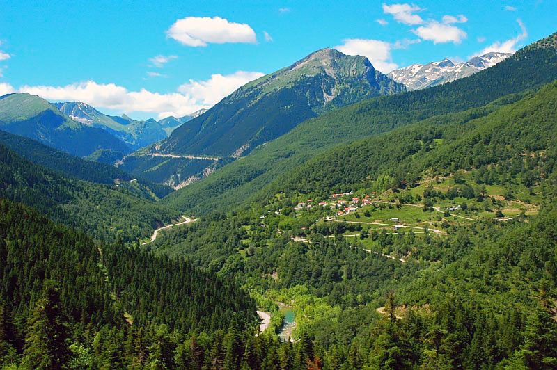
The Katara Pass or Metsovo Pass () is a mountain pass in the Pindus mountains in northern Greece. It is northeast of the town Metsovo. Situated on the border of Epirus ( Ioannina regional unit) and Thessaly ( Trikala regional unit), it forms the divide between the river basins of the Aoos to the southwest and the Pineios to the east. Its elevation is about making it one of the highest in the nation. Greek National Road 6 (Larissa - Trikala - Metsovo - Ioannina - Igoumenitsa) crosses the Katara Pass. With the opening of the A2 motorway A, or a, is the first Letter (alphabet), letter and the first vowel letter of the Latin alphabet, used in the modern English alphabet, and others worldwide. Its name in English is ''English alphabet#Letter names, a'' (pronounced ), plural ... (Egnatia Odos), which passes through tunnels further south, traffic has sharply declined. External links Pictures of the Katara Pass {{coord, 39.7948, 21.2293, type:pass_region:GR, display=title ... [...More Info...] [...Related Items...] OR: [Wikipedia] [Google] [Baidu] |
Mountain Pass
A mountain pass is a navigable route through a mountain range or over a ridge. Since mountain ranges can present formidable barriers to travel, passes have played a key role in trade, war, and both Human migration, human and animal migration throughout history. At lower elevations it may be called a hill pass. A mountain pass is typically formed between two volcanic peaks or created by erosion from water or wind. Overview Mountain passes make use of a gap (landform), gap, saddle (landform), saddle, col or notch (landform), notch. A topographic saddle is analogous to the mathematical concept of a saddle surface, with a saddle point marking the minimum high point between two valleys and the lowest point along a ridge. On a topographic map, passes can be identified by contour lines with an hourglass shape, which indicates a low spot between two higher points. In the high mountains, a difference of between the summit and the mountain is defined as a mountain pass. Passes are o ... [...More Info...] [...Related Items...] OR: [Wikipedia] [Google] [Baidu] |
Larissa
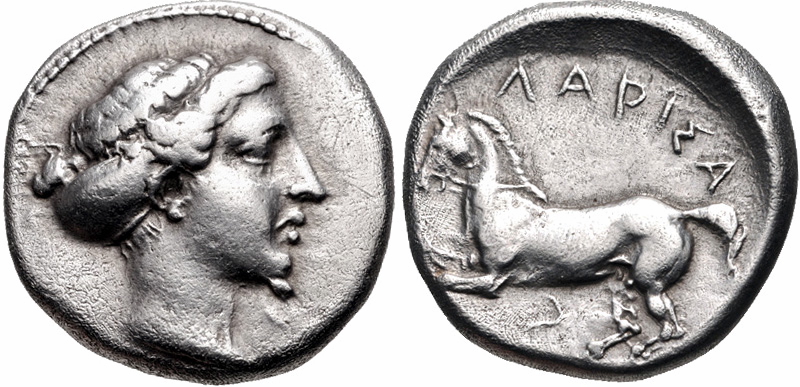
Larissa (; , , ) is the capital and largest city of the Thessaly region in Greece. It is the fifth-most populous city in Greece with a population of 148,562 in the city proper, according to the 2021 census. It is also the capital of the Larissa regional unit. It is a principal agricultural centre and a national transport hub, linked by road and rail with the port of Volos, the cities of Thessaloniki and Athens. The municipality of Larissa has inhabitants, while the regional unit of Larissa reached a population of (). Legend has it that Achilles was born here. Hippocrates, the "Father of Medicine", died here. Today, Larissa is an important commercial, transportation, educational, agricultural and industrial centre of Greece. The city straddles the Pineios river and N.-NE. of the city are the Mount Olympus and Mount Kissavos. Mythology According to Greek mythology, it is said that the city was founded by Acrisius, who was killed accidentally by his grandson, Perseus. There l ... [...More Info...] [...Related Items...] OR: [Wikipedia] [Google] [Baidu] |
Landforms Of Trikala (regional Unit)
A landform is a land feature on the solid surface of the Earth or other planetary body. They may be natural or may be anthropogenic (caused or influenced by human activity). Landforms together make up a given terrain, and their arrangement in the landscape is known as topography. Landforms include hills, mountains, canyons, and valleys, as well as shoreline features such as bays, peninsulas, and seas, including submerged features such as mid-ocean ridges, volcanoes, and the great oceanic basins. Physical characteristics Landforms are categorized by characteristic physical attributes such as elevation, slope, orientation, structure stratification, rock exposure, and soil type. Gross physical features or landforms include intuitive elements such as berms, cliffs, hills, mounds, peninsulas, ridges, rivers, valleys, volcanoes, and numerous other structural and size-scaled (e.g. ponds vs. lakes, hills vs. mountains) elements including various kinds of inland and oceanic waterbodi ... [...More Info...] [...Related Items...] OR: [Wikipedia] [Google] [Baidu] |
Mountain Passes Of Greece
A mountain is an elevated portion of the Earth's crust, generally with steep sides that show significant exposed bedrock. Although definitions vary, a mountain may differ from a plateau in having a limited summit area, and is usually higher than a hill, typically rising at least above the surrounding land. A few mountains are isolated summits, but most occur in mountain ranges. Mountains are formed through tectonic forces, erosion, or volcanism, which act on time scales of up to tens of millions of years. Once mountain building ceases, mountains are slowly leveled through the action of weathering, through slumping and other forms of mass wasting, as well as through erosion by rivers and glaciers. High elevations on mountains produce colder climates than at sea level at similar latitude. These colder climates strongly affect the ecosystems of mountains: different elevations have different plants and animals. Because of the less hospitable terrain and climate, mountains te ... [...More Info...] [...Related Items...] OR: [Wikipedia] [Google] [Baidu] |
A2 Motorway (Greece)
The A2 motorway, also known as the Egnatia Odos (), (FEK AAP' 253/21.12.2015, pp. 2098–2099). is a toll road, tolled controlled-access highway in northern Greece that runs from the western port of Igoumenitsa to the eastern Greek–Turkish border at Kipoi, Evros, Kipoi. The entire route is part of the Greek section of the European route E90, E90 road, which runs from Lisbon, Portugal in the west, and Zakho, Iraq in the east. The A2 motorway runs a total of . The megaproject began in 1994 and was completed in 2009 at a cost of €5.93 billion ($ billion); it was managed by the state-owned company Egnatia Odos, S.A. Geography The route traverses the mountainous Greek regions of Epirus (region), Epirus and Macedonia (Greece), Macedonia, crossing the Pindus, Pindos and Vermio Mountains, ...[...More Info...] [...Related Items...] OR: [Wikipedia] [Google] [Baidu] |
Igoumenitsa
Igoumenitsa () is a coastal city in northwestern Greece. It is the capital of the regional unit of Thesprotia. Igoumenitsa is the chief port of Thesprotia and Epirus, and one of the largest passenger ports of Greece, connecting northwestern Mainland Greece with the Ionian Islands and Italy. The city is built on the easternmost end of the Gulf of Igoumenitsa in the Ionian Sea and primary aspects of the economy are maritime, transport, services, agriculture and tourism. The long A2 motorway (Greece), A2 motorway (Egnatia Odos), which serves northern Greece, terminates at Igoumenitsa, making it a popular starting point for tourists coming from Europe and ending point for trucks from Turkey. Igoumenitsa features many shops, schools, offices and cargo storages, a university department, a library, an archeological museum, several sport stadiums and tennis courses, a courthouse and a medical clinic. The Thesprotia Police Headquarters and the Municipal Sailing Club are located here. The ... [...More Info...] [...Related Items...] OR: [Wikipedia] [Google] [Baidu] |
Ioannina
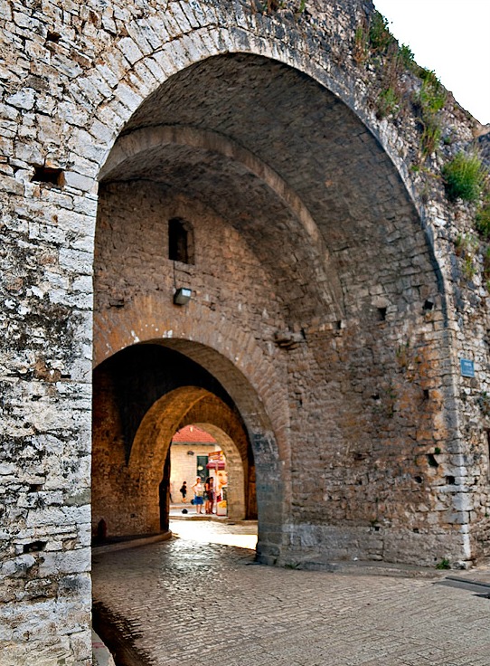
Ioannina ( ' ), often called Yannena ( ' ) within Greece, is the capital and largest city of the Ioannina (regional unit), Ioannina regional unit and of Epirus (region), Epirus, an Modern regions of Greece, administrative region in northwestern Greece. According to the 2021 census, the city population was 64,896 while the municipality had 113,978 inhabitants. It lies at an elevation of approximately above mean sea level, above sea level, on the western shore of Lake Pamvotis (). Ioannina is located northwest of Athens, southwest of Thessaloniki and east of the port of Igoumenitsa on the Ionian Sea. The city's foundation has traditionally been ascribed to the Byzantine Emperor Justinian in the 6th century AD, but modern archaeological research has uncovered evidence of Hellenistic settlements. Ioannina flourished in the late Byzantine period (13th–15th centuries). It became part of the Despotate of Epirus following the Fourth Crusade and many wealthy Byzantine families f ... [...More Info...] [...Related Items...] OR: [Wikipedia] [Google] [Baidu] |
Trikala
Trikala () is a city in northwestern Thessaly, Greece, and the capital of the Trikala (regional unit), Trikala regional unit. The city straddles the Lithaios river, which is a tributary of Pineios (Thessaly), Pineios. According to the Greek National Statistical Service, Trikala is populated by 81,355 inhabitants (2011), while in total the Trikala regional unit is populated by 131,085 inhabitants (2011). Trikala is a lively Greek city with picturesque monuments and old neighborhoods with traditional architecture. The city is near Meteora and also near the mountain range of south Pindus, where there are many destinations (i.e. Pyli's stone bridge, Elati, Pertouli, Palaiokarya's stone bridge and waterfall, Pertouli Ski Center etc.). Name The city's name derives from the ancient ''Trikka'' or ''Trikke'' ( or ), which was itself named after a nymph that was a daughter of Peneus or Asopos. The name ''Trikala'' appears in the Byzantine period. In Turkish language, Turkish, the city is k ... [...More Info...] [...Related Items...] OR: [Wikipedia] [Google] [Baidu] |
Greek National Road 6
Greek National Road 6 (, abbreviated as EO6) is a national road in north-central Greece. It begins at the port of Igoumenitsa and ends at Volos, passing through the towns Ioannina, Metsovo, Trikala and Larissa. The section between Metsovo and Volos is part of the European route E92. The road runs through five regional units (Thesprotia, Ioannina (regional unit), Ioannina, Trikala (regional unit), Trikala, Larissa (regional unit), Larissa and Magnesia (regional unit), Magnesia) and the regions of Epirus (region), Epirus and Thessaly. Route The EO6 is officially defined as an east-west route through central and northwestern Greece, between Volos in the east and Igoumenitsa to the west: the EO6 passes through Larissa, Trikala, Kalabaka, , Katara Pass, Metsovo and Ioannina. [...More Info...] [...Related Items...] OR: [Wikipedia] [Google] [Baidu] |
Pindus
The Pindus (also Pindos or Pindhos; ; ; ) is a mountain range located in Northern Greece and Southern Albania. It is roughly long, with a maximum elevation of (Smolikas, Mount Smolikas). Because it runs along the border of Thessaly and Epirus, the Pindus range is known colloquially as the ''spine of Greece''. The mountain range stretches from near the Greek-Albanian border in southern Albania, entering the Epirus (region), Epirus and Macedonia (Greece), Macedonia regions in northern Greece down to the north of the Peloponnese. Geologically, it is an extension of the Dinaric Alps, which dominate the western region of the Balkans, Balkan Peninsula. History of the name Historically, the name Pindos refers to the mountainous territory that separates the greater Epirus region from the regions of Macedonia and Thessaly. According to John Tzetzes (a 12th-century Byzantine writer), the Pindos range was then called Metzovon. When translated (between 1682/83 and 1689) to a more co ... [...More Info...] [...Related Items...] OR: [Wikipedia] [Google] [Baidu] |
Pineios (Thessaly)
The Pineios (, , , referred to in Latin sources as Peneus) is a river in Thessaly, Greece. The river is named after the god Peneus. During the later Middle Ages, it was also known as the Salamvrias or Salavrias (Σαλα[μ]βριάς). It flows from the Pindus mountains through the Thessalian plain and empties into the Aegean Sea, northeast of the Vale of Tempe, near Stomio, Larissa, Stomio. It creates a large delta, well known for its beauty and for many animal species, protected by international environmental treaties. Its total length is 205 km. Its drainage basin is . Its source is near the village Malakasi, on the eastern slope of the Pindus main range, east of Metsovo. The Meteora region and the city of Larissa lie along the Pineios. Trikala lies on its tributary, the Lithaios. In the 1960s, a freeway connecting Athens and Thessaloniki was constructed in much of the Vale of Tempe. Three ships of the Hellenic Navy Greek ship Pineios, have been named after the river ... [...More Info...] [...Related Items...] OR: [Wikipedia] [Google] [Baidu] |


