|
Meteor-3M No.1
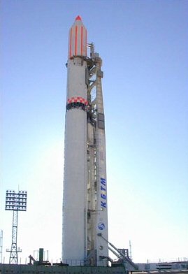
Meteor-3M No.1 was the first and only of the Meteor-3M series polar-orbiting weather satellites. It was launched on 10 December 2001 at 17:18:57 UTC from the Baikonur Cosmodrome in Kazakhstan. The satellite is in a sun-synchronous orbit with an ascending node time of about 9AM. Capabilities An APT transmission was planned to only have a reduced resolution (2 km) visible channel data. The status of any APT capability on this satellite was unclear, but it was thought not to have an APT transmitter. No APT transmissions were received from this satellite. SLR mission support began on 1 May 2002. Secondary mission objective was the flight testing of the novel-type spherical retroreflector for precise laser ranging. ILRS Mission Support Status SLR was used for precise orbit determination and retroreflector research. Instrumentation * SAGE III * Spherical retroreflector * Other weather monitoring instruments Retro-reflector Array (RRA) characteristics The retro-reflecto ... [...More Info...] [...Related Items...] OR: [Wikipedia] [Google] [Baidu] |
Weather Satellite
A weather satellite or meteorological satellite is a type of Earth observation satellite that is primarily used to monitor the weather and climate of the Earth. Satellites can be polar orbiting (covering the entire Earth asynchronously), or geostationary (hovering over the same spot on the equator). While primarily used to detect the development and movement of storm systems and other cloud patterns, meteorological satellites can also detect other phenomena such as city lights, fires, effects of pollution, auroras, sand and dust storms, snow cover, ice mapping, boundaries of ocean currents, and energy flows. Other types of environmental information are collected using weather satellites. Weather satellite images helped in monitoring the volcanic ash cloud from Mount St. Helens and activity from other volcanoes such as Mount Etna. Smoke from fires in the western United States such as Colorado and Utah have also been monitored. El Niño and its effects on weather are mo ... [...More Info...] [...Related Items...] OR: [Wikipedia] [Google] [Baidu] |
Kazakhstan
Kazakhstan, officially the Republic of Kazakhstan, is a transcontinental country located mainly in Central Asia and partly in Eastern Europe. It borders Russia Russia (, , ), or the Russian Federation, is a transcontinental country spanning Eastern Europe and Northern Asia. It is the largest country in the world, with its internationally recognised territory covering , and encompassing one-eigh ... to Kazakhstan–Russia border, the north and west, China to China–Kazakhstan border, the east, Kyrgyzstan to Kazakhstan–Kyrgyzstan border, the southeast, Uzbekistan to Kazakhstan–Uzbekistan border, the south, and Turkmenistan to Kazakhstan–Turkmenistan border, the southwest, with a coastline along the Caspian Sea. Its capital is Astana, known as Nur-Sultan from 2019 to 2022. Almaty, Kazakhstan's largest city, was the country's capital until 1997. Kazakhstan is the world's largest landlocked country, the largest and northernmost Muslim world, Muslim-majority cou ... [...More Info...] [...Related Items...] OR: [Wikipedia] [Google] [Baidu] |
Meteor (satellite)
The Meteor spacecraft are weather observation satellites launched by the Soviet Union and Russia. The Meteor satellite series was initially developed during the 1960s.Soviet Weather Satellite Falls in Antarctica , 27 March 2012, accessed 28 March 2012 The Meteor satellites were designed to monitor atmospheric and sea-surface s, , |
Stratospheric Aerosol And Gas Experiment
The Stratospheric Aerosol and Gas Experiment (SAGE) is a series of remote sensing satellite instruments used to study the chemical composition of Earth's atmosphere. Specifically, SAGE has been used to study the Earth's ozone layer and aerosols at the troposphere through the stratosphere. The SAGE instruments use solar occultation measurement technique to determine chemical concentrations in the atmosphere. Solar occultation measurement technique measures sunlight through the atmosphere and ratios that measurement with a sunlight measurement without atmospheric attenuation. This is achieved by observing sunrises and sunsets during a satellite orbit. Physically, the SAGE instruments measure ultraviolet/visible energy and this is converted via algorithms to determine chemical concentrations. SAGE data has been used to study the atmospheres aerosols, ozone, water vapor, and other trace gases. History There has been 4 series of SAGE instruments: * SAGE I - Flew on the Explorer 60 s ... [...More Info...] [...Related Items...] OR: [Wikipedia] [Google] [Baidu] |
LAGEOS
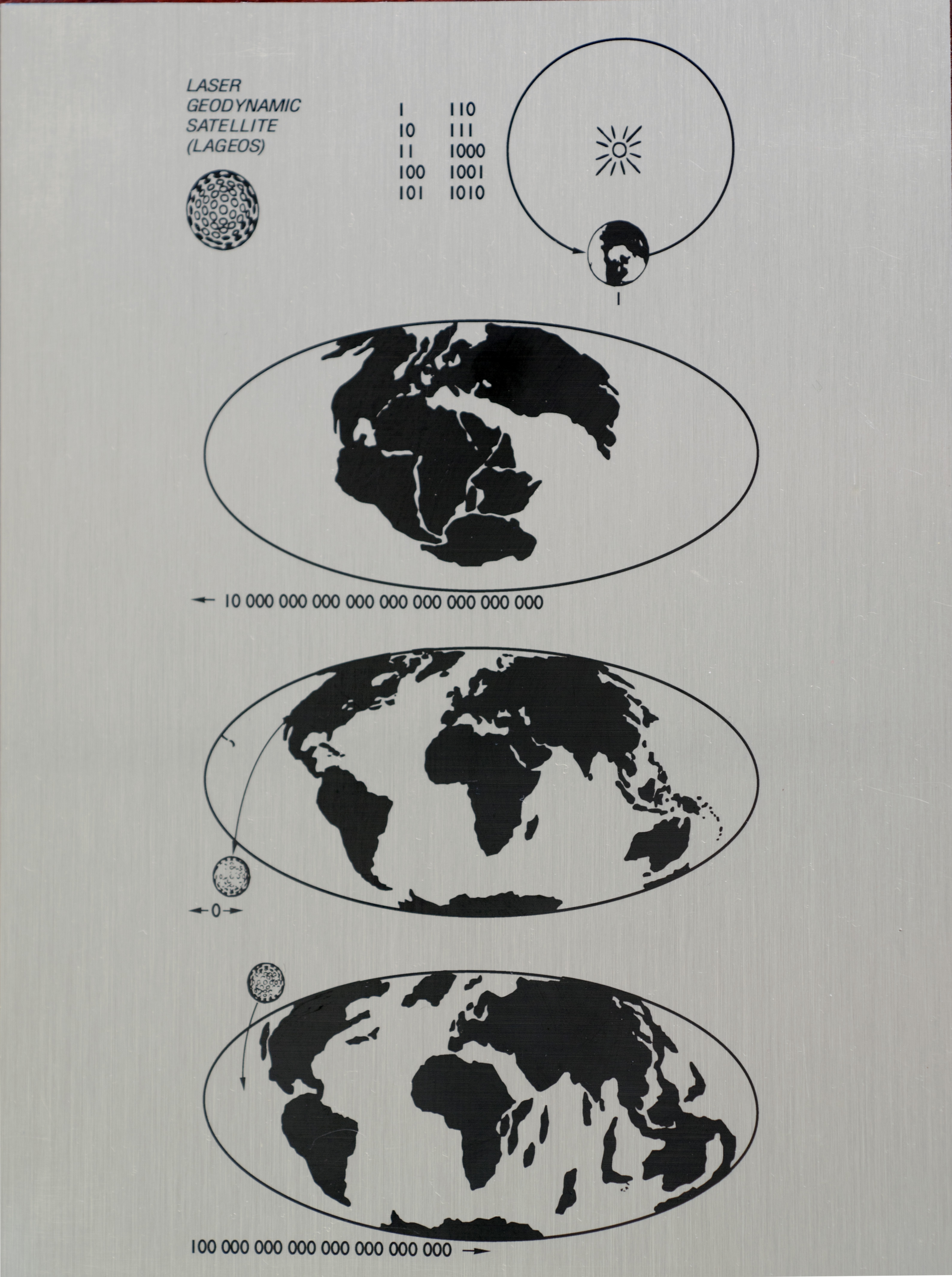
LAGEOS, Laser Geodynamics Satellite or Laser Geometric Environmental Observation Survey, are a series of two scientific research satellites designed to provide an orbiting laser ranging benchmark for geodynamical studies of the Earth. Each satellite is a high-density passive laser reflector in a very stable medium Earth orbit (MEO). Function and operation The spacecraft are aluminum-covered brass spheres with diameters of and masses of , covered with 426 cube-corner retroreflectors, giving them the appearance of giant golf balls. Of these retroreflectors, 422 are made from fused silica glass while the remaining 4 are made from germanium to obtain measurements in the infrared for experimental studies of reflectivity and satellite orientation. They have no on-board sensors or electronics, and are not attitude-controlled. They orbit at an altitude of , well above low Earth orbit and well below geostationary orbit, at orbital inclinations of 109.8 and 52.6 degrees. Measurement ... [...More Info...] [...Related Items...] OR: [Wikipedia] [Google] [Baidu] |
Weather Satellite
A weather satellite or meteorological satellite is a type of Earth observation satellite that is primarily used to monitor the weather and climate of the Earth. Satellites can be polar orbiting (covering the entire Earth asynchronously), or geostationary (hovering over the same spot on the equator). While primarily used to detect the development and movement of storm systems and other cloud patterns, meteorological satellites can also detect other phenomena such as city lights, fires, effects of pollution, auroras, sand and dust storms, snow cover, ice mapping, boundaries of ocean currents, and energy flows. Other types of environmental information are collected using weather satellites. Weather satellite images helped in monitoring the volcanic ash cloud from Mount St. Helens and activity from other volcanoes such as Mount Etna. Smoke from fires in the western United States such as Colorado and Utah have also been monitored. El Niño and its effects on weather are mo ... [...More Info...] [...Related Items...] OR: [Wikipedia] [Google] [Baidu] |
Roscosmos
The State Space Corporation "Roscosmos" (russian: Государственная корпорация по космической деятельности «Роскосмос»), commonly known simply as Roscosmos (russian: Роскосмос), is a state corporation of the Russian Federation responsible for space flights, cosmonautics programs, and aerospace research. Originating from the Soviet space program founded in the 1950s, Roscosmos emerged following the dissolution of the Soviet Union in 1991. It initially began as the Russian Space Agency, which was established on 25 February 1992russian: Российское космическое агентство, ''Rossiyskoye kosmicheskoye agentstvo'', or RKA (russian: РКА). and restructured in 1999 and 2004, as the Russian Aviation and Space Agencyrussian: Российское авиационно-космическое агентство, ''Rossiyskoye aviatsionno-kosmicheskoye agentstvo'', commonly known as (ru ... [...More Info...] [...Related Items...] OR: [Wikipedia] [Google] [Baidu] |
Sun-synchronous Orbit
A Sun-synchronous orbit (SSO), also called a heliosynchronous orbit, is a nearly polar orbit around a planet, in which the satellite passes over any given point of the planet's surface at the same local mean solar time. More technically, it is an orbit arranged so that it precesses through one complete revolution each year, so it always maintains the same relationship with the Sun. Applications A Sun-synchronous orbit is useful for imaging, reconnaissance, and weather satellites, because every time that the satellite is overhead, the surface illumination angle on the planet underneath it is nearly the same. This consistent lighting is a useful characteristic for satellites that image the Earth's surface in visible or infrared wavelengths, such as weather and spy satellites, and for other remote-sensing satellites, such as those carrying ocean and atmospheric remote-sensing instruments that require sunlight. For example, a satellite in Sun-synchronous orbit might ascend ac ... [...More Info...] [...Related Items...] OR: [Wikipedia] [Google] [Baidu] |


