|
Metabetaeus Minutus
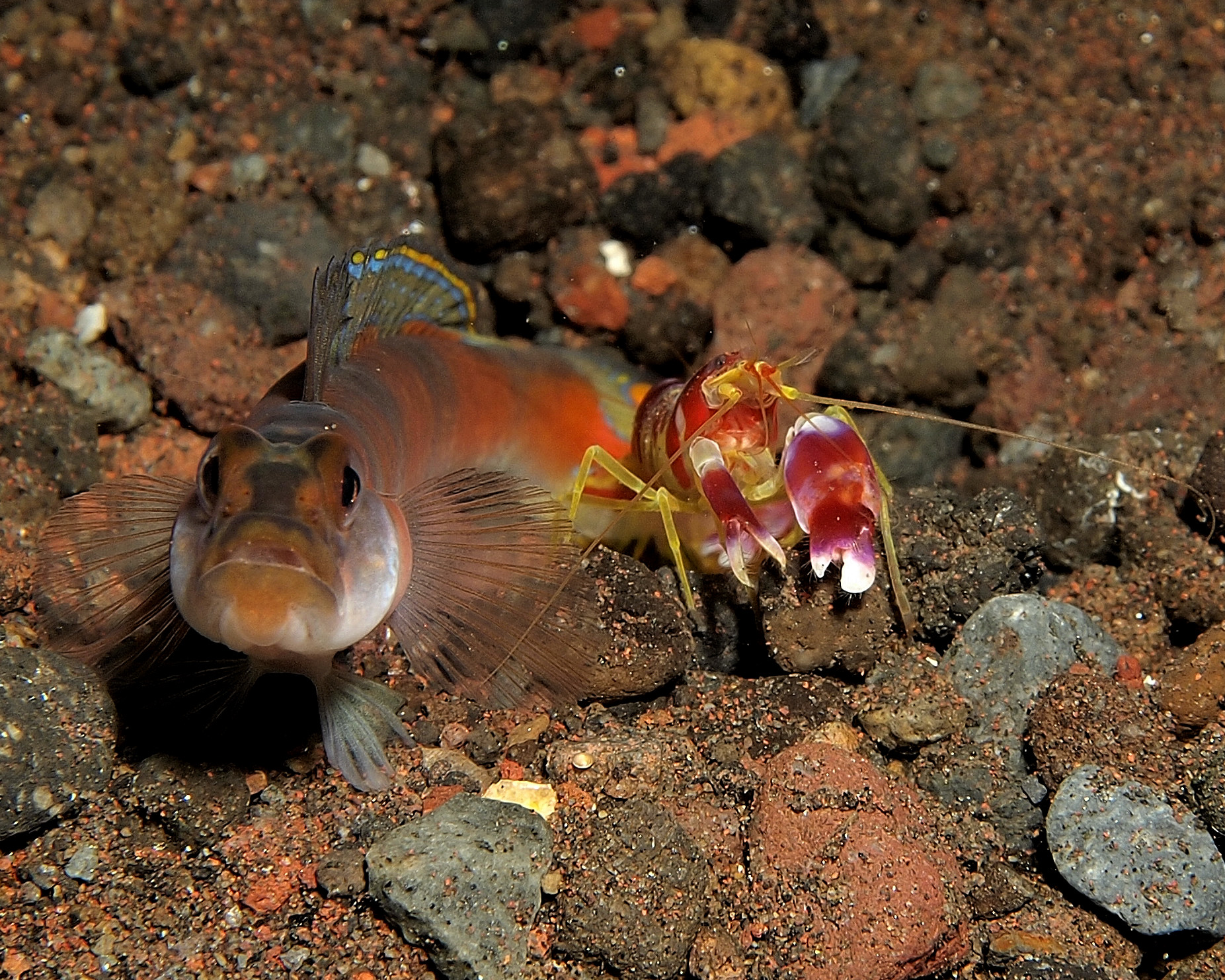
''Metabetaeus minutus'' is a species of alpheid shrimp native to the Indo-West Pacific. Description ''Metabetaeus minutus'' can vary in colour from blood red to pink, orange or white depending on the concentration of red chromatophores on the shrimps body. The average size can range depending on the population, with the smallest collected from Fakaofo being 12 mm long and largest known specimen being collected from Jaluit Atoll at 17 mm long. Distribution and habitat ''Metabetaeus minutus'' is native to the Indo-West pacific, where it can be found living on many islands including: Funafuti, Fakaofo, Jaluit Atoll, Arno Atoll, Easter Island, Minami Daito, Miyako Islands, Lifou, Sulawesi, Muna Island. ''M. minutus'' can be found inhabiting landlocked anchialine pools, containing brackish water. Populations can also be found living in anchialine cave An anchialine system (, from Greek ''ankhialos'', "near the sea") is a landlocked body of water with a subterranea ... [...More Info...] [...Related Items...] OR: [Wikipedia] [Google] [Baidu] |
Alpheidae
Alpheidae is a family of caridean snapping shrimp, characterized by having asymmetrical claws, the larger of which is typically capable of producing a loud snapping sound. Other common names for animals in the group are pistol shrimp or alpheid shrimp. The family is diverse and worldwide in distribution, consisting of about 1,119 species within 38 or more genera. The two most prominent genera are ''Alpheus'' and ''Synalpheus'', with species numbering well over 250 and 100, respectively. Most snapping shrimp dig burrows and are common inhabitants of coral reefs, submerged seagrass flats, and oyster reefs. While most genera and species are found in tropical and temperate coastal and marine waters, ''Betaeus'' inhabits cold seas and ''Potamalpheops'' is found only in freshwater caves. When in colonies, the snapping shrimp can interfere with sonar and underwater communication. The shrimp are considered a major source of sound in the ocean. Description The "Pistol Shrimp" grows to o ... [...More Info...] [...Related Items...] OR: [Wikipedia] [Google] [Baidu] |
Miyako Islands
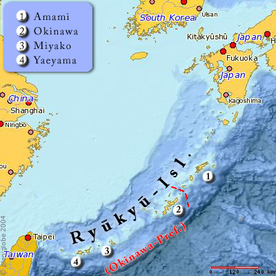
The (also Miyako Jima group) are a group of islands in Okinawa Prefecture, Japan, belonging to the Ryukyu Islands. They are situated between the Okinawa Island and Yaeyama Islands. In the early 1870s, the population of the islands was estimated to number approximately 10,000. Miyako island has 55,914 people. A bridge connects Miyako Island to Ikema Island, which has 801 people. Tarama village has 1,214 people, between the two islands of Minna and Tarama. Important Bird Area The islands have been recognised as an Important Bird Area (IBA) by BirdLife International because they support populations of the resident Ryukyu green pigeons, as well as migrating whimbrels. Inhabited islands * Miyakojima City ** ** ** ** ** ( ja) ** * Tarama Village ( Miyako District) ** ** ( ja) See also *Miyako people * Sakishima Islands *Miyakoan language The Miyakoan language ( ''Myākufutsu/Myākufutsї'' or ''Sumafutsu/Sїmafutsї'') is a diverse dialect cluster spoken in the M ... [...More Info...] [...Related Items...] OR: [Wikipedia] [Google] [Baidu] |
Anchialine Cave
An anchialine system (, from Greek ''ankhialos'', "near the sea") is a landlocked body of water with a subterranean connection to the ocean. Depending on its formation, these systems can exist in one of two primary forms: pools or caves. The primary differentiating characteristics between pools and caves is the availability of light; cave systems are generally aphotic while pools are euphotic. The difference in light availability has a large influence on the biology of a given system. Anchialine systems are a feature of coastal aquifers which are density stratified, with water near the surface being fresh or brackish, and saline water intruding from the coast at depth. Depending on the site, it is sometimes possible to access the deeper saline water directly in the anchialine pool, or sometimes it may be accessible by cave diving. Anchialine systems are extremely common worldwide especially along neotropical coastlines where the geology and aquifer systems are relatively young ... [...More Info...] [...Related Items...] OR: [Wikipedia] [Google] [Baidu] |
Muna Island
Muna (Pulau Muna) is an island in the Southeast Sulawesi province of Indonesia with an area of and had a population of 316,293 at the 2010 Census and 368,654 at the 2020 Census.Badan Pusat Statistik, Jakarta, 2021. It is just southeast of the island of Sulawesi and west of Buton Island. It currently comprises most of three administrative regencies within the province: Muna Regency Muna Regency (''Kabupaten Muna'') is a regency of Southeast Sulawesi Province of Indonesia, covering parts of the island of Muna as well as part of the neighbouring Buton Island and smaller islands off its coast. Until 2014 it had an area of 2 ... (''Kabupaten Muna''), West Muna Regency (''Kabupaten Muna Barat''), and Central Buton Regency (''Kabupaten Buton Tengah''). References {{Authority control Islands of Sulawesi Landforms of Southeast Sulawesi ... [...More Info...] [...Related Items...] OR: [Wikipedia] [Google] [Baidu] |
Sulawesi
Sulawesi (), also known as Celebes (), is an island in Indonesia. One of the four Greater Sunda Islands, and the world's eleventh-largest island, it is situated east of Borneo, west of the Maluku Islands, and south of Mindanao and the Sulu Archipelago. Within Indonesia, only Sumatra, Borneo, and Papua are larger in territory, and only Java and Sumatra have larger populations. The landmass of Sulawesi includes four peninsulas: the northern Minahasa Peninsula, the East Peninsula, the South Peninsula, and the Southeast Peninsula. Three gulfs separate these peninsulas: the Gulf of Tomini between the northern Minahasa and East peninsulas, the Tolo Gulf between the East and Southeast peninsulas, and the Bone Gulf between the South and Southeast peninsulas. The Strait of Makassar runs along the western side of the island and separates the island from Borneo. Etymology The name ''Sulawesi'' possibly comes from the words ''sula'' ("island") and ''besi'' ("iron") and may ref ... [...More Info...] [...Related Items...] OR: [Wikipedia] [Google] [Baidu] |
Lifou
Lifou is a commune of France in the Loyalty Islands Province of New Caledonia in the Pacific Ocean. Geography Lifou is made up of Lifou Island, the largest and most heavily populated of the Loyalty Islands, its smaller neighbour Tiga Island, and several uninhabited islets in between these two. All these islands lie among the Loyalty Islands, northeast of New Caledonia's mainland. At , Lifou Island is the largest atoll in the world. The town of Wé, on Lifou Island, is the administrative centre of the commune of Lifou as well as the provincial seat of the Loyalty Islands Province. Climate Lifou has a tropical monsoon climate (Köppen climate classification ''Am''). The average annual temperature in Lifou is . The average annual rainfall is with March as the wettest month. The temperatures are highest on average in February, at around , and lowest in August, at around . The highest temperature ever recorded in Lifou was on 7 February 2016; the coldest temperature ever recor ... [...More Info...] [...Related Items...] OR: [Wikipedia] [Google] [Baidu] |
Minamidaitōjima
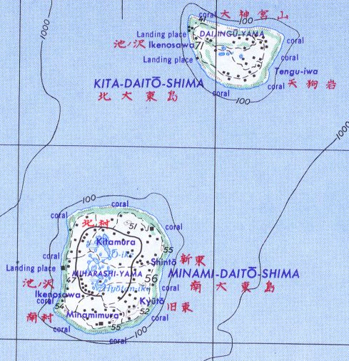
, also spelt as Minami Daitō or Minami-Daitō, is the largest island in the Daitō Islands group southeast of Okinawa, Japan. It is administered as part of the village of Minamidaitō, Okinawa. Shimajiri District, Okinawa and has a population of 2,107. The island is entirely cultivated for agriculture, although it lacks freshwater sources. The island has no beaches but has a fishing boat harbor and three cargo and ferry ports; as well as an airport Minami Daito Airport (airport code "MMD"). Geography Minamidaitōjima is a relatively isolated coralline island, located approximately south of Kitadaitōjima, the second largest island of the archipelago, and from Naha, Okinawa. As with the other islands in the archipelago, Minamidaitōjima is an uplifted coral atoll with a steep coastal cliff of limestone (the former fringing coral reef of the island), and a depressed center (the former lagoon of the island). The island is roughly oval in shape, with a circumference of about ... [...More Info...] [...Related Items...] OR: [Wikipedia] [Google] [Baidu] |
Native Species
In biogeography, a native species is indigenous to a given region or ecosystem if its presence in that region is the result of only local natural evolution (though often popularised as "with no human intervention") during history. The term is equivalent to the concept of indigenous or autochthonous species. Every wild organism (as opposed to a domesticated organism) is known as an introduced species within the regions where it was anthropogenically introduced. If an introduced species causes substantial ecological, environmental, and/or economic damage, it may be regarded more specifically as an invasive species. The notion of nativity is often a blurred concept, as it is a function of both time and political boundaries. Over long periods of time, local conditions and migratory patterns are constantly changing as tectonic plates move, join, and split. Natural climate change (which is much slower than human-caused climate change) changes sea level, ice cover, temperature, and r ... [...More Info...] [...Related Items...] OR: [Wikipedia] [Google] [Baidu] |
Easter Island
Easter Island ( rap, Rapa Nui; es, Isla de Pascua) is an island and special territory of Chile in the southeastern Pacific Ocean, at the southeasternmost point of the Polynesian Triangle in Oceania. The island is most famous for its nearly 1,000 extant monumental statues, called '' moai'', which were created by the early Rapa Nui people. In 1995, UNESCO named Easter Island a World Heritage Site, with much of the island protected within Rapa Nui National Park. Experts disagree on when the island's Polynesian inhabitants first reached the island. While many in the research community cited evidence that they arrived around the year 800, there is compelling evidence presented in a 2007 study that places their arrival closer to 1200. The inhabitants created a thriving and industrious culture, as evidenced by the island's numerous enormous stone ''moai'' and other artifacts. However, land clearing for cultivation and the introduction of the Polynesian rat led to gradual defo ... [...More Info...] [...Related Items...] OR: [Wikipedia] [Google] [Baidu] |


_image_number_219_caves.jpg)


