|
Memkumlis
Memkumlis or, officially Meem Quam Leese, Memkoomlish, Memqumlis, 'mimkumlis or Mi'mkwamlis, commonly known as Mamalilaculla, which is actually the name of the subgroup of the Kwakwaka'wakw whose home it is, is located on the west side of Village Island in the Johnstone Strait region of the Central Coast of British Columbia. The village is on Mahmalillikullah Indian Reserve No. 1 on Eliot Passage, which was created in 1886. The name means "village with rocks and islands out front", or as translated by famous chief and carver Mungo Martin, "group of little islands" and by Franz Boas as "round things slandsin front at beach". History When the Kwikwasut'inux village of Gwayasdums was destroyed in the 1850s by the Nuxalk, the survivors joined the Mamalilikulla at Memkumlis. The village was partly destroyed by fire in 1892 and rebuilt. The village's population was estimated at 2000 in 1836-41 (before the Kwikwasut'inux moved there), but by 1911 it was only 90.Franz Boaz, Americ ... [...More Info...] [...Related Items...] OR: [Wikipedia] [Google] [Baidu] |
Mamalilaculla
{{Kwakwaka'wakw ...
The Mamalilikala (Mamalelequala, Mamalilikulla, Mamalillaculla, Mamaleleqala) are an indigenous nation, a part of the Kwakwaka'wakw, in central British Columbia, on northern Vancouver Island. Their main village was Memkumlis ('Mimkwamlis), located on Village Island. Their Indian Act band government is the Mamalilikulla-Qwe'Qwa'Sot'Em First Nation. See also * Kwakwaka'wakw External links U'mista Cultural Society - Alert Bay Mamalilikala The Mamalilikala (Mamalelequala, Mamalilikulla, Mamalillaculla, Mamaleleqala) are an indigenous nation, a part of the Kwakwaka'wakw, in central British Columbia, on northern Vancouver Island. Their main village was Memkumlis ('Mimkwamlis), locat ... [...More Info...] [...Related Items...] OR: [Wikipedia] [Google] [Baidu] |
Village Island
Village Island is an island in the Johnstone Strait region of the Central Coast region of British Columbia, Canada, located on the northwest side of Turnour Island. The Kwakwaka'wakw village of Memkumlis or Meem Quam Leese or Memkoomlish, commonly known as Mamalilaculla, which is actually the name of the subgroup of the Kwakwaka'wakw whose home it is, is located on the west side of the island at . Its site is on Mahmalillikullah Indian Reserve No. 1. on Eliot Passage. The name means "village with rocks and islands out front", or as translated by famous chief and carver Mungo Martin, "group of little islands" and by Franz Boas as "round things slandsin front at beach". See also *List of islands of British Columbia This is a list of islands of British Columbia. South Coast Vancouver Island *Vancouver Island Gulf of Georgia Gulf Islands =Southern Gulf Islands= * Brethour Island * Cabbage Island * Curlew Island *De Courcy Islands **Mudge Island **Link ... * Village ... [...More Info...] [...Related Items...] OR: [Wikipedia] [Google] [Baidu] |
Eliot Passage
Eliot Passage is a marine waterway between Village Island (E) and Pearl Island (W) in the Johnstone Strait region of the Central Coast of British Columbia, Canada, southwest of the opening of Knight Inlet. The Kwakwaka'wakw village of Memkumlis, also known as Mamalillaculla after the name of the group of Kwakwaka'wakw whose principal village it is, is on its eastern shore on Village Island. Name origin The passage was named in 1866 by Daniel Pender, then 2nd Lieutenant aboard under Captain Turnour. Eliot served with the Royal Navy's Pacific Station The Pacific Station was created in 1837 as one of the geographical military formations into which the Royal Navy divided its worldwide responsibilities. The South America Station was split into the Pacific Station and the South East Coast of A ... from 1859 to 1862 and again in 1864 to 1868.15th Report of the Geographic Board of Canada, 31 March 1917 (supplement to the Annual Report of the Dept of the Interior), 1917, Ottawa, ... [...More Info...] [...Related Items...] OR: [Wikipedia] [Google] [Baidu] |
Gwayasdums
Gwayasdums is a village of the Kwakwaka'wakw peoples on the west side of Gilford Island in the Johnstone Strait region of the Central Coast of British Columbia, Canada. The village, located on Retreat Pass, is on Gwayasdums Indian Reserve No. 1. Other spellings of the name are Kwaustums and gwa'yasdams and Gwa'yasdams and Gwa’yasdams. The locality has also been known as Health Bay, also the name for an adjoining body of water at which is a side bay. Health Lagoon is nearby Gwayasdums just to the south at . History Gwayasdums, which today has about 70 residents, is the ancestral home of the Kwikwasut’inuxw, though it has been used by many other Kwakwaka'wakw groups over time. The village was destroyed by the Nuxalk in 1856, possibly in relation to a famine at Bella Coola resulting from the closing of Fort McLoughlin. The survivors joined the Mamalilikulla at Memkumlis on Village Island. The Gwawa’enuxw, the Haxwa’mis, and the Dzawada’enuxw began to use Gwayasdums as ... [...More Info...] [...Related Items...] OR: [Wikipedia] [Google] [Baidu] |
Johnstone Strait
, image = Pacific Ranges over Johnstone Strait.jpg , image_size = 250px , alt = , caption = Johnstone Strait backdropped by the Vancouver Island Ranges , image_bathymetry = Carte baie Knight.png , alt_bathymetry = , caption_bathymetry = Map of Johnstone Strait (bottom) and the surrounding islands and inlets , location = British Columbia, Canada , group = , coordinates = , type = Channel , etymology = , part_of = , inflow = , rivers = , outflow = , oceans = Pacific Ocean , catchment = , basin_countries = , agency = , designation = , date-built = , engineer = , date-flooded = , length = , width = , area = , depth = , max-depth = , volume = , ... [...More Info...] [...Related Items...] OR: [Wikipedia] [Google] [Baidu] |
British Columbia Coast
, settlement_type = Region of British Columbia , image_skyline = , nickname = "The Coast" , subdivision_type = Country , subdivision_name = Canada , subdivision_type1 = Province , subdivision_name1 = British Columbia , parts_type = Principal cities , p1 = Vancouver , p2 = Surrey , p3 = Burnaby , p4 = Richmond , p5 = Abbotsford , p6 = Coquitlam , p7 = Delta , p8 = Nanaimo , p9 = Victoria , p10 = Chilliwack , p11 = Maple Ridge , p12 = New Westminster , p13 = Port Coquitlam , p14 = North Vancouver , area_blank1_title = 15 Districts , area_blank1_km2 = 244,778 , area_footnotes = , elevation_max_m = 4019 , elevation_min_m = 0 , elevation_max_footnotes = ... [...More Info...] [...Related Items...] OR: [Wikipedia] [Google] [Baidu] |
Mungo Martin
Chief Mungo Martin or ''Nakapenkem'' (lit. ''Potlatch chief "ten times over"''), ''Datsa'' (lit. ''"grandfather"''), was an important figure in Northwest Coast style art, specifically that of the Kwakwaka'wakw Aboriginal people who live in the area of British Columbia and Vancouver Island. He was a major contributor to Kwakwaka'wakw art, especially in the realm of wood sculpture and painting. He was also known as a singer and songwriter. Personal life Martin was born in 1879 in Fort Rupert, British Columbia, to parents of the Kwakwaka'wakw Nation. He was the son of Yaxnukwelas, a high-ranking native from Gilford Island. His mother was Q'omiga, also known by her English name, Sarah Finlay, who was the mixed-race daughter of a Kwakwaka'wakw woman and a Scottish man working with the Hudson's Bay Company. Martin's father died when he was in his teen years. His mother married ''Yakuglas,'' also known in English as Charlie James. Martin's mother wanted her son to become a woodcarver ... [...More Info...] [...Related Items...] OR: [Wikipedia] [Google] [Baidu] |
Franz Boas
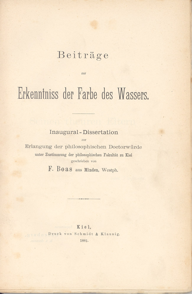
Franz Uri Boas (July 9, 1858 – December 21, 1942) was a German-American anthropologist and a pioneer of modern anthropology who has been called the "Father of American Anthropology". His work is associated with the movements known as historical particularism and cultural relativism. Studying in Germany, Boas was awarded a doctorate in 1881 in physics while also studying geography. He then participated in a geographical expedition to northern Canada, where he became fascinated with the culture and language of the Baffin Island Inuit. He went on to do field work with the indigenous cultures and languages of the Pacific Northwest. In 1887 he emigrated to the United States, where he first worked as a museum curator at the Smithsonian, and in 1899 became a professor of anthropology at Columbia University, where he remained for the rest of his career. Through his students, many of whom went on to found anthropology departments and research programmes inspired by their mentor, Boas pr ... [...More Info...] [...Related Items...] OR: [Wikipedia] [Google] [Baidu] |
Nuxalk
The Nuxalk people ( Nuxalk: ''Nuxalkmc''; pronounced )'','' also referred to as the Bella Coola, Bellacoola or Bilchula, are an Indigenous First Nation of the Pacific Northwest Coast, centred in the area in and around Bella Coola, British Columbia. Their language is also called Nuxalk. Their on-reserve tribal government is the Nuxalk Nation. Name and tribes/groups The name "Bella Coola", often used in academic writing, is not preferred by the Nuxalk; it is a derivation of the neighbouring Wakashan-speaking coastal Heiltsuk people's name for the Nuxalk as ''bəlxwəlá'' or ''bḷ́xʷlá'', meaning "stranger" (rendered plxwla in Nuxalk orthography). Within the Nuxalk language, "Nuxalkmc" is the term for the people, and "ItNuxalkmc" is the term for the language, and these terms are increasingly being used in English locally. The Nuxalk peoples, known today collectively as Nuxalkmc, are made up of lineages representing several ancestral villages within their territory. From ... [...More Info...] [...Related Items...] OR: [Wikipedia] [Google] [Baidu] |
List Of Kwakwaka'wakw Villages
A ''list'' is any set of items in a row. List or lists may also refer to: People * List (surname) Organizations * List College, an undergraduate division of the Jewish Theological Seminary of America * SC Germania List, German rugby union club Other uses * Angle of list, the leaning to either port or starboard of a ship * List (information), an ordered collection of pieces of information ** List (abstract data type), a method to organize data in computer science * List on Sylt, previously called List, the northernmost village in Germany, on the island of Sylt * ''List'', an alternative term for ''roll'' in flight dynamics * To ''list'' a building, etc., in the UK it means to designate it a listed building that may not be altered without permission * Lists (jousting), the barriers used to designate the tournament area where medieval knights jousted * ''The Book of Lists'', an American series of books with unusual lists See also * The List (other) * Listing ( ... [...More Info...] [...Related Items...] OR: [Wikipedia] [Google] [Baidu] |
.jpg)

_a_Kwakwaka'wakw_big_house.jpg)


