|
Melksham Without
Melksham Without is a civil parish in the county of Wiltshire, England. It surrounds, but does not include, the town of Melksham and is the largest rural parish in Wiltshire, with a population of 7,230 (as of 2011) and an area of . In 1894 the ancient parish of Melksham was divided into Melksham Urban District and the rural parish of Melksham Without. The northern boundary of the parish is the Roman road from Silchester to Bath; downstream from Melksham the Bristol Avon forms the southwestern boundary, and parts of the southern boundary are the Semington Brook and the Kennet and Avon Canal. The parish includes the villages of Beanacre, Berryfield, Shaw and Whitley, and the hamlets of Outmarsh and Redstocks. It also includes the outer Melksham suburbs of Bowerhill and The Spa, and the dispersed settlement of Sandridge which includes Sandridge Common. Governance The Local Government Act of 1894 created the parish of Melksham Without, dividing the ancient parish of Me ... [...More Info...] [...Related Items...] OR: [Wikipedia] [Google] [Baidu] |
Shaw, Wiltshire
Shaw is a village in the civil parish of Melksham Without, Wiltshire, England. It is about northwest of Melksham on the A365 Melksham to Box road, where the B3353 diverges to Corsham. History The manor of Shaw was recorded in the 13th century and became a tithing of Melksham parish. By 1335 there was a chapel of St Leonard, but there are no records of this chapel after 1460. The higher ground to the west of the village was known as Shaw Hill. Shaw House, built in 1711 and extended c. 1840, is Grade II* listed. The house was used as a school in the early 19th century, as a home for the elderly in the 20th century, and as of 2015 has returned to residential use. The Anglican Christ Church was built in 1838 to designs by T.H. Wyatt, and served Shaw and Whitley as a chapelry of the parish church at Melksham. This church proved to be too small and was rebuilt in 1905 to designs of C.E. Ponting at the expense of Charles Selwyn Awdry, who had served as High Sheriff of Wiltshi ... [...More Info...] [...Related Items...] OR: [Wikipedia] [Google] [Baidu] |
Parish Councils In England
Parish councils are civil local authorities found in England which are the lowest tier of local government. They are elected corporate bodies, with variable tax raising powers, and they carry out beneficial public activities in geographical areas known as civil parishes. There are about 9,000 parish and town councils in England, and over 16 million people live in communities served by them. Parish councils may be known by different styles, they may resolve to call themselves a town council, village council, community council, neighbourhood council, or if the parish has city status, it may call itself a city council. However their powers and duties are the same whatever name they carry.Local Government and Public Involvement in Health Act 2007 Parish councils receive the majority of their funding by levying a precept upon the council tax paid by the residents of the parish (or parishes) covered by the council. In 2021-22 the amount raised by precept was £616 million. Other f ... [...More Info...] [...Related Items...] OR: [Wikipedia] [Google] [Baidu] |
Abingdon-on-Thames
Abingdon-on-Thames ( ), commonly known as Abingdon, is a historic market town and civil parish in the ceremonial county of Oxfordshire, England, on the River Thames. Historically the county town of Berkshire, since 1974 Abingdon has been administered by the Vale of White Horse district within Oxfordshire. The area was occupied from the early to middle Iron Age and the remains of a late Iron Age and Roman defensive enclosure lies below the town centre. Abingdon Abbey was founded around 676, giving its name to the emerging town. In the 13th and 14th centuries, Abingdon was an agricultural centre with an extensive trade in wool, alongside weaving and the manufacture of clothing. Charters for the holding of markets and fairs were granted by various monarchs, from Edward I to George II. The town survived the dissolution of the abbey in 1538, and by the 18th and 19th centuries, with the building of Abingdon Lock in 1790, and Wilts & Berks Canal in 1810, was a key link between major ... [...More Info...] [...Related Items...] OR: [Wikipedia] [Google] [Baidu] |
Swindon
Swindon () is a town and unitary authority with borough status in Wiltshire, England. As of the 2021 Census, the population of Swindon was 201,669, making it the largest town in the county. The Swindon unitary authority area had a population of 233,410 as of 2021. Located in South West England, the town lies between Bristol, 35 miles (56 kilometres) to its west, and Reading, equidistant to its east. Recorded in the 1086 Domesday Book as ''Suindune'', it was a small market town until the mid-19th century, when it was selected as the principal site for the Great Western Railway's repair and maintenance works, leading to a marked increase in its population. The new town constructed for the railway workers produced forward-looking amenities such as the UK’s first lending library and a ‘cradle-to-grave' health care centre that was later used as a blueprint for the NHS. After the Second World War, the town expanded dramatically again, as industry and people moved out f ... [...More Info...] [...Related Items...] OR: [Wikipedia] [Google] [Baidu] |
Chippenham
Chippenham is a market town in northwest Wiltshire, England. It lies northeast of Bath, west of London, and is near the Cotswolds Area of Natural Beauty. The town was established on a crossing of the River Avon and some form of settlement is believed to have existed there since before Roman times. It was a royal vill, and probably a royal hunting lodge, under Alfred the Great. The town continued to grow when the Great Western Railway arrived in 1841. The town had a population of 36,548 in 2021. Geography Location Chippenham is in western Wiltshire, at a prominent crossing of the River Avon, between the Marlborough Downs to the east, the southern Cotswolds to the north and west and Salisbury Plain to the southeast. The town is surrounded by sparsely populated countryside and there are several woodlands in or very near the town, such as Bird's Marsh, Vincients Wood and Briars Wood. Suburbs Suburbs include Cepen Park (North & South), Hardenhuish, Monkton, Lowden, Pewsh ... [...More Info...] [...Related Items...] OR: [Wikipedia] [Google] [Baidu] |
Semington
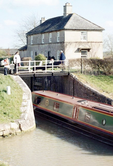
Semington is a village and civil parish in Wiltshire, England. The village is about south of Melksham and about northeast of Trowbridge. The parish includes the hamlets of Little Marsh and Littleton.election-maps.co.uk Semington Civil Parish boundary on Ordnance Survey 1:50,000 colour raster layer. Retrieved 23 October 2006. The village has two locks on the , known as the , and nearby is the start of the disused [...More Info...] [...Related Items...] OR: [Wikipedia] [Google] [Baidu] |
Wilts & Berks Canal
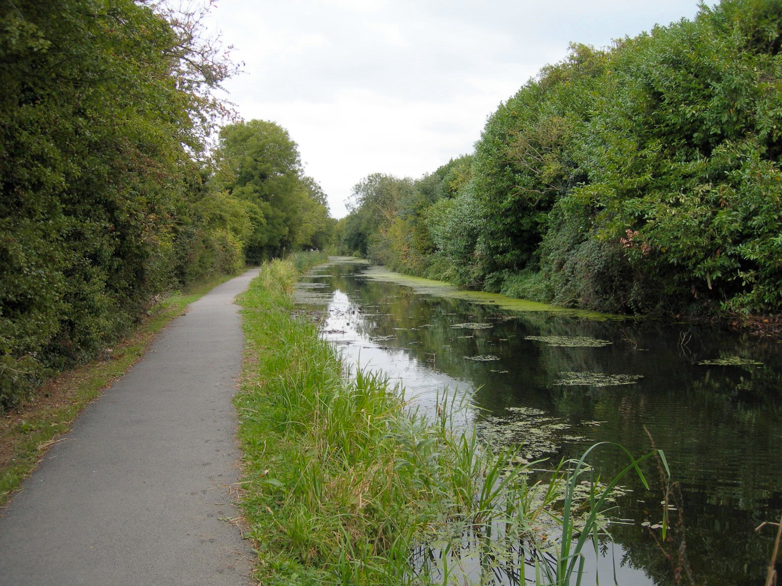
The Wilts & Berks Canal is a canal in the historic counties of Wiltshire and Berkshire, England, linking the Kennet and Avon Canal at Semington near Melksham, to the River Thames at Abingdon. The North Wilts Canal merged with it to become a branch to the Thames and Severn Canal at Latton near Cricklade. Among professional trades boatmen, the canal was nicknamed the Ippey Cut, possibly short for Chippenham. The canal was opened in 1810, but abandoned in 1914 – a fate hastened by a breach at Stanley aqueduct in 1901. Much of the canal subsequently became unnavigable: many of the structures were deliberately damaged by army demolition exercises; parts of the route were filled in and in some cases built over. In 1977 the Wilts & Berks Canal Amenity Group was formed with a view to full restoration of the canal. Several locks and bridges have since been restored, and over of the canal have been rewatered. Name The official name of the canal is the "Wilts & Berks Canal" ... [...More Info...] [...Related Items...] OR: [Wikipedia] [Google] [Baidu] |
Packhorse Bridge
A packhorse bridge is a bridge intended to carry packhorses ( horses loaded with sidebags or panniers) across a river or stream. Typically a packhorse bridge consists of one or more narrow (one horse wide) masonry arches, and has low parapets so as not to interfere with the panniers borne by the horses. Multi-arched examples sometimes have triangular cutwaters that are extended upward to form pedestrian refuges. Packhorse bridges were often built on the trade routes (often called packhorse routes) that formed major transport arteries across Europe and Great Britain until the coming of the turnpike roads and canals in the 18th century. Before the road-building efforts of Napoleon, all crossings of the Alps were on packhorse trails. Travellers' carriages were dismantled and transported over the mountain passes by ponies and mule trains. Definition In the British Isles at least, the definition of a packhorse bridge is somewhat nebulous. Ernest Hinchliffe discusses the diffi ... [...More Info...] [...Related Items...] OR: [Wikipedia] [Google] [Baidu] |
Charles Ponting
Charles Edwin Ponting, F.S.A., (1850–1932) was a Gothic Revival architect who practised in Marlborough, Wiltshire. Career Ponting began his architectural career in 1864 in the office of the architect Samuel Overton. He was agent for Meux brewing family's estate from 1870 until 1888. After Admiral Hedworth Meux inherited Theobalds House in Hertfordshire in 1910, Ponting enlarged the house for him. In 1883 the Diocese of Salisbury appointed Ponting Surveyor of Ecclesiastical Dilapidations for the Archdeaconry of Wiltshire. Part of the Diocese of Bristol was added to his responsibilities in 1887 and the Diocese of Salisbury added the Archdeaconry of Dorset to his duties in 1892. He resigned from his post with the Bristol Diocese in 1915 and from that with the Salisbury Diocese in 1923. Family Ponting married Overton's daughter Martha Margaretta in 1872. She died in 1873 at the age of 20 while giving birth to their twin daughters Martha and Mary. Ponting never remarried, a ... [...More Info...] [...Related Items...] OR: [Wikipedia] [Google] [Baidu] |
Gothic Revival Architecture
Gothic Revival (also referred to as Victorian Gothic, neo-Gothic, or Gothick) is an architectural movement that began in the late 1740s in England. The movement gained momentum and expanded in the first half of the 19th century, as increasingly serious and learned admirers of the neo-Gothic styles sought to revive medieval Gothic architecture, intending to complement or even supersede the neoclassical styles prevalent at the time. Gothic Revival draws upon features of medieval examples, including decorative patterns, finials, lancet windows, and hood moulds. By the middle of the 19th century, Gothic had become the preeminent architectural style in the Western world, only to fall out of fashion in the 1880s and early 1890s. The Gothic Revival movement's roots are intertwined with philosophical movements associated with Catholicism and a re-awakening of high church or Anglo-Catholic belief concerned by the growth of religious nonconformism. Ultimately, the " Anglo-Catholicis ... [...More Info...] [...Related Items...] OR: [Wikipedia] [Google] [Baidu] |
Grade I Listed
In the United Kingdom, a listed building or listed structure is one that has been placed on one of the four statutory lists maintained by Historic England in England, Historic Environment Scotland in Scotland, in Wales, and the Northern Ireland Environment Agency in Northern Ireland. The term has also been used in the Republic of Ireland, where buildings are protected under the Planning and Development Act 2000. The statutory term in Ireland is "protected structure". A listed building may not be demolished, extended, or altered without special permission from the local planning authority, which typically consults the relevant central government agency, particularly for significant alterations to the more notable listed buildings. In England and Wales, a national amenity society must be notified of any work to a listed building which involves any element of demolition. Exemption from secular listed building control is provided for some buildings in current use for worship, ... [...More Info...] [...Related Items...] OR: [Wikipedia] [Google] [Baidu] |
Office For National Statistics
The Office for National Statistics (ONS; cy, Swyddfa Ystadegau Gwladol) is the executive office of the UK Statistics Authority, a non-ministerial department which reports directly to the UK Parliament. Overview The ONS is responsible for the collection and publication of statistics related to the economy, population and society of the UK; responsibility for some areas of statistics in Scotland, Northern Ireland and Wales is devolved to the devolved governments for those areas. The ONS functions as the executive office of the National Statistician, who is also the UK Statistics Authority's Chief Executive and principal statistical adviser to the UK's National Statistics Institute, and the 'Head Office' of the Government Statistical Service (GSS). Its main office is in Newport near the United Kingdom Intellectual Property Office and Tredegar House, but another significant office is in Titchfield in Hampshire, and a small office is in London. ONS co-ordinates data colle ... [...More Info...] [...Related Items...] OR: [Wikipedia] [Google] [Baidu] |


