|
Mbalabala
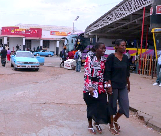
Mbalabala (Balla Balla until 1982) is a village on the main Beitbridge-Bulawayo road (at the junction with the Filabusi Road) in Matabeleland, Zimbabwe. Situated approximately 41 miles (66 km) south-east of the city of Bulawayo. The name is derived from the Ndebele name for the greater kudu (scientific name: Tragelaphus strepsiceros). It was originally rendered ''Balla Balla'' by Europeans, which was altered to its present name in 1982 by the Zimbabwean government in order to coincide closer with the local pronunciation. The village has a railway station on the Beitbridge Bulawayo Railway and is the railhead for the mining area of Filabusi. The village also hosts a large army barracks, which is the Zimbabwe School of Infantry, formerly Shaw Barracks for the Rhodesian African Rifles from 1976 to 1980. The site was previously St. Stephen's College from February 1959 to December 1975. Mbalabala is situated on high ground, which forms a ridge between the Mzingwane and Mb ... [...More Info...] [...Related Items...] OR: [Wikipedia] [Google] [Baidu] |
Mzingwane River
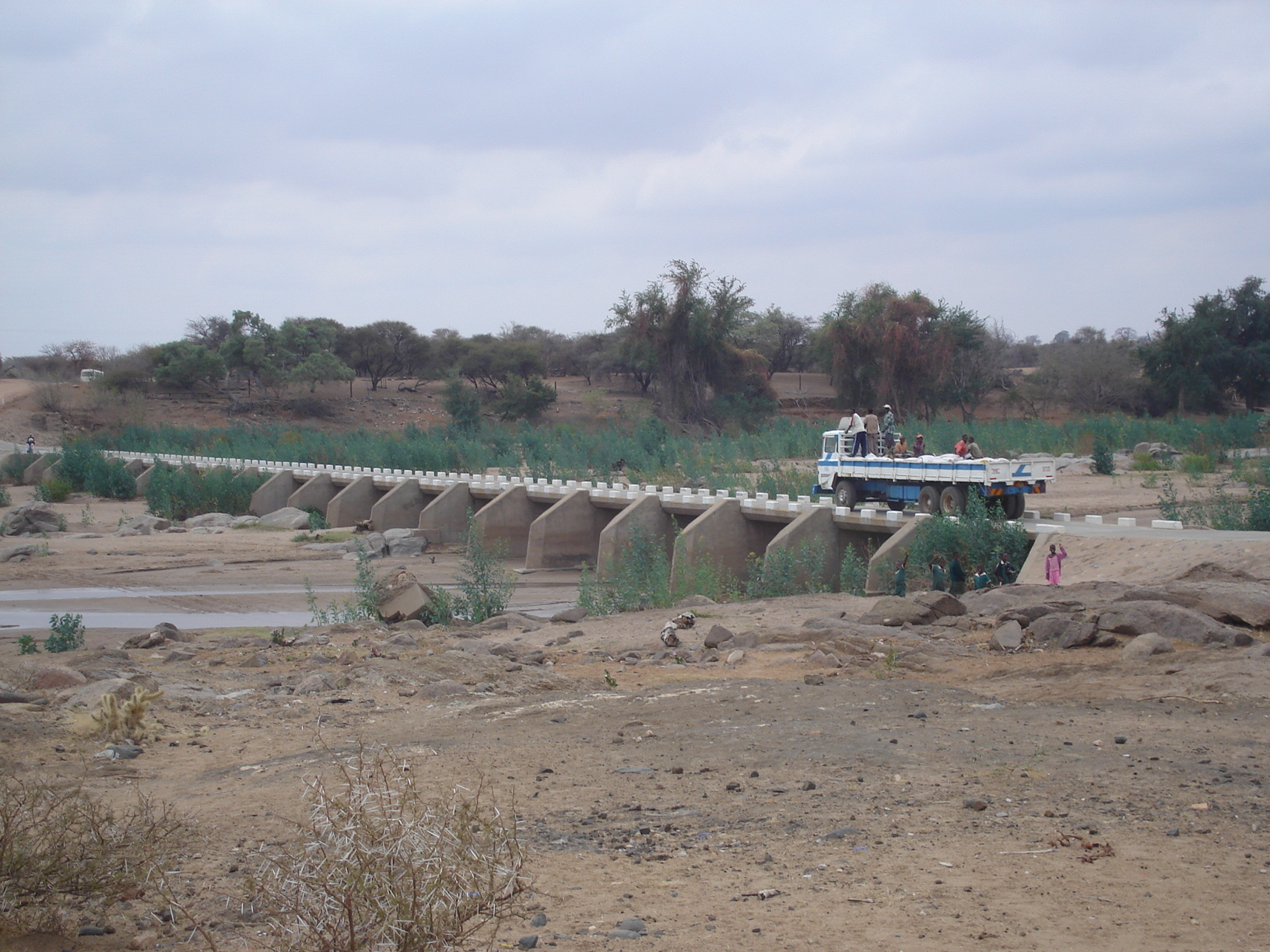
The Mzingwane River, formerly known Umzingwane River as or Umzingwani River is a major left-bank tributary of the Limpopo River in Zimbabwe. It rises near Fort Usher, Matobo District, south of Bulawayo and flows into the Limpopo River near Beitbridge, downstream of the mouth of the Shashe River and upstream of the mouth of the Bubye River. Hydrology The Mzingwane River is an ephemeral river with flow generally restricted to the months when rain takes place (November to March), with most flow recorded between December and February, except where it has been modified by dam operations. The river contributes 9.3% of the mean annual runoff of the Limpopo Basin, making it the third largest tributary to the Limpopo basin. Major tributaries of the Mzingwane River include the Insiza, Inyankuni, Ncema, Umchabezi (not to be confused with Mtshabezi) and Mtetengwe Rivers. The lower Mzingwane River is a sand filled channel, with extensive alluvial aquifers in the river channel ... [...More Info...] [...Related Items...] OR: [Wikipedia] [Google] [Baidu] |
Filabusi
Filabusi is a town in the Matabeleland South Province of Zimbabwe. The town is the district capital of Insiza District and a service centre for the surrounding mining and farming areas. Location Filabusi lies off the Mbalabala–Mutare Road, approximately , southeast of Bulawayo, the nearest large city. This is approximately , by road, west of Zvishavane, in Zvishavane District. The geographical coordinates of Filabusi are 20°31'46.0"S, 29°17'12.0"E (Latitude:-20.529444; Longitude:29.286667). The town sits at an average elevation of above mean sea level. Overview The town of Filabusi is supplied with water from a weir on the Insiza River. The Filabusi Mining District was a major producer of gold, with mines such as Fred and Royal Family. Nickel was mined at Epoch Mines, owned by Bindura Nickel Corporation. Asbestos was also mined at Pangani and Croft. However all these large scale mining operations are now closed, with mining in the district limited to small scale ... [...More Info...] [...Related Items...] OR: [Wikipedia] [Google] [Baidu] |
Village
A village is a clustered human settlement or community, larger than a hamlet but smaller than a town (although the word is often used to describe both hamlets and smaller towns), with a population typically ranging from a few hundred to a few thousand. Though villages are often located in rural areas, the term urban village is also applied to certain urban neighborhoods. Villages are normally permanent, with fixed dwellings; however, transient villages can occur. Further, the dwellings of a village are fairly close to one another, not scattered broadly over the landscape, as a dispersed settlement. In the past, villages were a usual form of community for societies that practice subsistence agriculture, and also for some non-agricultural societies. In Great Britain, a hamlet earned the right to be called a village when it built a church. [...More Info...] [...Related Items...] OR: [Wikipedia] [Google] [Baidu] |
Kopje
An inselberg or monadnock () is an isolated rock hill, knob, ridge, or small mountain that rises abruptly from a gently sloping or virtually level surrounding plain. In Southern Africa a similar formation of granite is known as a koppie, an Afrikaans word ("little head") from the Dutch diminutive word ''kopje''. If the inselberg is dome-shaped and formed from granite or gneiss, it can also be called a bornhardt, though not all bornhardts are inselbergs. An inselberg results when a body of rock resistant to erosion, such as granite, occurring within a body of softer rocks, is exposed by differential erosion and lowering of the surrounding landscape. Etymology Inselberg The word ''inselberg'' is a loan word from German, and means "island mountain". The term was coined in 1900 by geologist Wilhelm Bornhardt (1864–1946) to describe the abundance of such features found in eastern Africa. At that time, the term applied only to arid landscape features. However, it has sin ... [...More Info...] [...Related Items...] OR: [Wikipedia] [Google] [Baidu] |
Zimbabwe
Zimbabwe (), officially the Republic of Zimbabwe, is a landlocked country located in Southeast Africa, between the Zambezi and Limpopo Rivers, bordered by South Africa to the south, Botswana to the south-west, Zambia to the north, and Mozambique to the east. The capital and largest city is Harare. The second largest city is Bulawayo. A country of roughly 15 million people, Zimbabwe has 16 official languages, with English, Shona language, Shona, and Northern Ndebele language, Ndebele the most common. Beginning in the 9th century, during its late Iron Age, the Bantu peoples, Bantu people (who would become the ethnic Shona people, Shona) built the city-state of Great Zimbabwe which became one of the major African trade centres by the 11th century, controlling the gold, ivory and copper trades with the Swahili coast, which were connected to Arab and Indian states. By the mid 15th century, the city-state had been abandoned. From there, the Kingdom of Zimbabwe was established, fol ... [...More Info...] [...Related Items...] OR: [Wikipedia] [Google] [Baidu] |
Matabeleland
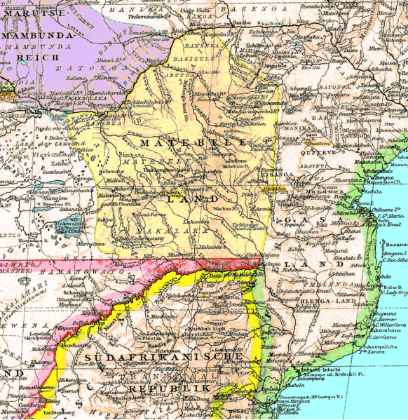
Matabeleland is a region located in southwestern Zimbabwe that is divided into three provinces: Matabeleland North, Bulawayo, and Matabeleland South. These provinces are in the west and south-west of Zimbabwe, between the Limpopo and Zambezi rivers and are further separated from Midlands by the Shangani River in central Zimbabwe. The region is named after its inhabitants, the Ndebele people who were called "Amatabele"(people with long spears - Mzilikazi 's group of people who were escaping the Mfecani wars). Other ethnic groups who inhabit parts of Matabeleland include the Tonga, Bakalanga, Venda, Nambya, Khoisan, Xhosa, Sotho, Tswana, and Tsonga. The population of Matabeleland is just over 20% of the Zimbabwe's total. The capital and largest city is Bulawayo, other notable towns are Plumtree, Victoria Falls, Beitbridge, Lupane, Esigodini, Hwange and Gwanda. The land is fertile but semi arid. This area has coal and gold deposits. Industries include gold ... [...More Info...] [...Related Items...] OR: [Wikipedia] [Google] [Baidu] |
Beitbridge
Beitbridge is a border town in the province of Matabeleland South, Zimbabwe. The name also refers to the border post and bridge spanning the Limpopo River, which forms the political border between South Africa and Zimbabwe. The border on the South African side of the river is also named Beitbridge. Background The town lies just north of the Limpopo River about 1 km from the Alfred Beit Road Bridge which spans the Limpopo between South Africa and Zimbabwe. The main roads are the A6 highway to Bulawayo and the Victoria Falls, being and away respectively and the A4 to Masvingo and Harare. According to the 2012 population census, the town had a population of 41,767 dominated by the Venda and Ndebele people . There is a sizable percentage of Shona people from other provinces this is a busy border post with traders from all over Zimbabwe. The Beitbridge border post is the busiest road border post in Southern Africa, and is best avoided during busy border-crossi ... [...More Info...] [...Related Items...] OR: [Wikipedia] [Google] [Baidu] |
Bulawayo
Bulawayo (, ; Ndebele: ''Bulawayo'') is the second largest city in Zimbabwe, and the largest city in the country's Matabeleland region. The city's population is disputed; the 2022 census listed it at 665,940, while the Bulawayo City Council claimed it to be about 1.2 million. Bulawayo covers an area of about in the western part of the country, along the Matsheumhlope River. Along with the capital Harare, Bulawayo is one of two cities in Zimbabwe that is also a province. Bulawayo was founded by a group led by Gundwane Ndiweni around 1840 as the kraal of Mzilikazi, the Ndebele king and was known as Gibixhegu. His son, Lobengula, succeeded him in the 1860s, and changed the name to kobulawayo and ruled from Bulawayo until 1893, when the settlement was captured by British South Africa Company soldiers during the First Matabele War. That year, the first white settlers arrived and rebuilt the town. The town was besieged by Ndebele warriors during the Second Matabele War. Bul ... [...More Info...] [...Related Items...] OR: [Wikipedia] [Google] [Baidu] |
Northern Ndebele Language
Northern Ndebele (), also called Ndebele, isiNdebele saseNyakatho, Zimbabwean Ndebele or North Ndebele, associated with the term Matabele, is a Bantu language spoken by the Northern Ndebele people which belongs to the Nguni group of languages. As a start and to give some context, Ndebele is a term used to refer to a collection of many different African cultures in Zimbabwe. It perhaps by default became a 'language' (for lack of better word) spoken predominantly by the descendants of Mzilikazi. As a language, it is by no means similar to the Ndebele language spoken in kwaNdebele in South Africa although, like many Nguni dialects, some words will be shared. Many of the natives that were colonized by the Matabele were assimilated into Mzilikazi's kingdom to create a version of isiZulu. The Matebele people of Zimbabwe descend from followers of the Zulu leader Mzilikazi (one of Zulu King Shaka's generals), who left the Zulu Kingdom in the early 19th century, during the Mfecane ... [...More Info...] [...Related Items...] OR: [Wikipedia] [Google] [Baidu] |
Kudu
The kudus are two species of antelope of the genus ''Tragelaphus'': * Lesser kudu, ''Tragelaphus imberbis'', of eastern Africa * Greater kudu, ''Tragelaphus strepsiceros'', of eastern and southern Africa The two species look similar, though greaters are larger than lessers. A large adult male greater kudu stands over tall at the shoulder, and a large male lesser kudu stands about tall. Males of both species have long horns, which point upward and slightly back, curling in a corkscrew shape. Etymology The name of the animal was imported into English in the 18th century from isiXhosa ''iqhude'', via Afrikaans ''koedoe''. Kudu, or koodoo, is the Khoikhoi and seTswana name for this antelope. ''Tragos'' (Greek) denotes a he-goat and ''elaphos'' (Greek) a deer. ''Strepho'' (Greek) means "I twist", and ''strephis'' is "twisting". ''Keras'' (Greek) means "horn". Habitat Lesser kudus occupy savanna near ''Acacia'' and ''Commiphora'' shrubs. They rely on thickets for protect ... [...More Info...] [...Related Items...] OR: [Wikipedia] [Google] [Baidu] |
Tragelaphus Strepsiceros
The greater kudu (''Tragelaphus strepsiceros'') is a woodland antelope found throughout eastern and southern Africa. Despite occupying such widespread territory, they are sparsely populated in most areas due to declining habitat, deforestation, and poaching. The greater kudu is one of two species commonly known as kudu, the other being the lesser kudu, ''T. imberbis''. Etymology of the name Kudu ( ), or koodoo, is the Khoikhoi name for this antelope. ''Trag-'' (Greek) denotes a goat and ''elaphos'' (Greek) a deer. ''Strepho'' (Greek) means "twist", and ''strepsis'' is "twisting". ''Keras'' (Greek) refers to the horn of the animal. Physical characteristics Greater kudus have a narrow body with long legs, and their coats can range from brown/bluish grey to reddish brown. They possess between 4 and 12 vertical white stripes along their torso. The head tends to be darker in colour than the rest of the body, and exhibits a small white chevron which runs between the e ... [...More Info...] [...Related Items...] OR: [Wikipedia] [Google] [Baidu] |
Beitbridge Bulawayo Railway
The Beitbridge Bulawayo Railway (BBR) is a privately owned railway company that provides a rail link in Zimbabwe between Beitbridge at the South African border and Zimbabwe's second city Bulawayo. The BBR is a build-operate-transfer project that has shortened the distance between Bulawayo in Zimbabwe and South Africa to . Prior to its inauguration, rail service between South Africa and Bulawayo used a route through Botswana that is about longer. The shorter line has been used primarily for freight transportation. The principal contractor was Concor. New Limpopo Projects Investments Limited (NLPI), a Mauritius registered company, specialises in private sector investments using the build-operate-transfer (BOT) concept. The BBR is one of the three connected NLPI railway operations in Zimbabwe and Zambia that form a rail link between South Africa and the Democratic Republic of Congo. The BBR was inaugurated on 15 July 1999. After 30 years of service the BBR will be handed ov ... [...More Info...] [...Related Items...] OR: [Wikipedia] [Google] [Baidu] |


.jpg)