|
Mazenzele
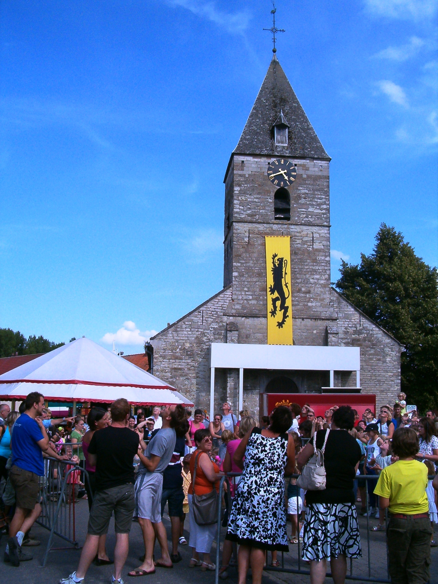 Mazenzele is a Flanders, Flemish village in the Belgian province Flemish Brabant and also a borough of Opwijk in the canton of Asse and the district Arrondissement of Halle-Vilvoorde, Halle-Vilvoorde. Mazenzele is situated at 20 km from Brussels in the Pajottenland region. Mazenzele originated in the Franks, Frankish period as a settlement around an open village fallow.
Kravaalbos is an old forest which is situated partly in Mazenzele. The other parts of the forest are located in Asse (Asse-ter-Heide) and Aalst, Belgium, Aalst (Meldert). The forest is a remnant of the ancient Coal Forest, which also included the Sonian Forest and the Hallerbos. The forest became famous in the Middle Ages for the quarries that were exploited there from the 12th to the 16th centuries on the initiative of ...
[...More Info...] [...Related Items...] OR: [Wikipedia] [Google] [Baidu] |
Opwijk
Opwijk () is a municipality located in the Belgian province of Flemish Brabant. The municipality comprises the towns of Mazenzele and Opwijk proper. On January 1, 2012, Opwijk had a total population of 13,990. The total area is 19.69 km2 which gives a population density of 690 inhabitants per km2. Places of interest Built heritage * The church of Saint-Paul * The monastery of the sisters of Saint-Vincentius a Pauo Places of commemoration * At the cemetery, against a red beech, a monument commemorates the fallen soldiers of World War I. Besides a lot of veterans are buried here. Other heritage * The garden of the notary house oWijnants Today the garden is part of a school. Only a few trees are left over, such as a beautiful weeping beech (''fagus sylvatica Pendula''). * The garden ofTemmershof. In 2007 most of the park was destroyed, except a few trees such as a big horse chestnut (''aesculus hippocastanum''). Parks * The central park 'Hof ten Hemelrijk' ... [...More Info...] [...Related Items...] OR: [Wikipedia] [Google] [Baidu] |
Kermis Mazenzele
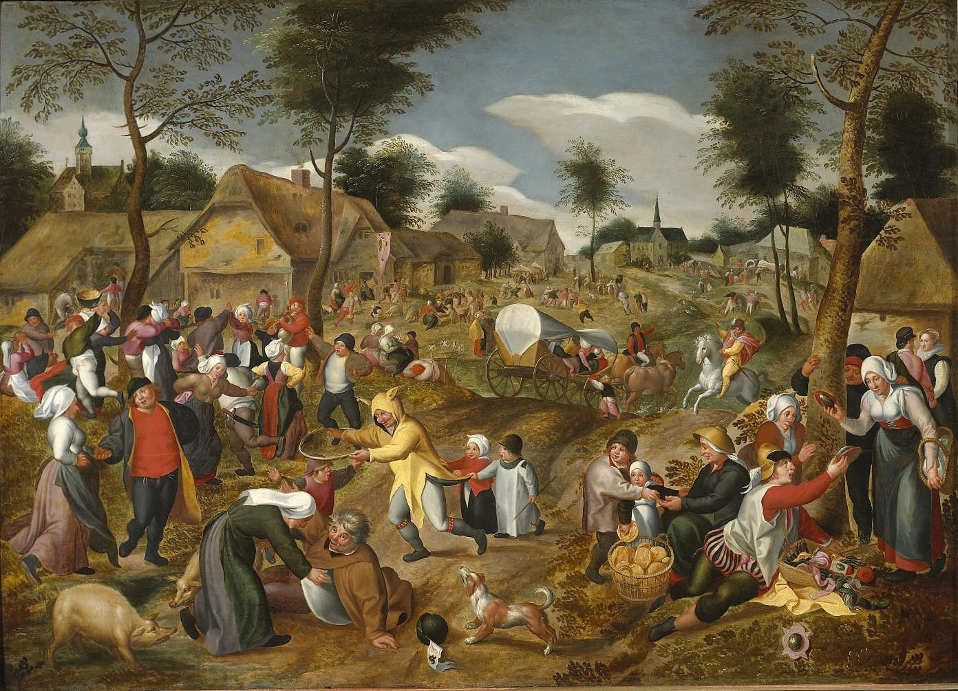
Kermesse, or kermis, or kirmess, is an outdoor fair or festival usually organized for charitable purposes. The term was derived from 'kerk' (church) and 'mis' (mass) in the original Dutch language term, and was borrowed in English, French, Spanish and many other languages. It originally denoted a mass and patronal festival held on the anniversary of the foundation of a church (or the parish) and in honour of the patron saint. Such celebrations were regularly held in the Low Countries, in Central Europe and also in northern France, and were accompanied by feasting, dancing and competitions of all kinds. The Kirchweih is the German equivalent, while church ale was a name of similar festivals in England. Many Catholic churches (parishes) still have patronal festivals of some sort for the anniversary of the church's founding, or the feast day of the saint it is dedicated to. The kermesse became a common subject in Dutch and Flemish Renaissance painting in the 16th century, though m ... [...More Info...] [...Related Items...] OR: [Wikipedia] [Google] [Baidu] |
Flanders
Flanders ( or ; ) is the Dutch language, Dutch-speaking northern portion of Belgium and one of the communities, regions and language areas of Belgium. However, there are several overlapping definitions, including ones related to culture, language, politics, and history, and sometimes involving neighbouring countries. The demonym associated with Flanders is Flemings, Fleming, while the corresponding adjective is Flemish people, Flemish, which can also refer to the collective of Dutch dialects spoken in that area, or more generally the Belgian variant of Standard Dutch. Most Flemings live within the Flemish Region, which is a federal state within Belgium with its own elected government. However, like Belgium itself, the official capital of Flanders is the City of Brussels, which lies within the Brussels, Brussels-Capital Region, not the Flemish Region, and the majority of residents there are French speaking. The powers of the Flemish Government in Brussels are limited mainly ... [...More Info...] [...Related Items...] OR: [Wikipedia] [Google] [Baidu] |
Flemish Brabant
Flemish Brabant ( ; ) is a province of Flanders, one of the three regions of Belgium. It borders on (clockwise from the North) the Belgian provinces of Antwerp, Limburg, Liège, Walloon Brabant, Hainaut and East Flanders. Flemish Brabant also surrounds the Brussels-Capital Region. Its capital is Leuven. It has an area of which is divided into two administrative districts (''arrondissementen'' in Dutch) containing 65 municipalities. As of January 2024, Flemish Brabant had a population of over 1.19 million. Flemish Brabant was created in 1995 by the splitting of the former province of Brabant into three parts: two new provinces, Flemish Brabant and Walloon Brabant; and the Brussels-Capital Region, which no longer belongs to any province. The split was made to accommodate the eventual division of Belgium in three regions (Flanders, Wallonia and the Brussels-Capital Region). The province is made up of two arrondissements. The Halle-Vilvoorde Arrondissement surrounds Brussels a ... [...More Info...] [...Related Items...] OR: [Wikipedia] [Google] [Baidu] |
Asse
Asse () is a Municipalities of Belgium, municipality located in the Belgium, Belgian province of Flemish Brabant. It comprises the towns of Asse proper, Bekkerzeel, Kobbegem, Mollem, Relegem and Zellik. Asse is also situated in the Pajottenland. As of 2020, Asse had a total population of 32,958. The total area is 49.64 km2 which gives a population density of circa 660 inhabitants per km2. History Asse (formerly spelt "Assche") was probably inhabited by the Celts, Celtic tribe of the Nervii. The name itself probably comes from a pre-Celtic word meaning "water" (cf Esch-, Es- and Axe- prefixes elsewhere in Europe). It was probably inhabited from an early date; stone tools have been found in various locations. The fertility of the soil and the relief which rises above the wetter plains of present-day Flanders would also suggest that his would have been an early area of settlement. From the middle of the first century, a Ancient Rome, Roman military road connected it to the ca ... [...More Info...] [...Related Items...] OR: [Wikipedia] [Google] [Baidu] |
Arrondissement Of Halle-Vilvoorde
The Halle-Vilvoorde Arrondissement () is one of the two administrative arrondissements in the Belgian province of Flemish Brabant. It almost completely surrounds the Brussels-Capital Region and lies to the west of the other arrondissement in the province, the Leuven Arrondissement. Unlike the Arrondissement of Leuven, it is not a judicial arrondissement; however since the sixth Belgian state reform in 2012–14, it has its own public prosecutor's service. The Halle-Vilvoorde Arrondissement and the Brussels-Capital Region together formed the Brussels-Halle-Vilvoorde electoral district and the Judicial Arrondissement of Brussels. Following the 2007 federal election, Yves Leterme, who was in charge of the negotiations for forming a new Federal Government, proposed to split up the Judicial Arrondissement of Brussels into two judicial arrondissements: one comprising Halle-Vilvoorde and the other comprising the Brussels Region. History The Arrondissement of Halle-Vilvoorde was estab ... [...More Info...] [...Related Items...] OR: [Wikipedia] [Google] [Baidu] |
Pajottenland
The Pajottenland (; in English occasionally Payottenland) is a distinct region within the Flemish Brabant province and the south-western part of the Brussels Region of Belgium. The region is located west-southwest of Brussels. The Pajottenland is predominantly farmland, with occasional gently rolling hills, and lies mostly between the rivers Dender and Zenne / Senne. The area has historically provided food and drink for the citizens of Brussels, especially Lambic beers, which are only produced here and in the Zenne valley where Brussels is. Geography The Pajottenland is generally understood to cover the following municipalities and submunicipalities: * Affligem: Essene, Hekelgem and Teralfene *Asse: Asse, Bekkerzeel, Kobbegem, Mollem, Relegem and Zellik * Bever *Dilbeek: Dilbeek, Itterbeek (with Sint-Anna-Pede), Schepdaal (with Sint-Gertrudis-Pede), Sint-Martens-Bodegem, Sint-Ulriks-Kapelle, Groot-Bijgaarden * Galmaarden: Galmaarden, Tollembeek, Vollezele * Gooik: G ... [...More Info...] [...Related Items...] OR: [Wikipedia] [Google] [Baidu] |
Franks
file:Frankish arms.JPG, Aristocratic Frankish burial items from the Merovingian dynasty The Franks ( or ; ; ) were originally a group of Germanic peoples who lived near the Rhine river, Rhine-river military border of Germania Inferior, which was the most northerly province of the Roman Empire in continental Europe. These Frankish tribes lived for centuries under varying degrees of Roman hegemony and influence, but after the collapse of Roman institutions in western Europe they took control of a large empire including areas which had been ruled by Rome, and what it meant to be a Frank began to evolve. Once they were deeply established in Gaul, the Franks became a multilingual, Catholic Christian people, who subsequently came to rule over several other post-Roman kingdoms both inside and outside the old empire. In a broader sense much of the population of western Europe could eventually described as Franks in some contexts. The term "Frank" itself first appeared in the third cent ... [...More Info...] [...Related Items...] OR: [Wikipedia] [Google] [Baidu] |
Fallow
Fallow is a farming technique in which arable land is left without sowing for one or more vegetative cycles. The goal of fallowing is to allow the land to recover and store Organic compound, organic matter while retaining moisture and disrupting pest life cycles and soil borne pathogens by temporarily removing their Host (biology), hosts. Crop rotation systems typically called for some of a farmer's fields to be left fallow each year. The increase in intensive farming, including the use of cover crops in lieu of fallow practices, has caused a loss of acreage of fallow land, as well as field margins, hedges, and wasteland. This has reduced biodiversity; fallows have been the primary habitat for farmland bird populations. Fallow syndrome Fallow syndrome is when a crop has insufficient nutrient uptake due to the lack of arbuscular mycorhizae (AM fungi) in the soil following a fallow period. Crops such as corn that are prone to fallow syndrome should not follow a period of fallow, b ... [...More Info...] [...Related Items...] OR: [Wikipedia] [Google] [Baidu] |
Aalst, Belgium
Aalst (; , ; Brabantian dialect, Brabantian: ''Oilsjt'') is a City status in Belgium, city and Municipalities in Belgium, municipality in the province of East Flanders in the Flemish Region of Belgium. It is located on the Dender River, about northwest of Brussels. The municipality comprises the city of Aalst itself and the villages of Baardegem, Erembodegem, Gijzegem, Herdersem, Hofstade, Meldert, Moorsel and Nieuwerkerken; it is the tenth largest city by population with 90.068 inhabitants. Aalst is crossed by the Molenbeek-Ter Erpenbeek in Aalst and Hofstade. The current mayor of Aalst is Christoph D'Haese, from the Nieuw-Vlaamse Alliantie, New-Flemish Alliance party. The town has a long-standing folkloric feud with Dendermonde, north along the same river, which dates from the Middle Ages. History The first historical records on Aalst date from the 9th century, when it was described as the ''villa Alost'', a dependency of the Abbey of Lobbes. During the Middle Ages, a town ... [...More Info...] [...Related Items...] OR: [Wikipedia] [Google] [Baidu] |
Sonian Forest
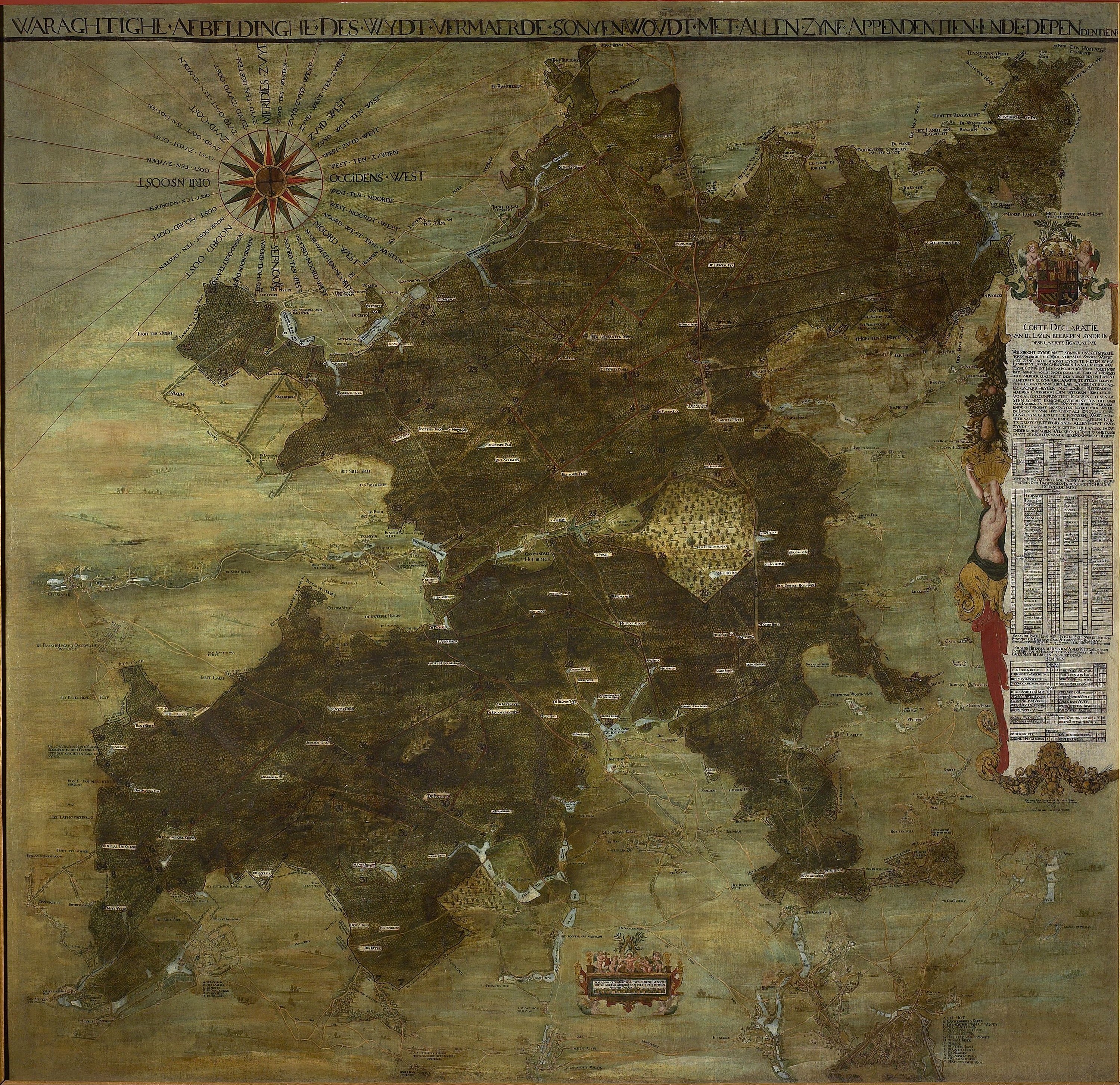
The Sonian Forest or Sonian Wood (, ; , ) is a forest at the south-eastern edge of Brussels, Belgium. It is connected to the Bois de la Cambre, Bois de la Cambre/Ter Kamerenbos, an urban public park which enters the city up to from the Pentagon (Brussels), city centre. The forest lies in the Flemish Region, Flemish municipalities of Sint-Genesius-Rode, Hoeilaart, Overijse, and Tervuren, in the Brussels-Capital Region municipalities of Uccle, Watermael-Boitsfort, Auderghem, and Woluwe-Saint-Pierre, and in the Wallonia, Walloon towns of La Hulpe and Waterloo, Belgium, Waterloo. Thus, it stretches out over the three Communities, regions and language areas of Belgium#Regions, Belgian Regions. It is maintained by Flanders (56%), Brussels (38%), and Wallonia (6%). There are some contiguous tracts of privately held forest and the ''Kapucijnenbos'', the "Capuchin Wood", which belongs to the Royal Trust (Belgium), Royal Trust. As of 2017, parts of the Sonian Forest have been inscribe ... [...More Info...] [...Related Items...] OR: [Wikipedia] [Google] [Baidu] |
Hallerbos
The Hallerbos (Dutch for ''Halle forest'') is a forest in Belgium, covering an area of . It is mostly situated in the municipality of Halle, in Flemish Brabant and has also a little part in Walloon Brabant. The forest is known in the region for its bluebell carpet which covers the forest floor for a few weeks each spring, attracting many visitors. Visitors can reach there either by their own vehicle or through public transport. For public transport, you can reach Halle railway station and get a bus to the entrance of the forest. History Historically, the Hallerbos was part of the Silva Carbonaria, along with other forests in the vicinity including the Sonian Forest and Meerdaal. As late as 1777, it was still connected by a woodland strip to the Sonian Forest. During World War I, most of the old trees were removed by the occupying German forces. Reforestation took place from 1930 to 1950. Gallery File:Hallerbos2.jpg, A walking path in October File:20081207 Hallerbos - ... [...More Info...] [...Related Items...] OR: [Wikipedia] [Google] [Baidu] |
