|
May Craig (island)
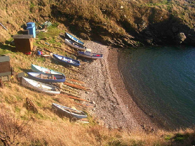
May Craig is a rocky island situated along the North Sea coast of Aberdeenshire, Scotland. May Craig lies about one half mile (0.8 km) south of Newtonhill and a mile (1.6 km) northeast of the village of Muchalls. A small islet of the same name lies three miles (five km) to the north-northeast. Area history The area to the west of May Craig was first inhabited by Pictish peoples who left prehistoric megalithic monuments along a trackway known as the Causey Mounth, a name coined in medieval times. Examples of these megaliths are Old Bourtreebush stone circle and Aquhorthies stone circle. Historic structures in the general area include Elsick House, Gillybrands and Muchalls Castle.Archibald Watt, ''Highways and Biways around Kincardineshire'', Stonehaven Heritage Society (1985) See also * Findon *Portlethen Portlethen (; ) is a town located approximately 7 miles south of Aberdeen, Scotland, along the A92 road, A92. The population according to the 2022 census was 8,969 makin ... [...More Info...] [...Related Items...] OR: [Wikipedia] [Google] [Baidu] |
North Sea
The North Sea lies between Great Britain, Denmark, Norway, Germany, the Netherlands, Belgium, and France. A sea on the European continental shelf, it connects to the Atlantic Ocean through the English Channel in the south and the Norwegian Sea in the north. It is more than long and wide, covering . It hosts key north European shipping lanes and is a major fishery. The coast is a popular destination for recreation and tourism in bordering countries, and a rich source of energy resources, including wind energy, wind and wave power. The North Sea has featured prominently in geopolitical and military affairs, particularly in Northern Europe, from the Middle Ages to the modern era. It was also important globally through the power northern Europeans projected worldwide during much of the Middle Ages and into the modern era. The North Sea was the centre of the Viking Age, Vikings' rise. The Hanseatic League, the Dutch Golden Age, Dutch Republic, and Kingdom of Great Britain, Brita ... [...More Info...] [...Related Items...] OR: [Wikipedia] [Google] [Baidu] |
Causey Mounth
The Causey Mounth is an ancient drovers' road over the coastal fringe of the Grampian Mountains in Aberdeenshire, Scotland. This route was developed around the 12th century Anno Domini, AD as the main highway between Stonehaven and Aberdeen, and it continued to function as the principal route connecting these two cities until the mid-20th century, when construction of the modern A90 road occurred in this area. There are extant paved and usable sections of this road over part of the alignment; however, many parts of the ancient route are no more than Trail, footpaths, and in some cases the road has vanished into agricultural fields. Constructed in the Middle Ages, the Causey Mounth was created as an elevated rock causeway to span many of the boggy areas such as the Portlethen Moss. A considerable portion of the alignment of the Causey Mounth is illustrated on the UK Ordnance Survey map, although a large fraction of the route cannot be navigated by a conventional passenger vehicle ... [...More Info...] [...Related Items...] OR: [Wikipedia] [Google] [Baidu] |
Portlethen
Portlethen (; ) is a town located approximately 7 miles south of Aberdeen, Scotland, along the A92 road, A92. The population according to the 2022 census was 8,969 making it the seventh most populous settlement within Aberdeenshire. To the east of Portlethen lie three fishing villages: Findon, Aberdeenshire, Findon, Downies and Portlethen Village (now often referred to as ''Old Portlethen''). Geography Portlethen is situated to the west of the Dundee–Aberdeen line railway tracks and on both sides of the A92 road, a short distance inland from the North Sea coast. It is in the historic county of Kincardineshire. History Portlethen is located half a mile inland from the small fishing village now known as Old Portlethen. Portlethen lies about two kilometres east of the ancient Causey Mounth road which was the only available medieval route from coastal points south to Aberdeen. This ancient passage connected the Bridge of Dee with Muchalls Castle and Stonehaven to the sou ... [...More Info...] [...Related Items...] OR: [Wikipedia] [Google] [Baidu] |
Findon, Aberdeenshire
Findon or Finnan is a fishing village eight miles south of Aberdeen, Scotland, Aberdeen, famous for originating the smoked haddock known as Finnan haddie. The Findon moorland, moor has a number of paths through it, many of which run along the cliffs. Deer can often be seen there. Nearby features include the Portlethen Moss Nature Reserve. Historical buildings in the area include Elsick House, Gillybrands and Muchalls Castle. Geography Findon is a coastal village along the North Sea in the area historically known as Kincardineshire. Somewhat to the south of Findon is the small offshore island of May Craig (island), May Craig. History The local area was first recorded in medieval history in association with the Causey Mounth. Findon is situated somewhat east of the ancient Causey Mounth trackway, which road was constructed on high ground to make passable this only available medieval route from coastal points south from Stonehaven to Aberdeen. This ancient passage specifically c ... [...More Info...] [...Related Items...] OR: [Wikipedia] [Google] [Baidu] |
Muchalls Castle
Muchalls Castle stands overlooking the North Sea in the countryside of Kincardine and Mearns, Aberdeenshire, Scotland. The lower course is a well-preserved Romanesque, double-groined 13th-century tower house structure, built by the Frasers of Muchalls. Upon this structure, the 17th-century castle was begun by Alexander Burnett of Leys and completed by his son, Sir Thomas Burnett, 1st Baronet, in 1627. The Burnetts of Leys built the remaining four-storey present-day castle. One of the most interesting castles in North-East Scotland, according to noted architectural historian Nigel Tranter, it is designed in the classic L style with a further extension wing at the west end. Muchalls Castle entered national history in 1638 when a seminal Covenanter gathering took place there, precedent the English Civil War. The plasterwork ceilings of the principal drawing rooms are generally regarded as among the three finest examples of plasterwork ceilings in Scotland. These adornments ... [...More Info...] [...Related Items...] OR: [Wikipedia] [Google] [Baidu] |
Elsick House
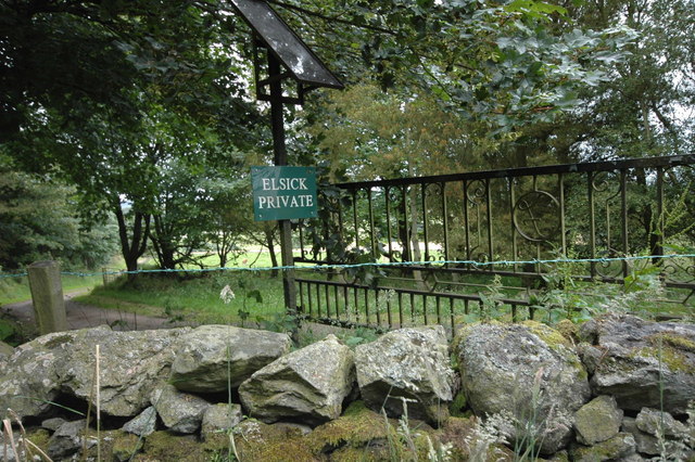
Elsick House is a historic house in Kincardineshire, North-East Scotland. It is situated in an agricultural area about two miles from the North Sea near the town of Newtonhill; the Elsick Estate is situated within the watershed of the Burn of Elsick, a stream that traverses the estate. The house is located on the Elsick Estate (), and is the present family seat of the Duke of Fife. Early area history Elsick House is located near the ancient Causey Mounth trackway, which road was constructed in medieval times to make passable this only available route across the coastal region of the Grampian Mounth connecting points south of Stonehaven to Aberdeen. This ancient drovers' road specifically connected the River Dee crossing (where the present Bridge of Dee is situated) via Portlethen Moss, Muchalls Castle and Stonehaven to the south. The route was that taken by William Keith, 7th Earl Marischal and the Marquess of Montrose when they led a Covenanter Covenanter ... [...More Info...] [...Related Items...] OR: [Wikipedia] [Google] [Baidu] |
Stone Circle
A stone circle is a ring of megalithic standing stones. Most are found in Northwestern Europe – especially Stone circles in the British Isles and Brittany – and typically date from the Late Neolithic and Early Bronze Age, with most being built between 3300 and 2500 BC. The best known examples include those at the henge monument at Avebury, the Rollright Stones, Castlerigg, and elements within the ring of standing stones at Stonehenge. Scattered examples exist from other parts of Europe. Later, during the Iron Age, stone circles were built in southern Scandinavia. The archetypical stone circle is an uncluttered enclosure, large enough to congregate inside, and composed of megalithic stones. Often similar structures are named 'stone circle', but these names are either historic, or incorrect. Examples of commonly misinterpreted stone circles are ring cairns, burial mounds, and kerb cairns. Although it is often assumed there are thousands of stone circles across the Br ... [...More Info...] [...Related Items...] OR: [Wikipedia] [Google] [Baidu] |
Old Bourtreebush
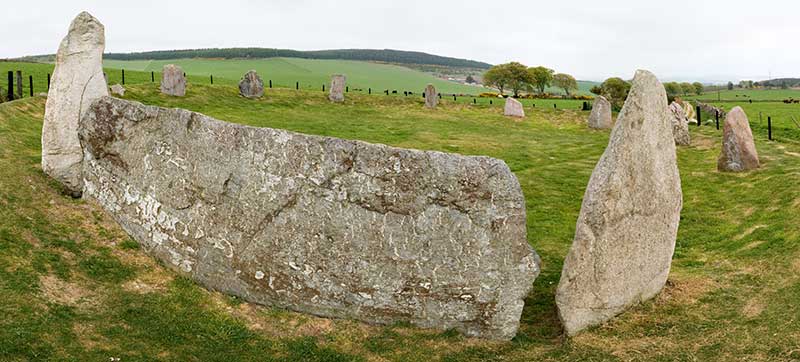
Auld Bourtreebush is a large Neolithic stone circle near Portlethen in Aberdeenshire, Scotland. It is also known as Old Bourtree Bush or Old Bourtreebush. This megalithic construction is situated very close to the recumbent stone circle at Aquhorthies stone circle, Aquhorthies and near the Causey Mounth, an ancient trackway which connects the Scottish Lowlands to the Scottish highlands, highlands. It is a scheduled monument. Stone circle Auld Bourtreebush stone circle lies 200 metres to the west of Old Bourtreebush in Aberdeenshire and within sight of the Aquhorthies recumbent stone circle. It is a scheduled monument. It is 25 metres in diameter and is thought to have been composed of up to 15 Megalithic architectural elements#Orthostat, orthostats, of which only four remain standing, although several others are lying fallen. Inside the circle was a ring cairn which has been destroyed over time. Whilst it was thought in the past to have been a recumbent stone circle, current arch ... [...More Info...] [...Related Items...] OR: [Wikipedia] [Google] [Baidu] |
Medieval Times
In the history of Europe, the Middle Ages or medieval period lasted approximately from the 5th to the late 15th centuries, similarly to the post-classical period of global history. It began with the fall of the Western Roman Empire and transitioned into the Renaissance and the Age of Discovery. The Middle Ages is the middle period of the three traditional divisions of Western history: classical antiquity, the medieval period, and the modern period. The medieval period is itself subdivided into the Early, High, and Late Middle Ages. Population decline, counterurbanisation, the collapse of centralised authority, invasions, and mass migrations of tribes, which had begun in late antiquity, continued into the Early Middle Ages. The large-scale movements of the Migration Period, including various Germanic peoples, formed new kingdoms in what remained of the Western Roman Empire. In the 7th century, North Africa and the Middle East—once part of the Byzantine Empire—came un ... [...More Info...] [...Related Items...] OR: [Wikipedia] [Google] [Baidu] |
Trackway
Historic roads (or historic trails in the US and Canada) are paths or routes that have historical importance due to their use over a period of time. Examples exist from prehistoric times until the early 20th century. They include ancient trackways, long-lasting roads, important trade routes, and migration trails. Many historic routes, such as the Silk Road, the Amber Road, and the Royal Road of the Persian Empire, covered great distances and their impact on human settlements remain today. The Post Track, a prehistoric causeway in the valley of the River Brue in the Somerset Levels, England, is one of the oldest known constructed trackways and dates from around 3800 BCE. The world's oldest known paved road was constructed in Egypt some time between 2600 and 2200 BC. The Roman roads, Romans were the most significant road builders of the ancient world. At the peak of the Roman Empire there were more than of roads, of which over were stone-paved. Another empire, that of the Inca ... [...More Info...] [...Related Items...] OR: [Wikipedia] [Google] [Baidu] |
Aberdeenshire
Aberdeenshire (; ) is one of the 32 Subdivisions of Scotland#council areas of Scotland, council areas of Scotland. It takes its name from the Shires of Scotland, historic county of Aberdeenshire (historic), Aberdeenshire, which had substantially different boundaries. The Aberdeenshire Council area includes all of the areas of the historic counties of Aberdeenshire and Kincardineshire except the area making up Aberdeen City Council area, as well as part of Banffshire. The historic county boundaries are still officially used for a few purposes, namely land registration and Lieutenancy areas of Scotland, lieutenancy. Aberdeenshire Council is headquartered at Woodhill House in Aberdeen, making it the only Scottish council whose headquarters are located outside its jurisdiction. Aberdeen itself forms a different council area (Aberdeen City). Aberdeenshire borders onto Angus, Scotland, Angus and Perth and Kinross to the south, Highland (council area), Highland and Moray to the west a ... [...More Info...] [...Related Items...] OR: [Wikipedia] [Google] [Baidu] |
Megalith
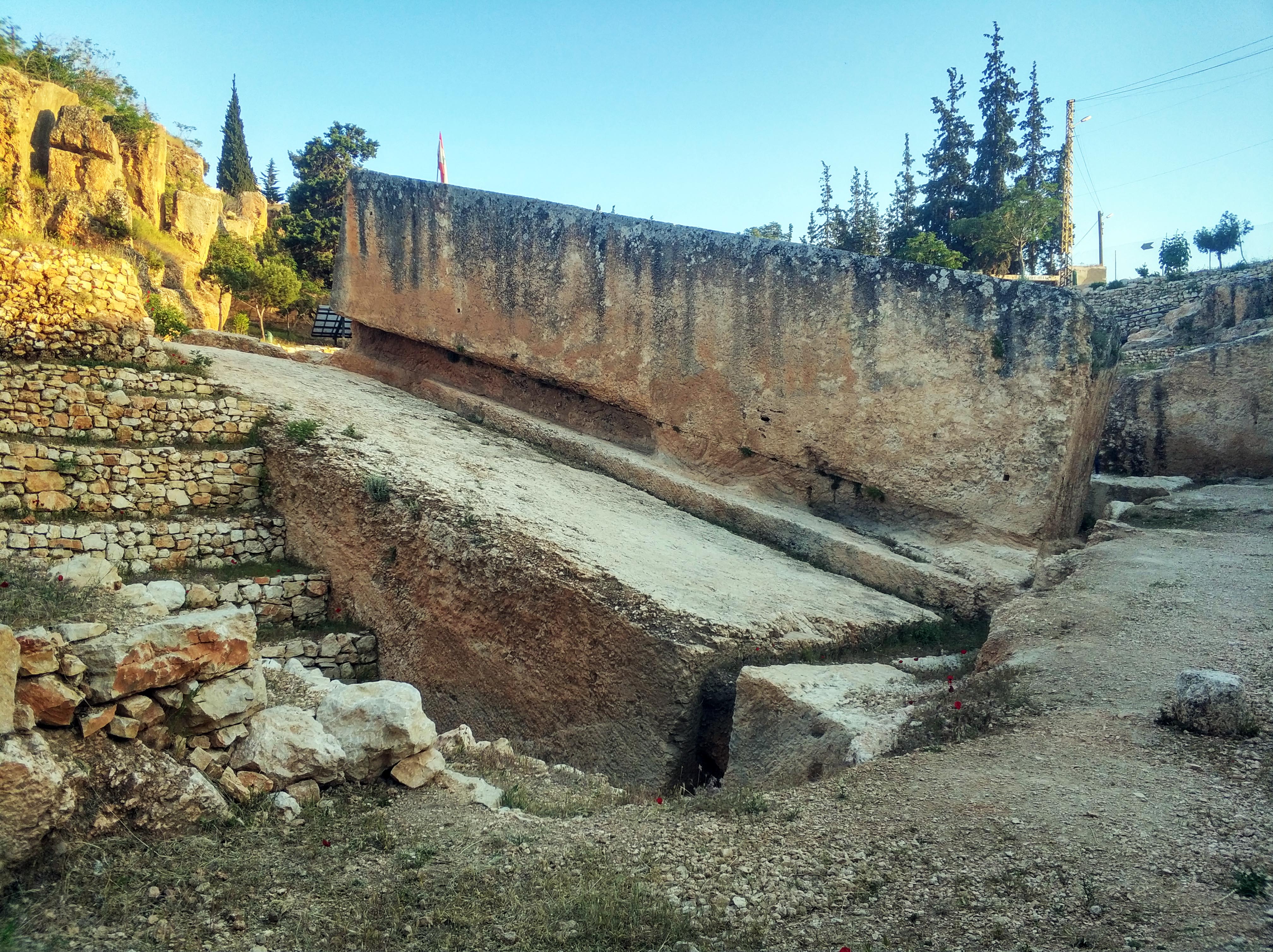
A megalith is a large stone that has been used to construct a prehistoric structure or monument, either alone or together with other stones. More than 35,000 megalithic structures have been identified across Europe, ranging geographically from Sweden in the north to the Mediterranean Sea in the south. The word was first used in 1849 by the British antiquarian Algernon Herbert in reference to Stonehenge and derives from the Ancient Greek words " mega" for great and " lithos" for stone. Most extant megaliths were erected between the Neolithic period (although earlier Mesolithic examples are known) through the Chalcolithic period and into the Bronze Age. Types and definitions While "megalith" is often used to describe a single piece of stone, it also can be used to denote one or more rocks hewn in definite shapes for special purposes. It has been used to describe structures built by people from many parts of the world living in many different periods. The most widely known ... [...More Info...] [...Related Items...] OR: [Wikipedia] [Google] [Baidu] |


