|
May 1960 Tornado Outbreak Sequence
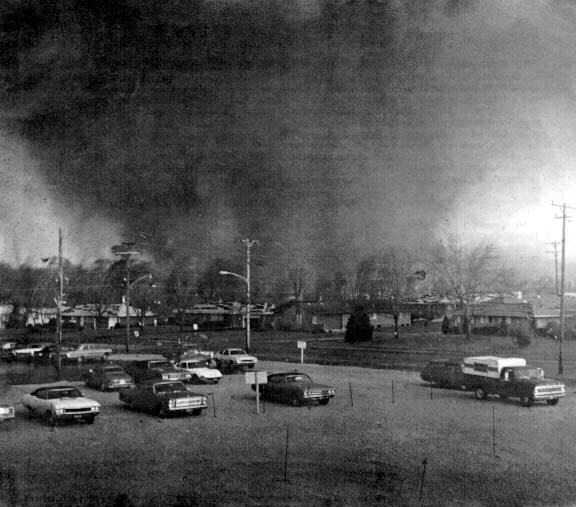
On May 4–6, 1960, a large tornado outbreak sequence affected parts of the Midwestern and Southern United States. The severe weather event produced at least 71 confirmed tornadoes, including five violent tornadoes in the U.S. state of Oklahoma. Major tornado activity began on the afternoon of May 4, with strong tornadoes affecting the Red River Valley and the Dallas-Fort Worth Metroplex. Two tornadoes struck parts of southern Oklahoma, causing significant damage to the Konawa and Soper areas. In all, at least 22 tornadoes formed between the early afternoon and late evening hours, with two more tornadoes forming early on May 5, shortly after midnight CDT. A much more significant tornado outbreak began on the afternoon of May 5 and continued overnight, spreading from eastern Oklahoma into portions of southern Missouri and Central Arkansas. At least 35 tornadoes developed between 6:00 a.m. CST on May 5–6, including a long-tr ... [...More Info...] [...Related Items...] OR: [Wikipedia] [Google] [Baidu] |
Midwestern United States
The Midwestern United States, also referred to as the Midwest or the American Midwest, is one of four census regions of the United States Census Bureau (also known as "Region 2"). It occupies the northern central part of the United States. It was officially named the North Central Region by the Census Bureau until 1984. It is between the Northeastern United States and the Western United States, with Canada to the north and the Southern United States to the south. The Census Bureau's definition consists of 12 states in the north central United States: Illinois, Indiana, Iowa, Kansas, Michigan, Minnesota, Missouri, Nebraska, North Dakota, Ohio, South Dakota, and Wisconsin. The region generally lies on the broad Interior Plain between the states occupying the Appalachian Mountains, Appalachian Mountain range and the states occupying the Rocky Mountains, Rocky Mountain range. Major rivers in the region include, from east to west, the Ohio River, the Upper Mississippi River, and ... [...More Info...] [...Related Items...] OR: [Wikipedia] [Google] [Baidu] |
Severe Weather
Severe weather is any dangerous meteorological phenomenon with the potential to cause damage, serious social disruption, or loss of human life. Types of severe weather phenomena vary, depending on the latitude, altitude, topography, and atmospheric conditions. High winds, hail, excessive precipitation (meteorology), precipitation, and wildfires are forms and effects of severe weather, as are thunderstorms, downbursts, tornadoes, waterspouts, tropical cyclones, and extratropical cyclones. Regional and seasonal severe weather phenomena include blizzards (snowstorms), ice storms, and duststorms. Extreme weather, Extreme weather phenomena which cause extreme heat, cold, wetness or drought often will bring severe weather events. One of the principal effects of anthropogenic climate change is changes in severe and extreme weather patterns. Terminology Meteorologists have generally defined severe weather as any aspect of the weather that poses risks to life, property or requires th ... [...More Info...] [...Related Items...] OR: [Wikipedia] [Google] [Baidu] |
Conway County, Arkansas
Conway County is a county located in the U.S. state of Arkansas. Created as Arkansas's 11th county on October 20, 1825, Conway County has four incorporated municipalities, including Morrilton, the county seat and most populous city. The county is also the site of numerous unincorporated communities and ghost towns. The county is named for Henry Wharton Conway, a politician from a powerful political family who served as the delegate from the Arkansas Territory to the U.S. Congress from 1823 to 1827. As of the 2010 census, the population was 21,273. The county seat is Morrilton. The county was formed on October 20, 1825, from a portion of Pulaski County and named for Henry Wharton Conway who was the territorial delegate to the U.S. Congress. In 2010, the center of population of Arkansas was located in Conway County, near the city of Plumerville. History Conway County was formed on October 20, 1825, from a portion of Pulaski County and named for Henry Wharton Conway, wh ... [...More Info...] [...Related Items...] OR: [Wikipedia] [Google] [Baidu] |
National Centers For Environmental Information
The National Centers for Environmental Information (NCEI), an agency of the United States government, manages one of the world's largest archives of atmospheric, coastal, geophysical, and oceanic data, containing information that ranges from the surface of the sun to Earth's core, and from ancient tree ring and ice core records to near-real-time satellite images. NCEI is operated by the National Environmental Satellite, Data, and Information Service (NESDIS), an office of the National Oceanic and Atmospheric Administration (NOAA), which operates under the U.S. Department of Commerce. In addition to archiving data, NCEI develops products and services that make the data readily available for use by scientists, government officials, the business community, academia, non-governmental organizations, and the general public. History NCEI was created in 2015 from the merger of three NOAA data centers: # National Climatic Data Center (NCDC) # National Geophysical Data Center (NGDC ... [...More Info...] [...Related Items...] OR: [Wikipedia] [Google] [Baidu] |
Little Rock Metropolitan Area
Central Arkansas, also known as the Little Rock metro, designated by the United States Office of Management and Budget as the Little Rock-North Little Rock-Conway Metropolitan Statistical Area, is the most populous metro area in the U.S. state of Arkansas. With an estimated 2020 population of 748,031, it is the most populated area in Arkansas. Located at the convergence of Arkansas's other geographic regions, the region's central location make Central Arkansas an important population, economic, education, and political center in Arkansas and the South. Little Rock is the state's capital and largest city, and the city is also home to two Fortune 500 companies, Arkansas Children's Hospital, and University of Arkansas for Medical Sciences (UAMS). History The site known as "little rock" along the Arkansas River was found by explorer Bernard de la Harpe in 1722. The territorial capitol had been located at Arkansas Post in Southeast Arkansas since 1819, but the site had proven unsu ... [...More Info...] [...Related Items...] OR: [Wikipedia] [Google] [Baidu] |
Sequoyah County, Oklahoma
Sequoyah County is a county located in the U.S. state of Oklahoma. As of the 2020 census, the population was 39,281. The county seat is Sallisaw. Sequoyah County was created in 1907 when Oklahoma became a state. It was named after Sequoyah, who created the Cherokee syllabary and its written language. William L. Anderson, "Sequoyah County." ''Encyclopedia of Oklahoma History and Culture''. Accessed May 23, 2012. Sequoyah County is part of the Fort Smith, AR-OK |
Green Country
Green Country, sometimes referred to as Northeast Oklahoma, is the northeastern portion of the U.S. state of Oklahoma, which lies west of the northern half of Arkansas, the southwestern corner the way of Missouri, and south of Kansas. Alternate definitions While the name's usage can be traced to the early part of the 20th century, it was popularized in the 1960s by the Oklahoma Department of Tourism and Recreation as one of six travel destination regions within the state. Said tourism designation is an 18-county region including Pawnee, Osage, Washington, Nowata, Craig, Ottawa, Delaware, Mayes, Rogers, Creek, Tulsa, Wagoner, Cherokee, Adair, Sequoyah, Muskogee, Okmulgee, and McIntosh counties. Another alternate usage of the term can include solely the immediate vicinity of Green Country's principal city, Tulsa; the Tulsa Metropolitan Area or the city of Tulsa proper is often referred to as "Green Country" in its own right. In this case, the terms "Tulsa Metropolitan ... [...More Info...] [...Related Items...] OR: [Wikipedia] [Google] [Baidu] |
List Of F5 And EF5 Tornadoes
This is a list of tornadoes which have been officially or unofficially labeled as F5, EF5, T10-T11, IF5, or an equivalent rating, the highest possible ratings on the various tornado intensity scales. These scales – the Fujita scale, the Enhanced Fujita scale, the International Fujita scale, and the TORRO tornado intensity scale – attempt to estimate the intensity of a tornado by classifying the damage caused to natural features and man-made structures in the tornado's path. Tornadoes are among the most violent known meteorological phenomena. Each year, more than 2,000 tornadoes are recorded worldwide, with the vast majority occurring in North America and Europe. In order to assess the intensity of these events, meteorologist Ted Fujita devised a method to estimate maximum wind speeds within tornadic storms based on the damage caused; this became known as the Fujita scale. The scale ranks tornadoes from F0 to F5, with F0 being the least intense and F5 being the most in ... [...More Info...] [...Related Items...] OR: [Wikipedia] [Google] [Baidu] |
Central Arkansas
Central Arkansas, also known as the Little Rock metro, designated by the United States Office of Management and Budget as the Little Rock-North Little Rock-Conway Metropolitan Statistical Area, is the most populous metro area in the U.S. state of Arkansas. With an estimated 2020 population of 748,031, it is the most populated area in Arkansas. Located at the convergence of Arkansas's other geographic regions, the region's central location make Central Arkansas an important population, economic, education, and political center in Arkansas and the South. Little Rock is the state's capital and largest city, and the city is also home to two Fortune 500 companies, Arkansas Children's Hospital, and University of Arkansas for Medical Sciences (UAMS). History The site known as "little rock" along the Arkansas River was found by explorer Bernard de la Harpe in 1722. The territorial capitol had been located at Arkansas Post in Southeast Arkansas since 1819, but the site had proven un ... [...More Info...] [...Related Items...] OR: [Wikipedia] [Google] [Baidu] |
Central Time Zone
The North American Central Time Zone (CT) is a time zone in parts of Canada, the United States, Mexico, Central America, some Caribbean Islands, and part of the Eastern Pacific Ocean. Central Standard Time (CST) is six hours behind Coordinated Universal Time (UTC). During summer, most of the zone uses daylight saving time (DST), and changes to Central Daylight Time (CDT) which is five hours behind UTC. The largest city in the Central Time Zone is Mexico City; the Mexico City metropolitan area is the largest metropolitan area in the zone and in North America. Regions using (North American) Central Time Canada The province of Manitoba is the only province or territory in Canada that observes Central Time in all areas. The following Canadian provinces and territories observe Central Time in the areas noted, while their other areas observe Eastern Time: * Nunavut (territory): western areas (most of Kivalliq Region and part of Qikiqtaaluk Region) * Ontario (province): a ... [...More Info...] [...Related Items...] OR: [Wikipedia] [Google] [Baidu] |
Soper, Oklahoma
Soper is a town in Choctaw County, Oklahoma, United States. The population was 261 at the 2010 census. The town was named for Pliny L. Soper, who was an attorney for the Arkansas and Choctaw Railway. History At the time of its founding, Soper was located in Kiamitia County, one of the constituent counties comprising the Apukshunnubbee District of the Choctaw Nation. Geography Soper is located in west-central Choctaw County at (34.033385, -95.696573). The town is located approximately west of Hugo, the county seat, and approximately east of Boswell. Soper has a volunteer fire department, local gas station and market, and several prominent families who have been in the area for many years. According to the United States Census Bureau, the town of Soper has a total area of , all land. Demographics As of the census of 2000, there were 600 people, 432 households, and 74 families residing in the town. The population density was . There were 159 housing units at an average ... [...More Info...] [...Related Items...] OR: [Wikipedia] [Google] [Baidu] |
Konawa, Oklahoma
Konawa is a city in Seminole County, Oklahoma, United States. The population was 1,298 at the 2010 census. ''Konawa'' is a Seminole word meaning, "string of beads."Konawa Genealogical Society, "Konawa," ''Encyclopedia of Oklahoma History and Culture''. Accessed May 24, 2015. History Located in southwestern Seminole County, Konawa, a Seminole word meaning "string of beads," lies at the intersection of State Highways 9A and 39. On January 7, 1904, Tom West, a mixed-blood Seminole, sold George Northrup a plot of land that became the Konawa townsite. The post office was established on July 15, 1904, with Robert C. Lovelace as postmaster. Early-day establishments included the first newspaper, the Konawa Chief, hardware an ...[...More Info...] [...Related Items...] OR: [Wikipedia] [Google] [Baidu] |


