|
Mauldre River
The Mauldre () is a 35 km long river in France. It is a left tributary of the Seine. Its basin area is about 410 square kilometres, which covers 66 municipalities corresponding to 400 000 inhabitants. Its source elevation is 135 m. The Mauldre flows into the Seine near Épône. One of its affluents is the ''ru de Gally'', whose source is in the gardens of Versailles. Course The Mauldre starts at an altitude of 135 m near the hamlet of Maison Blanche at the limit of the municipalities of Saint-Rémy-l'Honoré and Coignières, and turns north along its entire route. It runs through Beynes and Maule, before flowing into the Seine at Épône at an altitude of 20 m, towards the upstream point of the island of Rangiport. The average slope is therefore 3.25 m/km (0.33%). Its confluence with the Ru de Gally marks the boundary between the basins of the upper Mauldre (which can generally be forded) and the lower Mauldre. In the lower basin, the Mauldre draws a few meander ... [...More Info...] [...Related Items...] OR: [Wikipedia] [Google] [Baidu] |
France
France, officially the French Republic, is a country located primarily in Western Europe. Overseas France, Its overseas regions and territories include French Guiana in South America, Saint Pierre and Miquelon in the Atlantic Ocean#North Atlantic, North Atlantic, the French West Indies, and List of islands of France, many islands in Oceania and the Indian Ocean, giving it Exclusive economic zone of France, one of the largest discontiguous exclusive economic zones in the world. Metropolitan France shares borders with Belgium and Luxembourg to the north; Germany to the northeast; Switzerland to the east; Italy and Monaco to the southeast; Andorra and Spain to the south; and a maritime border with the United Kingdom to the northwest. Its metropolitan area extends from the Rhine to the Atlantic Ocean and from the Mediterranean Sea to the English Channel and the North Sea. Its Regions of France, eighteen integral regions—five of which are overseas—span a combined area of and hav ... [...More Info...] [...Related Items...] OR: [Wikipedia] [Google] [Baidu] |
Seine
The Seine ( , ) is a river in northern France. Its drainage basin is in the Paris Basin (a geological relative lowland) covering most of northern France. It rises at Source-Seine, northwest of Dijon in northeastern France in the Langres plateau, flowing through Paris and into the English Channel at Le Havre (and Honfleur on the left bank). It is navigable by ocean-going vessels as far as Rouen, from the sea. Over 60 percent of its length, as far as Burgundy (region), Burgundy, is negotiable by large barges and most tour boats, and nearly its whole length is available for recreational boating; Bateaux Mouches, excursion boats offer sightseeing tours of the river banks in the capital city, Paris. There are 37 List of bridges in Paris#Seine, bridges in Paris across the Seine (the most famous of which are the Pont Alexandre III and the Pont Neuf) and dozens List of crossings of the River Seine, more outside the city. A notable bridge, which is also the last along the course of ... [...More Info...] [...Related Items...] OR: [Wikipedia] [Google] [Baidu] |
Épône
Épône () is a commune in the Yvelines department in the Île-de-France region in north-central France. It is situated on the left bank of the River Seine west of Paris. Together with Mézières-sur-Seine and La Falaise, it forms a settlement of around 10,000 inhabitants. Its inhabitants are known as Épônois. The name comes from the Latin ''Spedona'' and, according to Daniel Bricon,''Épône racontée aux Épônois'' (cf. Bibliographie). has no link to Epona the Gaulish goddess of horses and protector of horseriders. Geography Situated in the north west of Yvelines at the confluence of the rivers Mauldre and Seine, Épône is located in the Mantois at around 10 kilometres to the east of Mantes-la-Jolie and 36 kilometres north west of Versailles. The commune is bordered by Gargenville to the north (on the opposite bank of the Seine), Aubergenville and La Falaise to the east, Maule to the south east, Jumeauville and Goussonville to the south west, and Mézières-sur ... [...More Info...] [...Related Items...] OR: [Wikipedia] [Google] [Baidu] |
Gardens Of Versailles
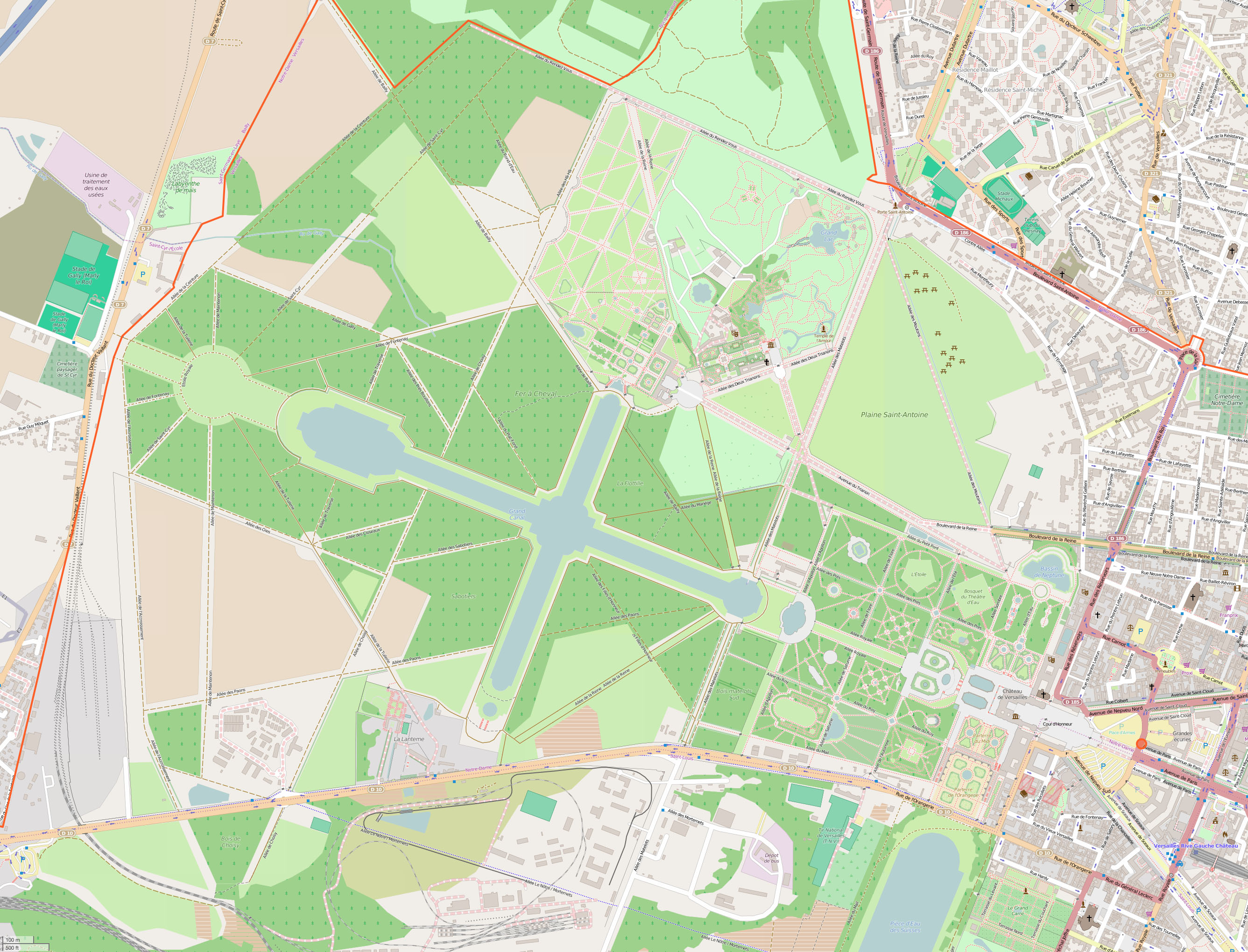
The Gardens of Versailles ( ) occupy part of what was once the ''Domaine royal de Versailles'', the royal demesne of the Palace of Versailles, château of Versailles. Situated to the west of the Palace of Versailles, palace, the gardens cover some of land, much of which is landscaped in the classic French formal garden style perfected here by André Le Nôtre. Beyond the surrounding belt of woodland, the gardens are bordered by the urban areas of Versailles (city), Versailles to the east and Le Chesnay to the north-east, by the National Arboretum de Chèvreloup to the north, the Versailles plain (a protected wildlife preserve) to the west, and by the Satory Forest to the south. Administered by the Public Establishment of the Palace, Museum and National Estate of Versailles, an autonomous public entity operating under the aegis of the Ministry of Culture (France), French Ministry of Culture, the gardens are now one of the most visited public sites in France, receiving more than s ... [...More Info...] [...Related Items...] OR: [Wikipedia] [Google] [Baidu] |
Saint-Rémy-l'Honoré
Saint-Rémy-l'Honoré () is a commune in the Yvelines department in the Île-de-France in north-central France. See also *Communes of the Yvelines department A commune is an alternative term for an intentional community. Commune or comună or comune or other derivations may also refer to: Administrative-territorial entities * Commune (administrative division), a municipality or township ** Communes o ... References External links Official town website Communes of Yvelines {{Yvelines-geo-stub ... [...More Info...] [...Related Items...] OR: [Wikipedia] [Google] [Baidu] |
Coignières
Coignières () is a French commune in the Yvelines department, region of Île-de-France. Geography Coignières is situated southwest of Versailles. Its neighbours include Maurepas to the north, Mesnil-Saint-Denis and Lévis-Saint-Nom to the east, Essarts-le-Roi to the south and Saint-Rémy-l'Honoré to the west. The village is roughly 170 m above sea level, fairly flat except to the west where there is a valley with the Mauldre river which runs from the area called ''la Maison Blanche'' to the north. Coignières is connected by route nationale 10 (RN10), which traverses the commune from the northeast to the southwest, and given the amount of traffic it effectively divides the commune in two. Coignières train station is located on the Paris–Chartres train line and runs parallel to the RN10. The commune is quite well developed with new housing and commercial zones near Maurepas and beyond the Saint-Quentin-en-Yvelines region. There is also a large industrial zone (le Ma ... [...More Info...] [...Related Items...] OR: [Wikipedia] [Google] [Baidu] |
Beynes, Yvelines
Beynes () is a commune in the Yvelines department in north-central France France, officially the French Republic, is a country located primarily in Western Europe. Overseas France, Its overseas regions and territories include French Guiana in South America, Saint Pierre and Miquelon in the Atlantic Ocean#North Atlan .... Population See also * Communes of the Yvelines department References External links Official site Communes of Yvelines {{Yvelines-geo-stub ... [...More Info...] [...Related Items...] OR: [Wikipedia] [Google] [Baidu] |
Maule, Yvelines
Maule () is a commune in the Yvelines department in the Île-de-France in north-central France. Population Twin towns * Carnoustie, Angus, United Kingdom See also *Communes of the Yvelines department A commune is an alternative term for an intentional community. Commune or comună or comune or other derivations may also refer to: Administrative-territorial entities * Commune (administrative division), a municipality or township ** Communes o ... References Communes of Yvelines {{Yvelines-geo-stub ... [...More Info...] [...Related Items...] OR: [Wikipedia] [Google] [Baidu] |
Island Of Rangiport
An island or isle is a piece of land, distinct from a continent, completely surrounded by water. There are continental islands, which were formed by being split from a continent by plate tectonics, and oceanic islands, which have never been part of a continent. Oceanic islands can be formed from volcanic activity, grow into atolls from coral reefs, and form from sediment along shorelines, creating barrier islands. River islands can also form from sediment and debris in rivers. Artificial islands are those made by humans, including small rocky outcroppings built out of lagoons and large-scale land reclamation projects used for development. Islands are host to diverse plant and animal life. Oceanic islands have the sea as a natural barrier to the introduction of new species, causing the species that do reach the island to evolve in isolation. Continental islands share animal and plant life with the continent they split from. Depending on how long ago the continental island form ... [...More Info...] [...Related Items...] OR: [Wikipedia] [Google] [Baidu] |


