|
Mashonaland
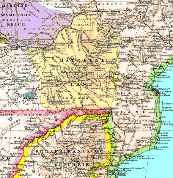
Mashonaland is a region in northeastern Zimbabwe. It is home to nearly half of the population of Zimbabwe. The majority of the Mashonaland people are from the Shona tribe while the Zezuru and Korekore dialects are most common. Harare is the largest city followed by Chitungwiza. Currently, Mashonaland is divided into four provinces, * Mashonaland West * Mashonaland Central * Mashonaland East * Harare The Zimbabwean capital of Harare, a province unto itself, lies entirely in Mashonaland. It receives moderate amount of rainfall yearly. Provincial history It was originally one of the regions that the country was divided into following occupation by the Pioneer Column in 1890. It was designated the extent of territory under administration of the British South Africa Company, as distinct from the remainder of the territory that was directly under the control of the Matabele king, Lobengula, which was named Matabeleland when it was occupied in 1893. The two had separate adminis ... [...More Info...] [...Related Items...] OR: [Wikipedia] [Google] [Baidu] |
Harare Province
Harare Metropolitan Province () is a province in northeastern Zimbabwe that comprises Harare, the country's capital and largest city, and three other municipalities, Chitungwiza, Epworth and Ruwa. At independence in 1980, it was originally part of Mashonaland Province which in 1983 was divided into three large provinces, Mashonaland Central, Mashonaland East, and Mashonaland West - at this point, the city of Harare became part of Mashonaland East. In 1997, along with Bulawayo, it became a metropolitan province, along with the then two nearby urban settlements. Harare Metropolitan Province is divided into four local government areas a city council an two local boards Harare Province has an area of , equal to 0.22% of the total area of Z ... [...More Info...] [...Related Items...] OR: [Wikipedia] [Google] [Baidu] |
British South Africa Company
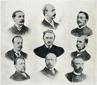
The British South Africa Company (BSAC or BSACo) was chartered in 1889 following the amalgamation of Cecil Rhodes' Central Search Association and the London-based Exploring Company Ltd, which had originally competed to capitalize on the expected mineral wealth of Mashonaland but united because of common economic interests and to secure British government backing. The company received a Royal Charter modelled on that of the British East India Company. Its first directors included The 2nd Duke of Abercorn, Rhodes himself, and the South African financier Alfred Beit. Rhodes hoped BSAC would promote colonisation and economic exploitation across much of south-central Africa, as part of the "Scramble for Africa". However, his main focus was south of the Zambezi, in Mashonaland and the coastal areas to its east, from which he believed the Portuguese could be removed by payment or force, and in the Transvaal, which he hoped would return to British control. It has been suggested that ... [...More Info...] [...Related Items...] OR: [Wikipedia] [Google] [Baidu] |
Mashonaland Central
Mashonaland Central is a province of Zimbabwe. It is divided into eight districts and has an area of 28,347 km2 and a population of 1,384,891 (2012 census), representing about 9.1% of the total Zimbabwe population. It is dominated by the Shona speaking locals. Geography The province spans the northern mainland of the country, extending into the Zambezi valley and reaching the Mozambican border in the northeast. Its capital, Bindura, is approximately 90 kilometers from the national capital, Harare. The province encompasses towns including Mount Darwin, Mazowe, Glendale, Guruve, Muzarabani, Centenary, and Shamva. Demographics Background Bindura is the capital of the province. During the 2002/2003 rainy season, the area experienced heavy flooding. Mashonaland Central districts The province is divided into eight districts: * Bindura * Mbire * Guruve * Mount Darwin * Rushinga * Shamva * Mazowe * Muzarabani See also * Provinces of Zimbabwe * Districts of Z ... [...More Info...] [...Related Items...] OR: [Wikipedia] [Google] [Baidu] |
Mashonaland East
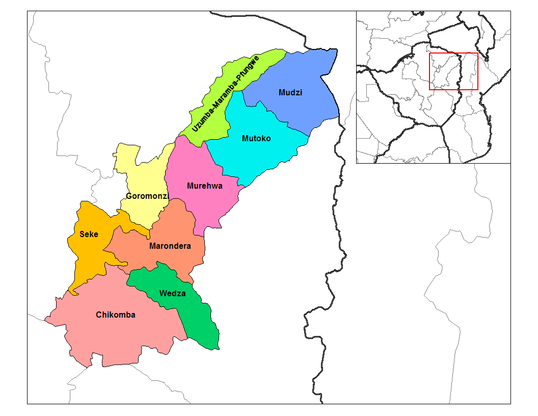
Mashonaland East, informally Mash East, is a province of Zimbabwe. It has an area of 32,230 km2 and a population of approximately 1.73 million (2022). Marondera is the capital of the province. Demographics The province has a history of African migrants from neigboouring countries such as Mozambique and Malawi. Notable ethnic groups in the province are the Shonas, Ndebele, Nyanja, Tumbuka and other groups. Several languages are spoken in different districts such as Shona, Nyanja, Ndebele, Chitumbuka, and Chibarwe, among others. Geography Districts The Mashonaland East is divided into nine districts: * Chikomba * Goromonzi * Marondera * Mudzi * Murehwa (Mrehwa) * Mutoko * Seke * Uzumba-Maramba-Pfungwe (UMP) * Wedza (Hwedza) Education See also * Provinces of Zimbabwe * Districts of Zimbabwe The Republic of Zimbabwe is broken down into 10 administrative provinces of Zimbabwe, provinces, which are divided into 64 districts and 1,970 Wards ... [...More Info...] [...Related Items...] OR: [Wikipedia] [Google] [Baidu] |
Zimbabwe
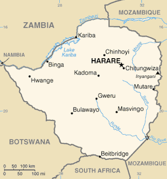
file:Zimbabwe, relief map.jpg, upright=1.22, Zimbabwe, relief map Zimbabwe, officially the Republic of Zimbabwe, is a landlocked country in Southeast Africa, between the Zambezi and Limpopo Rivers, bordered by South Africa to the south, Botswana to the southwest, Zambia to the north, and Mozambique to the east. The capital and largest city is Harare, and the second largest is Bulawayo. A country of roughly 16.6 million people as per 2024 census, Zimbabwe's largest ethnic group are the Shona people, Shona, who make up 80% of the population, followed by the Northern Ndebele people, Northern Ndebele and other #Demographics, smaller minorities. Zimbabwe has 16 official languages, with English, Shona language, Shona, and Northern Ndebele language, Ndebele the most common. Zimbabwe is a member of the United Nations, the Southern African Development Community, the African Union, and the Common Market for Eastern and Southern Africa. The region was long inhabited by the San people, ... [...More Info...] [...Related Items...] OR: [Wikipedia] [Google] [Baidu] |
Mashonaland West
Mashonaland West is a province of Zimbabwe. It has an area of 57,441 km² and a population of approximately 1.9 million (2022). Chinhoyi is the capital of the province. Demographics Geography Districts Mashonaland West is divided into 7 districts: * Chegutu * Hurungwe * Kariba * Makonde * Mhondoro-Ngezi * Sanyati * Zvimba See also *Provinces of Zimbabwe *Districts of Zimbabwe The Republic of Zimbabwe is broken down into 10 administrative provinces of Zimbabwe, provinces, which are divided into 64 districts and 1,970 Wards of Zimbabwe, wards. Bulawayo Province * Bulawayo Harare Province * Harare ... References {{Zimbabwe-gov-stub Provinces of Zimbabwe ... [...More Info...] [...Related Items...] OR: [Wikipedia] [Google] [Baidu] |
Geography Of Zimbabwe
Zimbabwe is a landlocked country in southern Africa lying north of the Tropic of Capricorn. During summer, the whole country experiences warm temperatures as a result of the sun being directly overhead. It straddles an extensive high inland plateau that drops northwards to the Zambezi valley where the border with Zambia is and similarly drops southwards to the Limpopo River, Limpopo valley and the border with South Africa. Area and boundaries ; Area: :* Total: 390,757 km² :**''country rank in the world:'' 60th :* Land: 386,850 km² :* Water: 3,910 km² ; Area comparative :* Australia comparative: slightly less than half the size of New South Wales :* Canada comparative: slightly smaller than Newfoundland and Labrador :* United Kingdom comparative: approximately larger than the United Kingdom :* United States comparative: slightly larger than Montana :* European Union, EU comparative: approximately larger than Germany ; Land boundaries: The country has borders with Botsw ... [...More Info...] [...Related Items...] OR: [Wikipedia] [Google] [Baidu] |
Pioneer Column
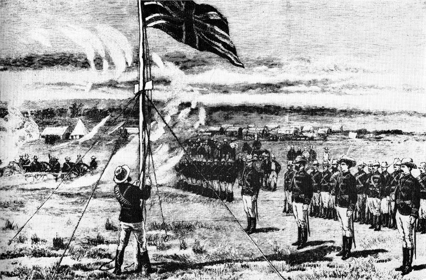
The Pioneer Column was a force raised by Cecil Rhodes and his British South Africa Company in 1890 and used in his efforts to annex the territory of Mashonaland, later part of Zimbabwe (once Southern Rhodesia). Background Rhodes was anxious to secure Matabeleland and Mashonaland before the Germans, Portuguese or Boers did. His first step was to persuade the Ndebele King Lobengula, in 1888, to sign a treaty giving him rights to mining and administration (but not settlement as such) in the area of Mashonaland which was not under direct Ndebele rule. Using this Rudd Concession (so called because Rhodes's business partner, Charles Rudd, was instrumental in securing the signature) between Rhodes' British South Africa Company (allegedly on behalf of Queen Victoria though without any official knowledge or authority) and Lobengula, he then sought and obtained a charter from the British government allowing him to act, essentially although in a limited way, with the government's consent ... [...More Info...] [...Related Items...] OR: [Wikipedia] [Google] [Baidu] |
Matabeleland
Matabeleland is a region located in southwestern Zimbabwe that is divided into three provinces: Matabeleland North, Bulawayo, and Matabeleland South. These provinces are in the west and south-west of Zimbabwe, between the Limpopo and Zambezi rivers and are further separated from Midlands by the Shangani River in central Zimbabwe. The region is named after its inhabitants, the Ndebele people who were called "Amatabele"(people with long shields – Mzilikazi 's group of people who were escaping the Mfecani wars). Other ethnic groups who inhabit parts of Matabeleland include the Tonga, Bakalanga, Venda, Nambya, Khoisan, Xhosa, Sotho, Tswana, and Tsonga. The capital and largest city is Bulawayo, other notable towns are Plumtree, Victoria Falls, Beitbridge, Lupane, Esigodini, Hwange Gwanda and Maphisa. The land is fertile but semi arid. This area has coal and gold deposits. Industries include gold and other mineral mines, and engineering. There has been a decli ... [...More Info...] [...Related Items...] OR: [Wikipedia] [Google] [Baidu] |
Harare
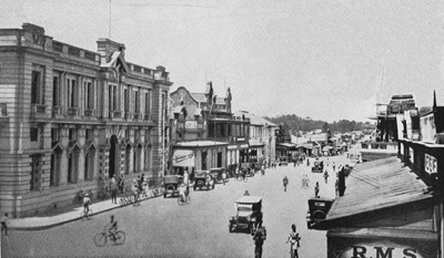
Harare ( ), formerly Salisbury, is the Capital city, capital and largest city of Zimbabwe. The city proper has an area of , a population of 1,849,600 as of the 2022 Zimbabwe census, 2022 census and an estimated 2,487,209 people in its metropolitan province. The city is situated in north-eastern Zimbabwe in the country's Mashonaland region. Harare Metropolitan Province incorporates the city and the municipalities of Chitungwiza, Epworth, Zimbabwe, Epworth and Ruwa. The city sits on a plateau at an elevation of above sea level, and its climate falls into the subtropical highland category. The city was founded in 1890 by the Pioneer Column, a small military force of the British South Africa Company, and was named Southern Rhodesia, Fort Salisbury after the British Prime Minister Robert Gascoyne-Cecil, 3rd Marquess of Salisbury, Lord Salisbury. Company Company rule in Rhodesia, administrators Demarcation line, demarcated the city and ran it until Southern Rhodesia achieved respo ... [...More Info...] [...Related Items...] OR: [Wikipedia] [Google] [Baidu] |
Manicaland
Manicaland is a province in eastern Zimbabwe. After Harare Province, it is the country's second-most populous province, with a population of 2.037 million, as of the 2022 census. Making it the third most densely populated province after Harare and Bulawayo provinces. Manicaland was one of five original provinces established in Southern Rhodesia in the early colonial period. The province endowed with country's major tourist attractions, the likes of Mutarazi Falls, Nyanga National Park and Zimbabwe's top three highest peaks. The province is divided into ten administrative subdivisions of seven rural districts and three towns/councils, including the provincial capital, Mutare. The name Manicaland is derived from one of the province's largest ethnic groups, the Manyika, who originate from the area north of the Manicaland province and as well as western Mozambique, who speak a distinct language called ChiManyika in Shona (one of the dialect of the Shona language). Manicaland is bo ... [...More Info...] [...Related Items...] OR: [Wikipedia] [Google] [Baidu] |
