|
Masca Gorge
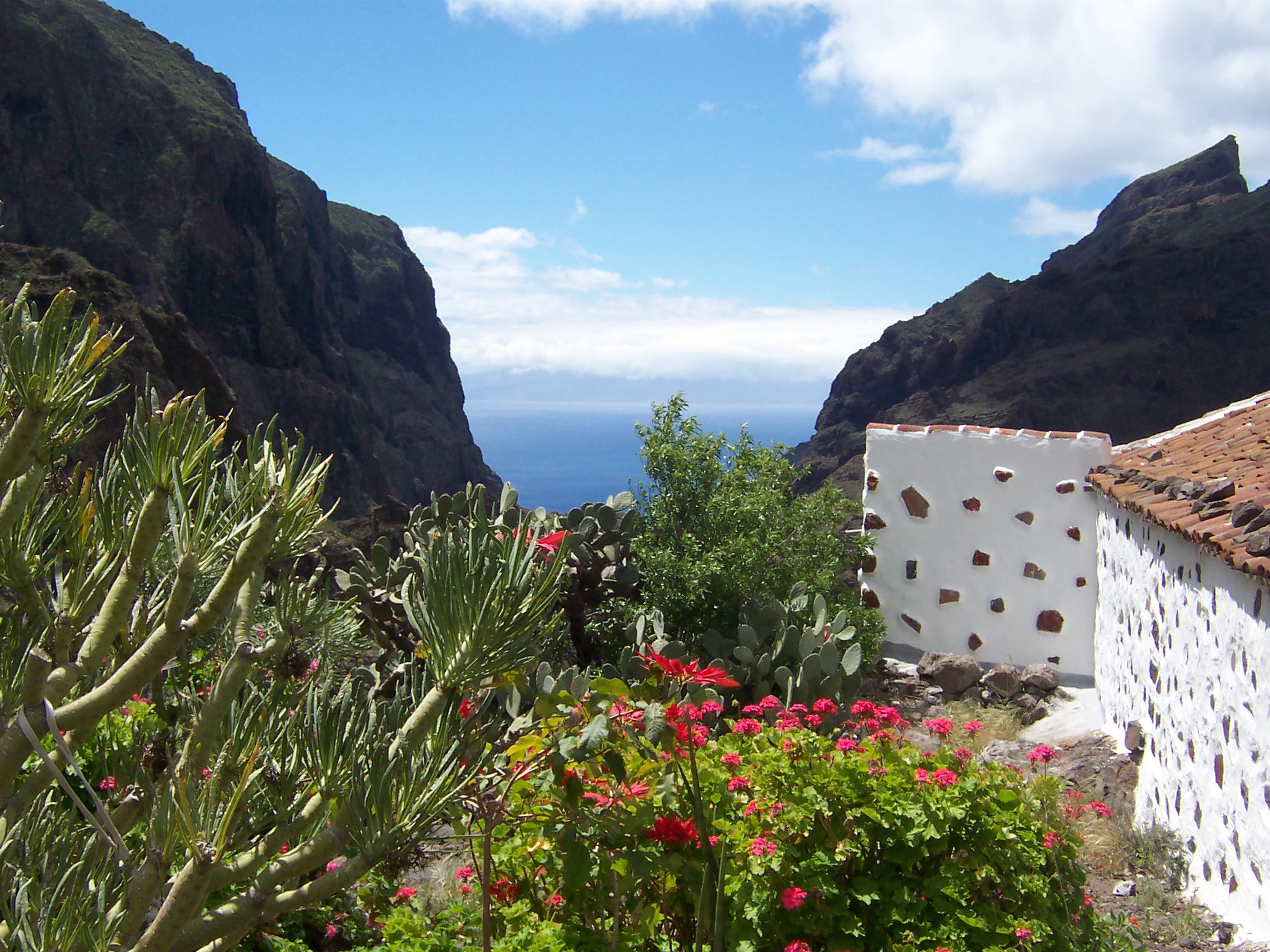
Masca Gorge () is a narrow valley in the north-west of the island of Tenerife. The gorge is situated within the Teno Massif. The gorge is a popular tourist destination due to its dramatic scenery and unique geology. An eight-kilometre long walking trail begins at Masca village and continues for the length of the gorge to finish at Masca beach (Spanish: ), approximately ten kilometres from the north-west tip of Tenerife. Geology Masca Gorge is found within the Teno Massif, a Miocene-age volcanic formation composed of basaltic lava flows. Much of the gorge itself is formed by steeply-dipping volcanic flows. These flows are generally less than a metre thick and mostly basaltic with scoriaceous inclusions. The flows have subsequently been intruded by several swarms of dykes, many of which form cross-cutting relationships. A particular formation of interest is the Masca Unconformity. The unconformity consists of a polymictite breccia Breccia ( , ; ) is a rock composed of ... [...More Info...] [...Related Items...] OR: [Wikipedia] [Google] [Baidu] |
Valley
A valley is an elongated low area often running between hills or mountains and typically containing a river or stream running from one end to the other. Most valleys are formed by erosion of the land surface by rivers or streams over a very long period. Some valleys are formed through erosion by glacial ice. These glaciers may remain present in valleys in high mountains or polar areas. At lower latitudes and altitudes, these glacially formed valleys may have been created or enlarged during ice ages but now are ice-free and occupied by streams or rivers. In desert areas, valleys may be entirely dry or carry a watercourse only rarely. In areas of limestone bedrock, dry valleys may also result from drainage now taking place underground rather than at the surface. Rift valleys arise principally from earth movements, rather than erosion. Many different types of valleys are described by geographers, using terms that may be global in use or else applied only locally ... [...More Info...] [...Related Items...] OR: [Wikipedia] [Google] [Baidu] |
Basalt
Basalt (; ) is an aphanite, aphanitic (fine-grained) extrusive igneous rock formed from the rapid cooling of low-viscosity lava rich in magnesium and iron (mafic lava) exposed at or very near the planetary surface, surface of a terrestrial planet, rocky planet or natural satellite, moon. More than 90% of all volcanic rock on Earth is basalt. Rapid-cooling, fine-grained basalt is chemically equivalent to slow-cooling, coarse-grained gabbro. The eruption of basalt lava is observed by geologists at about 20 volcanoes per year. Basalt is also an important rock type on other planetary bodies in the Solar System. For example, the bulk of the plains of volcanism on Venus, Venus, which cover ~80% of the surface, are basaltic; the lunar mare, lunar maria are plains of flood-basaltic lava flows; and basalt is a common rock on the surface of Mars. Molten basalt lava has a low viscosity due to its relatively low silica content (between 45% and 52%), resulting in rapidly moving lava flo ... [...More Info...] [...Related Items...] OR: [Wikipedia] [Google] [Baidu] |
Geology Of Spain
The geology of the Iberian Peninsula consists of the study of the rock formations on the Iberian Peninsula, connected to the rest of the European landmass by the Pyrenees. The peninsula contains rocks from every geological period from the Ediacaran to the Quaternary, and many types of rock are represented. World-class mineral deposits are also found there. The core of the Iberian Peninsula consists of a Hercynian cratonic block known as the Iberian Massif. On the northeast, this is bounded by the Pyrenean fold belt, and on the southeast, it is bounded by the Betic fold mountain chain. These two mountain chains are part of the Alpine belt. To the west, the peninsula is delimited by the continental boundary formed by the opening of the Atlantic Ocean. The Hercynian fold belt is mostly buried by Mesozoic and Cenozoic cover rocks to the east but nevertheless outcrops through the Iberian Chain and the Catalan Coastal Ranges. Iberian Massif The Iberian Massif consists of rock ... [...More Info...] [...Related Items...] OR: [Wikipedia] [Google] [Baidu] |
Breccia
Breccia ( , ; ) is a rock composed of large angular broken fragments of minerals or Rock (geology), rocks cementation (geology), cemented together by a fine-grained matrix (geology), matrix. The word has its origins in the Italian language, in which it means "rubble". A breccia may have a variety of different origins, as indicated by the named types including sedimentary breccia, fault (geology), fault or tectonics, tectonic breccia, igneous breccia, Impact event, impact breccia, and Hydrothermal circulation, hydrothermal breccia. A megabreccia is a breccia composed of very large rock fragments, sometimes kilometers across, which can be formed by landslides, impact events, or caldera collapse. Types Breccia is composed of coarse rock fragments held together by cement or a fine-grained matrix. Like Conglomerate (geology), conglomerate, breccia contains at least 30 percent of gravel-sized particles (particles over 2mm in size), but it is distinguished from Conglomerate (geol ... [...More Info...] [...Related Items...] OR: [Wikipedia] [Google] [Baidu] |
Unconformity
An unconformity is a buried erosional or non-depositional surface separating two rock masses or strata of different ages, indicating that sediment deposition was not continuous. In general, the older layer was exposed to erosion for an interval of time before deposition of the younger layer, but the term is used to describe any break in the sedimentary geologic record. The significance of angular unconformity (see below) was shown by James Hutton, who found examples of Hutton's Unconformity at Jedburgh in 1787 and at Siccar Point in Berwickshire in 1788, both in Scotland. The rocks above an unconformity are younger than the rocks beneath (unless the sequence has been overturned). An unconformity represents time during which no sediments were preserved in a region or were subsequently eroded before the next deposition. The local record for that time interval is missing and geologists must use other clues to discover that part of the geologic history of that area. The interval ... [...More Info...] [...Related Items...] OR: [Wikipedia] [Google] [Baidu] |
Geological Formation
A geological formation, or simply formation, is a body of rock having a consistent set of physical characteristics (lithology) that distinguishes it from adjacent bodies of rock, and which occupies a particular position in the layers of rock exposed in a geographical region (the stratigraphic column). It is the fundamental unit of lithostratigraphy, the study of strata or rock layers. A formation must be large enough that it can be mapped at the surface or traced in the subsurface. Formations are otherwise not defined by the thickness (geology), thickness of their rock strata, which can vary widely. They are usually, but not universally, tabular in form. They may consist of a single lithology (rock type), or of alternating beds of two or more lithologies, or even a heterogeneous mixture of lithologies, so long as this distinguishes them from adjacent bodies of rock. The concept of a geologic formation goes back to the beginnings of modern scientific geology. The term was used by ... [...More Info...] [...Related Items...] OR: [Wikipedia] [Google] [Baidu] |
Dike (geology)
In geology, a dike or dyke is a sheet of rock that is formed in a fracture of a pre-existing rock body. Dikes can be either magmatic or sedimentary in origin. Magmatic dikes form when magma flows into a crack then solidifies as a sheet intrusion, either cutting across layers of rock or through a contiguous mass of rock. Clastic dikes are formed when sediment fills a pre-existing crack.Essentials of Geology, 3rd Ed, Stephen Marshak Magmatic dikes A magmatic dike is a sheet of igneous rock that cuts across older rock beds. It is formed when magma fills a fracture in the older beds and then cools and solidifies. The dike rock is usually more resistant to weathering than the surrounding rock, so that erosion exposes the dike as a natural wall or ridge. It is from these natural walls that dikes get their name. Dikes preserve a record of the fissures through which most mafic magma (fluid magma low in silica) reaches the surface. They are studied by geologists for the clues they ... [...More Info...] [...Related Items...] OR: [Wikipedia] [Google] [Baidu] |
Scoria
Scoria or cinder is a pyroclastic, highly vesicular, dark-colored volcanic rock formed by ejection from a volcano as a molten blob and cooled in the air to form discrete grains called clasts.Neuendorf, K.K.E., J.P. Mehl, Jr., and J.A. Jackson, eds. (2005) ''Glossary of Geology'' (5th ed.). Alexandria, Virginia, American Geological Institute. 779 pp. It is typically dark in color (brown, black or purplish-red), and basaltic or andesitic in composition. Scoria has relatively low density, as it is riddled with macroscopic ellipsoidal vesicles (gas bubbles), but in contrast to pumice, scoria always has a specific gravity greater than 1 and sinks in water. Scoria may form as part of a lava flow, typically near its surface, or as fragmental ejecta ( lapilli, blocks, and bombs), for instance in Strombolian eruptions that form steep-sided scoria cones, also called cinder cones. Scoria's holes or vesicles form when gases dissolved in the original magma come out of solution as it er ... [...More Info...] [...Related Items...] OR: [Wikipedia] [Google] [Baidu] |
Miocene
The Miocene ( ) is the first epoch (geology), geological epoch of the Neogene Period and extends from about (Ma). The Miocene was named by Scottish geologist Charles Lyell; the name comes from the Greek words (', "less") and (', "new") and means "less recent" because it has 18% fewer modern marine invertebrates than the Pliocene has. The Miocene followed the Oligocene and preceded the Pliocene. As Earth went from the Oligocene through the Miocene and into the Pliocene, the climate slowly cooled towards a series of ice ages. The Miocene boundaries are not marked by distinct global events but by regionally defined transitions from the warmer Oligocene to the cooler Pliocene Epoch. During the Early Miocene, Afro-Arabia collided with Eurasia, severing the connection between the Mediterranean and Indian Oceans, and allowing the interchange of fauna between Eurasia and Africa, including the dispersal of proboscideans and Ape, hominoids into Eurasia. During the late Miocene, the conn ... [...More Info...] [...Related Items...] OR: [Wikipedia] [Google] [Baidu] |
Tenerife
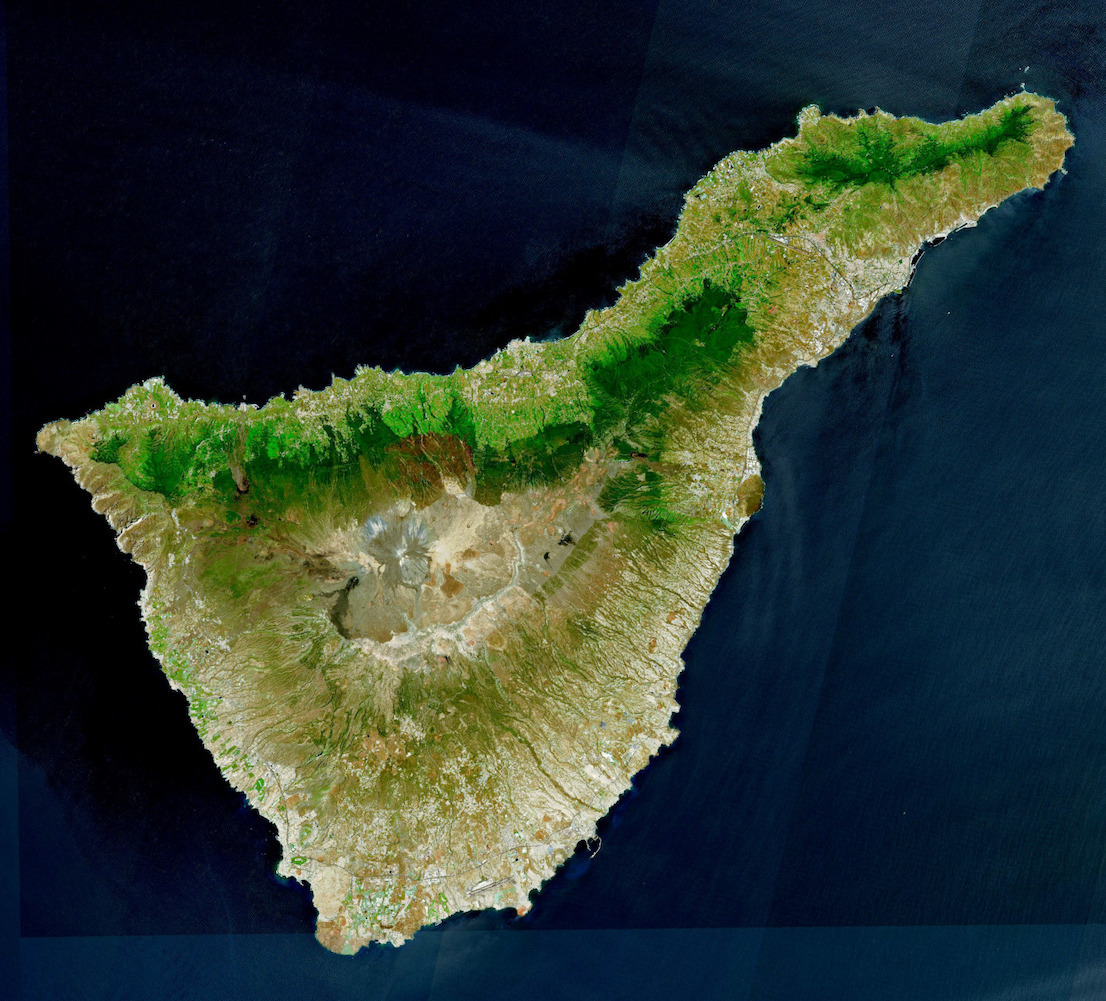
Tenerife ( ; ; formerly spelled ''Teneriffe'') is the largest and most populous island of the Canary Islands, an Autonomous communities of Spain, autonomous community of Spain. With a land area of and a population of 965,575 inhabitants as of April 2025, it is the most populous island in Spain and the entire Macaronesia region. Tenerife is also home to 42.7% of the total population of the archipelago. More than seven million tourists (7,384,707 in 2024) visit Tenerife each year, making it by far the most visited island in the archipelago. It is one of the most important tourist destinations in Spain and the world, hosting one of the world's largest carnivals, the Carnival of Santa Cruz de Tenerife. The capital of the island, , is also the seat of the island council (). That city and are the co-capitals of the Autonomous communities of Spain, autonomous community of the Canary Islands. The two cities are both home to governmental institutions, such as the offices of the preside ... [...More Info...] [...Related Items...] OR: [Wikipedia] [Google] [Baidu] |
Masca Gorge View Towards North-west, Sunset (Dec 2014)
Masca is a small mountain village on the island of Tenerife. It was originally a Guanche settlement before the Spanish conquest in 1496. The village is now home to around 90 inhabitants. The village lies at an altitude of 650 m in the Macizo de Teno mountains, which extend up to the northwesternmost point of Tenerife. Forests including cypresses and palm trees abound. The village lies at the head of the Masca Gorge. The trail from the village down the gorge to the beach on the Atlantic Ocean The Atlantic Ocean is the second largest of the world's five borders of the oceans, oceanic divisions, with an area of about . It covers approximately 17% of Earth#Surface, Earth's surface and about 24% of its water surface area. During the ... is a popular, though strenuous, hiking route, which takes about 3 hours each way. These "hiking routes" are not just demanding, but also strenuous with, conditions that can very easily claim your life, should you venture into them unprepar ... [...More Info...] [...Related Items...] OR: [Wikipedia] [Google] [Baidu] |


