|
Maryland City, Maryland
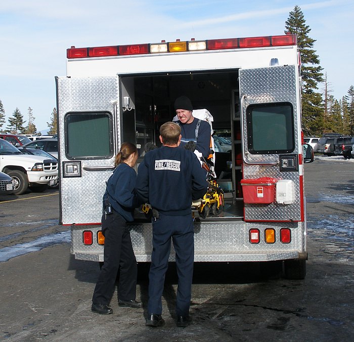
Maryland City is a census-designated place (CDP) in Anne Arundel County, Maryland, United States. The population was at the 2010 census. It is located east of Laurel, just over the border with Prince George's County, and it has a Laurel ZIP Code. Maryland City mostly consists of an older, compact housing development and is adjacent to Fort Meade army base. A large newer development (built mid-1990s) on the north side of Maryland Route 198 is known as Russett and is included within the Maryland City CDP. Services Maryland City is home to the Maryland City Volunteer Fire Department, which is part of the Anne Arundel County Fire Department. MCVFD Station 27 is located at 3498 Laurel Fort Meade Road. It is staffed 24 hours a day by four career firefighters, one of whom is an EMT-paramedic. The career staff is supplemented by volunteers. History Maryland City was developed by the Maryland City Corp, owned by developer Harvey Kayne. The of eastern Laurel, Maryland, were purchase ... [...More Info...] [...Related Items...] OR: [Wikipedia] [Google] [Baidu] |
Census-designated Place
A census-designated place (CDP) is a Place (United States Census Bureau), concentration of population defined by the United States Census Bureau for statistical purposes only. CDPs have been used in each decennial census since 1980 as the counterparts of incorporated places, such as self-governing city (United States), cities, town (United States), towns, and village (United States), villages, for the purposes of gathering and correlating statistical data. CDPs are populated areas that generally include one officially designated but currently unincorporated area, unincorporated community, for which the CDP is named, plus surrounding inhabited countryside of varying dimensions and, occasionally, other, smaller unincorporated communities as well. CDPs include small rural communities, Edge city, edge cities, colonia (United States), colonias located along the Mexico–United States border, and unincorporated resort and retirement community, retirement communities and their environs. ... [...More Info...] [...Related Items...] OR: [Wikipedia] [Google] [Baidu] |
Emergency Medical Technician
An emergency medical technician (often, more simply, EMT) is a medical professional that provides emergency medical services. EMTs are most commonly found serving on ambulances and in fire departments in the US and Canada, as full-time and some part-time departments require their firefighters to at least be EMT certified. In English-speaking countries, paramedics are a separate profession that has additional educational requirements, qualifications, and scope of practice. EMTs are often employed by public ambulance services, municipal EMS agencies, governments, hospitals, and fire departments. Some EMTs are paid employees, while others (particularly those in rural areas) are volunteers. EMTs provide medical care under a set of protocols, which are typically written by a physician. Hazard controls EMTs are exposed to a variety of hazards such as lifting patients and equipment, treating those with infectious disease, handling hazardous substances, and transportation via g ... [...More Info...] [...Related Items...] OR: [Wikipedia] [Google] [Baidu] |
Native Americans In The United States
Native Americans (also called American Indians, First Americans, or Indigenous Americans) are the Indigenous peoples of the Americas, Indigenous peoples of the United States, particularly of the Contiguous United States, lower 48 states and Alaska. They may also include any Americans whose origins lie in any of the indigenous peoples of North or South America. The United States Census Bureau publishes data about "American Indians and Alaska Natives", whom it defines as anyone "having origins in any of the original peoples of North and South America ... and who maintains tribal affiliation or community attachment". The census does not, however, enumerate "Native Americans" as such, noting that the latter term can encompass a broader set of groups, e.g. Native Hawaiians, which it tabulates separately. The European colonization of the Americas from 1492 resulted in a Population history of Indigenous peoples of the Americas, precipitous decline in the size of the Native American ... [...More Info...] [...Related Items...] OR: [Wikipedia] [Google] [Baidu] |
Non-Hispanic Or Latino African Americans
African Americans, also known as Black Americans and formerly also called Afro-Americans, are an American racial and ethnic group that consists of Americans who have total or partial ancestry from any of the Black racial groups of Africa. African Americans constitute the second largest ethno-racial group in the U.S. after White Americans. The term "African American" generally denotes descendants of Africans enslaved in the United States. In 2023, an estimated 48.3 million people self-identified as Black, making up 14.4% of the country’s population. This marks a 33% increase since 2000, when there were 36.2 million Black people living in the U.S. African-American history began in the 16th century, with Africans being sold to European slave traders and transported across the Atlantic to the Western Hemisphere. They were sold as slaves to European colonists and put to work on plantations, particularly in the southern colonies. A few were able to achieve freedom through ... [...More Info...] [...Related Items...] OR: [Wikipedia] [Google] [Baidu] |
Non-Hispanic Or Latino Whites
Non-Hispanic Whites, also referred to as White Anglo Americans or Non-Latino Whites, are White Americans who are classified by the United States census as "White people, White" and not of White Hispanic and Latino Americans, Hispanic or Latino origin. According to annual estimates from the United States Census Bureau, as of July 1, 2023, non-Hispanic Whites comprised approximately 58.4% of the Demographics of the United States, U.S. population. Although non-Hispanic Whites remain the largest single Race and ethnicity in the United States, racial and ethnic group in the United States and still constitute a majority of the population, their share has declined significantly over the past eight decades. In 1940 United States census, 1940, they comprised approximately 89.8% of the total population, illustrating the extent of the demographic transformation that has occurred since the mid-20th century. This decline has been attributed to factors such as lower Birth rate, birth rates am ... [...More Info...] [...Related Items...] OR: [Wikipedia] [Google] [Baidu] |
United States Census Bureau
The United States Census Bureau, officially the Bureau of the Census, is a principal agency of the Federal statistical system, U.S. federal statistical system, responsible for producing data about the American people and American economy, economy. The U.S. Census Bureau is part of the United States Department of Commerce, U.S. Department of Commerce and its Director of the United States Census Bureau, director is appointed by the president of the United States. Currently, Ron S. Jarmin is the acting director of the U.S. Census Bureau. The Census Bureau's primary mission is conducting the United States census, U.S. census every ten years, which allocates the seats of the United States House of Representatives, U.S. House of Representatives to the U.S. state, states based on their population. The bureau's various censuses and surveys help allocate over $675 billion in federal funds every year and it assists states, local communities, and businesses in making informed decisions. T ... [...More Info...] [...Related Items...] OR: [Wikipedia] [Google] [Baidu] |
Maryland Route 32
Maryland Route 32 (MD 32) is a state highway in the U.S. state of Maryland. The road runs from Interstate 97 (I-97) and Maryland Route 3, MD 3 in Millersville, Maryland, Millersville west and north to Washington Road in Westminster, Maryland, Westminster. The 30 mile four- to six-lane freeway portion of MD 32 is the Patuxent Freeway between I-97 and Interstate 70 in Maryland, I-70 in West Friendship, Maryland, West Friendship. The freeway passes through Odenton, Maryland, Odenton and Fort Meade, Maryland, Fort Meade, the site of Fort George G. Meade and the National Security Agency (NSA), in western Anne Arundel County, Maryland, Anne Arundel County and along the southern part of Columbia, Maryland, Columbia in Howard County, Maryland, Howard County. Via I-97, MD 32 connects those communities with U.S. Route 50 in Maryland, U.S. Route 50 (US 50)/U.S. Route 301 in Maryland, US 301 in Annapolis, Maryland, Annapolis. MD 32 ... [...More Info...] [...Related Items...] OR: [Wikipedia] [Google] [Baidu] |
Baltimore
Baltimore is the most populous city in the U.S. state of Maryland. With a population of 585,708 at the 2020 census and estimated at 568,271 in 2024, it is the 30th-most populous U.S. city. The Baltimore metropolitan area is the 20th-largest metropolitan area in the country at 2.84 million residents. The city is also part of the Washington–Baltimore combined statistical area, which had a population of 9.97 million in 2020. Baltimore was designated as an independent city by the Constitution of Maryland in 1851. Though not located under the jurisdiction of any county in the state, it forms part of the central Maryland region together with the surrounding county that shares its name. The land that is present-day Baltimore was used as hunting ground by Paleo-Indians. In the early 1600s, the Susquehannock began to hunt there. People from the Province of Maryland established the Port of Baltimore in 1706 to support the tobacco trade with Europe and established the Town ... [...More Info...] [...Related Items...] OR: [Wikipedia] [Google] [Baidu] |
Baltimore–Washington Parkway
The Baltimore–Washington Parkway (also referred to as the B–W Parkway) is a controlled-access parkway in the U.S. state of Maryland, running southwest from Baltimore to Washington, D.C. The road begins at an interchange with U.S. Route 50 (US 50) near Cheverly in Prince George's County at the Washington, D.C., border, and continues northeast as a parkway maintained by the National Park Service (NPS) to MD 175 near Fort Meade, serving many federal institutions. This portion of the parkway is dedicated to Gladys Noon Spellman, a representative of Maryland's 5th congressional district, and has the unsigned Maryland Route 295 (MD 295) designation. Commercial vehicles, including trucks, are prohibited within this stretch. This section is administered by the NPS's Greenbelt Park unit. After leaving park service boundaries the highway is maintained by the state and signed with the MD 295 designation. This section of the parkway passes near Ba ... [...More Info...] [...Related Items...] OR: [Wikipedia] [Google] [Baidu] |
Fort Meade, Maryland
Fort Meade is a census-designated place (CDP) in Anne Arundel County, Maryland, United States. The population was 9,324 at the 2020 census. It is the home to the National Security Agency, Central Security Service, United States Cyber Command and the Defense Information Systems Agency, which are located on the U.S. Army post Fort George G. Meade. Geography Fort Meade is located at (39.105015, −76.741260) in northwestern Anne Arundel County. It is located between the cities of Baltimore and Washington, D.C., and is located approximately 20 minutes from the state capital of Annapolis. It is bounded on the northwest by the Baltimore–Washington Parkway (Maryland Route 295) and on the south and southwest by the Patuxent Freeway ( Maryland Route 32), which leads southeast towards Annapolis and northwest to Columbia. Exit 38A off Interstate 95 (in adjacent Howard County) also offers access to here. Adjacent CDPs and communities * Annapolis Junction *Hanover * Jessup * Laure ... [...More Info...] [...Related Items...] OR: [Wikipedia] [Google] [Baidu] |
Jessup, Maryland
Jessup ( ) is an unincorporated community and census-designated place in Howard and Anne Arundel counties, about southwest of Baltimore, Maryland, United States. Per the 2020 census, the population was 10,535. Geography Jessup is located at (39.138374, −76.774929). According to the United States Census Bureau, the CDP has a total area of , all land. As of the 2010 census, the center of population for the state of Maryland is located on the grounds of the Clifton T. Perkins Hospital Center in Jessup. History Jessup is located near the site of the historic Spurrier's Tavern, a farm and tavern located on the post road between Baltimore and Washington (Route One) where George Washington traveled regularly. The location of the town was named Pierceland on early maps, but the post-civil war name more commonly given was Jessup's Cut, or Jessop's Cut, a post village in Howard County on the Baltimore and Ohio Railroad. The name is generally attributed to Jonathan Jessup, a civ ... [...More Info...] [...Related Items...] OR: [Wikipedia] [Google] [Baidu] |


