|
Maroantsetra
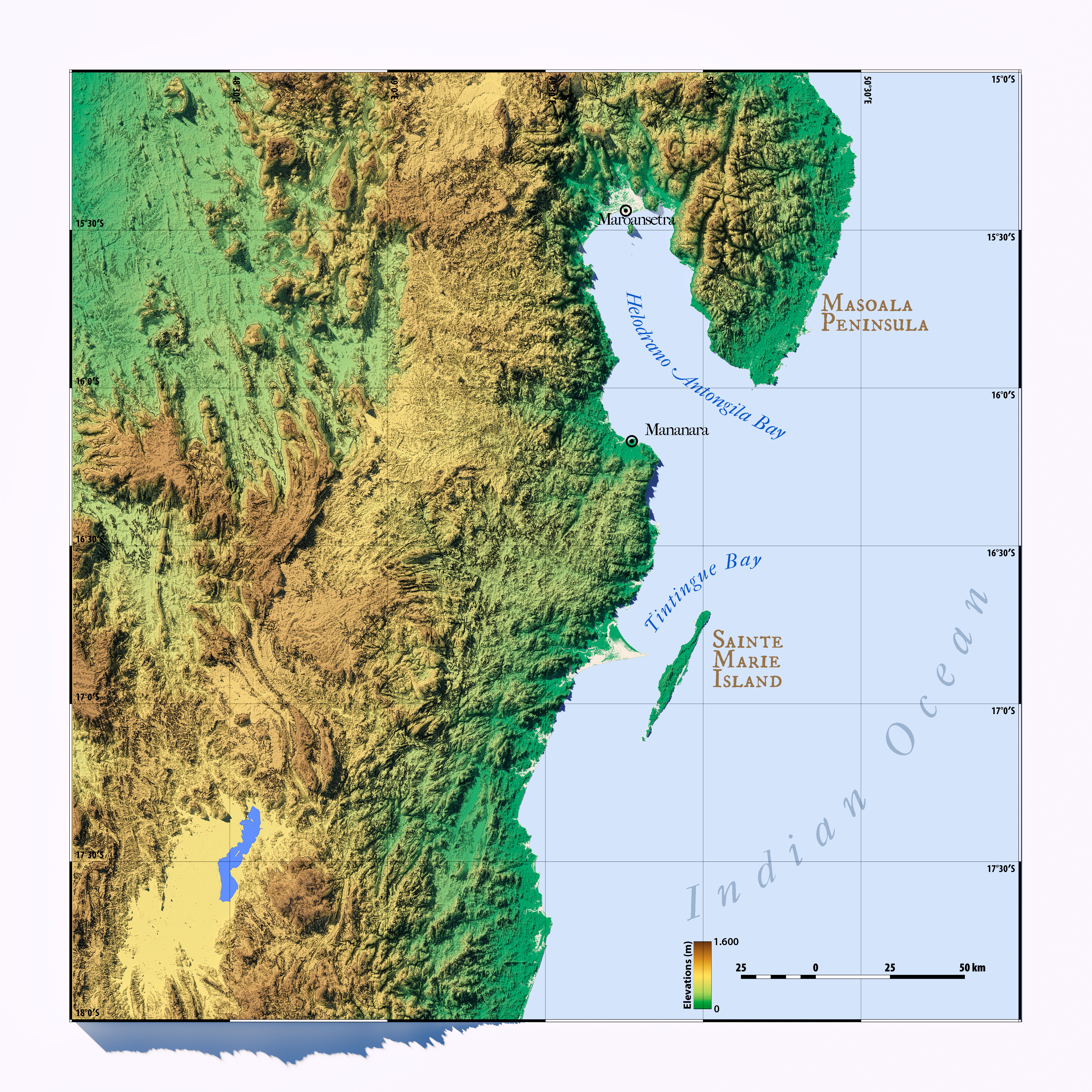
Maroantsetra , formerly Louisbourg, is a market town and domestic seaport in Analanjirofo Region, Madagascar, at the northern end of the Bay of Antongil. In 2018, Maroantsetra counted 42,529 people. Even though it is a small city, Maroantsetra played an important role in the Betsimisaraka history as the unification of this tribe by Ratsimilaho started there. Throughout the eighteenth century, Maroantsetra also actively participated in the piracy and the attack led collectively by the Betsimisarakas against the islands of Comoros and some east African countries. History Maurice Benyovszky arrived in Maroantsetra in February 1774. He established a colony here, which was named Louisbourg. A hospital was built as well as a quarantine post on Nosy Mangabe island just off the coast. Geography and climate Maroantsetra is a coastal town in northeastern Madagascar, approximately by air northeast of Antananarivo Antananarivo (Malagasy language, Malagasy: ; French language, Fr ... [...More Info...] [...Related Items...] OR: [Wikipedia] [Google] [Baidu] |
Maroantsetra District
Maroantsetra is a Districts of Madagascar, district of Analanjirofo in Districts of Madagascar, Madagascar. It hosts part of Masoala National Park and part of Makira Natural Park. The district has an area of , and the estimated population in 2020 was 264,234. Communes The district is further divided into 20 communes: * Ambanizana * Ambinanitelo * Ambodimanga Rantabe * Anandrivola * Andranofotsy * Androndrono * Anjanazana * Ankofa * Ankofabe * Antakotako * Antsahana * Antsirabe Sahatany * Mahalevona, Mahavelona * Manambolo * Mariarano, Maroantsetra, Mariharano * Maroantsetra * Morafeno, Maroantsetra, Morafeno * Rantabe * Sahasindro * Voloina Rivers This district is crossed by the Rantabe river, Ivoloina River, Antainambalana River, Manambolo (Est), Amaranofotsy, Mahalevona River and the Ambanizana. References Districts of Analanjirofo {{Madagascar-geo-stub ... [...More Info...] [...Related Items...] OR: [Wikipedia] [Google] [Baidu] |
Maroantsetra Airport
Maroantsetra Airport is an airport in Maroantsetra, Analanjirofo Region, Madagascar Madagascar, officially the Republic of Madagascar, is an island country that includes the island of Madagascar and numerous smaller peripheral islands. Lying off the southeastern coast of Africa, it is the world's List of islands by area, f ... . Airlines and destinations References Airports in Madagascar Analanjirofo {{Madagascar-airport-stub ... [...More Info...] [...Related Items...] OR: [Wikipedia] [Google] [Baidu] |
Nosy Mangabe
Nosy Mangabe is a small island reserve located in Antongil Bay about offshore from the town of Maroantsetra in north-east Madagascar. it is accessible by small boat and is part of the larger Masoala National Park complex. It is a tropical rainforest national park for a species of lemur, the aye-aye (''Daubentonia madagascariensis''). It lies close enough to Maroantsetra for a day trip, although an overnight stay is recommended for seeing the nocturnal aye-aye. History The island has a rich history of trading and piracy and on the west side of the island are rock carvings by Dutch sailors from the 16th-century. In the 17th-century the area was invaded by the French who established a trading post. British science fiction writer Douglas Adams visited the island searching for the aye-aye, for a radio programme and in one of his lesser known books, '' Last Chance to See''. Geography Nosy Mangabe is a island national park in Antongil Bay in the north-east of Madagasgar. The island is ... [...More Info...] [...Related Items...] OR: [Wikipedia] [Google] [Baidu] |
Bay Of Antongil
''Helodranon' Antongila'' (Bay of Antongila), more commonly called Antongil Bay in English, is the largest bay in Madagascar. This bay is on the island's east coast, toward the northern end of the eastern coastline of the island. It is within Analanjirofo administrative region. The bay is about long and wide. Forming the eastern edge of the bay is the Masoala peninsula. The island Nosy Mangabe and the town of Maroantsetra Maroantsetra , formerly Louisbourg, is a market town and domestic seaport in Analanjirofo Region, Madagascar, at the northern end of the Bay of Antongil. In 2018, Maroantsetra counted 42,529 people. Even though it is a small city, Maroantsetra ... are situated at the northern end of the bay, while the southern end of the bay is near the site of the town of Mananara Avaratra and the mouth of the Mananara River (Analanjirofo). Bays of Madagascar Analanjirofo Pirate dens and locations {{Analanjirofo-geo-stub ... [...More Info...] [...Related Items...] OR: [Wikipedia] [Google] [Baidu] |
Analanjirofo
Analanjirofo is a region in northeastern Madagascar. Until 2009 it was a part of Toamasina Province. It borders Sava Region to the north, Sofia Region to the west, Alaotra-Mangoro Region to the southwest and Atsinanana Region to the south. The capital of the region is Fenoarivo Atsinanana (), and the population was 1,152,345 in 2018. The area of Analanjirofo Region is . Administrative divisions Analanjirofo Region is divided into six districts, which are sub-divided into 63 communes. * Fenoarivo-Atsinanana District - 14 communes * Mananara Avaratra District - 16 communes * Maroantsetra District - 20 communes * Nosy Boraha District - 1 commune * Soanierana Ivongo District - 9 communes * Vavatenina District - 11 communes President Rajoelina announced on 5 June 2023 that this region will be divided into Ambatosoa region, covering the actual districts of Mananara Avaratra District and Maroantsetra District, and the other districts of Analanjirofo Region. Transport Airpo ... [...More Info...] [...Related Items...] OR: [Wikipedia] [Google] [Baidu] |
Analanjirofo Region
Analanjirofo is a region in northeastern Madagascar. Until 2009 it was a part of Toamasina Province. It borders Sava Region to the north, Sofia Region to the west, Alaotra-Mangoro Region to the southwest and Atsinanana Region to the south. The capital of the region is Fenoarivo Atsinanana (), and the population was 1,152,345 in 2018. The area of Analanjirofo Region is . Administrative divisions Analanjirofo Region is divided into six districts, which are sub-divided into 63 communes. * Fenoarivo-Atsinanana District - 14 communes * Mananara Avaratra District - 16 communes * Maroantsetra District - 20 communes * Nosy Boraha District - 1 commune * Soanierana Ivongo District - 9 communes * Vavatenina District - 11 communes President Rajoelina announced on 5 June 2023 that this region will be divided into Ambatosoa region, covering the actual districts of Mananara Avaratra District and Maroantsetra District, and the other districts of Analanjirofo Region. Transport Airports * Man ... [...More Info...] [...Related Items...] OR: [Wikipedia] [Google] [Baidu] |
Route Nationale 5 (Madagascar)
Route nationale 5 (RN5) is a primary highway in Madagascar of 402 km. The route runs from Toamasina to Maroantsetra, a city on the eastern coast of the Madagascar. The first 160 km until Soanierana Ivongo are paved and in good condition, but the remaining is unpaved and in a bad state of conservation. Several rivers must be crossed by ferry boats. The part from Soanierana Ivongo to Mananara Avaratra is scheduled to be paved in 2022. Selected locations on route (from North to South) *Maroantsetra (Masoala National Park) *Rantabe (river crossing) *Fahambany (river crossing) *Mananara Avaratra (ferry crossing Mananara River (Analanjirofo), Mananara river) ** (Mananara-Nord National Park) *Andrangazaha (ferry crossing Simianona river) *Soanierana Ivongo (ferry over Marimbona river / ferry to Nosy Boraha ) ** (Ambatovaky Special Reserve) *Manangory River crossing *Fenoarivo Atsinanana, Fenoarivo Atsinanana (Fénérive) **(intersection with Route nationale 22 (Madagascar), RN 22) * ... [...More Info...] [...Related Items...] OR: [Wikipedia] [Google] [Baidu] |
Antainambalana River
''Antainambalana'' (Also known as Antainambalan on some maps) is a river in the region of Analanjirofo in north-eastern Madagascar. It flows down from the highlands to flow into the Bay of Antongil and the Indian Ocean near Maroantsetra. Its basin has the size of . History In the 18th century this river was called ''Tingballe River'' by early European navigator A navigator is the person on board a ship or aircraft responsible for its navigation.Grierson, MikeAviation History—Demise of the Flight Navigator FrancoFlyers.org website, October 14, 2008. Retrieved August 31, 2014. The navigator's prim ...s. References Rivers of Analanjirofo Rivers of Madagascar {{Madagascar-river-stub ... [...More Info...] [...Related Items...] OR: [Wikipedia] [Google] [Baidu] |
Jacques Rabemananjara
Jacques Rabemananjara (23 June 1913 – 2 April 2005) was a Madagascar, Malagasy politician, playwright and poet. He served as a government minister, rising to Vice President of Madagascar. Rabemananjara was said to be the most prolific writer of his negritude generation after Léopold Sédar Senghor, Senghor, and he had the first négritude poetry published. Early life Rabemananjara was born in Maroantsetra in Antongil Bay in eastern Madagascar on 23 June 1913, of Betsimisaraka people, Betsimisarakan origin. He began his education on the island of Sainte-Marie, Madagascar, Sainte Marie, but soon left to finish his studies at the seminary at Antananarivo, the capital of Madagascar. In 1935–36, the Madagascan authorities prohibited any further publication of a monthly journal of young people of Madagascar, which he was responsible for. The magazine, ''Revue des Jeunes de Madagascar'', had 10 issues. The journal was an early example of political writing pre-dating later more ... [...More Info...] [...Related Items...] OR: [Wikipedia] [Google] [Baidu] |
Districts Of Madagascar
Districts are second-level administrative divisions of Madagascar below the regions. There are 114 districts in Madagascar. Districts are themselves divided into communes; while some of the districts in urban areas (such as the City districts of Antananarivo, Antsirabe I, Antsiranana I, Fianarantsoa I, Toamasina I and Toliara I) and offshore islands (such as the districts of Nosy Be and Nosy Boraha) each consist of only one commune, most of the districts are divided typically into 5–20 communes. List of districts * Note that Isandra, Lalangina and Vohibato Districts previously formed Fianarantsoa II District (within Haute Matsiatra Region) which has now been split into these three new districts. Another new district was formed by the splitting off of the new Mandoto District from Betafo District (within Vakinankaratra Region). See also * Subdivisions of Madagascar * Provinces of Madagascar * Regions of Madagascar Madagascar is divided into 23 region, reg ... [...More Info...] [...Related Items...] OR: [Wikipedia] [Google] [Baidu] |
Madagascar
Madagascar, officially the Republic of Madagascar, is an island country that includes the island of Madagascar and numerous smaller peripheral islands. Lying off the southeastern coast of Africa, it is the world's List of islands by area, fourth largest island, the List of island countries, second-largest island country, and the List of countries and dependencies by area, 46th largest country overall. Its capital and List of cities in Madagascar, largest city is Antananarivo. Following the prehistoric breakup of the supercontinent Gondwana, Madagascar split from Africa during the Early Jurassic period, around 180 million years ago, and separated from the Indian subcontinent approximately 90 million years ago. This isolation allowed native plants and animals to evolve in relative seclusion; as a result, Madagascar is a biodiversity hotspot and one of the world's 17 megadiverse countries, with over 90% of its wildlife of Madagascar, wildlife being endemic. The island has ... [...More Info...] [...Related Items...] OR: [Wikipedia] [Google] [Baidu] |
Tamatave
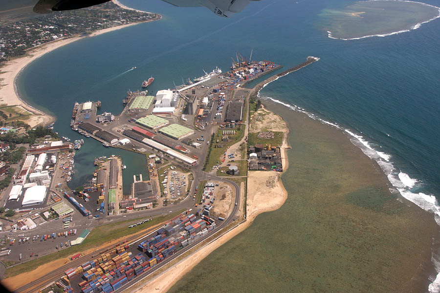
Toamasina (), meaning "like salt" or "salty", unofficially and in French Tamatave or in the past as Port aux prunes, is the capital of the Atsinanana region on the east coast of Madagascar on the Indian Ocean. The city is the chief seaport of the country, situated northeast of its capital and largest city Antananarivo. In 2018 Toamasina had a population of 325,857. History Under French rule, Toamasina was the seat of several foreign consuls, as well as of numerous French officials, and was the chief port for the capital and the interior. Imports consisted principally of piece-goods, farinaceous foods, and iron and steel goods; main exports were gold dust, raffia, hides, caoutchouc (natural rubber) and live animals. Communication with Europe was maintained by steamers of the Messageries Maritimes and the Havraise companies, and also with Mauritius, and thence to Sri Lanka, by the British Union-Castle Line. During the colonial period, owing to the character of the soil and the f ... [...More Info...] [...Related Items...] OR: [Wikipedia] [Google] [Baidu] |

