|
Marmore
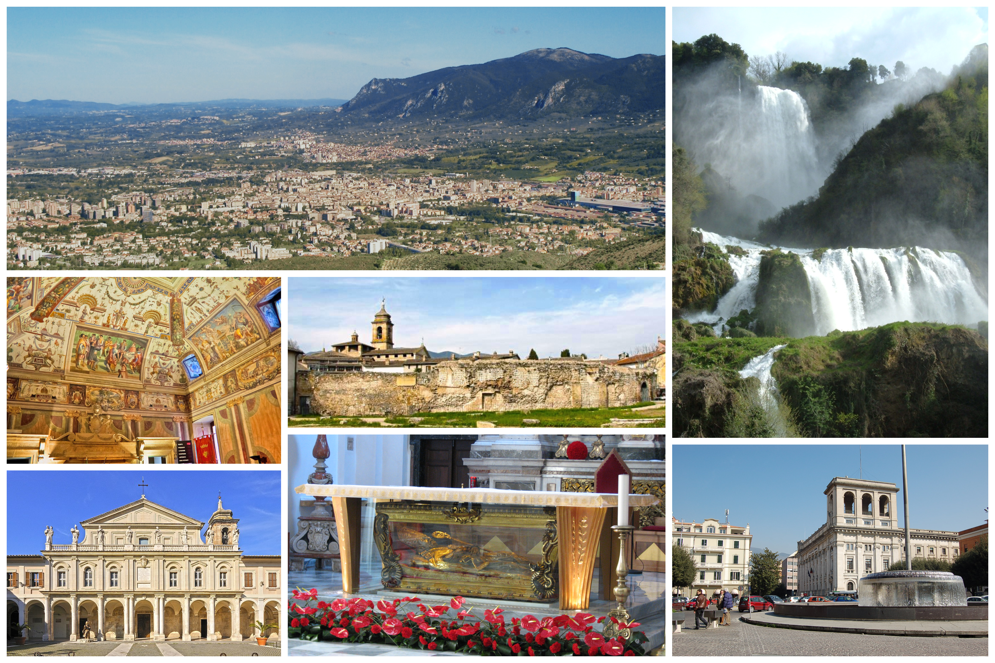
The Cascata delle Marmore () or Marmore Falls is a man-made waterfall created by the ancient Romans. Its total height is 165 m (541 feet), making it the tallest man-made waterfall in the world. It is located 7.7 km from Terni, a provincial capital of the Italian region of Umbria. Its source is a portion of the waters of the river Velino (the rest of the river flows into a hydroelectric power plant), after flowing through Piediluco lake near the community of Marmore (italian). It pours into the valley below formed by the river Nera. Its flow is turned on and off according to a published schedule, to satisfy the needs of tourists and the power company alike. Tourists try to be there the moment the gates are opened to see the powerful rush of water. History The Velino river flows through the highlands that surround the city of Rieti. In ancient times, it fed a wetland in the Rieti Valley that was thought to bring illness (probably malaria). To remove that threat to t ... [...More Info...] [...Related Items...] OR: [Wikipedia] [Google] [Baidu] |
Terni
Terni ( , ; lat, Interamna (Nahars)) is a city in the southern portion of the region of Umbria in central Italy. It is near the border with Lazio. The city is the capital of the province of Terni, located in the plain of the Nera river. It is northeast of Rome and 81 km south of the regional capital, Perugia. The Latin name means "between-two-rivers", in reference to its location on the confluence of the Nera river ( Ancient Umbrian ''Nahar'', lat, Nār, Nahar) and the Serra stream. When disambiguation was needed, it was referred to as ''Interamna Nahars''. Its inhabitants were known in Latin as ''Interamnātēs Na(ha)rtēs''. Interamna was founded as an Ancient Roman town, albeit settlements in the Terni area well precede this occurrence. During the 19th century, steel mills were introduced and led the city to have a role in the second industrial revolution in Italy. Because of its industrial importance, the city was heavily bombed during World War II by the Allies. It r ... [...More Info...] [...Related Items...] OR: [Wikipedia] [Google] [Baidu] |
Umbria
it, Umbro (man) it, Umbra (woman) , population_note = , population_blank1_title = , population_blank1 = , demographics_type1 = , demographics1_footnotes = , demographics1_title1 = , demographics1_info1 = , demographics1_title2 = , demographics1_info2 = , demographics1_title3 = , demographics1_info3 = , timezone1 = CET , utc_offset1 = +1 , timezone1_DST = CEST , utc_offset1_DST = +2 , postal_code_type = , postal_code = , area_code_type = ISO 3166 code , area_code = IT-55 , blank_name_sec1 = GDP (nominal) , blank_info_sec1 = €22.5 billion (2018) , blank1_name_sec1 = GDP per capita , blank1_info_sec1 = €25,400 (2018) , blank2_name_sec1 = HDI (2018) , blank2_info_sec1 = 0.884 · 12th of 21 , blank_name_sec2 = NUTS Region , blank_info_sec2 = ITE , ... [...More Info...] [...Related Items...] OR: [Wikipedia] [Google] [Baidu] |
Velino
The Velino is a river in central Italy, a tributary of the Nera. Its source is located on Monte Pozzoni's slopes (1,903 m) near Cittareale. Aftwards it runs through a narrow valley next the Mount Terminillo, known as "Gole del Vento" ("Wind's Ravines") and, near Antrodoco, receives the Peschiera Springs, which have a discharge of some 18 m³/s (9.5 m³/s is sent to Rome) through an aqueduct. Then it receives the waters of its left tributaries Salto and Turano, and then enters the plain of Rieti, where its discharge if further increased by other minor streams to reach 60 m³/s. Near Papigno, it falls into the Nera forming the famous Cascate delle Marmore falls. In pre- Romans times the river ended into a marsh within the plain of Rieti. The falls were created by consul Manius Curius Dentatus and enlarged in medieval times, being updated to the current state in the 18th century by architect Andrea Vici Andrea Vici (1743–1817) was an Italian architect and ... [...More Info...] [...Related Items...] OR: [Wikipedia] [Google] [Baidu] |
Waterfall
A waterfall is a point in a river or stream where water flows over a vertical drop or a series of steep drops. Waterfalls also occur where meltwater drops over the edge of a tabular iceberg or ice shelf. Waterfalls can be formed in several ways, but the most common method of formation is that a river courses over a top layer of resistant bedrock before falling on to softer rock, which erodes faster, leading to an increasingly high fall. Waterfalls have been studied for their impact on species living in and around them. Humans have had a distinct relationship with waterfalls for years, travelling to see them, exploring and naming them. They can present formidable barriers to navigation along rivers. Waterfalls are religious sites in many cultures. Since the 18th century they have received increased attention as tourist destinations, sources of hydropower, andparticularly since the mid-20th centuryas subjects of research. Definition and terminology A waterfall is general ... [...More Info...] [...Related Items...] OR: [Wikipedia] [Google] [Baidu] |
List Of Waterfalls
This list of notable waterfalls of the world is sorted by continent, then country, then province, state or territory. A waterfall is included if it has an existing article specifically for it on Wikipedia, and it is at least high, or the falls have some historical significance based on multiple reliable references. There is no standard way to measure the height or width of a waterfall. No ranking of waterfalls should be assumed because of the heights or widths provided in the list. Many numbers are estimated and measurements may be imprecise. See additional lists of waterfalls by List of waterfalls by height, height, List of waterfalls by flow rate, flow rate and List of waterfalls by type, type. Africa Angola * Kalandula Falls – high Burundi * Kagera waterfalls, Kagera Falls * Rusumo Falls Central African Republic * Boali, Boali Falls Chad * Gauthiot Falls Democratic Republic of the Congo * Boyoma Falls – formerly known as Stanley Falls; highest f ... [...More Info...] [...Related Items...] OR: [Wikipedia] [Google] [Baidu] |
Waterfalls Of Umbria
A waterfall is a point in a river or stream where water flows over a vertical drop or a series of steep drops. Waterfalls also occur where meltwater drops over the edge of a tabular iceberg or ice shelf. Waterfalls can be formed in several ways, but the most common method of formation is that a river courses over a top layer of resistant bedrock before falling on to softer rock, which erodes faster, leading to an increasingly high fall. Waterfalls have been studied for their impact on species living in and around them. Humans have had a distinct relationship with waterfalls for years, travelling to see them, exploring and naming them. They can present formidable barriers to navigation along rivers. Waterfalls are religious sites in many cultures. Since the 18th century they have received increased attention as tourist destinations, sources of hydropower, andparticularly since the mid-20th centuryas subjects of research. Definition and terminology A waterfall is generall ... [...More Info...] [...Related Items...] OR: [Wikipedia] [Google] [Baidu] |
Piediluco
Lago di Piediluco is a lake that straddles the border between the Province of Terni, Umbria, Italy and the Province of Rieti, Lazio. At an elevation of 375 m, its surface area is 1.58 km². The lake is formed by the inflow of water from three sources: the Rio Fuscello, the Velino river and the Nera river. The flow from the Rio Fuscello is naturally occurring, while the flows from the Nera and Velino rivers are each influenced in some part due to man-made means. A partial diversion of the Nera in the Nera river valley (Valnerina) conducts the flow via a lengthy aqueduct and canal system built in the 1920s during the fascist regime of Benito Mussolini, entering the lake at the north-western end of the village of Piediluco, near the entrance to the town from the "Via Ternana" SS79 motorway. A canal of approximately 400 meters' length was built, also in the 1920s, to divert the Velino river from its existing natural course into the lake. The purpose of this work was to improve hy ... [...More Info...] [...Related Items...] OR: [Wikipedia] [Google] [Baidu] |
Nera River (Italy)
The Nera is a long river that flows almost entirely in Umbria, Italy. It is the largest tributary to the Tiber, its sources are in the Monti Sibillini, east of Foligno Foligno (; Southern Umbrian: ''Fuligno'') is an ancient town of Italy in the province of Perugia in east central Umbria, on the Topino river where it leaves the Apennines and enters the wide plain of the Clitunno river system. It is located so .... It flows southward past Terni and Narni. It joins the Tiber near Orte. Its largest tributaries are the Velino and the Corno. See also * Roman shipyard of Stifone (Narni) References Rivers of Italy Rivers of the Province of Macerata Rivers of the Province of Perugia Rivers of the Province of Terni Rivers of the Province of Viterbo {{Italy-river-stub ... [...More Info...] [...Related Items...] OR: [Wikipedia] [Google] [Baidu] |
List Of Waterfalls By Height
The following are lists of waterfalls in the world by height, classified into two categories — natural and artificial waterfall, artificial. Natural waterfalls are further subdivided between overall height and tallest single drop. Each column (Waterfall, Height, Locality, Country) is sortable by using the up/down link in the column headings at the top of each column. World's tallest natural waterfalls By overall height This list consists of waterfalls which are known to have an overall height of at least . Underwater falls, such as the Denmark Strait cataract, are not included. By tallest single drop This list consists of the waterfalls which are known to have a singular individual step with a vertical drop of at least . World's tallest artificial waterfalls See also *List of waterfalls *List of waterfalls by flow rate *List of waterfalls by type References {{Reflist External linksWorld Waterfall Database: Worlds Tallest Waterfalls Lists of waterfalls, Heightne ... [...More Info...] [...Related Items...] OR: [Wikipedia] [Google] [Baidu] |
Malaria
Malaria is a mosquito-borne infectious disease that affects humans and other animals. Malaria causes symptoms that typically include fever, tiredness, vomiting, and headaches. In severe cases, it can cause jaundice, seizures, coma, or death. Symptoms usually begin ten to fifteen days after being bitten by an infected mosquito. If not properly treated, people may have recurrences of the disease months later. In those who have recently survived an infection, reinfection usually causes milder symptoms. This partial resistance disappears over months to years if the person has no continuing exposure to malaria. Malaria is caused by single-celled microorganisms of the '' Plasmodium'' group. It is spread exclusively through bites of infected '' Anopheles'' mosquitoes. The mosquito bite introduces the parasites from the mosquito's saliva into a person's blood. The parasites travel to the liver where they mature and reproduce. Five species of ''Plasmodium'' can infect and be spr ... [...More Info...] [...Related Items...] OR: [Wikipedia] [Google] [Baidu] |


