|
Mara River
The Mara River is a river that begins in Narok County in Kenya and ends in Mara Region in Tanzania. It lies across the migration path of ungulates in the Maasai Mara/Serengeti National Park, Serengeti ecosystem. The River's flow The Mara River basin covers a surface of 13,504 km2, of which approximately 65% is located in Kenya and 35% in Tanzania.Jim K. Kairu, "Biodiversity Action Plan for Sustainable Management: Mara River Basin" (WWF, 2008) From its sources in the Kenyan highlands, the river flows for about 395 km and originates from the Mau Escarpment and drains into Lake Victoria. The basin can be roughly divided into four land use and/or administrative units. The Mara's regions The Mau Escarpment: The Mara River originates from the Napuiyapi swamp (2932 m), with the main perennial tributaries being the Amala and the Nyangores, which drain from the western Mau Escarpment. This part of the basin supports besides forests, both small-scale agriculture (less th ... [...More Info...] [...Related Items...] OR: [Wikipedia] [Google] [Baidu] |
Kenya
Kenya, officially the Republic of Kenya, is a country located in East Africa. With an estimated population of more than 52.4 million as of mid-2024, Kenya is the 27th-most-populous country in the world and the 7th most populous in Africa. Kenya's capital and largest city is Nairobi. Its second-largest and oldest city is Mombasa, a major port city located on Mombasa Island. Other major cities within the country include Kisumu, Nakuru & Eldoret. Going clockwise, Kenya is bordered by South Sudan to the northwest (though much of that border includes the disputed Ilemi Triangle), Ethiopia to the north, Somalia to the east, the Indian Ocean to the southeast, Tanzania to the southwest, and Lake Victoria and Uganda to the west. Kenya's geography, climate and population vary widely. In western, rift valley counties, the landscape includes cold, snow-capped mountaintops (such as Batian, Nelion and Point Lenana on Mount Kenya) with vast surrounding forests, wildlife and ... [...More Info...] [...Related Items...] OR: [Wikipedia] [Google] [Baidu] |
Masai Mara National Reserve
Maasai Mara, sometimes also spelt Masai Mara and locally known simply as The Mara, is a large national game reserve in Narok County, Kenya, contiguous with the Serengeti National Park in Tanzania. It is named in honour of the Maasai people, the ancestral inhabitants of the area, who migrated to the area from the Nile Basin. Their description of the area when looked at from afar: "Mara" means "spotted" in the Maa language because of the short bushy trees which dot the landscape. Maasai Mara is one of the wildlife conservation and wilderness areas in Africa, with its populations of lions, leopards, cheetahs and African bush elephants. It also hosts the Great Migration, which secured it as one of the Seven Natural Wonders of Africa, and as one of the ten Wonders of the World. The Great Migration usually happens in July depending on weather as the wildebeest moves in large numbers crossing the Mara River from Tanzania. The Greater Mara ecosystem encompasses areas known as the Ma ... [...More Info...] [...Related Items...] OR: [Wikipedia] [Google] [Baidu] |
Rivers Of Tanzania
A river is a natural stream of fresh water that flows on land or inside caves towards another body of water at a lower elevation, such as an ocean, lake, or another river. A river may run dry before reaching the end of its course if it runs out of water, or only flow during certain seasons. Rivers are regulated by the water cycle, the processes by which water moves around the Earth. Water first enters rivers through precipitation, whether from rainfall, the runoff of water down a slope, the melting of glaciers or snow, or seepage from aquifers beneath the surface of the Earth. Rivers flow in channeled watercourses and merge in confluences to form drainage basins, or catchments, areas where surface water eventually flows to a common outlet. Rivers have a great effect on the landscape around them. They may regularly overflow their banks and flood the surrounding area, spreading nutrients to the surrounding area. Sediment or alluvium carried by rivers shapes the landscape aro ... [...More Info...] [...Related Items...] OR: [Wikipedia] [Google] [Baidu] |
Rivers Of Kenya
This is a very short list of rivers in Kenya.For a list of more than 3,800 rivers of Kenya, see :sw:Mito ya Kenya This list is arranged by drainage basin, with respective tributaries indented under each larger stream's name. Mediterranean Sea *''Nile'' **''White Nile'' ***''Victoria Nile (Uganda)'' ****Lake Victoria *****Nzoia River *****Yala River *****Nyando River *****Sondu River (Miriu River) *****Awach River ******Itare River *****Kitare River (South Awach River) *****Gucha River (Kuja River) ******Migori River ******Riana River ******Mogonga River *****Mara River Lake Turkana *Suguta River *Kerio River *Lokichar River (Lomenyangaparat) *Turkwel River **Suam River **Omo River **Turkwel River Lake Baringo *Ol Arabel, Olarabel River (Ngusero River) *Molo River **Perkerra River *Njoro River Lake Naivasha *Gilgil River *Malewa River **Turasha River (Kija river) Lake Natron *Southern Ewaso Ng'iro **Seyabei River Indian Ocean *Jubba River (Somalia) **Lagh Dera ***Lak Bor ... [...More Info...] [...Related Items...] OR: [Wikipedia] [Google] [Baidu] |
Masai Mara
Maasai Mara, sometimes also spelt Masai Mara and locally known simply as The Mara, is a large national game reserve in Narok County, Kenya, contiguous with the Serengeti National Park in Tanzania. It is named in honour of the Maasai people, the ancestral inhabitants of the area, who migrated to the area from the Nile Basin. Their description of the area when looked at from afar: "Mara" means "spotted" in the Maa language because of the short bushy trees which dot the landscape. Maasai Mara is one of the wildlife conservation and wilderness areas in Africa, with its populations of lions, leopards, cheetahs and African bush elephants. It also hosts the Great Migration, which secured it as one of the Seven Natural Wonders of Africa, and as one of the ten Wonders of the World. The Great Migration usually happens in July depending on weather as the wildebeest moves in large numbers crossing the Mara River from Tanzania. The Greater Mara ecosystem encompasses areas known as ... [...More Info...] [...Related Items...] OR: [Wikipedia] [Google] [Baidu] |
Nyando River
Nyando may refer to: *The Nyando River in Kenya **The former Nyando District Nyando district is a former district in Kenya which broke away from Kisumu District in Nyanza Province in 1998. Nyando district bordered the Rift Valley Province. The district was named after the Nyando River. Its capital was a small town called ..., named after the river *The New York and Ottawa Railroad (NY and O) ** Nyando, New York, named after the railroad, and now known as Rooseveltown {{dab ... [...More Info...] [...Related Items...] OR: [Wikipedia] [Google] [Baidu] |
Yala River
{{Infobox river , name = Yala River , image = YalaRiver.JPG , image_size = , image_caption = Yala river within Kakamega rainforest, western Kenya , image_alt = , map = , map_size = , map_caption = , map_alt = , pushpin_map = Kenya , pushpin_map_size = , pushpin_map_caption= Mouth location , pushpin_map_alt = , subdivision_type1 = Country , subdivision_name1 = Kenya , subdivision_type2 = , subdivision_name2 = , subdivision_type3 = , subdivision_name3 = , subdivision_type4 = , subdivision_name4 = , subdivision_type5 = , subdivision_name5 = , length = {{convert, 219, km , width_min = , width_avg = , width_max = , depth_min = , depth_avg = , depth_max = , discharge1_location= , discharge1_min = , discharge1_avg = , discharge1_max = , ... [...More Info...] [...Related Items...] OR: [Wikipedia] [Google] [Baidu] |
Nzoia River
The Nzoia River is a Kenyan river, rising from Cherangany hills. It passes through Kapsara, Springer, and Moi's Bridge then crosses to Kakamega County. It flows south and then west, eventually flowing into Lake Victoria near the town of Port Victoria. The river has a discharge of about 118 m3/s or about 3,721 million cubic metres annually, making it the second biggest river in the country by discharge. The river is important to Western Kenya, flowing through a region estimated to be populated by over 3.5 million people. Its waters provide irrigation all year round, while the annual floods around the lowland area of Budalang'i deposit sediment that contributes to the area's good agricultural production, albeit displacing hundreds of people and destroying settlements. Around the industrial region centred at Webuye, the river absorbs a lot of effluent from the paper and sugar Sugar is the generic name for sweet-tasting, soluble carbohydrates, many of which are use ... [...More Info...] [...Related Items...] OR: [Wikipedia] [Google] [Baidu] |
Nile
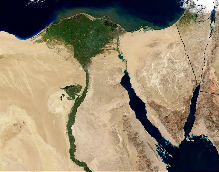
The Nile (also known as the Nile River or River Nile) is a major north-flowing river in northeastern Africa. It flows into the Mediterranean Sea. The Nile is the longest river in Africa. It has historically been considered the List of river systems by length, longest river in the world, though this has been contested by research suggesting that the Amazon River is slightly longer.Amazon Longer Than Nile River, Scientists Say Of the world's major rivers, the Nile has one of the lowest average annual flow rates. About long, its drainage basin covers eleven countries: the Democratic Republic of the Congo, Tanzania, Burundi, Rwanda, Uganda, Kenya, Ethiopia, Eritrea, South Sudan, Sudan, and Egypt. In pa ... [...More Info...] [...Related Items...] OR: [Wikipedia] [Google] [Baidu] |
Masai Mara River Aerial
Masai may refer to: *Masai, Johor, a town in Malaysia *Masai Plateau, a plateau in Kolhapur, Maharashtra, India *Maasai people, an ethnic group in East Africa *Maasai language, language of the Maasai ethnic group * Masai (name), Kenyan / African name See also * Kota Masai, a township in Pasir Gudang, Johor Bahru District, Johor, Malaysia *Masai giraffe (''Giraffa camelopardalis tippelskirchi''), also known as the Maasai Giraffe or Kilimanjaro Giraffe, the largest subspecies of giraffe and the tallest land mammal * Masai ostrich, subspecies of ostrich *Sire Ma (馬賽; pinyin: Mǎ Sài; born 1987), a Chinese actress and beauty pageant titleholder *Marseille, a city in France, written as 馬賽 or 马赛 for Chinese Mandarin *Maasai Mara National Reserve, a large game reserve in Kenya *Massai Massai (also known as: Masai, Massey, Massi, Mah–sii, Massa, Wasse, Wassil, Wild, Sand Coyote or by the nickname "Big Foot" Massai) was a member of the Mimbres/Mimbreños local group of th ... [...More Info...] [...Related Items...] OR: [Wikipedia] [Google] [Baidu] |
River Nile
The Nile (also known as the Nile River or River Nile) is a major north-flowing river in northeastern Africa. It flows into the Mediterranean Sea. The Nile is the longest river in Africa. It has historically been considered the longest river in the world, though this has been contested by research suggesting that the Amazon River is slightly longer.Amazon Longer Than Nile River, Scientists Say Of the world's major rivers, the Nile has one of the lowest average annual flow rates. About long, its covers eleven countries: the |
Drainage Basin
A drainage basin is an area of land in which all flowing surface water converges to a single point, such as a river mouth, or flows into another body of water, such as a lake or ocean. A basin is separated from adjacent basins by a perimeter, the drainage divide, made up of a succession of elevated features, such as ridges and hills. A basin may consist of smaller basins that merge at river confluences, forming a hierarchical pattern. Other terms for a drainage basin are catchment area, catchment basin, drainage area, river basin, water basin, and impluvium. In North America, they are commonly called a watershed, though in other English-speaking places, " watershed" is used only in its original sense, that of the drainage divide line. A drainage basin's boundaries are determined by watershed delineation, a common task in environmental engineering and science. In a closed drainage basin, or endorheic basin, rather than flowing to the ocean, water converges toward the ... [...More Info...] [...Related Items...] OR: [Wikipedia] [Google] [Baidu] |


