|
Mamilla
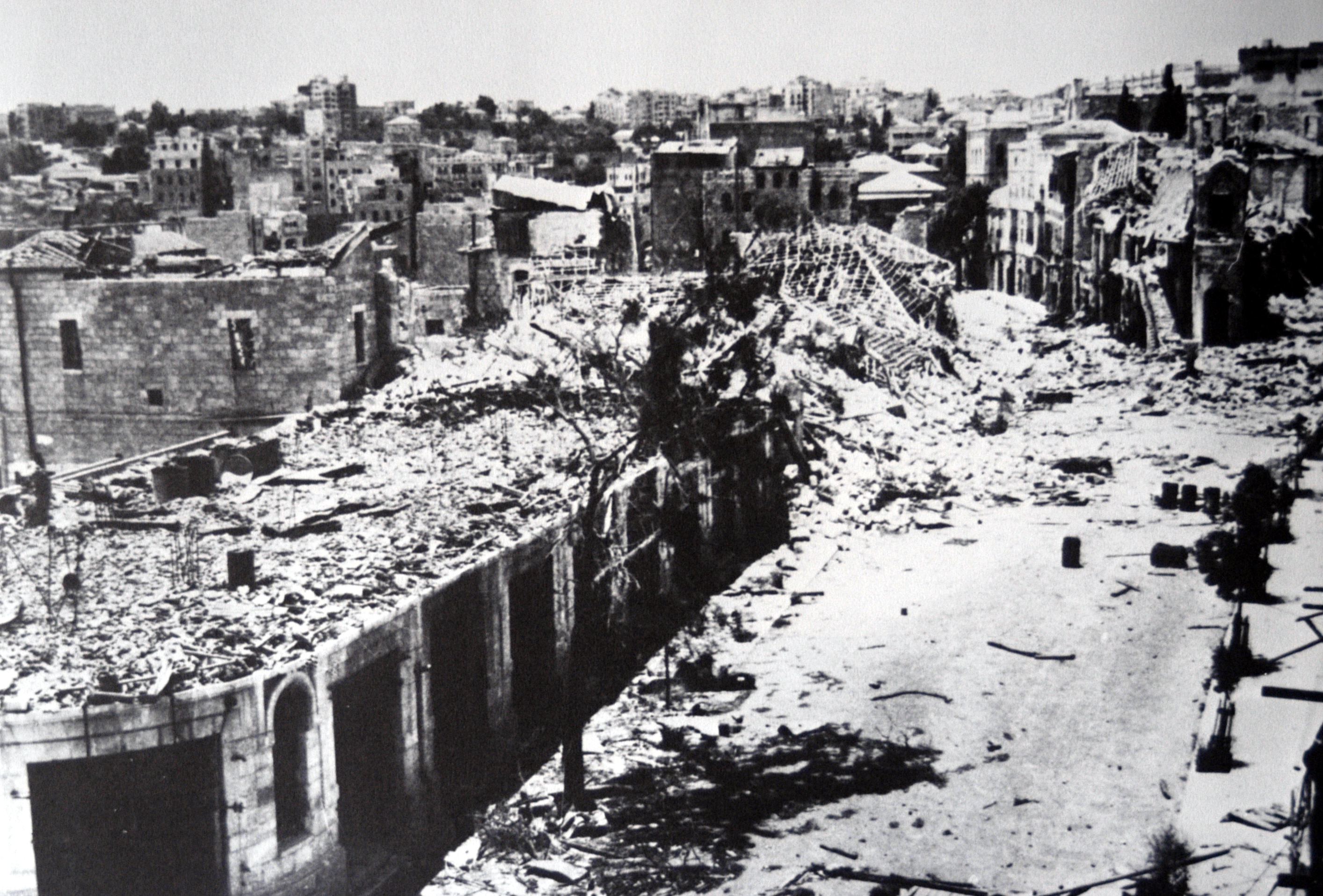
Mamilla () is a neighbourhood of Jerusalem that was established in the late 19th century outside the Old City, west of the Jaffa Gate. Until 1948 it was a mixed Jewish–Arab business district. Between 1948 and 1967, it was located along the armistice line between the Israeli and Jordanian-held sector of the city, and many buildings were destroyed by Jordanian shelling. The Israeli government approved an urban renewal project for Mamilla, apportioning land for residential and commercial zones, including hotels and office space. The Mamilla Mall opened in 2007. Geography The neighbourhood of Mamilla is located within the northwest extension of the Hinnom Valley, which extends from the southwest corner of the Old City along the city's western wall. The neighbourhood is bounded by the Jaffa Gate and Jaffa Road to the east and north, the downtown and Rehavia neighbourhood above it to the west, and Yemin Moshe's upward slope along its southwestern edge. Its total area is 120 ... [...More Info...] [...Related Items...] OR: [Wikipedia] [Google] [Baidu] |
Mamilla Mall
Mamilla Mall, also called Alrov Mamilla Avenue, is an upscale shopping street and the only open-air mall in West Jerusalem. Located northwest of Jaffa Gate, the mall consists of a pedestrian promenade called Alrov Mamilla Avenue lined by 140 stores, restaurants, and cafes, and office space on upper floors. It sits atop a multi-story parking garage for 1,600 cars and buses, and a bus terminal. Designed by Moshe Safdie and developed by Alrov Properties and Lodgings Ltd. of Tel Aviv, the mall incorporates the facades of 19th-century buildings from the original Mamilla Street, as well as the original structures of the Convent of St. Vincent de Paul, the Stern House, and the Clark House. The mall is part of the Alrov Mamilla Quarter, a $400 million mixed-use development that also includes the David's Village luxury condominium project, the David Citadel Hotel, the Alrov Mamilla Hotel, and the Karta parking lot. While the overall project was approved by the municipality in the ear ... [...More Info...] [...Related Items...] OR: [Wikipedia] [Google] [Baidu] |
Mamilla Herzl2
Mamilla () is a neighbourhood of Jerusalem that was established in the late 19th century outside the Old City, west of the Jaffa Gate. Until 1948 it was a mixed Jewish–Arab business district. Between 1948 and 1967, it was located along the armistice line between the Israeli and Jordanian-held sector of the city, and many buildings were destroyed by Jordanian shelling. The Israeli government approved an urban renewal project for Mamilla, apportioning land for residential and commercial zones, including hotels and office space. The Mamilla Mall opened in 2007. Geography The neighbourhood of Mamilla is located within the northwest extension of the Hinnom Valley, which extends from the southwest corner of the Old City along the city's western wall. The neighbourhood is bounded by the Jaffa Gate and Jaffa Road to the east and north, the downtown and Rehavia neighbourhood above it to the west, and Yemin Moshe's upward slope along its southwestern edge. Its total area is 120 dun ... [...More Info...] [...Related Items...] OR: [Wikipedia] [Google] [Baidu] |
Turbat El-Kubakiya
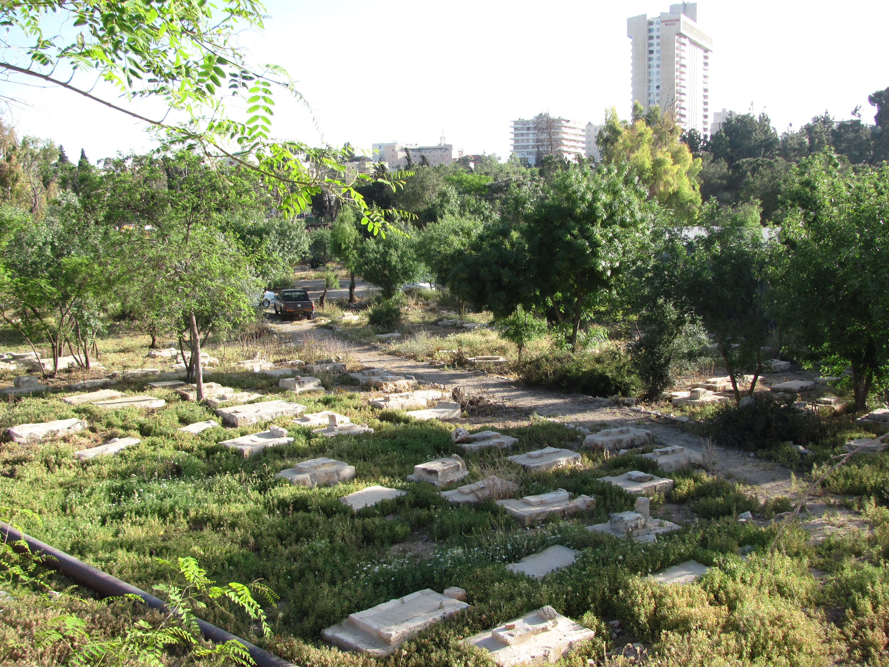
Mamilla Cemetery, sometimes called Ma'aman Allah Cemetery (), is a historic Muslim cemetery in West Jerusalem that dates back to the Crusades, and lies just to the west of the north-west corner of the walls of the Old City of Jerusalem, near the New Gate. The cemetery, at the center of which lies the Mamilla Pool, contains the remains of figures from the early Islamic period, several Sufi shrines and Mamluk-era tombs. The cemetery grounds also contain the bodies of thousands of Christians killed in the pre-Islamic era, as well as several tombs from the time of the Crusades. Its identity as an Islamic cemetery is noted by Arab and Persian writers as early as the 11th century, and it has been characterized as "the largest and most important Muslim cemetery in all of Palestine". It was used as a burial site up until 1927 when the Supreme Muslim Council decided to preserve it as a historic site. Following the 1948 Arab–Israeli War, the cemetery and other waqf properties in West J ... [...More Info...] [...Related Items...] OR: [Wikipedia] [Google] [Baidu] |
Jaffa Gate
Jaffa Gate (; , "Hebron Gate") is one of the seven main open gates of the Old City of Jerusalem. The name Jaffa Gate is currently used for both the historical Ottoman gate from 1538, and for the wide gap in the city wall adjacent to it to the south. The old gate has the layout of a medieval gate tower with an L-shaped entryway, which was secured at both ends (north and east) with heavy doors. The breach in the wall was created in 1898 by the Ottoman authorities in order to allow German emperor Wilhelm II to enter the city triumphally. The breach and the ramp leading to it now allow cars to access the Old City from the west. The L-shape of the historical gateway was a classical defensive measure designed to slow oncoming attackers, with its outer gate oriented in the direction of Jaffa Road, from which travellers including pilgrims arrived at the end of their journey from the port of Jaffa. Names Both the Jaffa Gate and Jaffa Road are named after the port of Jaffa, from ... [...More Info...] [...Related Items...] OR: [Wikipedia] [Google] [Baidu] |
Hezekiah's Pool
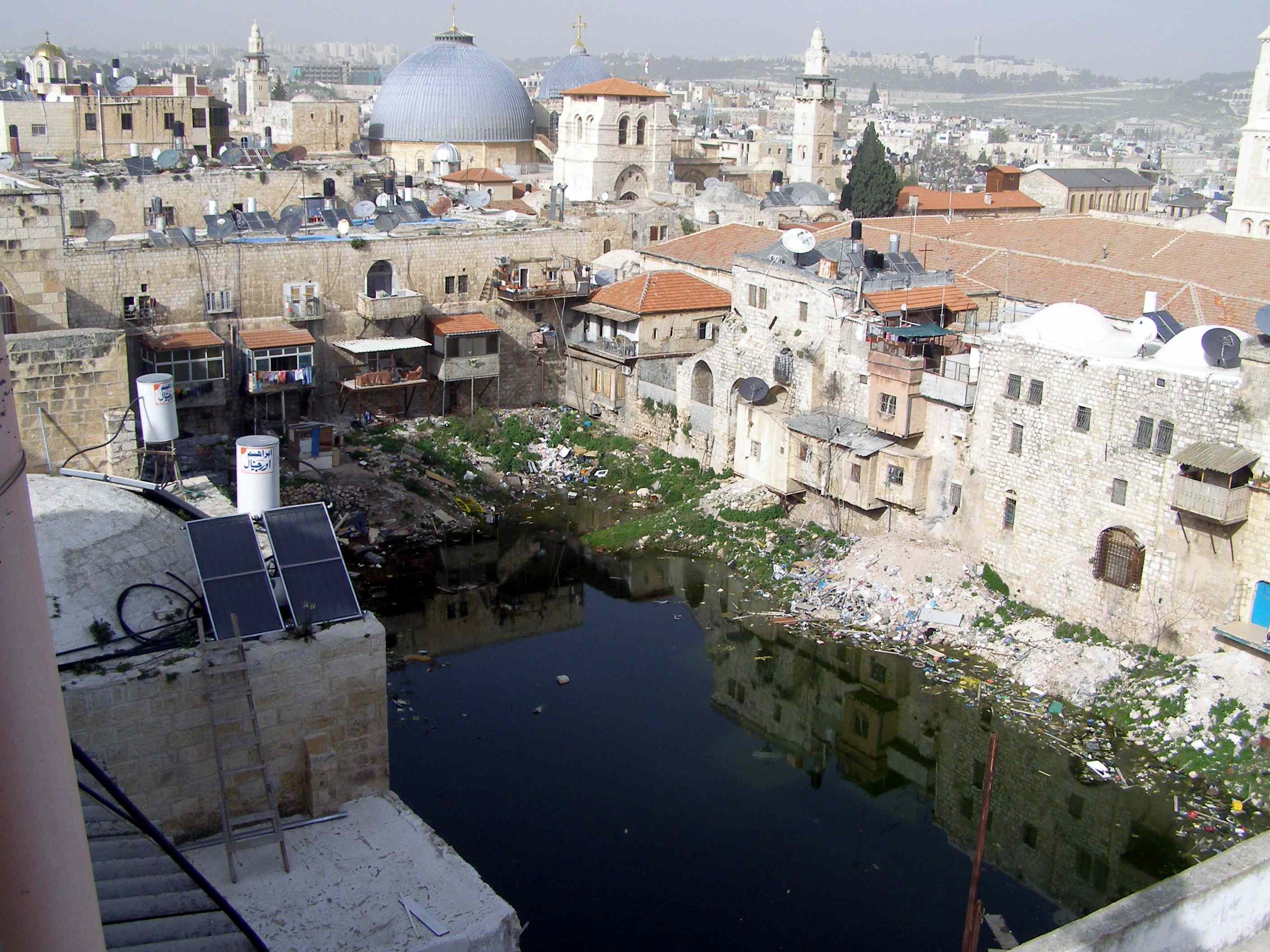
Hezekiah's Pool (, ''Brikhat Hizkiyahu''), or the Patriarch's Pool, located in the Christian Quarter of the Old City of Jerusalem, was once a reservoir forming part of the city's ancient water system. History Flavius Josephus referred to the pool as Amygdalon, meaning 'almond tree' in Greek language, Greek, but it is very likely that he derived the name phonetically from the Hebrew language, Hebrew word ''migdal'', meaning 'tower', thus it is believed that the original name was Pool of the Tower or Towers. The pool is also known as the ''Pool of Pillars'', or the ''Pool of the Patriarch's Bath'' (Arabic: ''Birkat Hammam el-Batrak''). The pool is believed to be the upper pool referred to in the Books of Kings (), built by King Hezekiah , who met messengers from the king of Assyria there. At a later time it was fed from the Mamilla Pool, one of the three reservoirs constructed by Herod the Great during the first century BCE by an underground conduit which still partially exists ... [...More Info...] [...Related Items...] OR: [Wikipedia] [Google] [Baidu] |
Clock Tower
Clock towers are a specific type of structure that house a turret clock and have one or more clock faces on the upper exterior walls. Many clock towers are freestanding structures but they can also adjoin or be located on top of another building. Some other buildings also have clock faces on their exterior but these structures serve other main functions. Clock towers are a common sight in many parts of the world with some being iconic buildings. One example is the Elizabeth Tower in London (usually called " Big Ben", although strictly this name belongs only to the bell inside the tower). Definition There are many structures that may have clocks or clock faces attached to them and some structures have had clocks added to an existing structure. According to the Council on Tall Buildings and Urban Habitat a structure is defined as a building if at least fifty percent of its height is made up of floor plates containing habitable floor area. Structures that do not meet this criter ... [...More Info...] [...Related Items...] OR: [Wikipedia] [Google] [Baidu] |
Ottoman Empire
The Ottoman Empire (), also called the Turkish Empire, was an empire, imperial realm that controlled much of Southeast Europe, West Asia, and North Africa from the 14th to early 20th centuries; it also controlled parts of southeastern Central Europe, between the early 16th and early 18th centuries. The empire emerged from a Anatolian beyliks, ''beylik'', or principality, founded in northwestern Anatolia in by the Turkoman (ethnonym), Turkoman tribal leader Osman I. His successors Ottoman wars in Europe, conquered much of Anatolia and expanded into the Balkans by the mid-14th century, transforming their petty kingdom into a transcontinental empire. The Ottomans ended the Byzantine Empire with the Fall of Constantinople, conquest of Constantinople in 1453 by Mehmed II. With its capital at History of Istanbul#Ottoman Empire, Constantinople (modern-day Istanbul) and control over a significant portion of the Mediterranean Basin, the Ottoman Empire was at the centre of interacti ... [...More Info...] [...Related Items...] OR: [Wikipedia] [Google] [Baidu] |
Souk
A bazaar or souk is a marketplace consisting of multiple small stalls or shops, especially in the Middle East, the Balkans, Central Asia, North Africa and South Asia. They are traditionally located in vaulted or covered streets that have doors on each end and served as a city's central marketplace. The term ''bazaar'' originates from Persian, where it referred to a town's public market district. The term bazaar is sometimes also used to refer collectively to the merchants, bankers and craftsmen who work in that area. The term ''souk'' comes from Arabic and refers to marketplaces in the Middle East and North Africa. Although the lack of archaeological evidence has limited detailed studies of the evolution of bazaars, the earliest evidence for the existence of bazaars or souks dates to around 3000 BCE. Cities in the ancient Middle East appear to have contained commercial districts. Later, in the historic Islamic world, bazaars typically shared in common certain institutions, ... [...More Info...] [...Related Items...] OR: [Wikipedia] [Google] [Baidu] |
Highway 60 (Israel)
The following highways are numbered 60: International * AH60, Asian Highway 60 * European route E60 Australia * Bruxner Highway * Dawson Highway (Rolleston to Gladstone) – Queensland State Route 60 Brazil * BR-060 Canada * Alberta Highway 60 * Manitoba Highway 60 * Newfoundland and Labrador Route 60 * Ontario Highway 60 * Saskatchewan Highway 60 China * G60 Shanghai–Kunming Expressway, G60 Expressway Greece * Greek National Road 60, EO60 road Hungary * M60 motorway (Hungary) India * Israel/Palestine * Highway 60 (Israel–Palestine) Italy * Autostrada A60 Japan * Obihiro-Hiroo Expressway Jordan * Korea, South * Seoul–Yangyang Expressway *Gukjido 60 New Zealand * New Zealand State Highway 60 Philippines * N60 highway (Philippines) United Kingdom * A60 road, British A60 * M60 motorway (Great Britain), British M60 United States * U.S. Route 60 * Alabama State Route 60 * Arkansas Highway 60 * California State Route 60 * Colorado State Highway 60 * Florida S ... [...More Info...] [...Related Items...] OR: [Wikipedia] [Google] [Baidu] |
Highway 1 (Israel)
The following highways are numbered 1. For roads numbered A1, see list of A1 roads. For roads numbered B1, see list of B1 roads. For roads numbered M1, see List of M1 roads. For roads numbered N1, see list of N1 roads. For roads numbered S1, see List of highways numbered S1. International *Asian Highway 1, an international route from Japan to the Turkey, Turkish-Bulgarian border * European route E1 * European route E001 * Cairo–Dakar Highway Afghanistan *Highway 1 (Afghanistan), also called A01 and formally called the Ring Road, circles Afghanistan connecting Kabul, Ghazni, Kandahar, Farah, Herat, and Mazar. Albania * National Road 1 (Albania), road running from border Montenegro (Hani i Hotit) to Tirana. * Albania–Kosovo Highway Algeria * Algeria East–West Highway Andorra * CG-1 Argentina * National Route 1 (Argentina), National Route 1 * National Route A001 (Argentina), National Route A001 * Brigadier Estanislao López Highway, Santa Fe Provincial Highway 01 ... [...More Info...] [...Related Items...] OR: [Wikipedia] [Google] [Baidu] |


