|
Mamakan (river)
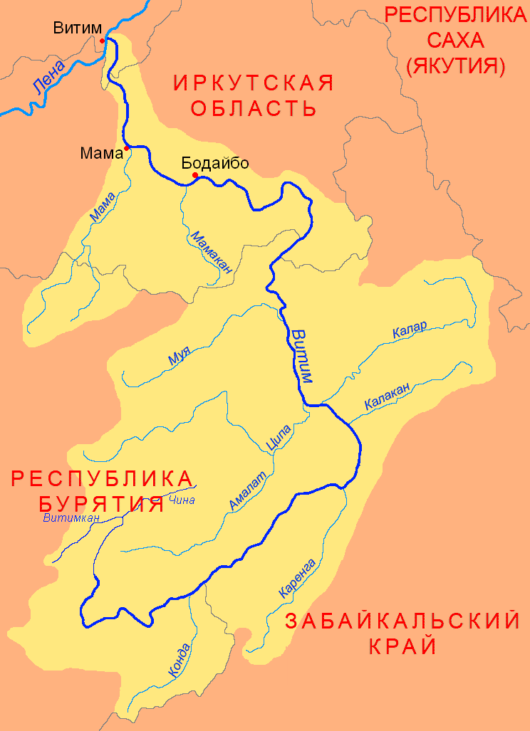
The Mamakan () is a river in Irkutsk Oblast, southern East Siberia, Russia. It is a tributary of the Vitim of the Lena basin. The river is long, and has a drainage basin of . There are no settlements by the river, only Mamakan near its mouth by the Vitim.Google Earth The Mamakan reservoir, the world's first hydroelectric power plant built on permafrost, is located in the lower course of the river, about from Bodaybo. Course The Mamakan is a left tributary of the Vitim. Its sources are in the Northern Muya Range, a subrange of the Stanovoy Highlands, at the northeastern limit of the Upper Angara Range. In its upper course it is known as the ''Sredny Mamakan'' (Middle Mamakan). The river flows roughly in a northwestward direction and is joined by the Left Mamakan and the Right Mamakan. It cuts across the Delyun-Uran Range (Делюн-Уранский хребет) and flows northwards. Finally near the Mamakan settlement it meets the Vitim from its mouth in the Lena. [...More Info...] [...Related Items...] OR: [Wikipedia] [Google] [Baidu] |
Northern Muya Range
The Northern Muya Range () is a mountain range in Buryatia, Russia, part of the Stanovoy Highlands.Google Earth The Baikal Amur Mainline (BAM) railway traverses the southern end of the mountain range via the Severomuysky Tunnel. Geography The Northern Muya Range stretches from the valley of the Svetlaya river, a left tributary of the Upper Angara, in the southwest, to the valley of the Vitim in the northeast. The Upper Angara Depression lies to the northwest and the Muya-Kuanda Depression to the southeast. To the north it runs parallel with the Delyun-Uran Range just south of it, and to the south with the Muyakan Range. The highest summit of the range is a high mountain located in its extreme southwestern part. Peaks and ridges have sharp glacial shapes in the central sector of the range, while flat summits predominate on the periphery. In its southwestern part the Northern Muya Range is broken by the valley of the Kotera. Hydrography The Northern Muya Range separates t ... [...More Info...] [...Related Items...] OR: [Wikipedia] [Google] [Baidu] |
Permafrost
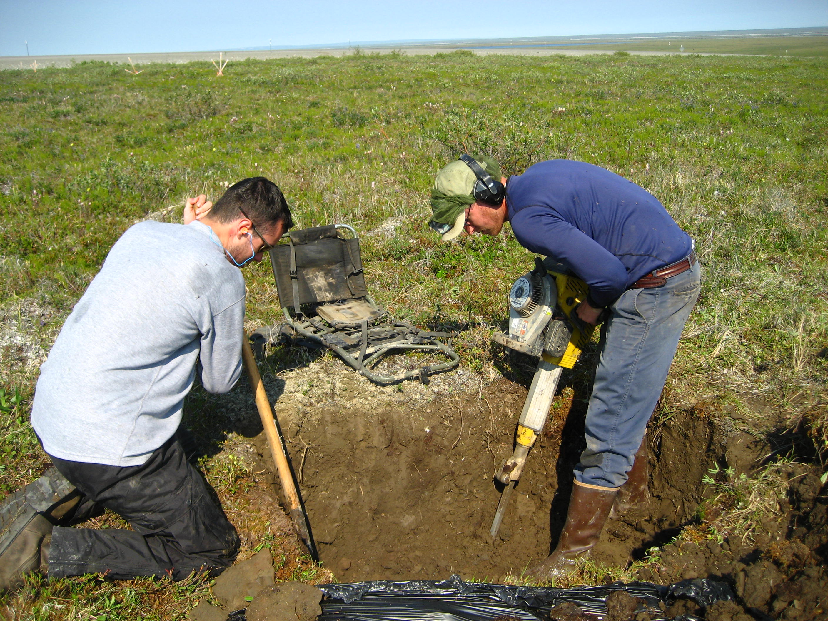
Permafrost () is soil or underwater sediment which continuously remains below for two years or more; the oldest permafrost has been continuously frozen for around 700,000 years. Whilst the shallowest permafrost has a vertical extent of below a meter (3 ft), the deepest is greater than . Similarly, the area of individual permafrost zones may be limited to narrow mountain summits or extend across vast Arctic regions. The ground beneath glaciers and ice sheets is not usually defined as permafrost, so on land, permafrost is generally located beneath a so-called active layer of soil which freezes and thaws depending on the season. Around 15% of the Northern Hemisphere or 11% of the global surface is underlain by permafrost, covering a total area of around . This includes large areas of Alaska, Canada, Greenland, and Siberia. It is also located in high mountain regions, with the Tibetan Plateau being a prominent example. Only a minority of permafrost exists in the Southern Hemi ... [...More Info...] [...Related Items...] OR: [Wikipedia] [Google] [Baidu] |
List Of Rivers Of Russia
Russia can be divided into a European and an Asian part. The dividing line is generally considered to be the Ural Mountains. The European part is drained into the Arctic Ocean, Baltic Sea, Black Sea, and Caspian Sea. The Asian part is drained into the Arctic Ocean and the Pacific Ocean. Notable rivers of Russia in Europe are the Volga (which is the longest river in Europe), Pechora, Don, Kama, Oka and the Northern Dvina, while several other rivers originate in Russia but flow into other countries, such as the Dnieper (flowing through Russia, then Belarus and Ukraine and into the Black Sea) and the Western Dvina (flowing through Russia, then Belarus and Latvia into the Baltic Sea). In Asia, important rivers are the Ob, the Irtysh, the Yenisei, the Angara, the Lena, the Amur, the Yana, the Indigirka, and the Kolyma. In the list below, the rivers are grouped by the seas or oceans into which they flow. Rivers that flow into other rivers are ordered by the proximit ... [...More Info...] [...Related Items...] OR: [Wikipedia] [Google] [Baidu] |
Vitim ;
{{Set index article, populated places in Russia ...
Vitim () is the name of several inhabited localities in Russia. Modern localities * Vitim, Sakha Republic, an urban locality (an urban-type settlement) in Lensky District of the Sakha Republic * Vitim, Republic of Buryatia, a rural locality (a settlement) in Muysky Selsoviet of Muysky District in the Republic of Buryatia; Alternative names *Vitim, alternative name of Romanovka, a '' selo'' in Vitimsky Selsoviet of Bauntovsky District in the Republic of Buryatia Buryatia, officially the Republic of Buryatia, is a Republics of Russia, republic of Russia located in the Russian Far East. Formerly part of the Siberian Federal District, it has been administered as part of the Far Eastern Federal District sin ... [...More Info...] [...Related Items...] OR: [Wikipedia] [Google] [Baidu] |
Great Soviet Encyclopedia
The ''Great Soviet Encyclopedia'' (GSE; , ''BSE'') is one of the largest Russian-language encyclopedias, published in the Soviet Union from 1926 to 1990. After 2002, the encyclopedia's data was partially included into the later ''Great Russian Encyclopedia'' in an updated and revised form. The GSE claimed to be "the first Marxist–Leninist general-purpose encyclopedia". Origins The idea of the ''Great Soviet Encyclopedia'' emerged in 1923 on the initiative of Otto Schmidt, a member of the Russian Academy of Sciences. In early 1924 Schmidt worked with a group which included Mikhail Pokrovsky, (rector of the Institute of Red Professors), Nikolai Meshcheryakov (Former head of the General Directorate for the Protection of State Secrets in the Press, Glavit, the State Administration of Publishing Affairs), Valery Bryusov (poet), Veniamin Kagan (mathematician) and Konstantin Kuzminsky to draw up a proposal which was agreed to in April 1924. Also involved was Anatoly Lunacharsky, People' ... [...More Info...] [...Related Items...] OR: [Wikipedia] [Google] [Baidu] |
Delyun-Uran Range
The Delyun-Uran Range () is a mountain range in Irkutsk Oblast and Buryatia, Russia, part of the Stanovoy Highlands. The nearest airport is Bodaybo Airport.Google Earth History This remote mountain area was first explored by Peter Kropotkin and Ivan Polyakov during the 1866 Olyokma- Vitim expedition of the East Siberian branch of the Imperial Russian Geographical Society. Kropotkin named the range after the area of conspicuous rapids of the Vitim river in the gorge where it crosses the range northwards (Делюн-Уранский порог). He described the range as a "desolate, gloomy place". The Vitim Nature Reserve was established in the eastern part of the range and neighboring mountainous areas in 1982. Geography This mountain range is located in the Baikal Rift Zone and it is part of the Baikal-Stanovoy Region. The Delyun-Uran is the northernmost subrange of the Stanovoy Highlands. It runs roughly parallel to the Northern Muya Range just north of it. The range ... [...More Info...] [...Related Items...] OR: [Wikipedia] [Google] [Baidu] |
Upper Angara Range
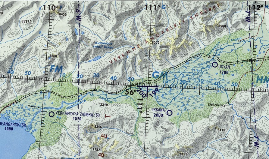
The Upper Angara Range () is a mountain range in Buryatia and Irkutsk Oblast, Russia, part of the Stanovoy Highlands.Google Earth The Baikal–Amur Mainline passes at the foot of the southern side of the range. Geography The range stretches from southwest to northeast for about , from the northern end of Lake Baikal to the sources of the Mamakan (river), Mamakan river, a left tributary of the Vitim (river), Vitim. It forms the northern limit of the Upper Angara Depression, rising above the right bank of the Upper Angara River which flows into Lake Baikal. To the east rises the Delyun-Uran Range, Delyun-Uran, the northernmost range of the Stanovoy Highlands. The main ridge is relatively narrow, with sharp peaks, cirques and glacial troughs.Верхнеангарский хребет — ''Great Soviet Encyclopedia: ... [...More Info...] [...Related Items...] OR: [Wikipedia] [Google] [Baidu] |
Bodaybo
Bodaybo ( rus, Бодайбо, p=bədɐjˈbo) is a town and the administrative center of Bodaybinsky District in Irkutsk Oblast, Russia. It is located from Irkutsk, the administrative center of the oblast. Geography The town is located in the Patom Highlands, on the right bank of the Vitim River at its confluence with the Bodaybo River. Besides Bodaybo, some of the settlements of the district are Aprilsk, Artyomovsky, Balakhninsky, Kropotkin, Mamakan, Svetly, Vasilievsky, Perevoz and Bolshoy Patom.Google Earth History It was founded in 1864 and served the needs of the local gold mining industry. The Lena massacre took place near Bodaybo in 1912. It was granted town status in 1925. Vitim event The Vitim event occurred on September 25, 2002 near the town. It was believed to be caused by a bolide or a comet nucleus impact. Administrative and municipal status Within the framework of administrative divisions, Bodaybo serves as the administrative center of Bodaybins ... [...More Info...] [...Related Items...] OR: [Wikipedia] [Google] [Baidu] |
Google Earth
Google Earth is a web mapping, web and computer program created by Google that renders a 3D computer graphics, 3D representation of Earth based primarily on satellite imagery. The program maps the Earth by superimposition, superimposing satellite images, aerial photography, and geographic information system, GIS data onto a 3D globe, allowing users to see cities and landscapes from various angles. Users can explore the globe by entering addresses and coordinates, or by using a Computer keyboard, keyboard or computer mouse, mouse. The program can also be downloaded on a smartphone or Tablet computer, tablet, using a touch screen or stylus to navigate. Users may use the program to add their own data using Keyhole Markup Language and upload them through various sources, such as forums or blogs. Google Earth is able to show various kinds of images overlaid on the surface of the Earth and is also a Web Map Service client. In 2019, Google revealed that Google Earth covers more than 97 ... [...More Info...] [...Related Items...] OR: [Wikipedia] [Google] [Baidu] |
Stanovoy Highlands
The Stanovoy Highlands () or Stanovoy Uplands is a mountain range in the Transbaikal region of Siberia, Russia. Geography The Stanovoy Highlands are a mountainous area between the Patom Highlands to the north and the Vitim Plateau to the south. To the northeast they border with the Olyokma-Chara Plateau —in the upper reaches of the Chara (river), Chara river. The ranges of the highlands stretch roughly in a WSW / ENE direction between the North Baikal Highlands in the west and the Olyokma River in the east. The latter separates it from the Stanovoy Range in the east. There are large intermontane basins, such as the Muya Depression and the Chara Depression at altitudes ranging between and . Subranges The system of the Stanovoy Highlands comprises a group of subranges, including the following: *Southern Muya Range (Южно-Муйский хребет), highest point Muisky Gigant, *Northern Muya Range (Северо-Муйский хребет), highest point *Kodar Range ( ... [...More Info...] [...Related Items...] OR: [Wikipedia] [Google] [Baidu] |
Mamakan, Russia
Mamakan () is an urban locality (an urban-type settlement) in Bodaybinsky District of Irkutsk Oblast, Russia. Population: Mamakan is the capital of the Mamakan Urban Settlement (Мамаканское городское поселение) municipal unit, which includes only the Mamakan urban locality. Geography The locality is located southwest of Bodaybo by the Vitim. The Mamakan, one of its main tributaries, flows into the Vitim near the settlement.Google Earth Google Earth is a web mapping, web and computer program created by Google that renders a 3D computer graphics, 3D representation of Earth based primarily on satellite imagery. The program maps the Earth by superimposition, superimposing satelli ... Climate Notable people * Fyodor Kudryashov (1987) - Russian footballer References Urban-type settlements in Irkutsk Oblast {{IrkutskOblast-geo-stub ... [...More Info...] [...Related Items...] OR: [Wikipedia] [Google] [Baidu] |


