|
Maliseet
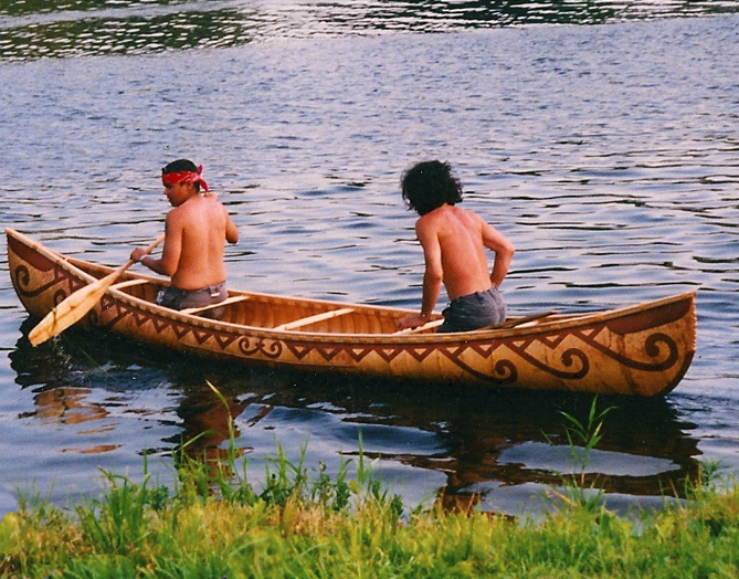
The Wolastoqiyik, (, also known as the Maliseet or Malecite () are an Algonquian-speaking First Nation of the Wabanaki Confederacy. They are the Indigenous people of the Wolastoq ( Saint John River) valley and its tributaries. Their territory extends across the current borders of New Brunswick and Quebec in Canada, and parts of Maine in the United States. The Houlton Band of Maliseet Indians, based on the Meduxnekeag River in the Maine portion of their historical homeland, are—since 19 July 1776—the first foreign treaty allies with the United States of America. They are a federally recognized tribe of Wolastoqey people. Today Wolastoqey people have also migrated to other parts of the world. The Wolastoqiyik have occupied areas of forest, river and coastal areas within their 20,000,000-acre, 200-mile-wide, and 600-mile-long homeland in the Saint John River watershed. Name The people call themselves ''Wəlastəkwewiyik'' and ''Wolastoqiyik. ''Wəlastəkw'' means "brigh ... [...More Info...] [...Related Items...] OR: [Wikipedia] [Google] [Baidu] |
Maliseet-Passamaquoddy Language
Peskotomuhkati-Wolastoqey ( or Maliseet-Passamaquoddy ( ; ''skicinuwatuwewakon'' or ''skicinuwi-latuwewakon'') is an endangered Algonquian languages, Algonquian language spoken by the Wolastoqiyik, Wolastoqey and Passamaquoddy people, Passamaquoddy peoples along both sides of the border between Maine in the United States and New Brunswick, Canada. The language consists of two major dialects: Maliseet, which is mainly spoken in the Saint John River (Bay of Fundy), Saint John River Valley in New Brunswick; and Passamaquoddy, spoken mostly in the Saint Croix River (Maine – New Brunswick), St. Croix River Valley of eastern Maine. However, the two dialects differ only slightly, mainly in their phonology. The indigenous people widely spoke Maliseet-Passamaquoddy in these areas until around the post-World War II era when changes in the education system and increased marriage outside of the speech community caused a large decrease in the number of children who learned or regularly used t ... [...More Info...] [...Related Items...] OR: [Wikipedia] [Google] [Baidu] |
Madawaska Maliseet First Nation
Madawaska Maliseet First Nation () or St. Basile 10 band is one of six Wolastoqiyik or Maliseet Nations on the Saint John River in Canada. The Madawaska Maliseet First Nation (MMFN) territory is in Northern New Brunswick. The MMFN reserve is located 1.6 km east of Edmundston in the north-western region of New Brunswick. The band membership has 350 people. About 114 members of the MMFN live on the St. Basile no. 10 reserve. They are part of the Saint John River Valley Tribal Council. Family names include Bernard, Cimon, Francis, and Wallace. History The Maliseet also Malecite, ''Malécites'' or ''Étchemins'', their name for themselves, or autonym is ''Wəlastəkwewiyik'', ''Wolastoqiyik.'' ''Wolastoq'' means "Beautiful River," referring to the Saint John River. ''Wolastoqiyik'' means "People of the Beautiful River" in Maliseet. Wəlastəkwewiyik "The Maliseet People," in Maliseet. Their traditional land extended along the Wolastoq/Saint John River in New Brunswick and ... [...More Info...] [...Related Items...] OR: [Wikipedia] [Google] [Baidu] |
Maliseet
The Wolastoqiyik, (, also known as the Maliseet or Malecite () are an Algonquian-speaking First Nation of the Wabanaki Confederacy. They are the Indigenous people of the Wolastoq ( Saint John River) valley and its tributaries. Their territory extends across the current borders of New Brunswick and Quebec in Canada, and parts of Maine in the United States. The Houlton Band of Maliseet Indians, based on the Meduxnekeag River in the Maine portion of their historical homeland, are—since 19 July 1776—the first foreign treaty allies with the United States of America. They are a federally recognized tribe of Wolastoqey people. Today Wolastoqey people have also migrated to other parts of the world. The Wolastoqiyik have occupied areas of forest, river and coastal areas within their 20,000,000-acre, 200-mile-wide, and 600-mile-long homeland in the Saint John River watershed. Name The people call themselves ''Wəlastəkwewiyik'' and ''Wolastoqiyik. ''Wəlastəkw'' means "brigh ... [...More Info...] [...Related Items...] OR: [Wikipedia] [Google] [Baidu] |
Houlton Band Of Maliseet Indians
The Houlton Band of Maliseet Indians of Maine (HBMI) ( (MW)) is a federally recognized tribe of Maliseet, whose land is along the Meduxnekeag River in Maine, United States. They are headquartered in Littleton, Maine, located in Aroostook County. This HBMI is related to the larger Maliseet First Nations of New Brunswick, Canada. The Maliseet have traditionally occupied areas of the Saint John River valley, including its tributary, the Meduxnekeag River. When Great Britain and the United States established a boundary through this area under the Jay Treaty of 1794, the Maliseet were given the right to freely cross the border with Canada, as it was within their ancestral territory. The HBMI was invited to take a nonvoting seat in the Maine Legislature, starting with the 126th Legislature in 2013. Politics The HBMI is governed by a tribal chief and a six-member council. The tribal chief is democratically elected and serves a four-year term, as are the tribal councilors, whose ... [...More Info...] [...Related Items...] OR: [Wikipedia] [Google] [Baidu] |
Miꞌkmaq
The Mi'kmaq (also ''Mi'gmaq'', ''Lnu'', ''Mi'kmaw'' or ''Mi'gmaw''; ; , and formerly Micmac) are an Indigenous group of people of the Northeastern Woodlands, native to the areas of Canada's Atlantic Provinces, primarily Nova Scotia, New Brunswick, Prince Edward Island, and Newfoundland, and the Gaspé Peninsula of Quebec as well as Native Americans in the northeastern region of Maine. The traditional national territory of the Mi'kmaq is named Mi'kma'ki (or Mi'gma'gi). There are 66,748 Mi'kmaq people in the region as of 2023 (including 25,182 members in the more recently formed Qalipu First Nation in Newfoundland). According to the Canadian 2021 census, 9,245 people claim to speak Mi'kmaq, an Eastern Algonquian language. Once written in Mi'kmaw hieroglyphic writing, it is now written using most letters of the Latin alphabet. The Mi'kmaq, Maliseet, and Pasamaquoddy nations signed a series of treaties known as the Covenant Chain of Peace and Friendship Treaties wit ... [...More Info...] [...Related Items...] OR: [Wikipedia] [Google] [Baidu] |
Passamaquoddy
The Passamaquoddy (Maliseet-Passamaquoddy language, Passamaquoddy: ''Peskotomuhkati'', Plural: ''Peskotomuhkatiyik'') are a Native Americans in the United States, Native American/First Nations in Canada, First Nations people who live in northeastern North America. Their traditional homeland, ''Peskotomuhkatikuk'', straddles the Canadian province of New Brunswick and the U.S. state of Maine in a region called Dawnland. They are one of the constituent nations of the Wabanaki Confederacy. The Passamaquoddy Tribe in Maine is a federally recognized tribe. The Passamaquoddy people in Canada have an organization known as the Peskotomuhkati Nation, but it does not have official First Nations status. Etymology The name "Passamaquoddy" is an anglicization of the Passamaquoddy word ''peskotomuhkati'', the prenoun form (prenouns being a linguistic feature of Algonquian languages) of ''Peskotomuhkat'' (''pestəmohkat''), their endonym, or the name that they use for themselves. ''Peskotomuhk ... [...More Info...] [...Related Items...] OR: [Wikipedia] [Google] [Baidu] |
Wabanaki Confederacy
The Wabanaki Confederacy (''Wabenaki, Wobanaki'', translated to "People of the Dawn" or "Easterner"; also: Wabanakia, "Dawnland") is a North American First Nations and Native American confederation of five principal Eastern Algonquian nations: the Abenaki, Mi'kmaq, Wolastoqiyik, Passamaquoddy (''Peskotomahkati'') and Penobscot. There were more tribes, along with many bands, that were once part of the Confederation. Native tribes such as the Nanrantsouak, Alemousiski, Pennacook, Sokoki, and Canibas, through massacres, tribal consolidation, and ethnic label shifting were absorbed into the five larger national identities. Members of the Wabanaki Confederacy, the Wabanakiyak, are located in and named for the area which they call Wabanaki ("Dawnland"), roughly the area that became the French colony of Acadia. The territory boundaries encompass present-day Maine, New Hampshire, and Vermont, in the United States, and New Brunswick, mainland Nova Scotia, Cape Breton Island, Pri ... [...More Info...] [...Related Items...] OR: [Wikipedia] [Google] [Baidu] |
Wolastoq
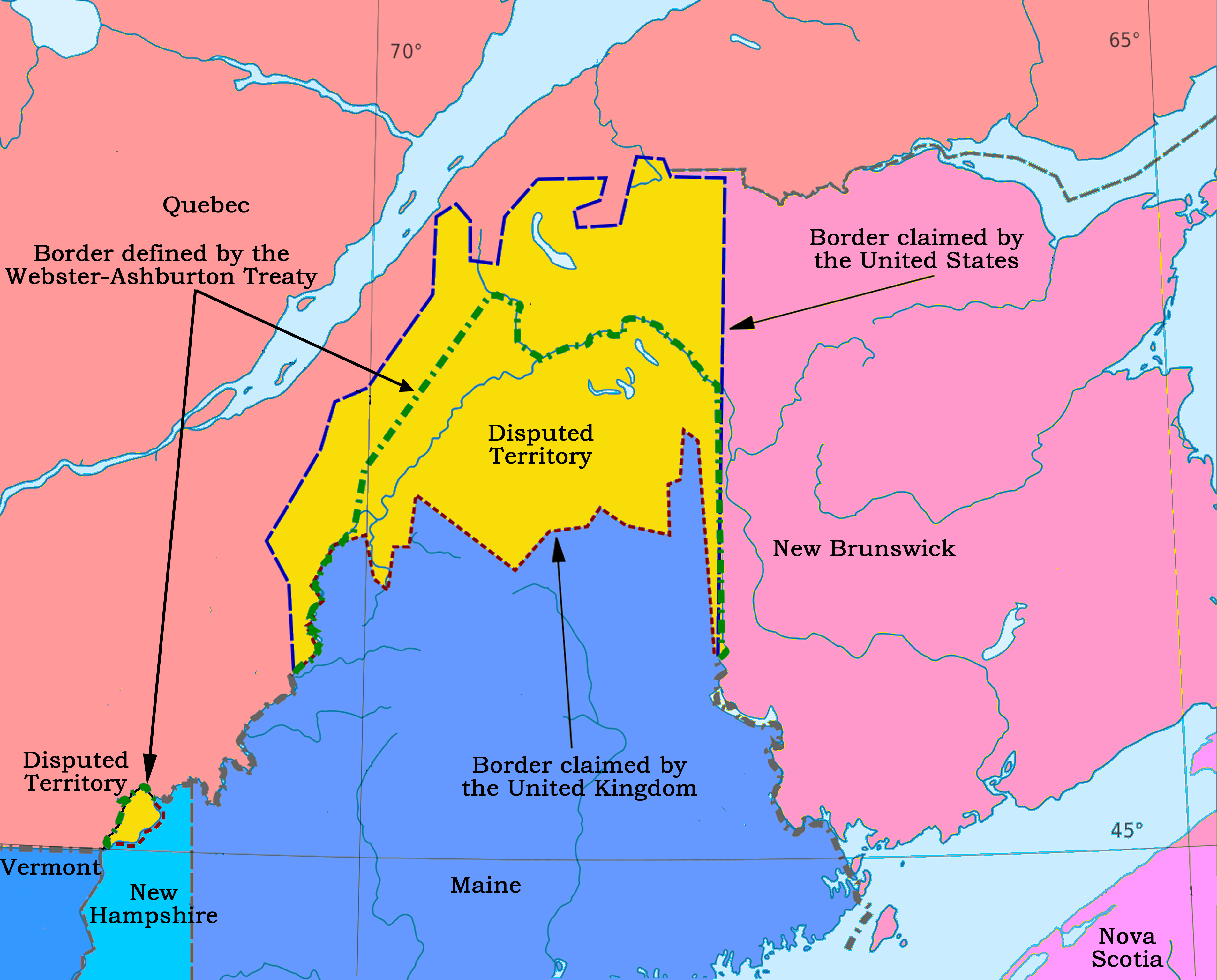
The Saint John River (; Maliseet-Passamaquoddy: ''Wolastoq'') is a river flowing within the Dawnland region from headwaters in the Notre Dame Mountains near the Maine-Quebec border through western New Brunswick to the northwest shore of the Bay of Fundy. Eastern Canada's longest river, its drainage basin is one of the largest on the east coast at about . This “River of the Good Wave” and its tributary drainage basin formed the territorial countries of the Wolastoqiyik and Passamaquoddy First Nations (named Wolastokuk and Peskotomuhkatik, respectively) prior to European colonization, and it remains a cultural centre of the Wabanaki Confederacy to this day. The Webster–Ashburton Treaty following the Aroostook War established a border between New Brunswick and Maine following of the river, while a tributary forms of the border between Quebec and Maine. Maine communities along the river include Fort Kent, Madawaska, and Van Buren. New Brunswick settlements through whic ... [...More Info...] [...Related Items...] OR: [Wikipedia] [Google] [Baidu] |
Saint John River (Bay Of Fundy)
The Saint John River (; Maliseet-Passamaquoddy: ''Wolastoq'') is a river flowing within the Dawnland region from headwaters in the Notre Dame Mountains near the Maine-Quebec border through western New Brunswick to the northwest shore of the Bay of Fundy. Eastern Canada's longest river, its drainage basin is one of the largest on the east coast at about . This “River of the Good Wave” and its tributary drainage basin formed the territorial countries of the Wolastoqiyik and Passamaquoddy First Nations (named Wolastokuk and Peskotomuhkatik, respectively) prior to European colonization, and it remains a cultural centre of the Wabanaki Confederacy to this day. The Webster–Ashburton Treaty following the Aroostook War established a border between New Brunswick and Maine following of the river, while a tributary forms of the border between Quebec and Maine. Maine communities along the river include Fort Kent, Madawaska, and Van Buren. New Brunswick settlements through ... [...More Info...] [...Related Items...] OR: [Wikipedia] [Google] [Baidu] |
Wolastoqiyik Wahsipekuk (Viger) First Nation
The Wolastoqiyik Wahsipekuk First Nation, formerly known as Maliseet Viger 1 First Nation, is an Algonquian People of the Wəlastəkwewiyik (Maliseet) Nation in Quebec, Canada. As of May, 2024 they were reported as having a registered population of 2035, all living off-reserve or on another reserve. They have two reserves, Cacouna 22 and Kataskomiq, and they are based at Cacouna in the Bas-Saint-Laurent region of Quebec. The majority of the Walastoqiyik living in Quebec speak French, and many speak English. The Maliseet-Passamaquoddy language is still spoken by some people in Maine and New Brunswick. Geography The Viger nation has two reserves: Kataskomiq (formerly known as Whitworth) and Cacouna 22, both at Bas-Saint-Laurent in Quebec. The nearest large town is Rivière-du-Loup. Government In addition to a Band council, the Viger nation has a council of sages composed of elders who have a role of examining political decisions which could influence the functioning of ... [...More Info...] [...Related Items...] OR: [Wikipedia] [Google] [Baidu] |
Tobique First Nation
Tobique First Nation () is one of six Wolastoqiyik or Maliseet Nation reserves in New Brunswick, Canada. The Tobique Reserve is located on the north side of the Tobique River. The reserve comprises two lots (The Brother's # 18, 4 ha; Tobique # 20, 2724 ha). The Tobique Reserve, established in 1801 with nearly , was granted after a petition to the government by band members. Over the years, the reserve was reduced by surrenders to squatters and a major surrender in 1892. Roughly two-thirds of members of Tobique First Nation reside on the reserve lands."Tobique Band" Aboriginal Affairs and Northern Development Canada In 2009. the accepted the ''Tobique Specific Land ... [...More Info...] [...Related Items...] OR: [Wikipedia] [Google] [Baidu] |
Quebec
Quebec is Canada's List of Canadian provinces and territories by area, largest province by area. Located in Central Canada, the province shares borders with the provinces of Ontario to the west, Newfoundland and Labrador to the northeast, New Brunswick to the southeast and a coastal border with the territory of Nunavut. In the south, it shares a border with the United States. Between 1534 and 1763, what is now Quebec was the List of French possessions and colonies, French colony of ''Canada (New France), Canada'' and was the most developed colony in New France. Following the Seven Years' War, ''Canada'' became a Territorial evolution of the British Empire#List of territories that were once a part of the British Empire, British colony, first as the Province of Quebec (1763–1791), Province of Quebec (1763–1791), then Lower Canada (1791–1841), and lastly part of the Province of Canada (1841–1867) as a result of the Lower Canada Rebellion. It was Canadian Confederation, ... [...More Info...] [...Related Items...] OR: [Wikipedia] [Google] [Baidu] |


