|
Mairangi Bay
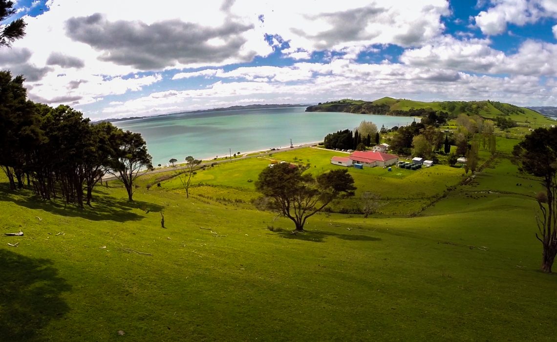
Mairangi Bay () is a coastal suburb of North Shore, Auckland, located in the northern North Island of New Zealand, on the south-east-facing peninsula forming the northern side of the Waitematā Harbour. Mairangi Bay came under the local governance of the North Shore City Council until subsumed into the Auckland Council in 2010. Geography Mairangi Bay is located in the East Coast Bays of the North Shore, between Murrays Bay and Campbells Bay. The bay to the east shares the same name as the suburb. The land is primarily formed from clay and Waitemata sandstone, which can be seen in the cliffs along the coast. Prior to human settlement, the inland Mairangi Bay area was primarily a northern broadleaf podocarp forest, dominated by tōtara, mataī, miro, kauri and kahikatea trees. Pōhutukawa trees were a major feature of the coastline. History Māori history Māori settlement of the Auckland Region began around the 13th or 14th centuries. The North Shore was settled by ... [...More Info...] [...Related Items...] OR: [Wikipedia] [Google] [Baidu] |
Auckland
Auckland ( ; ) is a large metropolitan city in the North Island of New Zealand. It has an urban population of about It is located in the greater Auckland Region, the area governed by Auckland Council, which includes outlying rural areas and the islands of the Hauraki Gulf, and which has a total population of as of It is the List of cities in New Zealand, most populous city of New Zealand and the List of cities in Oceania by population, fifth-largest city in Oceania. The city lies between the Hauraki Gulf to the east, the Hunua Ranges to the south-east, the Manukau Harbour to the south-west, and the Waitākere Ranges and smaller ranges to the west and north-west. The surrounding hills are covered in rainforest and the landscape is dotted with 53 volcanic centres that make up the Auckland Volcanic Field. The central part of the urban area occupies a narrow isthmus between the Manukau Harbour on the Tasman Sea and the Waitematā Harbour on the Pacific Ocean. Auckland is one of ... [...More Info...] [...Related Items...] OR: [Wikipedia] [Google] [Baidu] |
East Coast Bays
East Coast Bays is an urban area along the east coast of the North Shore, New Zealand, North Shore in New Zealand. First established as independent borough during the 1950s, East Coast Bays became contiguous with the Auckland urban area and was amalgamated into North Shore City and later into Auckland Council. East Coast Bays lines the north-east coast of the city along the shore of the Hauraki Gulf and Rangitoto Channel. They include, from north to south, Long Bay, New Zealand, Long Bay, Torbay, New Zealand, Torbay, Waiake, Waiake Bay, Browns Bay, New Zealand, Browns Bay, Rothesay Bay, Murrays Bay, Mairangi Bay, Campbells Bay and Castor Bay. Most of the East Coast Bays are covered under the East Coast Bays subdivision of the Hibiscus and Bays local board area. Definition and etymology The East Coast Bays is a stretch of coastline in the North Shore, New Zealand, North Shore of Auckland along the Hauraki Gulf, from Long Bay, New Zealand, Long Bay in the north to Castor Bay in ... [...More Info...] [...Related Items...] OR: [Wikipedia] [Google] [Baidu] |
Waka Kotahi
NZ Transport Agency Waka Kotahi (NZTA), superseded by is a New Zealand Crown entity tasked with promoting safe and functional transport by land, including the responsibility for driver and vehicle licensing, and administering the New Zealand state highway network. means 'one vessel' and is intended to convey the concept of "travelling together as one". History and leadership Formation The agency was established on 1 August 2008 by the Land Transport Management Amendment Act 2008, merging Transit New Zealand with Land Transport New Zealand. Leadership changes, 2008–2019 NZTA's board was criticised by the National Party-led opposition in July 2008 as being "stacked" with political appointees of the Labour Party-led government. A National Party-led government was formed after 2008 New Zealand general election, and a number of board members were reappointed or replaced. In January 2019, three members of the board of directors resigned, about six weeks after the resignat ... [...More Info...] [...Related Items...] OR: [Wikipedia] [Google] [Baidu] |
Ngāi Tai Ki Tāmaki
Ngāi Tai ki Tāmaki is a Māori people, Māori tribe that is based in the area around Clevedon, New Zealand, Clevedon, part of the Auckland region (''Tāmaki'' in the Māori language). It is one of the twelve members of the Hauraki Collective of tribes. The founding ancestors of Ngāi Tai ki Tāmaki came to New Zealand in the ''Tainui (canoe), Tainui'' migration canoe and left it when it was dragged across Portages of New Zealand#Te Tō Waka, Te Tō Waka, the portage from the Tāmaki River to the Manukau Harbour. Their descendants occupied parts of the Hauraki Gulf, including east Auckland as far inland as Ōtara, and Maungarei, as well as Clevedon, Maraetai and Howick, New Zealand, Howick. Te Irirangi Drive, a major highway in Manukau City, is named after one of their ''rangatira'' (chiefs), Tara Te Irirangi. Ngāi Tai has a marae at Umupuia Beach, between Maraetai and Clevedon. They also use the Ngāti Tamaoho marae at Karaka, New Zealand, Karaka. In 2015 the Crown sett ... [...More Info...] [...Related Items...] OR: [Wikipedia] [Google] [Baidu] |
Tainui (canoe)
''Tainui'' was one of the Māori migration canoes, great ocean-going canoes in which Polynesians migrated to New Zealand approximately 800 years ago. It was commanded by the chief Hoturoa, who had decided to leave Hawaiki because over-population had led to famine and warfare. The ship first reached New Zealand at Cape Runaway, Whangaparāoa in the Bay of Plenty and then skirted around the north coast of the North Island, finally landing at Kawhia in the western Waikato. The crew of the ''Tainui'' were the ancestors of the iwi that form the Tainui confederation. Crafting The Tainui waka (canoe), waka (canoe) was made from a great tree, at a place in Hawaiki known then as Maungaroa, on the spot where a stillborn child had been buried. According to Te Tāhuna Herangi the waka was named after the child who had been called Tainui. The canoe was made by Rakatāura, an expert boat builder in the tradition of Rātā (Māori mythology), Rātā, or according to Wirihana Aoterangi by R ... [...More Info...] [...Related Items...] OR: [Wikipedia] [Google] [Baidu] |
Tāmaki Māori
Tāmaki Māori are Māori ''iwi'' and ''hapū'' (tribes and sub-tribes) who have a strong connection to Tāmaki Makaurau (the Auckland Region), and whose rohe was traditionally within the region. Among Ngā Mana Whenua o Tāmaki Makaurau (the Māori tribes of Auckland), also known as the Tāmaki Collective, there are thirteen iwi and hapū, organised into three rōpū (collectives), however Tāmaki Māori can also refer to subtribes and historical iwi not included in this list. Ngāti Whātua Rōpū Ngāti Whātua descend from the '' Māhuhu-ki-te-rangi'' waka, which landed north of the Kaipara Harbour. The rōpū includes Ngāti Whātua o Kaipara, Ngāti Whātua Ōrākei and Te Rūnanga o Ngāti Whātua. Te Rūnanga o Ngāti Whātua is a Māori Trust Board formed in the mid 2000s to represent the interests of Ngāti Whātua iwi and hapū collectively, including those outside of Ngāti Whātua o Kaipara and Ngāti Whātua Ōrākei. The rūnanga represents Ngā Oho, Ngāi Tāhu ... [...More Info...] [...Related Items...] OR: [Wikipedia] [Google] [Baidu] |
Waka Kotahi NZ Transport Agency
NZ Transport Agency Waka Kotahi (NZTA), superseded by is a New Zealand Crown entity tasked with promoting safe and functional transport by land, including the responsibility for driver and vehicle licensing, and administering the New Zealand state highway network. means 'one vessel' and is intended to convey the concept of "travelling together as one". History and leadership Formation The agency was established on 1 August 2008 by the Land Transport Management Amendment Act 2008, merging Transit New Zealand with Land Transport New Zealand. Leadership changes, 2008–2019 NZTA's board was criticised by the National Party-led opposition in July 2008 as being "stacked" with political appointees of the Labour Party-led government. A National Party-led government was formed after 2008 New Zealand general election, and a number of board members were reappointed or replaced. In January 2019, three members of the board of directors resigned, about six weeks after the resignati ... [...More Info...] [...Related Items...] OR: [Wikipedia] [Google] [Baidu] |
Auckland Region
Auckland () is one of the 16 regions of New Zealand, which takes its name from the eponymous urban areas of New Zealand, urban area. The region encompasses the Auckland, Auckland metropolitan area, smaller towns, rural areas, and the islands of the Hauraki Gulf. Containing percent of the nation's residents, it has by far the largest population and economy of any region of New Zealand, but the second-smallest land area. On 1 November 2010, the Auckland region became a unitary authority administered by the Auckland Council, replacing the previous regional council and seven local councils. In the process, an area in its southeastern corner was transferred to the neighbouring Waikato region. Since then, the Auckland Council has introduced a system of local boards to divide the region for local government. Geography On the mainland, the region extends from the mouth of the Kaipara Harbour in the north across the southern stretches of the Northland Peninsula, through the Waitā ... [...More Info...] [...Related Items...] OR: [Wikipedia] [Google] [Baidu] |
Metrosideros Excelsa
''Metrosideros'' is a genus of approximately 60 trees, shrubs, and vines in the family Myrtaceae, mostly found in the Pacific region. Most of the tree forms are small, but some are exceptionally large, the New Zealand species in particular. The name derives from the Ancient Greek language, Ancient Greek ''metra'' or "heartwood" and ''sideron'' or "iron". Perhaps the best-known species are the pōhutukawa (''M. excelsa''), Metrosideros robusta, northern rātā (''M. robusta'') and Metrosideros umbellata, southern rātā (''M. umbellata'') of New Zealand, and ''Metrosideros polymorpha, ōhia lehua'' (''M. polymorpha'') from the Hawaiian Islands. Distribution ''Metrosideros'' is one of the most widely spread flowering plant genera in the Pacific. New Caledonia has 21 species, New Zealand has 12, New Guinea has seven and Hawaii has 5. The genus is present on most other high Pacific Islands, including Solomon Islands, Vanuatu, Fiji, Samoa, Cook Islands, French Polynesia, Bonin Island ... [...More Info...] [...Related Items...] OR: [Wikipedia] [Google] [Baidu] |
Dacrycarpus Dacrydioides
''Dacrycarpus dacrydioides'', commonly known as kahikatea (from Māori) and white pine, is a coniferous tree endemic to New Zealand. A podocarp, it is New Zealand's tallest tree, gaining heights of over a life span of 600 years. It was first described botanically by the French botanist Achille Richard in 1832 as ''Podocarpus'' ''dacrydioides'', and was given its current binomial name ''Dacrycarpus dacrydioides'' in 1969 by the American botanist David de Laubenfels. Analysis of DNA has confirmed its evolutionary relationship with other species in the genera ''Dacrycarpus'' and ''Dacrydium''. In Māori culture, it is an important source of timber for the building of waka and making of tools, of food in the form of its berries, and of dye. Its use for timber and its damp fertile habitat, ideal for dairy farming, have led to its decimation almost everywhere except South Westland. Kahikatea seeds have fleshy structures called receptacles attached to them, which encourage bi ... [...More Info...] [...Related Items...] OR: [Wikipedia] [Google] [Baidu] |
Agathis Australis
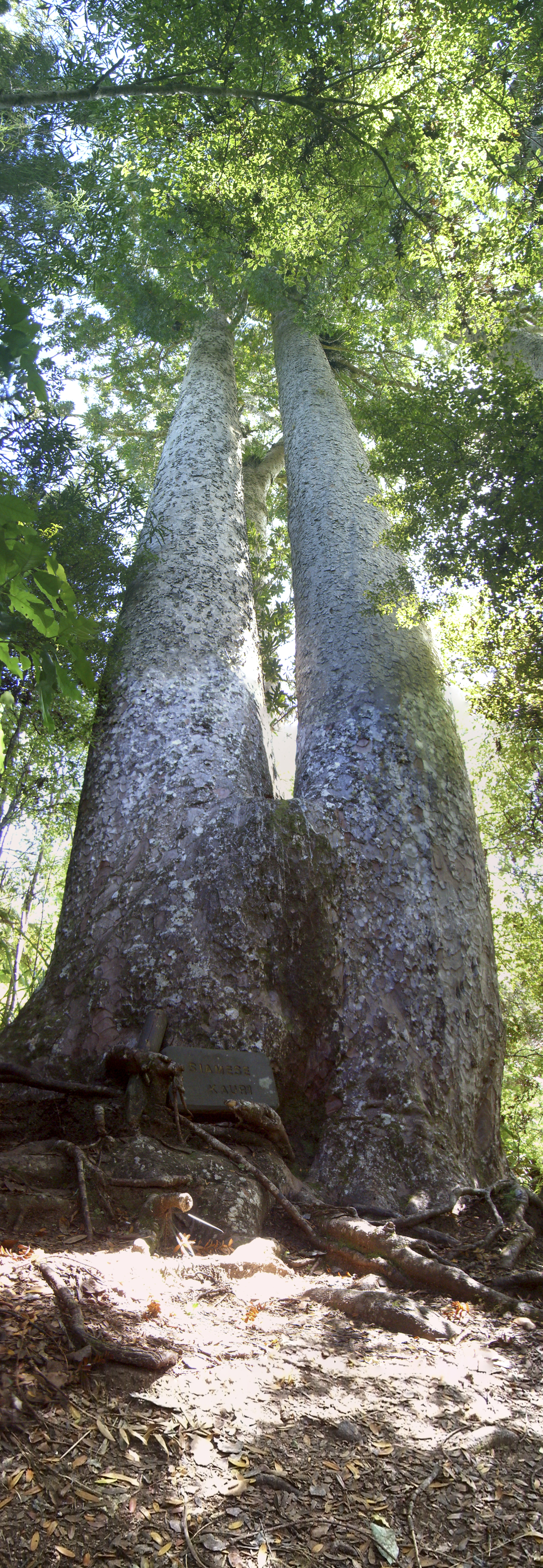
''Agathis australis'', commonly known as kauri, is a species of coniferous tree in the family Araucariaceae, found north of 38°S in the northern regions of New Zealand's North Island. It is the largest (by volume) but not tallest species of tree in New Zealand, standing up to tall in the emergent layer above the forest's main canopy. The tree has smooth bark and small narrow leaves. Other common names to distinguish ''A. australis'' from other members of '' Agathis'' are southern kauri and New Zealand kauri. With its podsolization capability and regeneration pattern it can compete with faster growing angiosperms. Because it is such a conspicuous species, forest containing kauri is generally known as kauri forest, although kauri need not be the most abundant tree. In the warmer northern climate, kauri forests have a higher species richness than those found further south. Kauri even act as a foundation species that modify the soil under their canopy to create unique plan ... [...More Info...] [...Related Items...] OR: [Wikipedia] [Google] [Baidu] |
Prumnopitys Ferruginea
''Pectinopitys ferruginea'', commonly known as miro or toromiro, is an evergreen coniferous tree which is endemic to New Zealand. Description It grows up to high, with a trunk up to 1.3 m diameter. The leaves are linear to sickle-shaped, 15–25 mm long and 2–3 mm broad, with downcurved margins. The plants are dioecious with pollen cones being solitary while those of female plants hang from a curved, scaly stalk. The seed cones are highly modified, reduced to a central stem 2–3 cm long bearing 1-3 scales, each scale maturing berry-like, oval, about 20 mm long and 10–15 mm broad, red to purple-red with a soft edible pulp covering the single seed. The seeds are dispersed by the kererū (New Zealand pigeon), which eats the very conspicuous 'berries' and passes the seeds in its droppings. It is found growing on both lowland terrain and on hill slopes throughout the two main islands as well as on Stewart Island / Rakiura (47° S). Miro can live for at ... [...More Info...] [...Related Items...] OR: [Wikipedia] [Google] [Baidu] |


