|
Main Sudetes Trail
Mieczysław Orłowicz Main Sudetes Trail (, GSS) is a public hiking trail in Poland running along the Sudetes. The total length of this route is 443 km and the approximate time to cover it is about 120 hours. The trail was constructed in 1947 and throughout its history has been several times modified. It is blazed red. Towns and landmarks on the trail The trail starts in Świeradów Zdrój in the Jizera Mountains. In Szklarska Poręba it enters the Giant Mountains, the highest mountain range on its way. For the next 20 km it merges with the Polish–Czech Friendship Trail at Szrenica and runs on the main ridge along Polish and Czech border, to reach its culminating point, Sněžka, the highest peak in the Sudetes. The path then descends to Karpacz and leads through another mountain range, the Rudawy Janowickie. Having passed Krzeszów, the Stone Mountains and Owl Mountains, the trail enters the area of the Kłodzko Valley and runs along the ridge of the Table Mou ... [...More Info...] [...Related Items...] OR: [Wikipedia] [Google] [Baidu] |
Sudetes
The Sudetes ( ), also known as the Sudeten Mountains or Sudetic Mountains, is a geomorphological subprovince of the Bohemian Massif province in Central Europe, shared by the Czech Republic, Poland and Germany. They consist mainly of mountain ranges and are the highest part of the Bohemian Massif. They stretch from the Saxon capital of Dresden in the northwest across to the region of Lower Silesia in Poland and to the city of Ostrava in the Czech Republic in the east. Geographically the Sudetes are a '' Mittelgebirge'' with some characteristics typical of high mountains. Its plateaus and subtle summit relief makes the Sudetes more akin to mountains of Northern Europe than to the Alps. In the east of the Sudetes, the Moravian Gate and Ostrava Basin separates from the Carpathian Mountains. The Sudetes' highest mountain is Sněžka () at , which is also the highest mountain of the Czech Republic, Bohemia, Silesia, and Lower Silesian Voivodeship. It lies in the Giant Mountain ... [...More Info...] [...Related Items...] OR: [Wikipedia] [Google] [Baidu] |
Kłodzko Valley
The Kłodzko Valley (, , ) a valley in the Sudetes mountain range, that covers the central part of Kłodzko County in south-western Poland, with the southern tip extending to the Czech Republic around the town of Králíky. The chief and largest town in the valley is Kłodzko. It is traversed by the upper Eastern Neisse river running from south to north and surrounded by the Table Mountains, Bardzkie Mountains and Bystrzyckie Mountains of the Central Sudetes in the west as well as by the Snieznik Mountains, Golden Mountains and Owl Mountains of the Eastern Sudetes in the east. The mountain passes of Kudowa/ Běloves in the west and of Międzylesie/ Lichkov in the south connect to Czech areas around Náchod and Králíky respectively. Flowing through the valley, the Eastern Neisse is joined by , and Ścinawka rivers, and then exits it in the northeast through the Bardzkie Mountains to Bardo in Lower Silesia. In ancient times, the Amber Road led through the Kłodzk ... [...More Info...] [...Related Items...] OR: [Wikipedia] [Google] [Baidu] |
Chairlift
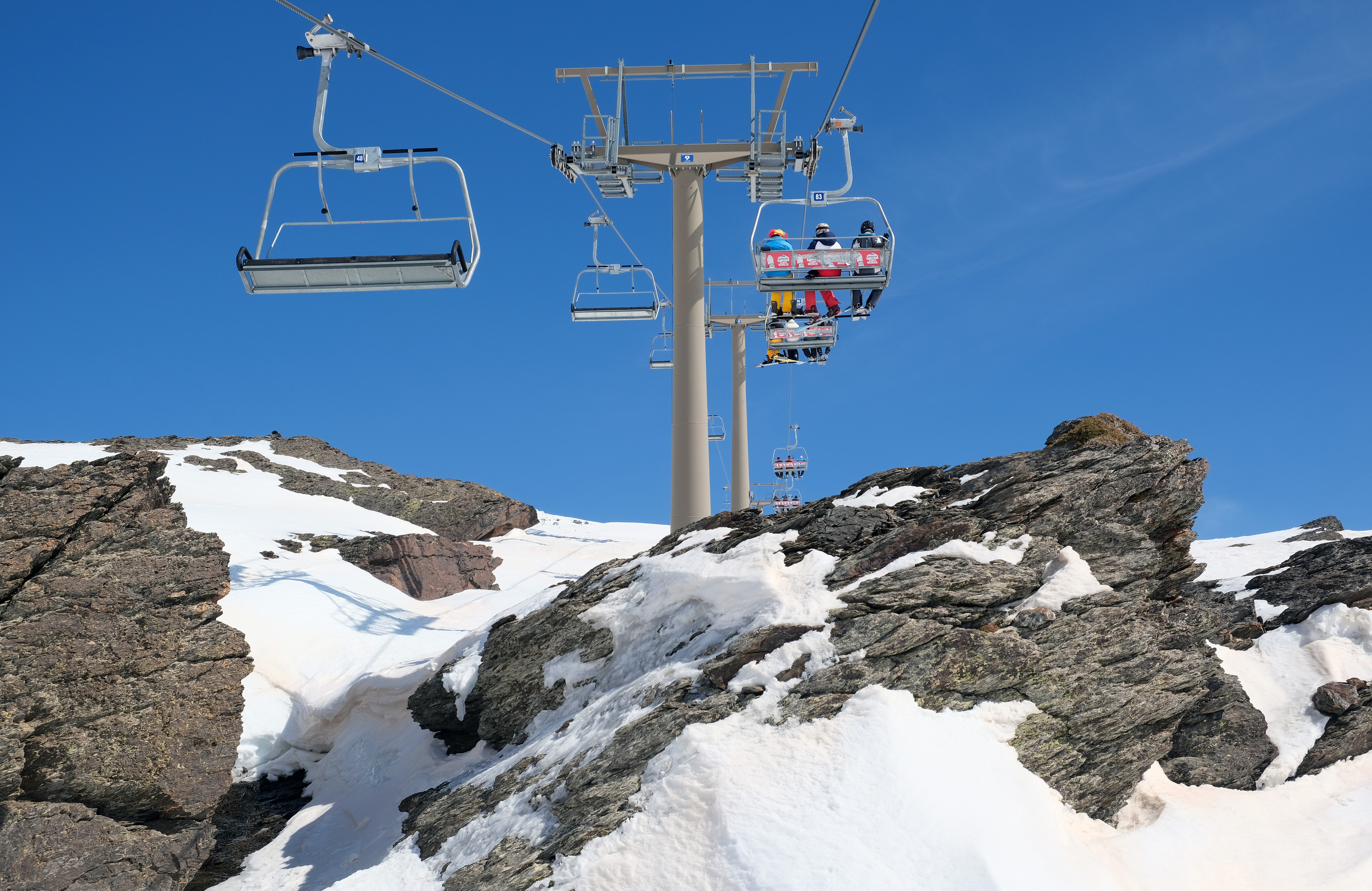
An elevated passenger ropeway, or chairlift, is a type of aerial lift, which consists of a continuously circulating steel wire rope loop strung between two end terminals and usually over intermediate towers. They are the primary on-hill transport at most ski areas (in such cases referred to as 'ski lifts'), but are also found at amusement parks and various tourist attractions. Depending on carrier size and loading efficiency, a passenger ropeway can move up to 4,000 people per hour, and the fastest lifts achieve operating speeds of up to or . The two-person double chair, which for many years was the workhorse of the ski industry, can move roughly 1,200 people per hour at rope speeds of up to . The four person detachable chairlift ("high-speed quad") can transport 2,400 people per hour with an average rope speed of . Some bi- and tri-cable elevated ropeways and reversible tramways achieve much greater operating speeds. Design and function A chairlift consists of numerous c ... [...More Info...] [...Related Items...] OR: [Wikipedia] [Google] [Baidu] |
Marsh
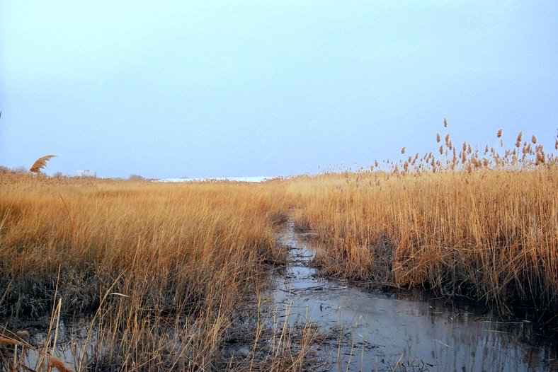
In ecology, a marsh is a wetland that is dominated by herbaceous plants rather than by woody plants.Keddy, P.A. 2010. Wetland Ecology: Principles and Conservation (2nd edition). Cambridge University Press, Cambridge, UK. 497 p More in general, the word can be used for any low-lying and seasonally waterlogged terrain. In Europe and in agricultural literature low-lying meadows that require draining and embanked polderlands are also referred to as marshes or marshland. Marshes can often be found at the edges of lakes and streams, where they form a transition between the aquatic and terrestrial ecosystems. They are often dominated by grasses, rushes or reeds. If woody plants are present they tend to be low-growing shrubs, and the marsh is sometimes called a carr. This form of vegetation is what differentiates marshes from other types of wetland such as swamps, which are dominated by trees, and mires, which are wetlands that have accumulated deposits of acidic peat. Marshes ... [...More Info...] [...Related Items...] OR: [Wikipedia] [Google] [Baidu] |
Karkonosze
The Giant Mountains, Krkonoše, or Karkonosze (Czech: , , ), are a mountain range located in the north of the Czech Republic and the south-west of Poland, part of the Sudetes mountain system (part of the Bohemian Massif). The Czech–Polish border, which divides the historic regions of Bohemia and Silesia, runs along the main ridge. The highest peak, Sněžka (), is the Czech Republic's highest natural point with an elevation of . On both sides of the border, large areas of the mountains are designated national parks (Krkonoše National Park in the Czech Republic and Karkonosze National Park in Poland), and these together comprise the Krkonoše/Karkonosze Transboundary Biosphere Reserve under the UNESCO Man and the Biosphere Programme. The source of the River Elbe is within the Giant Mountains. The range has a number of major ski resorts, and is a popular destination for tourists engaging in downhill and cross-country skiing, hiking, cycling and other activities. Names The rang ... [...More Info...] [...Related Items...] OR: [Wikipedia] [Google] [Baidu] |
Avalanche
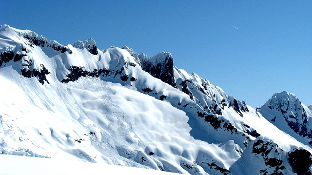
An avalanche is a rapid flow of snow down a Grade (slope), slope, such as a hill or mountain. Avalanches can be triggered spontaneously, by factors such as increased precipitation or snowpack weakening, or by external means such as humans, other animals, and earthquakes. Primarily composed of flowing snow and air, large avalanches have the capability to capture and move ice, rocks, and trees. Avalanches occur in two general forms, or combinations thereof: slab avalanches made of tightly packed snow, triggered by a collapse of an underlying weak snow layer, and loose snow avalanches made of looser snow. After being set off, avalanches usually accelerate rapidly and grow in mass and volume as they capture more snow. If an avalanche moves fast enough, some of the snow may mix with the air, forming a powder snow avalanche. Though they appear to share similarities, avalanches are distinct from slush flows, Mudflow, mudslides, Landslide#Debris landslide, rock slides, and serac collap ... [...More Info...] [...Related Items...] OR: [Wikipedia] [Google] [Baidu] |
Paczków
Paczków (; ) is a town in Nysa County, Opole Voivodeship, in southern Poland, with 7,460 inhabitants (2019). It is one of the few towns in Europe in which medieval fortifications have been almost completely preserved.Gazeta Wyborcza. Piotr Walczak, Odwiedz polskie Carcassonne (Visit Polish Carcassonne) retrieved on April 21, 2009 Located in the southeastern outskirts of the historical province of Lower Silesia, along the medieval road from to [...More Info...] [...Related Items...] OR: [Wikipedia] [Google] [Baidu] |
Opawskie Mountains
The Opawskie Mountains (, ) or Zlatohorská Highlands / Zlaté Hory Highlands (, ) are a mountain range of the Eastern Sudetes in the Czech Republic and Poland. Location The Opawskie Mountains stretch from northern Czech Silesia into Polish Upper Silesia, the eastern continuation of the Golden Mountains range. It borders on the Nízký Jeseník range in the south and the Hrubý Jeseník (High Ash Mountains) in the southwest. The Polish part of the range includes the protected area known as Opawskie Mountains Landscape Park. It is named after the Opava River with its source in the neighbouring Hrubý Jeseník range. The highest peak is Příčný vrch (975 meters above sea level). Towns and villages Poland * Prudnik * Głuchołazy * Jarnołtówek * Pokrzywna * Łąka Prudnicka * Moszczanka * Trzebina * Skrzypiec * Dytmarów * Krzyżkowice * Dębowiec * Opawica * Lenarcice * Krasne Pole * Chomiąża * Pietrowice * Ciermięcice * Pielgrzymów * Dobieszów * G ... [...More Info...] [...Related Items...] OR: [Wikipedia] [Google] [Baidu] |
Golden Mountains (Sudetes)
The Golden Mountains (; ; ) are a mountain range in the Sudetes on the border between Poland and the Czech Republic. Various ores were mined here from the 13th to the 20th century, including gold Gold is a chemical element; it has chemical symbol Au (from Latin ) and atomic number 79. In its pure form, it is a brightness, bright, slightly orange-yellow, dense, soft, malleable, and ductile metal. Chemically, gold is a transition metal ... (), hence the name Golden Mountains. There is a gold mine open to the public in Złoty Stok. It is the wildest, least civilized and least visited mountain range in Poland. File:DW390.jpg, Voivodeship Road nr 390 in winter File:Złoty Stok - Muzeum Kopalni Złota.JPG, Entrance to the gold mine in Złoty Stok See also * Bielice, Lower Silesian Voivodeship * Crown of Polish Mountains Sudetes Geography of the Olomouc Region Landforms of Lower Silesian Voivodeship Mountain ranges of Poland Mountain ranges of the Czech Republi ... [...More Info...] [...Related Items...] OR: [Wikipedia] [Google] [Baidu] |
Sněžník Mountains
Sněžník may refer to: *Děčínský Sněžník, a mountain in the Czech Republic *Králický Sněžník Králický Sněžník () or Śnieżnik () is a mountain on the border between the Czech Republic and Poland. With , it is the highest mountain of the Králický Sněžník Mountains. Etymology The name ''Sněžník'' or ''Śnieżnik'' derives ..., a mountain on the Czech–Polish border * Králický Sněžník Mountains, a mountain range {{geodis ... [...More Info...] [...Related Items...] OR: [Wikipedia] [Google] [Baidu] |
Stołowe Mountains National Park
Stołowe Mountains National Park (), anglicized to Table Mountains National Park, is a national park in southwestern Poland. It comprises the Polish section of the Table Mountains (''Góry Stołowe''), which are part of the Sudetes range. It is located in Kłodzko County of the Lower Silesian Voivodeship, at the border with the Czech Republic. Created in 1993, the park covers an area of , of which forests account for 57.79 km2. The area of strict protection is 3.76 km2. History The landscape of the Table Mountains began to form 70 million years ago. The range's unique shape is a result of hundreds of thousands of years of erosion. There are several notable rock formations, among them ''Kwoka'' ("Hen"), ''Wielblad'' ("Camel") and ''Glowa wielkoluda'' ("Giant’s head"). Also, there is a sophisticated system of corridors which creates rock labyrinths. Currently, plant life is mostly made up of spruce, which was introduced to the area at the turn of the 19th century to rep ... [...More Info...] [...Related Items...] OR: [Wikipedia] [Google] [Baidu] |


