|
Maianga (comuna)
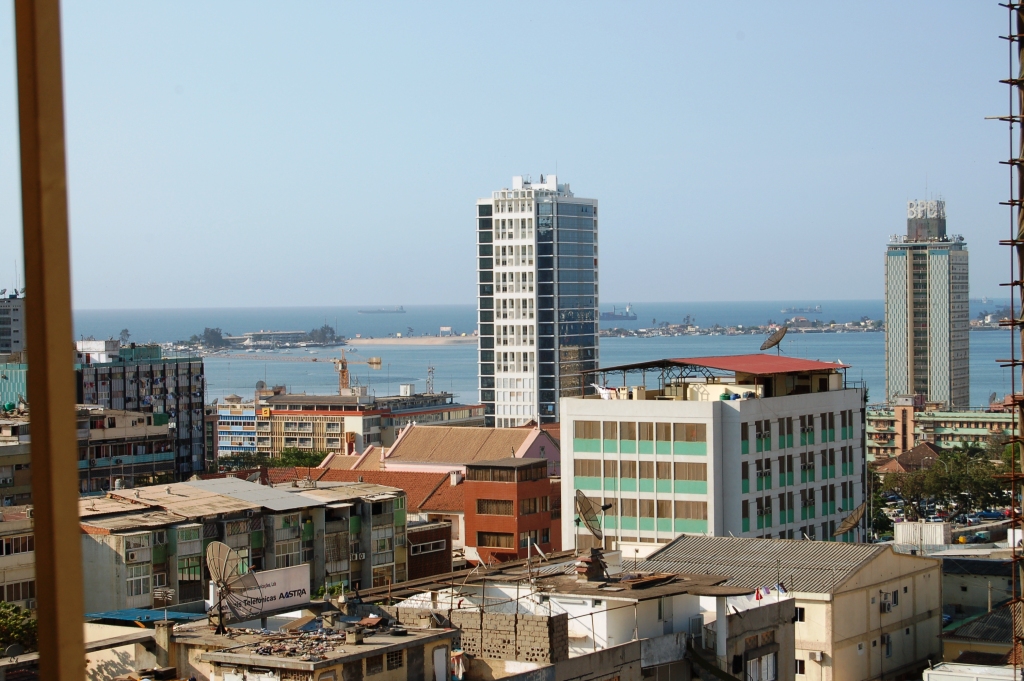
Maianga is one of the six municipalities of the administrative division of the province of Luanda, Angola. In 2011, as part of a restructuring of Luanda's regional government, the municipality was designated as one of Luanda's six urban districts. The area is one of the older quarters of Luanda and was established before independence. The area is best known for Quatro de Fevereiro Airport and its strong musical culture. History The name Maianga comes from the word Kimbundu Mazanga which means ponds. Before being urbanized, Maianga was an area known as a place that was routinely submerged by rainwater. The area was attractive to residents on account of the existence of two wells called Maianga do Rei and Maianga do Povo. The wells are located in the neighborhoods of Prenda and Cassenda. The northern part of Maianga is an extension of the colonial center of Luanda. The neighborhoods in the northern part of Maianga are formally built and set on paved streets with city services. N ... [...More Info...] [...Related Items...] OR: [Wikipedia] [Google] [Baidu] |
Luanda Municipality
The Municipality of Luanda is one of the nine municipalities that make up the province of Luanda, Angola. It covers roughly 116 km2 (second smallest in the province) and includes Ilha de Luanda. The population was 2,194,747 at the 2014 census and is projected to be 2,571,861 in 2019 per Instituto Nacional de Estatística, República de Angola. Administrative divisions The municipality of Luanda is made up of six urban districts: * Ingombota * Rangel * Maianga * Angola Quiluanje * Samba * Sambizanga Sambizanga is one of the six urban districts that make up the municipality of Luanda, in the province of Luanda, Angola. Overview Sambizanga has a 14.5 km² area and about 244,000 inhabitants. Limited to the west by the Atlantic Ocean, ... References Municipalities in Luanda Populated places in Luanda Province {{Angola-geo-stub ... [...More Info...] [...Related Items...] OR: [Wikipedia] [Google] [Baidu] |
Port Of Luanda
The port of Luanda is an Angolan port located in the city of Luanda, the national capital, in the province of Luanda. It is connected to the city center of Luanda and the district of Ingombota. It is located in the Luanda Bay, which is separated from the Atlantic Ocean by the island of Luanda. The port belongs to the Angolan government, which is responsible for its administration through the public company Porto de Luanda E.P.. This company was established to administer the license for terminals for loading and unloading, in addition to the passenger terminal. Together with the ports of Lobito (Benguela), Moçamedes ( Namibe), Soyo (Zaire) and Cabinda ( Cabinda), it forms the largest port complexes in the country. It is the largest port in the country, in addition to being the main import and export terminal for long-haul cargo in the nation. The port is the outlet point of the Luanda railway, which carries cargo from the city of Malanje in the Malanje Province. Another import ... [...More Info...] [...Related Items...] OR: [Wikipedia] [Google] [Baidu] |
Maianga (comuna)
Maianga is one of the six municipalities of the administrative division of the province of Luanda, Angola. In 2011, as part of a restructuring of Luanda's regional government, the municipality was designated as one of Luanda's six urban districts. The area is one of the older quarters of Luanda and was established before independence. The area is best known for Quatro de Fevereiro Airport and its strong musical culture. History The name Maianga comes from the word Kimbundu Mazanga which means ponds. Before being urbanized, Maianga was an area known as a place that was routinely submerged by rainwater. The area was attractive to residents on account of the existence of two wells called Maianga do Rei and Maianga do Povo. The wells are located in the neighborhoods of Prenda and Cassenda. The northern part of Maianga is an extension of the colonial center of Luanda. The neighborhoods in the northern part of Maianga are formally built and set on paved streets with city services. N ... [...More Info...] [...Related Items...] OR: [Wikipedia] [Google] [Baidu] |
Angola International Airport
Angola International Airport () (IATA: none, ICAO: none) is an international airport currently under-construction, which will serve the capital of Angola, Luanda. It is located in Bengo Province, 40 km southeast of the city center. It will be an alternative to the existing Quatro de Fevereiro International Airport. Along with some Chinese contractors, the Brazilian company, Odebrecht, are constructing the airport. The first phase was completed in 2012. The airport was originally scheduled to completed and opened in 2015/2016, but due to delays caused by problems within the company and the COVID-19 pandemic, the opening was delayed until 2022. The airport is now expected to be completed by the end of 2023. Design and construction The airport will be having the capacity to serve 13 million passengers per year. The lead construction company is China International Fund, which was founded in Hong Kong in 2003. The company built a village named Vila Chinesa, meaning "Chinese villag ... [...More Info...] [...Related Items...] OR: [Wikipedia] [Google] [Baidu] |
Quilamba Quiaxi
Quilamba Quiaxi, also spelled as Kilamba Kiaxi, is an city and one of nine municipalities that make up the province of Luanda in Angola. In the Kimbundu language the name means ''Land (Kiaxi) of Kilamba''. According to the population projections of 2018, prepared by the National Institute of Statistics, it has a population of approximately 750 000 inhabitants and a territorial area of 64.1 km². Geography It is limited to the west with the urban district of Maianga, to the north with the urban district of Rangel and the municipality of Cazenga Cazenga is an city and the most densely populated of the nine municipalities that make up the province of Luanda, Angola. It has a population of 892,401 (2014 census), with an estimated 1,045,722 in 2019, covering an area of 37 km2. Administrativ ..., to the east the municipality of Viana and to the south with the municipality of Talatona. It is only the commune, which is subdivided into the urban districts of Golfe , Golfe II ... [...More Info...] [...Related Items...] OR: [Wikipedia] [Google] [Baidu] |
Samba
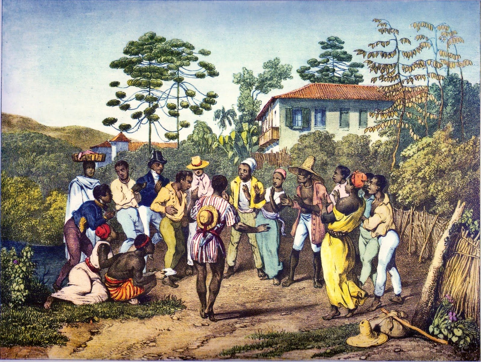
Samba (), also known as samba urbano carioca (''urban Carioca samba'') or simply samba carioca (''Carioca samba''), is a Brazilian music genre that originated in the Afro-Brazilian communities of Rio de Janeiro in the early 20th century. Having its roots in Brazilian folk traditions, especially those linked to the primitive rural samba of the colonial and imperial periods, it is considered one of the most important cultural phenomena in Brazil and one of the country's symbols. Present in the Portuguese language at least since the 19th century, the word "samba" was originally used to designate a "popular dance". Over time, its meaning has been extended to a "batuque-like circle dance", a dance style, and also to a "music genre". This process of establishing itself as a musical genre began in the 1910s and it had its inaugural landmark in the song "Pelo Telefone", launched in 1917. Despite being identified by its creators, the public, and the Brazilian music industry as "samba" ... [...More Info...] [...Related Items...] OR: [Wikipedia] [Google] [Baidu] |
Rangel
Rangel (, ) is a surname of Portuguese origin. Rangel is a toponymic surname. The origin of the term is uncertain but French And Germanic roots are discussed, one are from the German "ragin-walt" - a mighty ruler. Other theory about the origin of surname is the Rang a commune in the Doubs department in the Bourgogne-Franche-Comté region in eastern France. Place where the estate would have been named after this place in Portugal with the addition of the suffix EL The Surname came from the estate of “Ronge or Range”, later Rangel, located in Ribeira de Coselhas, Coimbra Portugal. It belonged to Gundisalvus and was taken from the Moors, during the siege of Coimbra in 1117 in the Christian reconquest of the Iberian peninsula. The surname is found in Portugal, Spain, Germany, France, England, United States, Brazil, Venezuela, Mexico, Russia, East Timor, and Angola. In places like Mexico the surname is strictly linked to the Spanish branch of the surname ... [...More Info...] [...Related Items...] OR: [Wikipedia] [Google] [Baidu] |
Ingombota
Ingombota is one of the six urban districts that make up the municipality of Luanda, in the province of Luanda, the capital city of Angola. Ingombota is home to the central business district of Luanda, Angola. The economic, political and symbolic center of the city and the nation, it is Luanda's oldest district. The district is home to most of Luanda's prominent hotels and office towers. Etymology The word Ingombota originates from Kimbundu, while existing two theories as to its origin. One saying Ingombota comes from the words ''joint'' and ''ingombo kuta'', meaning ''place where there are abundant quiabos''. Another possibility would be to join the words ''Ngombo kuta'' and ''meaning a refuge for outlaws'' (possibly slaves), giving rise to the word ''Ngombota'', in Portuguese to Ingombota. Orientation Ingombota has 9.6 square kilometers (3.7 square miles) and about 370,000 inhabitants. The district is bordered on the west by the Atlantic Ocean, Sambizanga to the north, ... [...More Info...] [...Related Items...] OR: [Wikipedia] [Google] [Baidu] |
Lobito
Lobito is a municipality in Angola. It is located in Benguela Province, on the Atlantic Coast north of the Catumbela Estuary. The Lobito municipality had a population of 393,079 in 2014. History The city was founded in 1843 and owes its existence to the bay of the same name having been chosen as the sea terminus of the Benguela railway to the far interior, passing through Luau to Katanga in the Democratic Republic of the Congo. The city is located on the coast of the Atlantic Ocean. The population of the municipality is 393,079 (2014) in an area of 3,648 km². The municipality consists of the communes Canjala, Egipto Praia and Lobito. Portuguese rule Lobito, was built on a sandspit and reclaimed land, with one of Africa's finest natural harbours, protected by a 5 km long sandspit. The old municipality (''concelho'') was created in 1843 by the Portuguese administration. The town was also founded in 1843 by order of Maria II of Portugal, and its harbour works w ... [...More Info...] [...Related Items...] OR: [Wikipedia] [Google] [Baidu] |
Portugal
Portugal, officially the Portuguese Republic, In recognized minority languages of Portugal: :* mwl, República Pertuesa is a country located on the Iberian Peninsula, in Southwestern Europe, and whose territory also includes the Macaronesian archipelagos of the Azores and Madeira. It features the westernmost point in continental Europe, its mainland west and south border with the North Atlantic Ocean and in the north and east, the Portugal-Spain border, constitutes the longest uninterrupted border-line in the European Union. Its archipelagos form two autonomous regions with their own regional governments. On the mainland, Alentejo region occupies the biggest area but is one of the least densely populated regions of Europe. Lisbon is the capital and largest city by population, being also the main spot for tourists alongside Porto, the Algarve and Madeira. One of the oldest countries in Europe, its territory has been continuously settled and fought over since prehistoric tim ... [...More Info...] [...Related Items...] OR: [Wikipedia] [Google] [Baidu] |
Angola
, national_anthem = "Angola Avante"() , image_map = , map_caption = , capital = Luanda , religion = , religion_year = 2020 , religion_ref = , coordinates = , largest_city = capital , official_languages = Portuguese , languages2_type = National languages , languages2 = , ethnic_groups = , ethnic_groups_ref = , ethnic_groups_year = 2000 , demonym = , government_type = Unitary dominant-party presidential republic , leader_title1 = President , leader_name1 = João Lourenço , leader_title2 = Vice President , leader_name2 = Esperança da CostaInvestidura do Pre ... [...More Info...] [...Related Items...] OR: [Wikipedia] [Google] [Baidu] |


