|
MV Moby Love
MF ''Sporades Star'' is a passenger ferry which belongs to Seajets. She was previously owned by Moby Lines and was named ''Moby Love''. She was launched in 1972 as ''Saint Eloi'' but not completed until 1975 due to the bankruptcy of the shipyard that built her. She was built as a multi-purpose ferry, capable of carrying railway rolling stock as well as road vehicles. Built for Société Anonyme de Gérance et d'Armement#Angleterre-Lorraine-Alsace Société Anonyme de Navigation, Angleterre-Lorraine-Alsace, she was renamed ''Channel Entente'' in 1989. She served on cross-channel routes until she was sold in 1990 to the Isle of Man Steam Packet Company (IoMSPCo) and reflagged to the Bahamas. Renamed ''King Orry'', she was reflagged to the Isle of Man in 1995. In 1998, she was sold to Moby Lines and renamed ''Moby Love'', and then ''Moby Love 2''. She was renamed ''Moby Love'' again in 2002 until 2017 when she sold in Greek company. Description The ship is long, with a beam of . S ... [...More Info...] [...Related Items...] OR: [Wikipedia] [Google] [Baidu] |
Livorno
Livorno () is a port city on the Ligurian Sea on the western coast of the Tuscany region of Italy. It is the capital of the Province of Livorno, having a population of 152,916 residents as of 2025. It is traditionally known in English as Leghorn (pronounced , "Leghorn" in the Oxford Dictionaries Online. or ). During the Italian Renaissance, Renaissance, Livorno was designed as an "ideal town". Developing considerably from the second half of the 16th century by the will of the House of Medici, Livorno was an important free port. Its intense commercial activity was largely dominated by foreign traders. Also the seat of consulates and shipping companies, it became the main port-city of the Grand Duchy of Tuscany. The high status of a multiethnic and multicultural Livorno lasted until the ... [...More Info...] [...Related Items...] OR: [Wikipedia] [Google] [Baidu] |
Dún Laoghaire
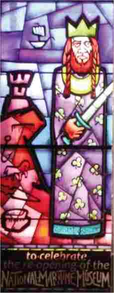
Dún Laoghaire ( , ) is a suburban coastal town in County Dublin in Ireland. It is the administrative centre of the county of Dún Laoghaire–Rathdown. The town was built up alongside a small existing settlement following 1816 legislation that allowed the building of a major port to serve Dublin. It was known as Dunleary in the English language, until it was renamed Kingstown in honour of King George IV's 1821 visit, and in 1920 was given its present name Dún Laoghaire, the original Irish form from which "Dunleary" was anglicised. Over time, the town became a residential location, a seaside resort, the terminus of Ireland's first railway and the administrative centre of the former borough of Dún Laoghaire, and from 1994, of the county of Dún Laoghaire–Rathdown. Toponymy The town's name means "fort of Laoghaire". This refers to Lóegaire mac Néill (modern spelling: Laoghaire Mac Néill), a 5th-century High King of Ireland, who chose the site as a sea base from which to ... [...More Info...] [...Related Items...] OR: [Wikipedia] [Google] [Baidu] |
Skiathos
Skiathos (, ; , ; and ) is a small Greece, Greek Islands of Greece, island in the northwest Aegean Sea. Skiathos is the westernmost island in the Northern Sporades archipelago, east of the Pelion peninsula in Magnesia (regional unit), Magnesia on the mainland, and west of the island of Skopelos. Geography The island has a north to southwestern axis and is about long and wide on average. The coastline is indented with inlets, capes and peninsulas. The southeast and southwest parts have gentler slopes and that is where most settlements and facilities are located. The terrain is more rugged on the north coast, with the highest peak at on mount Karafiltzanaka (). The main town is Skiathos (town), Skiathos (pop. 4,883 in 2011), in the eastern part of the island. Other main settlements are Kalyvia (312), Troullos (158), Χanemos (143), Koukounaries (119), and Achladias (118). The Communities and Municipalities of Greece, Municipality of Skiathos includes the islets of Tsougria, ... [...More Info...] [...Related Items...] OR: [Wikipedia] [Google] [Baidu] |
Volos
Volos (; ) is a coastal port city in Thessaly situated midway on the Greek mainland, about north of Athens and south of Thessaloniki. It is the capital of the Magnesia (regional unit), Magnesia regional unit of the Thessaly Region. Volos is also the only outlet to the sea from Thessaly, the country's largest agricultural region. With a population of 85,803 (2021), the city is an important industrial centre, and its port provides a bridge between Europe and Asia. Volos is the newest of the Greek port cities, with a large proportion of modern buildings erected following catastrophic earthquakes in 1955. It includes the municipality, municipal units of Volos, Nea Ionia (Magnesia), Greece, Nea Ionia and Iolkos, as well as smaller suburban communities. The economy of the city is based on manufacturing, trade, services and tourism. Home to the University of Thessaly, the city also offers facilities for conferences, exhibitions and major sporting, cultural and scientific events. ... [...More Info...] [...Related Items...] OR: [Wikipedia] [Google] [Baidu] |
Kavala
Kavala (, ''Kavála'' ) is a city in northern Greece, the principal seaport of eastern Macedonia and the capital of Kavala regional unit. It is situated on the Bay of Kavala, across from the island of Thasos and on the A2 motorway, a one-and-a-half-hour drive to Thessaloniki ( west) and a forty-minute drive to Drama ( north) and Xanthi ( east). It is also about 150 kilometers west of Alexandroupoli. Kavala is an important economic centre of Northern Greece, a center of commerce, tourism, fishing and oil-related activities and formerly a thriving trade in tobacco. Names Historically the city is known by several names. In antiquity the name of the city was Neapolis ('new city', like many Greek colonies). In the Early Middle Ages it was renamed to Christo(u)polis ('city of Christ') and from the 16th century and on to Kavala. Etymology The etymology of the modern name of the city is disputed. Some mention an ancient Greek settlement of ''Skavala'' near the town. Others prop ... [...More Info...] [...Related Items...] OR: [Wikipedia] [Google] [Baidu] |
Agios Efstratios
Agios Efstratios or Saint Eustratius (), colloquially Ai Stratis (), anciently Halonnesus or Halonnesos (), is a small Greek island in the northern Aegean Sea about southwest of Lemnos and northwest of Lesbos. The municipality has an area of 43.325 km2. Together with Lemnos and nearby islets it forms the regional unit of Lemnos, part of the Greek archipelagic region of the North Aegean. Name In antiquity the island was known as Halonnesus, and under this name was a bone of contention between ancient Athens and Macedon as was noted in '' On the Halonnesus'', attributed to Demosthenes. The island was named after Saint Eustratius (), who lived on the island in the 9th century as an exile, because he was opposed to the iconoclastic policies of the Byzantine Emperor Leo the Armenian. His grave is still being shown by the inhabitants. The island is mentioned in the by Cristoforo Buondelmonti in 1420 as Sanstrati. It was also known as "Bozbaba" during Ottoman rule. The Ottoman ... [...More Info...] [...Related Items...] OR: [Wikipedia] [Google] [Baidu] |
Lemnos
Lemnos ( ) or Limnos ( ) is a Greek island in the northern Aegean Sea. Administratively the island forms a separate municipality within the Lemnos (regional unit), Lemnos regional unit, which is part of the North Aegean modern regions of Greece, region. The principal town of the island and seat of the municipality is Myrina, Greece, Myrina. At , it is the Greek islands, 8th-largest island of Greece. Geography Lemnos is primarily a flat island, but the western region, particularly the northwest, is rocky and mountainous. At 430 meters above sea level, Mount Skopia is the highest point. The chief towns are Myrina, Greece, Myrina, on the western coast, and Moudros on the eastern shore of a large bay in the middle of the island. Myrina (also called Kastro, meaning "castle") possesses a good harbour. It is the seat of all trade carried on with the mainland. Lemnos also has a 7-hectare desert, the Pachies Ammoudies of Lemnos. Climate The climate in Lemnos is mainly Mediterranean c ... [...More Info...] [...Related Items...] OR: [Wikipedia] [Google] [Baidu] |
Lavrion
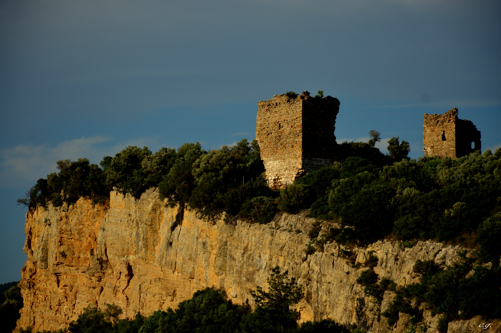
Lavrio, Lavrion or Laurium (; (later ); from Middle Ages until 1908: Εργαστήρια ''Ergastiria'') is a town in southeastern part of Attica, Greece. It is part of Athens metropolitan area and the seat of the municipality of Lavreotiki. Laurium was famous in Classical antiquity for its silver mines, which was one of the chief sources of revenue of the Athenian state. The metallic silver was mainly used for coinage. The Archaeological Museum of Lavrion shows much of the story of these mines. It is located about 60 km SE of Athens city center, SE of Keratea and N of Cape Sounio. Laurium is situated on a bay overlooking the island of Makronisos (ancient times: Helena) in the east. The port is in the middle and gridded streets cover the residential area of Lavrio. GR-89 runs through Lavrio and ends south in Sounio. History The modern town of Lavrio is at the site of the ancient village of Thoricus; its name is taken from that of the entire region of the Mines ... [...More Info...] [...Related Items...] OR: [Wikipedia] [Google] [Baidu] |
Samothraki
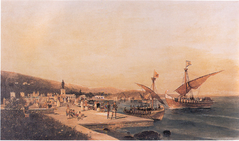
Samothrace (also known as Samothraki; , ) is a Greek island in the northern Aegean Sea. It is a municipality within the Evros regional unit of Thrace. The island is long, in size and has a population of 2,596 (2021 census). Its main industries are fishing and tourism. Resources on the island include granite and basalt. Samothrace is one of the most rugged Greek islands, with Mt Saos and its highest peak, Fengari, rising to . The ''Winged Victory of Samothrace'' statue, which is now displayed at the Louvre in Paris, was found on the island. History Antiquity Samothrace never became a state of any political significance in ancient Greece, since it lacks natural harbours and most of the island is too mountainous for cultivation: Mount Fengari (literally 'Mt Moon') rises to . It was, however, the home of the Sanctuary of the Great Gods, site of important Hellenic and pre-Hellenic religious ceremonies. Those who visited this shrine to be initiated into the island cult inclu ... [...More Info...] [...Related Items...] OR: [Wikipedia] [Google] [Baidu] |
Alexandroupoli
Alexandroupolis (, ) or Alexandroupoli (, ) is a city in Greece and the capital of the Evros (regional unit), Evros regional unit. It is the largest city in Greek Thrace and the region of Eastern Macedonia and Thrace, with a population of 71,751, and is an important port and commercial center for northeastern Greece. The city was first settled by the Ottoman Empire in the 19th century and grew into the fishing village ''Dedeağaç''. In 1873, it became a ''kaza'' and one year later was promoted to a ''Sanjak of Dedeağaç, sanjak''. The city developed into a regional trading center. Later, it became a part of Adrianople Vilayet. During the Russo-Turkish War (1877–1878), the area was briefly captured by the Russians. Ottoman rule ended with the First Balkan War, when the city was captured by Kingdom of Bulgaria, Bulgaria in 1912. In the Second Balkan War, Kingdom of Greece, Greece took control of the city. With the Treaty of Bucharest (1913), Treaty of Bucharest (10 August 1913 ... [...More Info...] [...Related Items...] OR: [Wikipedia] [Google] [Baidu] |
Portoferraio
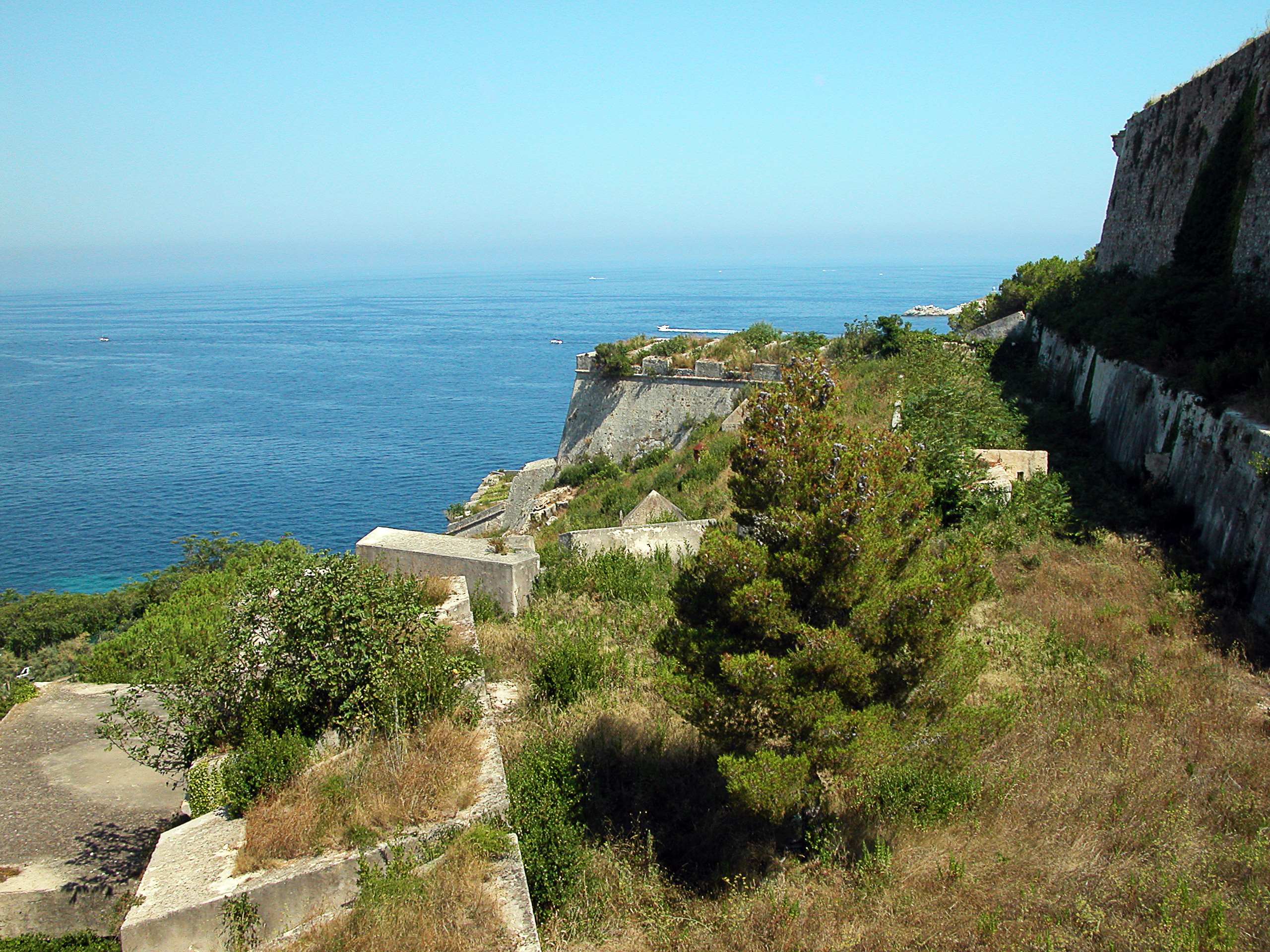
Portoferraio () is a town and ''comune'' in the province of Livorno, on the edge of the eponymous harbour of the island of Elba. It is the island's largest town. Because of its terrain, many of its buildings are situated on the slopes of a tiny hill bordered on three sides by the sea. History It was founded by Cosimo I de' Medici, List of rulers of Tuscany, Grand Duke of Tuscany, in 1548, with the name of ''Cosmopoli'' ("Cosimo's City"), to balance the presence of the Spanish citadel in Porto Azzurro. It had three forts (Forte Stella, Forte Falcone, and Forte Inglese) and a massive line of walls, all still visible today. The name evolved from Ferraia in Etruscan civilization, Etruscan times, Fabricia with Romans and Ferraio with Grand Duchy of Tuscany. The city remained attached to the Grand Duchy of Tuscany until the late 18th century, when, due to its strategic position, it came into contention with France, United Kingdom, Great Britain, and Habsburg monarchy, Austria. A Br ... [...More Info...] [...Related Items...] OR: [Wikipedia] [Google] [Baidu] |
Piombino
Piombino is an Italian town and ''comune'' of about 35,000 inhabitants in the province of Livorno (Tuscany). It lies on the border between the Ligurian Sea and the Tyrrhenian Sea, in front of Elba Island and at the northern side of Maremma. Overview It has an ancient historical centre, derived from the time in which it was the Etruscans' port, in the surroundings of Populonia. In the Middle Ages, it was instead an important port of the Republic of Pisa. Its hinterland hosts a considerable industrial area. Its port is still heavily used, both for industry and for tourism, with ferry boats to Portoferraio (Elba) and Olbia (Sardinia). Geography The bounding communes of Piombino are Campiglia Marittima, Follonica, San Vincenzo and Suvereto. The town has seven civil parishes (''frazioni''): Baratti, Colmata, Fiorentina, La Sdriscia, Populonia, Populonia Stazione and Riotorto. History Early history The area of modern Piombino was settled since ancient times. During the Etr ... [...More Info...] [...Related Items...] OR: [Wikipedia] [Google] [Baidu] |


