|
MBTA Orange Line
The Orange Line is a rapid transit line operated by the Massachusetts Bay Transportation Authority (MBTA) as part of the MBTA subway system. The line runs south on the surface from Oak Grove station in Malden, Massachusetts through Malden and Medford, paralleling the Haverhill Line, then crosses the Mystic River on a bridge into Somerville, then into Charlestown. It passes under the Charles River and runs through Downtown Boston in the Washington Street Tunnel. The line returns to the surface in the South End, then follows the Southwest Corridor southwest in a cut through Roxbury and Jamaica Plain to Forest Hills station. The Orange Line operates during normal MBTA service hours (all times except late nights) with six-car trains. It uses a 152-car CRRC fleet built in 2018–2024. The Orange Line is fully grade-separated and trains are driven by operators with automatic train control for safety. Wellington Carhouse in Medford is used for heavy maintenance and storage; a sma ... [...More Info...] [...Related Items...] OR: [Wikipedia] [Google] [Baidu] |
Haymarket Station (MBTA)
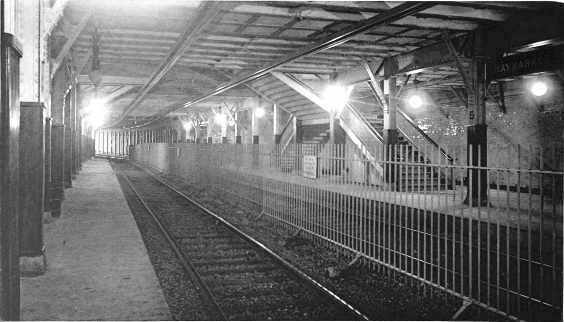
Haymarket station is an underground Massachusetts Bay Transportation Authority (MBTA) rapid transit station located at Haymarket Square (Boston), Haymarket Square in downtown Boston, Massachusetts. It is a transfer station between the Green Line (MBTA), Green Line and Orange Line (MBTA), Orange Line of the MBTA subway system, as well as a terminal for MBTA bus routes serving northern and northeastern suburbs. The two lines run parallel to each other through the station, with two side platforms for the Orange Line and a single island platform for the Green Line. The station is fully accessible. The Tremont Street subway, predecessor of the modern Green Line, opened in 1898. It had a four-track streetcar station at Haymarket. The subway was also used by the Main Line, predecessor of the Orange Line, from 1901 to 1908. The Main Line was rerouted into the Washington Street tunnel, with Union and Friend stations at Haymarket Square, in 1908. Union and Friend were renamed Haymarket in ... [...More Info...] [...Related Items...] OR: [Wikipedia] [Google] [Baidu] |
Southwest Corridor (Boston)
The Southwest Corridor or Southwest Expressway was a project designed to bring an eight-lane highway into the City of Boston from a direction southwesterly of downtown. It was supposed to connect with Interstate 95 (I-95) at Route 128. As originally designed, it would have followed the right of way of the former Penn Central/ New Haven Railroad mainline (current Amtrak Northeast Corridor) running from Readville, north through Roslindale, Forest Hills and Jamaica Plain, where it would have met the also-cancelled I-695 (Inner Belt Expressway). The 50-foot-wide (15 m) median for the uncompleted "Southwest Expressway" would have carried the southwest stretch of the MBTA Orange Line within it, replacing the Washington Street Elevated railway's 1901/1909-built elevated railbed. Another highway, the four-lane South End Bypass, was proposed to run along the railroad corridor between I-695 in Roxbury and I-90 near Back Bay. History Early railroad history The Boston and Providence Rai ... [...More Info...] [...Related Items...] OR: [Wikipedia] [Google] [Baidu] |
Interstate 95
Interstate 95 (I-95) is the main north–south Interstate Highway on the East Coast of the United States, running from U.S. Route 1 (US 1) in Miami, Florida, north to the Houlton–Woodstock Border Crossing between Maine and the Canada, Canadian province of New Brunswick. The highway largely parallels the Atlantic Ocean, Atlantic coast and US 1, except for the portion between Savannah, Georgia, and Washington, D.C., and the portion between Portland, Maine, Portland and Houlton, Maine, Houlton in Maine, both of which follow a more direct inland route. I-95 serves as the principal road link between the major cities of the East Coast of the United States, Eastern Seaboard. Major metropolitan areas along its route include Miami metropolitan area, Miami, Jacksonville metropolitan area, Jacksonville, and Savannah metropolitan area, Savannah in the Southeastern United States, Southeast; Greater Richmond Region, Richmond, Washington metropolitan area, Washington, Bal ... [...More Info...] [...Related Items...] OR: [Wikipedia] [Google] [Baidu] |
Haymarket North Extension
The Haymarket North Extension is a section of the Massachusetts Bay Transportation Authority's rapid transit Orange Line (MBTA), Orange Line which currently constitutes the northern section of the line. It runs from North Station (subway), North Station through an underground crossing of the Charles River (with the 2003-completed Leonard P. Zakim Bunker Hill Memorial Bridge, Leonard Zakim Bridge later built directly over it), then along the Haverhill Line right-of-way to Oak Grove (MBTA station), Oak Grove station in Malden, Massachusetts. Built to replace the Charlestown Elevated and originally intended to be extended as far as Reading, Massachusetts, Reading, it opened in stages between 1975 and 1977. Route The Haymarket North Extension begins just north of Haymarket station (MBTA), Haymarket station in Boston, with an underground station at . The tunnel runs under the Charles River, surfacing in Charlestown, Boston, Charlestown just south of Community College station. The exte ... [...More Info...] [...Related Items...] OR: [Wikipedia] [Google] [Baidu] |
Infill Station
An infill station (sometimes in-fill station) is a train station built on an existing passenger rail, rapid transit, or light rail line to address demand in a location between existing stations. Such stations take advantage of existing train service and encourage new riders by providing a more convenient location. Many older transit systems have widely spaced stations and can benefit from infill stations. In some cases, new infill stations are built at sites where a station had once existed many years ago, for example the station on the Chicago 'L''s Green Line. Examples The Americas Canada *Montreal ** Griffintown–Bernard-Landry station, 2027 *Ottawa ** Corso Italia station, 2025 ** Walkley station, 2025 *Toronto ** North York Centre station, 1987 *Vancouver ** Lake City Way station, 2003 ** Capstan station, 2024 Chile *Santiago ** San José de la Estrella metro station, 2009 United States * Atlanta ** Peachtree Center station, 1982 * Phoenix ** 50th Street/Washingto ... [...More Info...] [...Related Items...] OR: [Wikipedia] [Google] [Baidu] |
Tremont Street Subway
The Tremont Street subway in Boston's MBTA subway system is the oldest subway tunnel in North America and the third-oldest still in use worldwide to exclusively use electric traction (after the City and South London Railway in 1890, and Line 1 (Budapest Metro), the Budapest Metro's Line 1 in 1896), opening on September 1, 1897. It was originally built, under the supervision of Howard Adams Carson, Howard A. Carson as chief engineer, to get streetcar lines off the traffic-clogged streets, instead of as a true rapid transit line. It now forms the central part of the Green Line (MBTA), Green Line, connecting Boylston (MBTA station), Boylston Street to Park Street station (MBTA), Park Street and Government Center (MBTA station), Government Center stations. History The tunnel originally served five closely spaced stations: Boylston station, Boylston, Park Street, Government Center station (MBTA), Scollay Square, Adams Square station, Adams Square, and Haymarket station (MBTA), Ha ... [...More Info...] [...Related Items...] OR: [Wikipedia] [Google] [Baidu] |
Washington Street Elevated
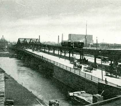
The Washington Street Elevated was an elevated segment of Boston's Massachusetts Bay Transportation Authority subway system, comprising the southern stretch of the Orange Line. It ran from Chinatown through the South End and Roxbury, ending in Forest Hills in Jamaica Plain, Boston. History Construction The initial section of the Main Line Elevated opened on June 10, 1901, running from Sullivan Square in Charlestown over the Charlestown Elevated, through the Canal Street incline into the Tremont Street subway, and out the Pleasant Street portal onto the Washington Street Elevated. The initial section of the elevated ran only to (now known as Nubian Square), with intermediate stations at Dover and Northampton. The Atlantic Avenue Elevated opened on August 22 of that year, joining the Washington Street El at Tower D Junction. The El, Boston's first heavy rail metro line, proved extremely popular. The Washington Street Tunnel was opened on November 30, 1908, providing ... [...More Info...] [...Related Items...] OR: [Wikipedia] [Google] [Baidu] |
Atlantic Avenue Elevated
The Atlantic Avenue Elevated was an elevated railway around the east side of Downtown Boston, Massachusetts, providing a second route for the Boston Elevated Railway's Main Line Elevated (now the MBTA's Orange Line) around the Washington Street tunnel. It was in use from 1901 to 1938, when it was closed due to low ridership, later being demolished. History The Atlantic Avenue El was conceived as a part of a greater mass transit proposal by the Boston Transit Commission in 1896. After the success of the Tremont Street subway (now the Green Line) the Commission began looking at options for a unified system that would serve all of downtown Boston and reach out into the growing suburbs. As conceived, there would be two corridors through which elevated trains would run: the Washington Street tunnel – the heart of today's MBTA Orange Line subway – under Washington Street from a portal at Oak Street to the then-existing subway portal north of Haymarket Square, and an all- ... [...More Info...] [...Related Items...] OR: [Wikipedia] [Google] [Baidu] |
Charlestown Elevated
The Charlestown Elevated was a segment of the MBTA Orange Line rapid transit line that ran from the Canal Street Incline in downtown Boston, Massachusetts through Charlestown to a terminal in Everett, Massachusetts. It opened in June 1901 and was replaced by the Haymarket North Extension in April 1975. Route The Charlestown Elevated began at the Canal Street incline, just north of Haymarket Square in the Bulfinch Triangle section of downtown Boston, Massachusetts. It paralleled the Causeway Street Elevated north to North Station just south of Boston Garden. There it turned east along Causeway Street to Tower C, the split with the Atlantic Avenue Elevated, then north over the Charlestown Bridge. The Elevated turned slightly with an elevated station at City Square, then followed Main Street through Charlestown with a station at Thompson Square. Sullivan Square, the original terminal, was a grand arched brick building with multiple streetcar loops. The Sullivan Squar ... [...More Info...] [...Related Items...] OR: [Wikipedia] [Google] [Baidu] |
Boston Elevated Railway
The Boston Elevated Railway (BERy) was a Tram, streetcar and rapid transit railroad operated on, above, and below, the streets of Boston, Massachusetts and surrounding communities. Founded in 1894, it eventually acquired the West End Street Railway via lease and merger to become the city's primary mass transit provider. Its modern successor is the state-run Massachusetts Bay Transportation Authority (MBTA), which continues to operate in part on infrastructure developed by BERy and its predecessors. History Originally intended to build a short electric Light rail, trolley line to Brookline, the West End Street Railway was organized in 1887. By the next year it had consolidated ownership of a number of Horsecar, horse-drawn streetcar lines, composing a fleet of 7,816 horses and 1,480 rail vehicles. As the system grew, a switch to underground pulled-cable propulsion (modeled after the San Francisco cable car system) was contemplated. After visiting Frank J. Sprague, Frank Spr ... [...More Info...] [...Related Items...] OR: [Wikipedia] [Google] [Baidu] |
MBTA Accessibility
The Massachusetts Bay Transportation Authority (MBTA) system is mostly but not fully accessible. Like most American mass transit systems, much of the MBTA subway and MBTA Commuter Rail, commuter rail were built before wheelchair access became a requirement under the Americans with Disabilities Act of 1990. The MBTA has renovated most stations to be compliant with the ADA, and all stations built since 1990 are accessible. The MBTA also has a paratransit program, The Ride (MBTA), The Ride, which provides accessible vehicles to transport passengers who cannot use the fixed-route system. Much of the MBTA subway system is accessible: all Orange Line (MBTA), Orange and Red Line (MBTA), Red Line stations, and all but one Blue Line (MBTA), Blue Line station, are accessible. Most of the underground portion of the Green Line (MBTA), Green Line is accessible, though only some surface stops are; all but one stop on the Mattapan Line are accessible. As of March 2025, about 84% of the MBTA Comm ... [...More Info...] [...Related Items...] OR: [Wikipedia] [Google] [Baidu] |
Automatic Train Control
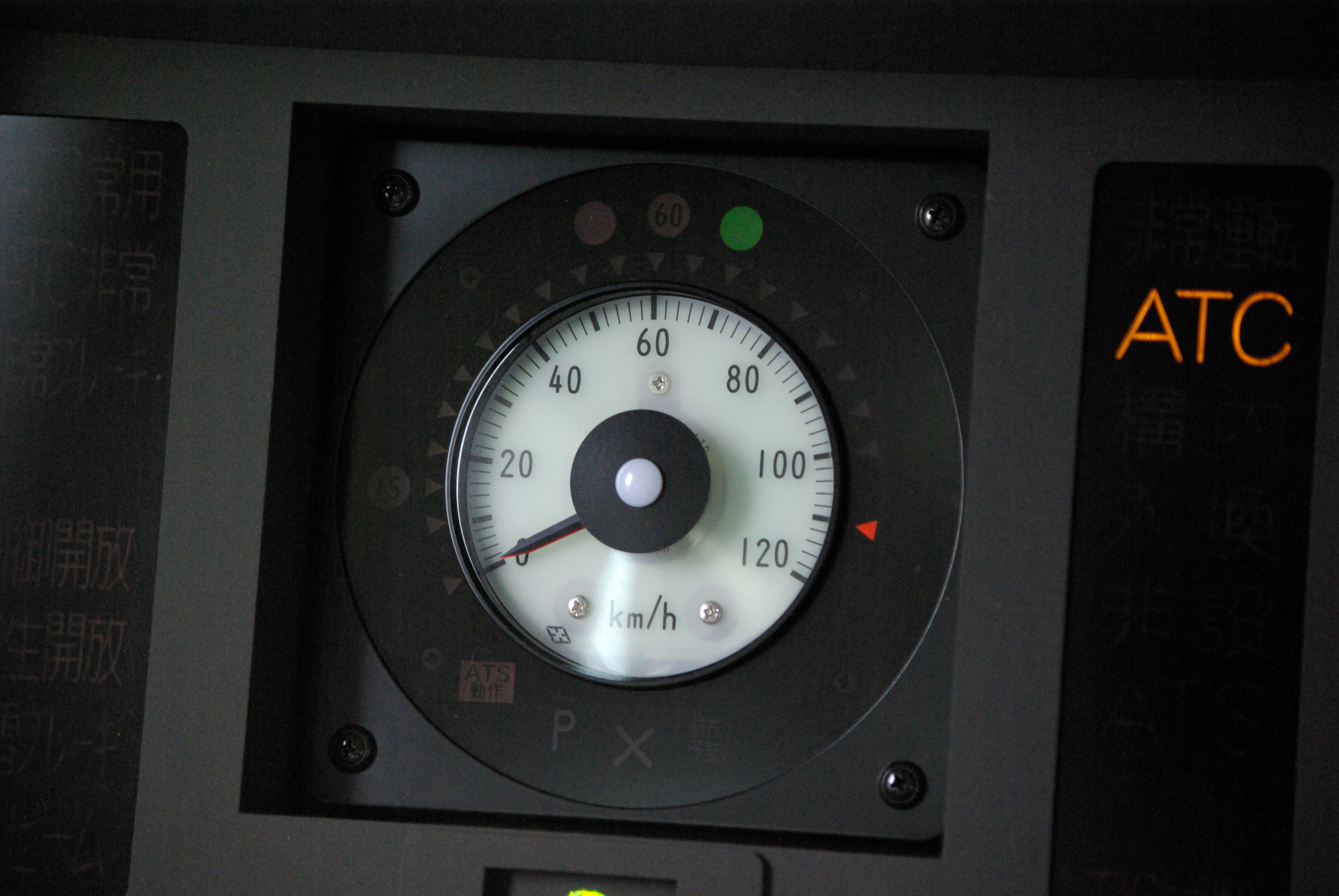
Automatic train control (ATC) is a general class of train protection systems for railways that involves a speed control mechanism in response to external inputs. For example, a system could effect an emergency brake application if the driver does not react to a signal at danger. ATC systems tend to integrate various cab signalling technologies and they use more granular deceleration patterns in lieu of the rigid stops encountered with the older automatic train stop (ATS) technology. ATC can also be used with automatic train operation (ATO) and is usually considered to be the safety-critical part of a railway system. There have been numerous different safety systems referred to as "automatic train control" over time. The first experimental apparatus was installed on the Henley branch line in January 1906 by the Great Western Railway, although it would now be referred to as an automatic warning system (AWS) because the driver retained full command of braking. The term is especi ... [...More Info...] [...Related Items...] OR: [Wikipedia] [Google] [Baidu] |


