|
Lyttelton Road Tunnel Administration Building
The Lyttelton Road Tunnel Administration Building was built in the mid-1960s as an operational building for the Lyttelton road tunnel in Christchurch, New Zealand. The building was designed by architect Peter Beaven and is seen as significant in the development of New Zealand architecture. When the building was commissioned, the Christchurch Lyttelton Road Tunnel Authority wanted an impressive structure that would reflect the importance of the newly built tunnel connection into Christchurch. The site of the building was additionally significant in being at the Christchurch end of the Bridle Path (New Zealand), Bridle Path, where Canterbury's first settlers travelled along. The building and the adjoining canopy were badly damaged during the 2011 Christchurch earthquake, and as a result the canopy was demolished and the building closed. The building itself was demolished in 2013. References {{Christchurch earthquakes Heritage New Zealand Category 1 historic places in Cante ... [...More Info...] [...Related Items...] OR: [Wikipedia] [Google] [Baidu] |
Heathcote Valley
Heathcote Valley is a suburb of Christchurch, New Zealand. It is named after Sir William Heathcote, who was secretary of the Canterbury Association. Location Nestled at the foot of the steep volcanic crags that form the northern edge of the hills, some southeast of the city centre the Heathcote Valley is dominated by the approaches to the Lyttelton road tunnel, a major arterial that passes through the Port Hills. The road is part of the State Highway 74 network. The Main South Railway line also passes through the suburb, before entering the Lyttelton rail tunnel that connects with the port of Lyttelton. Heathcote Valley is the lower terminus of the Christchurch Gondola, which goes up to Mount Cavendish on the Port Hills, and also for the Bridle Path walking track over the northern rim of the Lyttelton volcano to the port of Lyttelton. History In the past the Heathcote Valley was known for its orchards, brickworks and maltworks. The distinctive towers of the Canterbu ... [...More Info...] [...Related Items...] OR: [Wikipedia] [Google] [Baidu] |
Christchurch
Christchurch ( ; mi, Ōtautahi) is the largest city in the South Island of New Zealand and the seat of the Canterbury Region. Christchurch lies on the South Island's east coast, just north of Banks Peninsula on Pegasus Bay. The Avon River / Ōtākaro flows through the centre of the city, with an urban park along its banks. The city's territorial authority population is people, and includes a number of smaller urban areas as well as rural areas. The population of the urban area is people. Christchurch is the second-largest city by urban area population in New Zealand, after Auckland. It is the major urban area of an emerging sub-region known informally as Greater Christchurch. Notable smaller urban areas within this sub-region include Rangiora and Kaiapoi in Waimakariri District, north of the Waimakariri River, and Rolleston and Lincoln in Selwyn District to the south. The first inhabitants migrated to the area sometime between 1000 and 1250 AD. They hunted moa, ... [...More Info...] [...Related Items...] OR: [Wikipedia] [Google] [Baidu] |
NZ Transport Agency
Waka Kotahi NZ Transport Agency (commonly known as Waka Kotahi, and abbreviated as NZTA) is a New Zealand Crown entity tasked with promoting safe and functional transport by land, including the responsibility for driver and vehicle licensing, and administering the New Zealand state highway network. It was created on 1 August 2008 by the Land Transport Management Amendment Act 2008, merging Transit New Zealand with Land Transport New Zealand. Its legal name, as established by the Act, is New Zealand Transport Agency, but it trades as ''Waka Kotahi'' ''NZ Transport Agency''., superseded by The Māori part of the name, ''Waka Kotahi'', means "one vessel" and is intended to convey the concept of "travelling together as one". Public data access The Transport Agency stores registration, licensing and warrant of fitness details for any road-registered vehicle within New Zealand, including cars, motorbikes, trailers, trucks and earthmoving or agricultural machinery. Any member of ... [...More Info...] [...Related Items...] OR: [Wikipedia] [Google] [Baidu] |
Peter Beaven
Peter may refer to: People * List of people named Peter, a list of people and fictional characters with the given name * Peter (given name) ** Saint Peter (died 60s), apostle of Jesus, leader of the early Christian Church * Peter (surname), a surname (including a list of people with the name) Culture * Peter (actor) (born 1952), stage name Shinnosuke Ikehata, Japanese dancer and actor * ''Peter'' (album), a 1993 EP by Canadian band Eric's Trip * ''Peter'' (1934 film), a 1934 film directed by Henry Koster * ''Peter'' (2021 film), Marathi language film * "Peter" (''Fringe'' episode), an episode of the television series ''Fringe'' * ''Peter'' (novel), a 1908 book by Francis Hopkinson Smith * "Peter" (short story), an 1892 short story by Willa Cather Animals * Peter, the Lord's cat, cat at Lord's Cricket Ground in London * Peter (chief mouser), Chief Mouser between 1929 and 1946 * Peter II (cat), Chief Mouser between 1946 and 1947 * Peter III (cat), Chief Mouser between 1947 ... [...More Info...] [...Related Items...] OR: [Wikipedia] [Google] [Baidu] |
NZIA Gold Medal
The New Zealand Institute of Architects Gold Medal is an award presented annually by the Te Kāhui Whaihanga New Zealand Institute of Architects (NZIA) to a New Zealand architect. History From 1927 until 1977 a gold, silver or bronze prize was awarded each for the design of a public building and was judged by the Royal institute of British Architects. In 1978 a "National Award" replaced the Gold Medal. The Gold Medal was reintroduced in 1999 and was awarded to an architect who, over a period of time, made an outstanding contribution to the practice of architecture, as demonstrated through the production of a consistently high-quality body of work. Recipients (1927 to 1956) Recipients (1999 to 2021) References {{Reflist Architecture awards Awards established in 1927 New Zealand awards Architecture in New Zealand * ... [...More Info...] [...Related Items...] OR: [Wikipedia] [Google] [Baidu] |
New Zealand Institute Of Architects
Te Kāhui Whaihanga New Zealand Institute of Architects (NZIA) is a membership-based professional organisation that represents 90 per cent of all registered architects in New Zealand, and promotes architecture that enhances the New Zealand living environment. The organisation was founded in 1905, and provides services to New Zealand architects, such as ongoing professional training, policies and guidelines to promote high quality architectural practice, events and general support for the architectural profession in New Zealand. New Zealand Architecture Awards The Institute also functions to celebrate outstanding architecture, in part by presenting annual awards for excellence in architecture. These annual awards are named the New Zealand Architecture Awards, and have been sponsored by Resene paints since 1990. The awards programme consists of Local Awards, run by each of the Institute's eight branches, and New Zealand Awards, a national level distinction. From 2016, the NZ ... [...More Info...] [...Related Items...] OR: [Wikipedia] [Google] [Baidu] |
Lyttelton Road Tunnel
The Lyttelton road tunnel runs through the Port Hills to connect the New Zealand city of Christchurch and its seaport, Lyttelton. It opened in 1964 and carries just over 10,000 vehicles per day as part of State Highway 74. At , it was the longest road tunnel in New Zealand from its opening until 2 July 2017, when it was superseded by the Waterview Tunnels. While the tunnel itself was not damaged due to the February 2011 Christchurch earthquake, the Heathcote tunnel canopy was destroyed. The nearby Tunnel Control Building — a Category I heritage building – suffered significant damage and was closed, before finally being demolished in 2013. Construction of a new control building was completed in 2014. History Early settler efforts When the first Europeans settled in Canterbury in the 1850s with no deepwater ports available other than on Banks Peninsula, they had to transport their produce from the plains to Heathcote, near Sumner. From there it was taken by longboat ... [...More Info...] [...Related Items...] OR: [Wikipedia] [Google] [Baidu] |
New Zealand
New Zealand ( mi, Aotearoa ) is an island country in the southwestern Pacific Ocean. It consists of two main landmasses—the North Island () and the South Island ()—and over 700 List of islands of New Zealand, smaller islands. It is the List of island countries, sixth-largest island country by area, covering . New Zealand is about east of Australia across the Tasman Sea and south of the islands of New Caledonia, Fiji, and Tonga. The country's varied topography and sharp mountain peaks, including the Southern Alps, owe much to tectonic uplift and volcanic eruptions. New Zealand's Capital of New Zealand, capital city is Wellington, and its most populous city is Auckland. The islands of New Zealand were the last large habitable land to be settled by humans. Between about 1280 and 1350, Polynesians began to settle in the islands and then developed a distinctive Māori culture. In 1642, the Dutch explorer Abel Tasman became the first European to sight and record New Zealand. ... [...More Info...] [...Related Items...] OR: [Wikipedia] [Google] [Baidu] |
Bridle Path (New Zealand)
The Bridle Path is a steep shared-use track that traverses the northern rim of the Lyttelton volcano connecting the port of Lyttelton with the city of Christchurch in the South Island of New Zealand. It is a popular walking and mountain biking route. The track ascends from the port itself to a height of before descending again via Heathcote Valley to Christchurch. At the summit, next to the Summit Road, is a stone shelter with covered seats that is a 1940 New Zealand centennial memorial to the Pioneer Women of Canterbury. There are also seven commemorative stone seats placed along the Bridle Path; most of these were built for the 1950 Canterbury centenary celebrations. Hastily constructed in late 1850, just in time for the first Canterbury Association settlers to use, it was the most direct way to travel from the port to the new settlements on the plains on the northern side of the Port Hills. Although very steep, it was the primary means of traversing the hills until the ''Su ... [...More Info...] [...Related Items...] OR: [Wikipedia] [Google] [Baidu] |
2011 Christchurch Earthquake
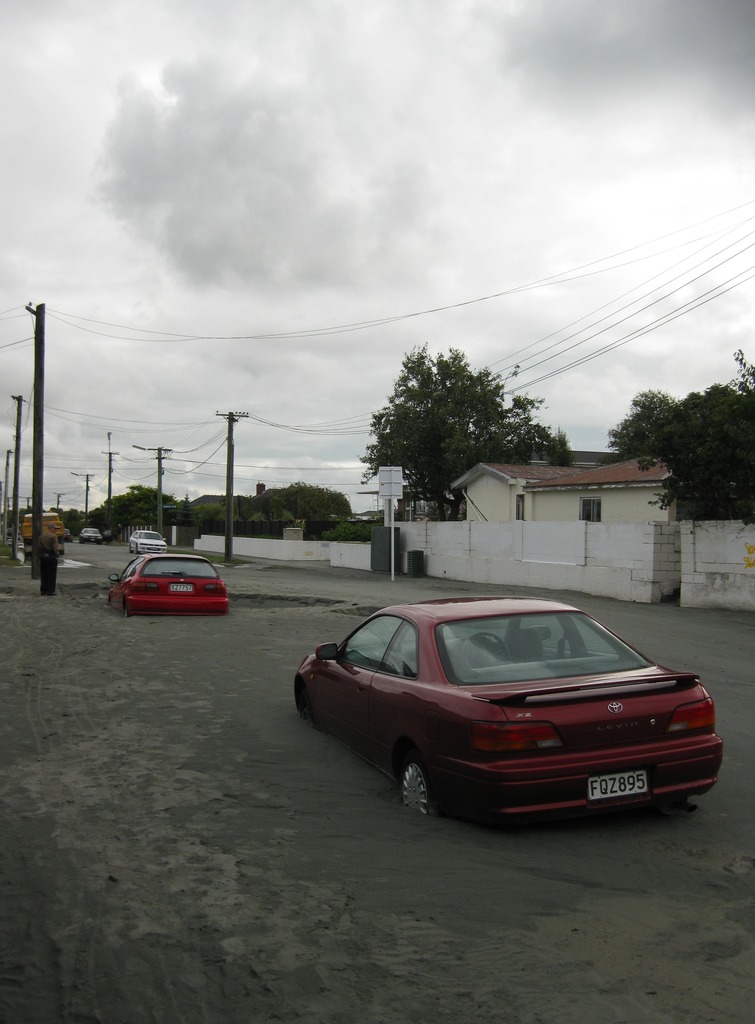
A major earthquake occurred in Christchurch on Tuesday 22 February 2011 at 12:51 p.m. local time (23:51 UTC, 21 February). The () earthquake struck the entire of the Canterbury region in the South Island, centred south-east of the central business district. It caused widespread damage across Christchurch, killing 185 people, in New Zealand's fifth-deadliest disaster. Christchurch's central city and eastern suburbs were badly affected, with damage to buildings and infrastructure already weakened by the magnitude 7.1 Canterbury earthquake of 4 September 2010 and its aftershocks. Significant liquefaction affected the eastern suburbs, producing around 400,000 tonnes of silt. The earthquake was felt across the South Island and parts of the lower and central North Island. While the initial quake only lasted for approximately 10 seconds, the damage was severe because of the location and shallowness of the earthquake's focus in relation to Christchurch as well ... [...More Info...] [...Related Items...] OR: [Wikipedia] [Google] [Baidu] |


