|
Lynn (MBTA Station)
Lynn station (signed as Central Square–Lynn) is an intermodal transit station in downtown Lynn, Massachusetts. It is a station on the MBTA Commuter Rail Newburyport/Rockport Line and a hub for the MBTA bus system. Service on the Eastern Railroad through Lynn began on August 27, 1838. The original wooden station was replaced by a larger structure in 1848, and the Saugus Branch began serving Lynn in 1855. In the "Great Lynn Depot War", a local disagreement in 1865 about where to place a replacement station became a major court case. It ended in 1872 with the construction of stations at two closely spaced sites, though one was soon torn down. The other station burned in 1889; it was replaced in 1895 by a depot with a large clock tower. The Boston and Maine Railroad (B&M), which had acquired the Eastern in 1883, began a grade separation project through Lynn in 1909 – part of an attempt to quadruple-track the whole line. Completed in 1914, it expanded the station to four trac ... [...More Info...] [...Related Items...] OR: [Wikipedia] [Google] [Baidu] |
Lynn, Massachusetts
Lynn is the eighth-largest List of municipalities in Massachusetts, municipality in Massachusetts, United States, and the largest city in Essex County, Massachusetts, Essex County. Situated on the Atlantic Ocean, north of the Boston city line at Suffolk Downs, Lynn is part of Greater Boston's urban inner core and is a major economic and cultural center of the North Shore (Massachusetts), North Shore. Settled by Europeans in 1629, Lynn is the 5th oldest colonial settlement in the Commonwealth. An early industrial center, Lynn was long colloquially referred to as the "City of Sin", owing to its historical reputation for crime and vice. Today, however, the city is known for its immigrant population, National Register of Historic Places listings in Lynn, Massachusetts, historic architecture, downtown cultural district, loft-style apartments, and public parks and open spaces, which include the oceanfront Lynn Shore Reservation; the 2,200-acre, Frederick Law Olmsted-designed Lynn Wo ... [...More Info...] [...Related Items...] OR: [Wikipedia] [Google] [Baidu] |
Panic Of 1837
The Panic of 1837 was a financial crisis in the United States that began a major depression (economics), depression which lasted until the mid-1840s. Profits, prices, and wages dropped, westward expansion was stalled, unemployment rose, and pessimism abounded. The panic had both domestic and foreign origins. Speculation, Speculative lending practices in the West, a sharp decline in cotton prices, a collapsing land bubble, international Bullion coin, specie flows, and restrictive lending policies in Britain were all factors. The lack of a central bank to regulate fiscal matters, which President Presidency of Andrew Jackson, Andrew Jackson had ensured by not extending the charter of the Second Bank of the United States, was also key. The ailing economy of early 1837 led investors to panic, and a bank run ensued, giving the crisis its name. The bank run came to a head on May 10, 1837, when banks in New York City ran out of gold and silver. They immediately suspended hard money (p ... [...More Info...] [...Related Items...] OR: [Wikipedia] [Google] [Baidu] |
Massachusetts Route 107
Route 107 is a north–south Massachusetts state route located along the North Shore of Massachusetts. Route 107 runs from Route 16 in Revere to Route 1A at the Essex Bridge in Salem. Route description Route 107 begins in Revere at an interchange with Route 16 (the Revere Beach Parkway) just north of the Chelsea town line. The route serves as Broadway, the main street through the city of Revere. The route intersects Route 60 at Brown Circle. From the rotary, the route becomes a limited access highway through the Rumney Marsh Reservation as the Salem Turnpike, entering Saugus over the Pines River. It continues as an expressway for roughly 2.2 miles until just before the Saugus River, where the road enters Lynn via the Belden Bly Bridge. In Lynn, Route 107 becomes Western Avenue, immediately passing the General Electric River Works. The route continues through the city, passing the western end of Lynn Commons before intersecting Route 129. The route passe ... [...More Info...] [...Related Items...] OR: [Wikipedia] [Google] [Baidu] |
Revere, Massachusetts
Revere (, ) is a city in Suffolk County, Massachusetts. Located approximately northeast of Downtown Boston, Revere is the terminus of the Blue Line (MBTA), MBTA Blue Line, with three stations located within the city: Wonderland station, Wonderland, Revere Beach station, Revere Beach, and Beachmont station, Beachmont. The city borders Massachusetts Bay, and was the site of the Battle of Chelsea Creek. Revere Beach, a three mile (4.8 km) stretch of beach on the city's eastern coast, is the oldest public beach in the United States. Revere is one of the oldest communities in the United States. Originally known as Rumney Marsh, in reference to the 600-acre salt marsh located within the Saugus, Massachusetts, Saugus and Pines River Inlet, present-day Revere was part of Boston from 1632 until 1739, when it became part of Chelsea. Revere and neighboring, present-day Winthrop, Massachusetts, Winthrop separated from Chelsea, Massachusetts, Chelsea and were established as the town of North ... [...More Info...] [...Related Items...] OR: [Wikipedia] [Google] [Baidu] |
Chelsea, Massachusetts
Chelsea is a city in Suffolk County, Massachusetts Suffolk County ( ) is located in the Commonwealth of Massachusetts, in the United States. As of the 2020 census, the population was 797,936, making it the fourth-most populous county in Massachusetts. The county comprises the cities of Boston ..., United States, which sits across the Mystic River from Boston. The 2020 United States census, 2020 census reported Chelsea as having a population of 40,787, thereby making it the List of United States cities by population density, third most densely populated city in Massachusetts. With a total area of , Chelsea is the smallest city in Massachusetts in terms of total area. History Prehistory The area of Chelsea was first called Winnisimmet, possibly meaning "swamp hill", by the Naumkeag people, Naumkeag tribe, which had lived there for thousands of years. 17th and 18th centuries Samuel Maverick (colonist), Samuel Maverick became the first European to settle permanently in ... [...More Info...] [...Related Items...] OR: [Wikipedia] [Google] [Baidu] |
Charlestown, Massachusetts
Charlestown is the oldest Neighborhoods in Boston, neighborhood in Boston, Boston, Massachusetts, in the United States. Also called Mishawum by the Massachusett, it is located on a peninsula north of the Charles River, across from downtown Boston, and also adjoins the Mystic River and Boston Harbor waterways. Charlestown was laid out in 1629 by engineer Thomas Graves (engineer), Thomas Graves, one of its earliest settlers, during the reign of Charles I of England. It was originally a separate town and the first capital of the Massachusetts Bay Colony. Charlestown became a city in 1848 and was annexed by Boston on January 5, 1874. With that, it also switched from Middlesex County, Massachusetts, Middlesex County, to which it had belonged since 1643, to Suffolk County, Massachusetts, Suffolk County. It has had a substantial Irish Americans, Irish-American population since the migration of Irish people during the Great Irish Famine of the 1840s. Since the late 1980s, the neighborho ... [...More Info...] [...Related Items...] OR: [Wikipedia] [Google] [Baidu] |
Lynn And Boston Railroad
The Lynn and Boston Railroad was a streetcar railway chartered for operations between Boston and Lynn, Massachusetts in 1859. Following a number of acquisitions, the railway was a part of a 1901 street railway merger that formed the Boston and Northern Street Railway. The Thomson-Houston Electric Company developed and implemented electrification in Lynn on the Highland Circuit route of the Lynn & Boston, the List of streetcar systems in the United States#Massachusetts, first electrified streetcar in Massachusetts with regular electric service begun November 19, 1888.The Thomson-Houston Road at Lynn, Mass.', The Electrical World, December 8, 1888, page 303Electric Railway at Lynn, Mass.', Electric Power, January 1889, page 21 The electrified cars were able to ascend the steep 8% grade into the Lynn Highlands far easier than even a team of four horses. Acquisitions * Boston and Chelsea Railroad (leased in 1880) * East Middlesex Street Railway (leased in 1893) * Essex Electric Stre ... [...More Info...] [...Related Items...] OR: [Wikipedia] [Google] [Baidu] |
Horsecar
A horsecar, horse-drawn tram, horse-drawn streetcar (U.S.), or horse-drawn railway (historical), is a tram or streetcar pulled by a horse. Summary The horse-drawn tram (horsecar) was an early form of public transport, public rail transport, which developed out of wagonway, industrial haulage routes that had long been in existence, and from the Omnibus (Horse-drawn vehicle), horse-drawn omnibus routes that first ran on public streets in the 1820s, using the newly improved iron or steel rail or 'Tramway (industrial), tramway'. They were local versions of the stagecoach lines and picked up and dropped off passengers on a regular route, without the need to be pre-hired. Horsecars on tramlines were an improvement over the omnibus, because the low rolling resistance of metal wheels on iron or steel track (rail transport), rails (usually Rail profile#Grooved rail, grooved Tram#History, from 1852 on) allowed the horses to haul a greater load for a given effort than the omnibus, and ga ... [...More Info...] [...Related Items...] OR: [Wikipedia] [Google] [Baidu] |
Everett, Massachusetts
Everett is a city in Middlesex County, Massachusetts, United States, directly north of Boston, bordering the neighborhood of Charlestown. The population was 49,075 at the time of the 2020 United States census. Everett was the last city in the United States to have a bicameral legislature, which was composed of a seven-member Board of Aldermen and an eighteen-member Common Council. On November 8, 2011, the voters approved a new City Charter that changed the City Council to a unicameral body with eleven members – six ward councilors and five councilors-at-large. The new City Council was elected during the 2013 City Election. History Everett was originally part of Charlestown, and later Malden. It separated from Malden in 1870. The community was named after Edward Everett, who served as U.S. Representative, U.S. Senator, the 15th Governor of Massachusetts, Minister to Great Britain, and United States Secretary of State. He also served as President of Harvard Universi ... [...More Info...] [...Related Items...] OR: [Wikipedia] [Google] [Baidu] |
Lynnfield, Massachusetts
Lynnfield is a town in Essex County, Massachusetts, United States. At the 2020 census, the town population was 13,000. Lynnfield initially consisted of two distinct villages with a single governing body. Lynnfield Center had a mostly agricultural population, while South Lynnfield had a mixed culture. Together, the two towns evolved into one of the most prosperous suburbs in the North Shore region of Massachusetts. History The town of Lynnfield was first settled in 1638 and was made a district separate from Lynn in 1782. It was later officially incorporated in 1814. Historically, Lynnfield functioned as two separate villages connected by one governing body: in Lynnfield Center resided a mostly agricultural population, while South Lynnfield was a crossroad situated amongst neighboring larger towns. During this time, the town had two inns, a granite rock quarry, a small, carbonated beverage bottler, and various eating institutions. The stagecoach line north from Boston to Port ... [...More Info...] [...Related Items...] OR: [Wikipedia] [Google] [Baidu] |
Saugus, Massachusetts
Saugus is a New England town, town in Essex County, Massachusetts, United States, in the Greater Boston area. The population was 28,619 at the 2020 United States census, 2020 census. Saugus is known as the site of the first integrated iron works in North America. History Native Americans inhabited the area around Saugus for thousands of years before the arrival of European settlers in the 1620s. At the time of European arrival, the Naumkeag people, Naumkeag, also known as Pawtucket, under the leadership of Montowampate were based near present-day Saugus and controlled land extending from what is now Boston to the Merrimack River. English settlers took the name ''Sagus'' or ''Saugus'' from the Pawtucket word for "outlet", and used the term to refer to the Saugus River and the region that includes the present day cities and towns of Swampscott, Massachusetts, Swampscott, Nahant, Massachusetts, Nahant, Lynn, Massachusetts, Lynn, Lynnfield, Massachusetts, Lynnfield, Reading, Massac ... [...More Info...] [...Related Items...] OR: [Wikipedia] [Google] [Baidu] |
Train Shed
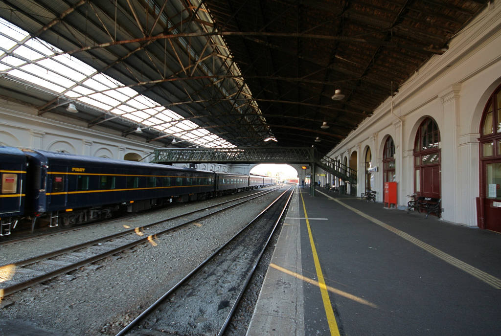
A train shed is a building adjacent to a station building where the tracks and platforms of a railway station are covered by a roof. It is also known as an overall roof. Its primary purpose is to store and protect from the elements train cars not in use, The first train shed was built in 1830 at Liverpool's Crown Street railway station, Crown Street Station. The biggest train sheds were often built as an arch of glass and iron, while the smaller were built as normal pitched roofs. The train shed with the biggest single span ever built was that at the second Broad Street Station (Philadelphia), Philadelphia Broad Street Station, built in 1891. Types of train shed Early wooden train sheds The earliest train sheds were wooden structures, often with unglazed openings to allow smoke and steam to escape. The oldest part of Bristol Temple Meads railway station, Bristol Temple Meads is a particularly fine – and large – example, designed by Isambard Kingdom Brunel with mock-ha ... [...More Info...] [...Related Items...] OR: [Wikipedia] [Google] [Baidu] |


