|
Lough Derravaragh
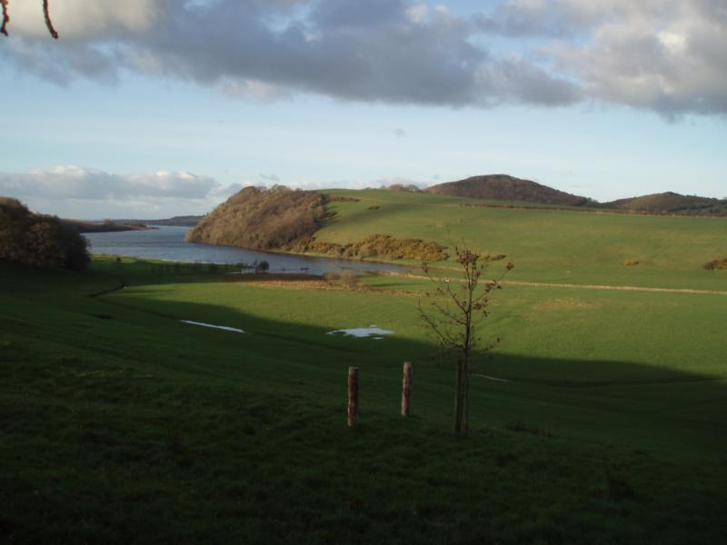
Lough Derravaragh ( ga, Loch Dairbhreach) is a lake in County Westmeath, Ireland, north of Mullingar between Castlepollard, Crookedwood and Multyfarnham. Lough Derravaragh sits on the River Inny which flows from Lough Sheelin on its way to the River Shannon. It is a popular lake for angling and other watersports. History There are ringforts to the east of Lough Derravaragh, within the hills of Ranaghan. Turgesius the Viking, renowned for taking Dublin, also possessed strongholds nearby, southwest of Lough Lene. Knockeyon, the hill of Saint Eyon, is located on the south-eastern shore of the lough, rising steeply to 215 metres. Halfway up the hill are the ruins of the ancient Saint Cauragh chapel, built and dedicated to Saint Eyon. The ruins of Saint Cauragh's Well are adjacent to the chapel. On the Kiltoom side of the lough mounds of stone can be found, these were part of artificial islands and gave protection to the people who lived in crannógs on these islands. ... [...More Info...] [...Related Items...] OR: [Wikipedia] [Google] [Baidu] |
County Westmeath
"Noble above nobility" , image_map = Island of Ireland location map Westmeath.svg , subdivision_type = Country , subdivision_name = Ireland , subdivision_type1 = Province , subdivision_name1 = , subdivision_type2 = Region , subdivision_name2 = Eastern and Midland , seat_type = County town , seat = Mullingar , parts_type = Largest settlement , parts = Athlone , leader_title = Local authority , leader_name = Westmeath County Council , leader_title2 = Dáil constituencies , leader_name2 = , leader_title3 = EP constituency , leader_name3 = Midlands–North-West , area_total_km2 = 1840 , area_rank = 21st , population_total = 95,840. , population_as_of = 2022 , population_footnotes = , population_density_km2 = auto , population_rank = 22nd , blank_ ... [...More Info...] [...Related Items...] OR: [Wikipedia] [Google] [Baidu] |
Lough Lene
Lough Lene ( Irish: ''Loch Léinn'') is a lake situated in north County Westmeath, Ireland, between the villages of Castlepollard, Collinstown and Fore. It possesses a rich and varied history. It also boasts the existence of prehistoric burial sites, old ruins, many ancient village-type communal circular dwellings locally called ringforts, stiles, and mass paths. Lough Lene also has claims to being the home to kings and Vikings, such as Turgesius who had one of his forts upon the hill on the southwest overlooking the lake from the Ranaghan side, before being killed by Máel Sechnaill mac Maíl Ruanaid. Legend & history The name of the lake has appeared in a variety of ways including Lane, Léin and Leibhinn. Sir Henry Piers believed the lake's name translated as Lake of Learning, tying in with his translation of Fore as the Town of Books. However, other sources seem more inclined to the tradition that the lake was named after the daughter of the fabled Manannán mac Lir (s ... [...More Info...] [...Related Items...] OR: [Wikipedia] [Google] [Baidu] |
Abbey Of Kells
The Abbey of Kells (''Mainistir Cheanannais'' in Irish) is a former monastery in Kells, County Meath, Ireland, north of Dublin. It was founded in the early 9th century, and the Book of Kells was kept there during the later medieval and early modern periods before finally leaving the abbey in the 1650s. Much of the Book of Kells may have been created there, but historians cannot be certain of the exact date and circumstances of its creation. History The Abbey of Kells was reportedly founded by St. Columba ca. 554, after High King Diarmuid Mac Caroll of Tara granted the land. The Abbey was refounded from Iona, the building taking from 807 until the consecration of the church in 814. The site was a former Irish hill fort. In 814, Cellach, Abbot of Iona, retired to Kells, but, contrary to what is sometimes claimed, it is clear from the ''Annals'' that Iona remained the main Columban house for several decades, despite the danger of Viking raids. Only in 878 were the main relic ... [...More Info...] [...Related Items...] OR: [Wikipedia] [Google] [Baidu] |
Columcille
Columba or Colmcille; gd, Calum Cille; gv, Colum Keeilley; non, Kolban or at least partly reinterpreted as (7 December 521 – 9 June 597 AD) was an Irish abbot and missionary evangelist credited with spreading Christianity in what is today Scotland at the start of the Hiberno-Scottish mission. He founded the important abbey on Iona, which became a dominant religious and political institution in the region for centuries. He is the patron saint of Derry. He was highly regarded by both the Gaels of Dál Riata and the Picts, and is remembered today as a Catholic saint and one of the Twelve Apostles of Ireland. Columba studied under some of Ireland's most prominent church figures and founded several monasteries in the country. Around 563 AD he and his twelve companions crossed to Dunaverty near Southend, Argyll, in Kintyre before settling in Iona in Scotland, then part of the Ulster kingdom of Dál Riata, where they founded a new abbey as a base for spreading Celtic Christian ... [...More Info...] [...Related Items...] OR: [Wikipedia] [Google] [Baidu] |
Erris
Erris is a barony in northwestern County Mayo in Ireland consisting of over , much of which is mountainous blanket bog. It has extensive sea coasts along its west and north boundaries. The main towns are Belmullet and Bangor Erris. The name Erris derives from the Irish 'Iar Ros' meaning 'western promontory'. The full name is the Iorrais Domnann, after the Fir Bolg tribe, the Fir Domnann. To its north is the wild Atlantic Ocean and the bays of Broadhaven and Sruth Fada Conn and to its west is Blacksod Bay. Its main promontories are the Doohoma Peninsula, Mullet Peninsula, Erris Head, the Dún Chiortáin and Dún Chaocháin peninsulas and Benwee Head. There are five Catholic parishes in Erris: Kilcommon, Kilmore, Kiltane, Belmullet and Ballycroy. Gaeltacht Parts of Erris are in a Gaeltacht area, with first-language speakers of Irish in the following areas of the barony: An Fál Mór, Tamhaiin na hUltaí, Glais, Eachléim, Tearmann, Tránn, An Mullach Rua, Ca ... [...More Info...] [...Related Items...] OR: [Wikipedia] [Google] [Baidu] |
Atlantic Ocean
The Atlantic Ocean is the second-largest of the world's five oceans, with an area of about . It covers approximately 20% of Earth#Surface, Earth's surface and about 29% of its water surface area. It is known to separate the "Old World" of Africa, Europe and Asia from the "New World" of the Americas in the European perception of Earth, the World. The Atlantic Ocean occupies an elongated, S-shaped basin extending longitudinally between Europe and Africa to the east, and North America, North and South America to the west. As one component of the interconnected World Ocean, it is connected in the north to the Arctic Ocean, to the Pacific Ocean in the southwest, the Indian Ocean in the southeast, and the Southern Ocean in the south (other definitions describe the Atlantic as extending southward to Antarctica). The Atlantic Ocean is divided in two parts, by the Equatorial Counter Current, with the North(ern) Atlantic Ocean and the South(ern) Atlantic Ocean split at about 8th paralle ... [...More Info...] [...Related Items...] OR: [Wikipedia] [Google] [Baidu] |
Scotland
Scotland (, ) is a country that is part of the United Kingdom. Covering the northern third of the island of Great Britain, mainland Scotland has a border with England to the southeast and is otherwise surrounded by the Atlantic Ocean to the north and west, the North Sea to the northeast and east, and the Irish Sea to the south. It also contains more than 790 islands, principally in the archipelagos of the Hebrides and the Northern Isles. Most of the population, including the capital Edinburgh, is concentrated in the Central Belt—the plain between the Scottish Highlands and the Southern Uplands—in the Scottish Lowlands. Scotland is divided into 32 administrative subdivisions or local authorities, known as council areas. Glasgow City is the largest council area in terms of population, with Highland being the largest in terms of area. Limited self-governing power, covering matters such as education, social services and roads and transportation, is devolved from the ... [...More Info...] [...Related Items...] OR: [Wikipedia] [Google] [Baidu] |
Straits Of Moyle
The North Channel (known in Irish and Scottish Gaelic as , in Scots as the ) is the strait between north-eastern Northern Ireland and south-western Scotland. It begins north of the Isle of Man, where the Irish Sea ends, and runs north-west into the Atlantic Ocean. Geography The North Channel connects the Irish Sea with the Atlantic Ocean and is part of the marine area officially classified as the "Inner Seas off the West Coast of Scotland" by the International Hydrographic Organization (IHO). The Straits of Moyle ( in Irish and Scottish Gaelic) or Sea of Moyle is the name given to the narrowest expanse of sea in the North Channel between north-eastern Northern Ireland (County Antrim) and south-western highlands of Scotland (Mull of Kintyre). The distance between the two shores is approximately at its closest point, and thus it is possible to see across in clear weather conditions. The straits gave their name to Moyle District Council, a local government area in Northern Ir ... [...More Info...] [...Related Items...] OR: [Wikipedia] [Google] [Baidu] |
Children Of Lir
The ''Children of Lir'' ( ga, Oidheadh chloinne Lir) is a legend from Irish mythology. It is a tale from the post-Christianisation period that mixes magical elements such as druidic wands and spells with a Christian message of Christian faith bringing freedom from suffering. Naming and manuscripts Named in Irish as ''Oidheadh Chlainne Lir'', the tale is today often known simply as "The Children of Lir" but the title has also been rendered as ''The Tragic Story of the Children of Lir'' or ''The Fate of the Children of Lir'', or, from the earlier title ''Aided Chlainne Lir'', as ''The Violent Death of the Children of Lir''.The English translation should properly be "The Children of Lear", Lir being a genitive, but the mistranslation has become culturally embedded. In post 18th-century scholarship, the tale has often been grouped with the ''Oidheadh chloinne Uisnigh'' ("The Fate of the Children of Uisnigh") and ''Oidheadh chloinne Tuireann'' ("The Fate of the Children of Tuirean ... [...More Info...] [...Related Items...] OR: [Wikipedia] [Google] [Baidu] |
Dug-out Canoe
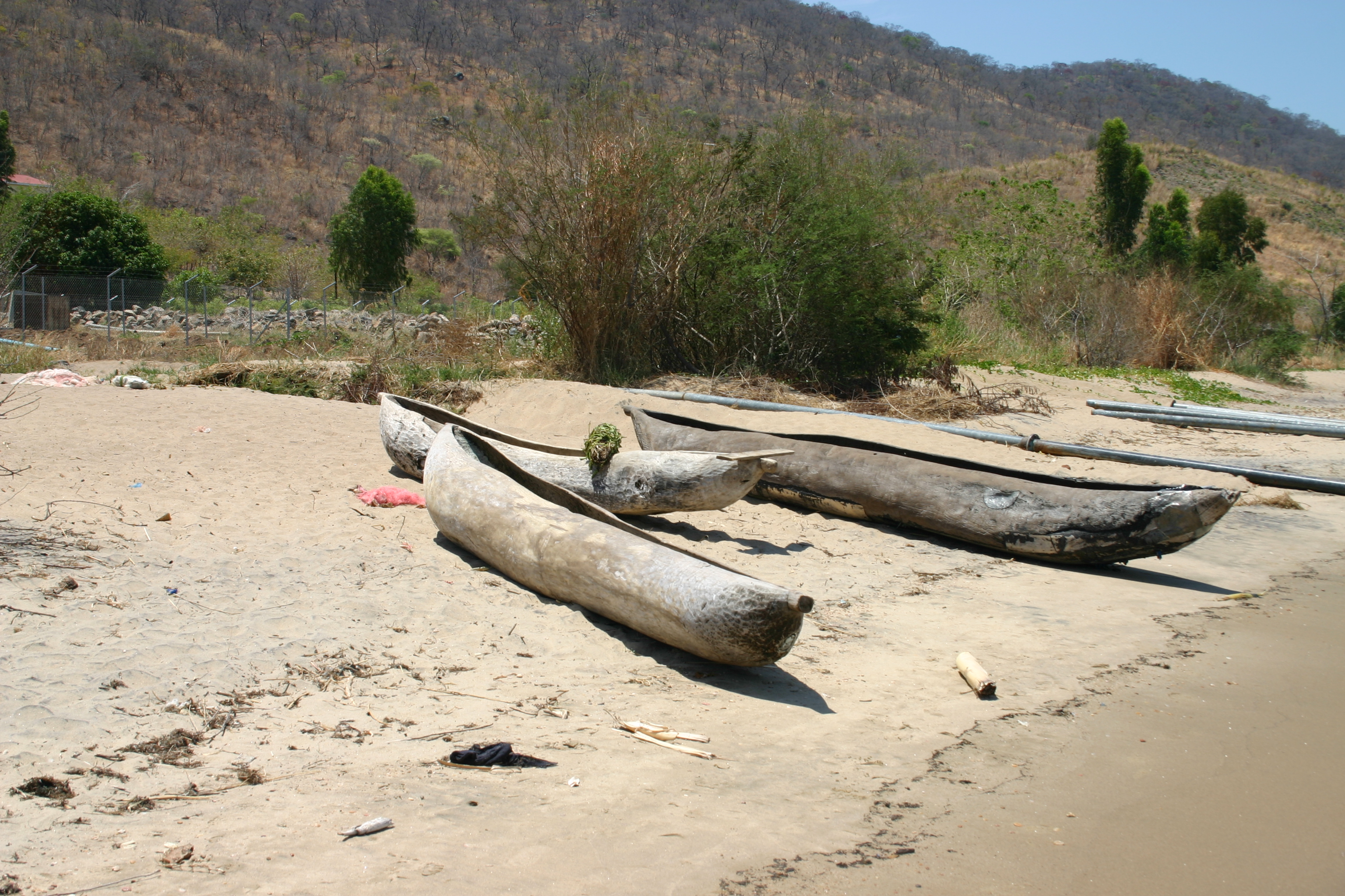
A dugout canoe or simply dugout is a boat made from a hollowed tree. Other names for this type of boat are logboat and monoxylon. ''Monoxylon'' (''μονόξυλον'') (pl: ''monoxyla'') is Greek – ''mono-'' (single) + '' ξύλον xylon'' (tree) – and is mostly used in classic Greek texts. In German, they are called Einbaum ("one tree" in English). Some, but not all, pirogues are also constructed in this manner. Dugouts are the oldest boat type archaeologists have found, dating back about 8,000 years to the Neolithic Stone Age. This is probably because they are made of massive pieces of wood, which tend to preserve better than others, such as bark canoes. Along with bark canoes and hide kayaks, dugouts were also used by Indigenous peoples of the Americas. Construction Construction of a dugout begins with the selection of a log of suitable dimensions. Sufficient wood must be removed to make the vessel relatively light in weight and buoyant, yet still strong enough ... [...More Info...] [...Related Items...] OR: [Wikipedia] [Google] [Baidu] |
Crannóg
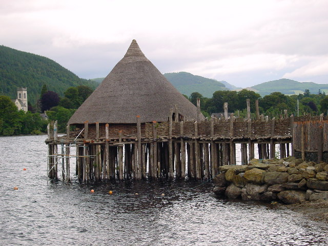
A crannog (; ga, crannóg ; gd, crannag ) is typically a partially or entirely artificial island, usually built in lakes and estuarine waters of Scotland, Wales, and Ireland. Unlike the prehistoric pile dwellings around the Alps, which were built on the shores and not inundated until later, crannogs were built in the water, thus forming artificial islands. Crannogs were used as dwellings over five millennia, from the European Neolithic Period to as late as the 17th/early 18th century. In Scotland there is no convincing evidence in the archaeological record of Early and Middle Bronze Age or Norse Period use. The radiocarbon dating obtained from key sites such as Oakbank and Redcastle indicates at a 95.4 per cent confidence level that they date to the Late Bronze Age to Early Iron Age. The date ranges fall ''after'' around 800 BC and so could be considered Late Bronze Age by only the narrowest of margins. Crannogs have been variously interpreted as free-standing wooden struct ... [...More Info...] [...Related Items...] OR: [Wikipedia] [Google] [Baidu] |


.jpg)


