|
Lomná (river)
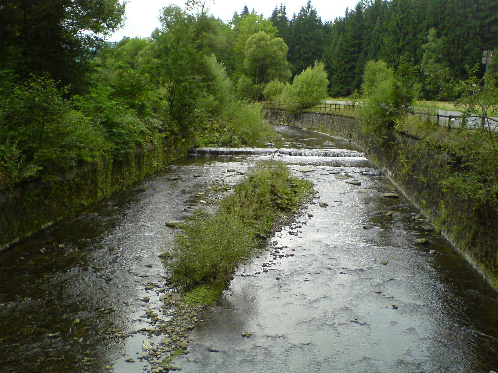
The Lomná () is a river in the Czech Republic, a left tributary of the Olza (river), Olza. It flows through the Moravian-Silesian Region. It is long. Etymology The name is derived from the Slavic word ''lom'', meaning 'turn', 'bend', but and earlier also 'clatter', 'rumble'. The name was first mentioned in 1592. Characteristic The Lomná originates in the territory of Horní Lomná in the Moravian-Silesian Beskids at an elevation of and flows to Jablunkov, where it merges with the Olza River at an elevation of . It is long. Its drainage basin has an area of . The average discharge at its mouth is 1.34 m3/s. The longest tributaries of the Lomná are: Course The river flows through the municipal territories of Horní Lomná, Dolní Lomná, Mosty u Jablunkova, Bocanovice and Jablunkov. Nature Most of the river flows through the Beskydy Protected Landscape Area. Among the protected species of fish living in the river are the common minnow and alpine bullhead. Part of the rive ... [...More Info...] [...Related Items...] OR: [Wikipedia] [Google] [Baidu] |
Jablunkov
Jablunkov (; , ) is a town in Frýdek-Místek District in the Moravian-Silesian Region of the Czech Republic. It has about 5,300 inhabitants. The town has a significant Polish minority in the Czech Republic, Polish minority. It is inhabited by a large amount of Silesian Gorals. Geography Jablunkov is located about southeast of Frýdek-Místek and southeast of Ostrava. It lies in the historical region of Cieszyn Silesia, and is the easternmost town of the country. It is located mainly in the Jablunkov Furrow lowland, but the municipal territory also extends to the Silesian Beskids on the east. The highest point is the hill Lysá at above sea level. Jablunkov lies at the confluence of the Olza (river), Olza and Lomná (river), Lomná rivers. History According to historians, the predecessor of Jablunkov is to be found in the place where the present-day village of Hrádek (Frýdek-Místek District), Hrádek or Nýdek is located. The first written mention of Jablunkov is from 1435 ... [...More Info...] [...Related Items...] OR: [Wikipedia] [Google] [Baidu] |
Dolní Lomná
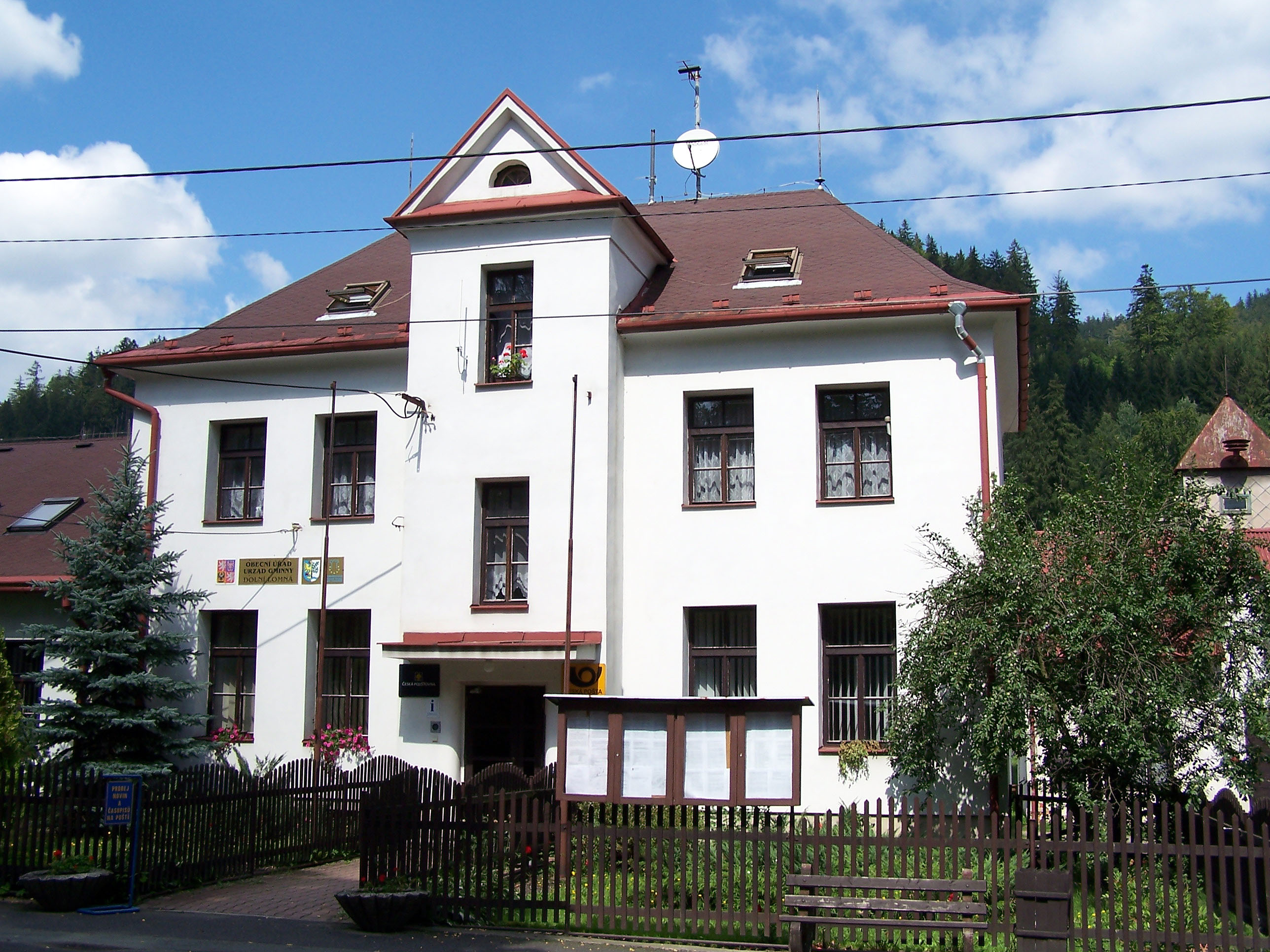
Dolní Lomná (, ) is a municipality and village in Frýdek-Místek District in the Moravian-Silesian Region of the Czech Republic. It has about 900 inhabitants. The municipality has a significant Polish minority. Etymology The name is borrowed from an older name of the Lomná River (mentioned in 1592 as ''Lomny''), which itself is derived from the word ''lom'' ("turn", "bend"). Geography Dolní Lomná is located about southeast of Frýdek-Místek and southeast of Ostrava, in the historical region of Cieszyn Silesia. The municipal territory borders Slovakia on the south. It lies in the Moravian-Silesian Beskids mountain range and within the Beskydy Protected Landscape Area. The highest point is near the top of the Kozubová mountain at above sea level. The Lomná River flows through the municipality. History The settlement on the territory of the village in the Lomná river valley in the Moravian-Silesian Beskids began in the middle of the 17th century. The village was fi ... [...More Info...] [...Related Items...] OR: [Wikipedia] [Google] [Baidu] |
Rivers Of The Moravian-Silesian Region
A river is a natural stream of fresh water that flows on land or inside caves towards another body of water at a lower elevation, such as an ocean, lake, or another river. A river may run dry before reaching the end of its course if it runs out of water, or only flow during certain seasons. Rivers are regulated by the water cycle, the processes by which water moves around the Earth. Water first enters rivers through precipitation, whether from rainfall, the runoff of water down a slope, the melting of glaciers or snow, or seepage from aquifers beneath the surface of the Earth. Rivers flow in channeled watercourses and merge in confluences to form drainage basins, or catchments, areas where surface water eventually flows to a common outlet. Rivers have a great effect on the landscape around them. They may regularly overflow their banks and flood the surrounding area, spreading nutrients to the surrounding area. Sediment or alluvium carried by rivers shapes the landscape ar ... [...More Info...] [...Related Items...] OR: [Wikipedia] [Google] [Baidu] |
List Of Rivers Of The Czech Republic
This is a list of rivers of the Czech Republic. Naming conventions Czech language distinguishes between large (river; in Czech '' řeka'') and small (stream, creek, brook; in Czech '' potok'') watercourses. River names are mostly self-standing one-word nouns. Stream names often consist of two words because they contain an adjective (usually stemming from physical properties (e.g. Černý potok – "black stream"), usage (e.g. Mlýnský potok – "mill stream") or derived from the location through which it flows (e.g. Rakovnický potok – "Rakovník stream"). These two-word names form an inseparable whole. Main rivers While the Elbe is the longest Czech-related river when measured through its overall length (i.e. including its lower course in Germany), its tributary the Vltava surpasses it as the longest river within the territory of the Czech Republic itself. (In fact the Vltava also carries more water than the Elbe at their confluence.) Hierarchical list This is a hierarchica ... [...More Info...] [...Related Items...] OR: [Wikipedia] [Google] [Baidu] |
Eurasian Otter
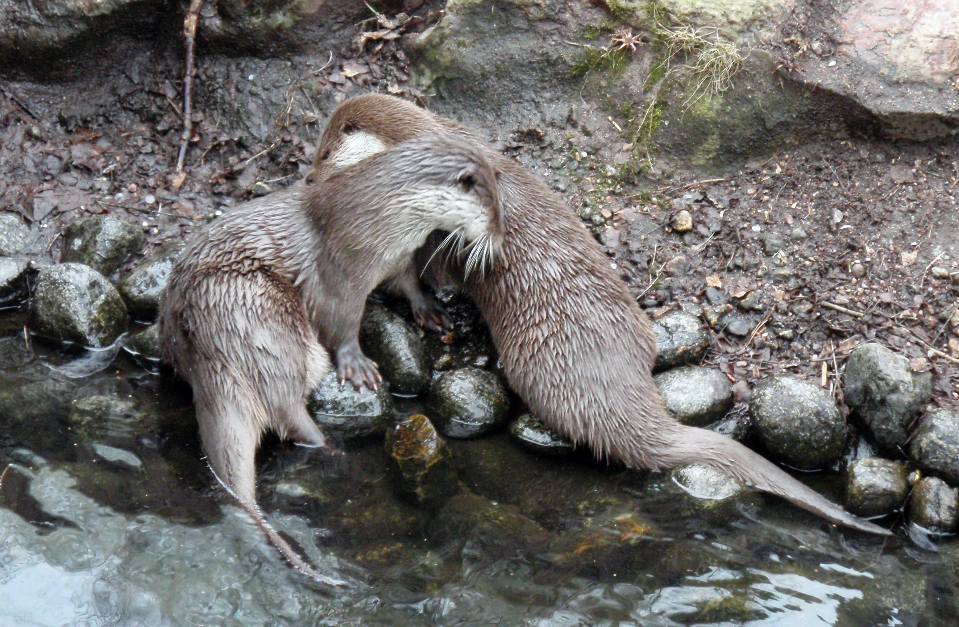
The Eurasian otter (''Lutra lutra''), also known as the European otter, Eurasian river otter, European river otter, common otter, and Old World otter, is a semiaquatic mammal native to Eurasia and the Maghreb. The most widely distributed member of the otter subfamily (Lutrinae) of the Mustelidae, weasel family (Mustelidae), it is found in the waterways and coasts of Europe, many parts of Asia, and parts of northern Africa. The Eurasian otter has a diet mainly of fish, and is strongly territorial. It is endangered in some parts of its range, but is recovering in others. Description The Eurasian otter is a typical species of the otter subfamily. Brown above and cream below, these long, slender creatures are well-equipped for their aquatic habits. Their bones show osteosclerosis, increasing their density to reduce buoyancy. This otter differs from the North American river otter by its shorter neck, broader visage, the greater space between the ears and its longer tail. However, the ... [...More Info...] [...Related Items...] OR: [Wikipedia] [Google] [Baidu] |
Alpine Bullhead
The alpine bullhead or Siberian bullhead (''Cottus poecilopus'') is a species of freshwater fish in the family Cottidae of sculpins. It is found in China, the Czech Republic, Denmark, Finland, Germany, North Korea, Moldova, Norway, Poland, Romania, Russia, Slovakia, Sweden, and Ukraine. This fish is listed as being of "Least Concern" by the IUCN. Description The alpine bullhead has a large broad head and tapering body, large fins and a rounded tail. It is light brown mottled with darker colour. The eyes are located near the top of the head. This fish resembles the European bullhead The European bullhead (''Cottus gobio'') is a freshwater fish that is widely distributed in Europe, mainly in rivers. It is a member of the family Cottidae, a type of sculpin. It is also known as the miller's thumb, freshwater sculpin, common bu ... and can occur in same streams with it. It can be told from the European bullhead by the fact that the innermost ray of its pelvic fins is shorter than ... [...More Info...] [...Related Items...] OR: [Wikipedia] [Google] [Baidu] |
Common Minnow
''Phoxinus phoxinus'' (known colloquially as the Eurasian minnow, minnow, Channel minnow, or common minnow) is a species of freshwater ray-finned fish belonging to the family Leuciscidae, which includes the daces, minnows and related fishes. It is the type species of genus '' Phoxinus''. This taxon was formerly considered to be the only species in the genus ''Phoxinus'' found in Europe and to have a wide geohraphic range in Eurasia, however, it is now regarded as part of a species complex with new species being described across its former range and this species being restricted to Western Europe. It occurs predominantly in cool () streams and well- oxygenated lakes and ponds. It is noted for being a gregarious species, shoaling in large numbers. Taxonomy ''Phoxinus phoxinus'' was first formally described as ''Cyprinus phoxinus'' by Carl Linnaeus in the 10th edition of ''Systema Naturae'' published in 1758 with its type locality given as the River Agger north of Lohmar at ... [...More Info...] [...Related Items...] OR: [Wikipedia] [Google] [Baidu] |
Beskydy Protected Landscape Area
Beskydy Protected Landscape Area (PLA) (, abbreviated as ''CHKO Beskydy'') is the largest PLA in the Czech Republic. The area is . Geography Beskydy PLA lies in the south-eastern part of the Moravian Silesian and eastern part of Zlín regions, on the border with Slovakia. All its area is located in the Outer Western Carpathians and comprises most of the Moravian-Silesian Beskids range, a large part of the Hostýn-Vsetín Mountains, and the Moravian part of the Javorníky range. In Slovakia, Kysuce Protected Landscape Area borders the area. Protection Beskydy PLA was declared on 5 March 1973 to protect the unique natural features of the area but also the aesthetic value of the area which is typical for its diversity of habitats developed over the centuries of human settlement: ridge-top meadows and pastures and hamlets scattered throughout the area. Many rare and protected plants and animals can be found in Beskydy PLA: there has been a stable population of Eurasian lynx (''Lynx ... [...More Info...] [...Related Items...] OR: [Wikipedia] [Google] [Baidu] |
Bocanovice
Bocanovice () is a municipality and village in Frýdek-Místek District in the Moravian-Silesian Region of the Czech Republic. It has about 500 inhabitants. The municipality has a significant Polish minority. Etymology The name is derived from Polish word '' bocian'' (meaning 'stork'). The storks hunted frogs that lived abundantly in the wetlands that used to be here. Geography Bocanovice is located about southeast of Frýdek-Místek and southeast of Ostrava. It is situated in the historical region of Cieszyn Silesia. The western part of the municipality lies in the Moravian-Silesian Beskids and the eastern part lies in the Jablunkov Furrow lowland. The highest point is at above sea level. The Lomná River forms the eastern municipal border. History The first written mention of Bocanovice is from 1597. It belonged then to the Duchy of Teschen. It was the princely court, where four families originally settled and cultivated the fields of the court and performed all farm work. ... [...More Info...] [...Related Items...] OR: [Wikipedia] [Google] [Baidu] |
Mosty U Jablunkova
Mosty u Jablunkova (until 1949 Mosty; , ) is a municipality and village in Frýdek-Místek District in the Moravian-Silesian Region of the Czech Republic. It has about 3,600 inhabitants. The municipality has a significant Polish minority in the Czech Republic, Polish minority. Etymology The name literally means "bridges near Jablunkov". It is connected with an ancient trade route passing through swamps and marshes in today's territory of the village. They were bridged by wooden beams and logs by the so-called ''mostors'' or ''mościorze'', who gave the village its name. Geography Mosty u Jablunkova is located about southeast of Frýdek-Místek and southeast of Ostrava. It lies in the historical region of Cieszyn Silesia on the border with Slovakia. The village is located in the Jablunkov Pass. The western half of the municipality lies in the Moravian-Silesian Beskids, the eastern part extends to the Jablunkov Intermontane region, and the northern part extends to the Jablunkov Fur ... [...More Info...] [...Related Items...] OR: [Wikipedia] [Google] [Baidu] |
Drainage Basin
A drainage basin is an area of land in which all flowing surface water converges to a single point, such as a river mouth, or flows into another body of water, such as a lake or ocean. A basin is separated from adjacent basins by a perimeter, the drainage divide, made up of a succession of elevated features, such as ridges and hills. A basin may consist of smaller basins that merge at river confluences, forming a hierarchical pattern. Other terms for a drainage basin are catchment area, catchment basin, drainage area, river basin, water basin, and impluvium. In North America, they are commonly called a watershed, though in other English-speaking places, " watershed" is used only in its original sense, that of the drainage divide line. A drainage basin's boundaries are determined by watershed delineation, a common task in environmental engineering and science. In a closed drainage basin, or endorheic basin, rather than flowing to the ocean, water converges toward the ... [...More Info...] [...Related Items...] OR: [Wikipedia] [Google] [Baidu] |
Horní Lomná
Horní Lomná (, ) is a municipality and village in Frýdek-Místek District in the Moravian-Silesian Region of the Czech Republic. It has about 400 inhabitants. The municipality has a significant Polish minority. Etymology The name of the village is borrowed from an older name of the Lomná river (mentioned in 1592 as ''Lomny''), which itself is derived from the words ''lom'' ('turn', 'bend'). Geography Horní Lomná is located about southeast of Frýdek-Místek and southeast of Ostrava. The municipal territory borders Slovakia on the south. It lies in the historical region of Cieszyn Silesia, in the Moravian-Silesian Beskids mountain range. The highest point is the Velký Polom mountain at above sea level, located on the Czech-Slovak border. The Lomná River flows through the municipality. Horní Lomná lies in the Beskydy Protected Landscape Area. There also several small-scale protected areas; the most notable is the Mionší National Nature Reserve, which is among the ... [...More Info...] [...Related Items...] OR: [Wikipedia] [Google] [Baidu] |


