|
Llanfachraeth
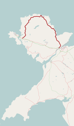
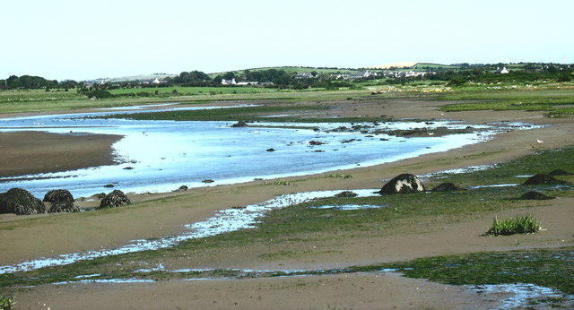
Llanfachraeth is a village and community (Wales), community in Anglesey, Wales. It is located near the west coast of the island, at the head of the Afon Alaw, Alaw estuary, east of Holyhead, south west of Amlwch and north west of Llangefni. The A5025 road runs through the village. A bus service operates along this road daily, except for Sundays, running between Cemaes, Llanfaethlu, Llanfachraeth and Holyhead. The Wales Coast Path is forced inland here to cross the Afon Alaw. The village has a pub and accommodation is provided by the Holland Hotel. At the 2001 census the community had a population of 566, increasing slightly at the 2011 census to 589. In the extreme north of the community, on the border with Llanfaethlu, stands Gronant, a listed building, Grade II* listed sub-medieval house dating from around 1540. A second house was built around 1618. In the 19th century the two houses were joined and a bell turret, used to call servants for meals, was added. The former ... [...More Info...] [...Related Items...] OR: [Wikipedia] [Google] [Baidu] |
Stryd-y-Facsen
Stryd-y-Facsen is a hamlet in the Community (Wales), community of Llanfachraeth, Anglesey, Wales, which is 139.2 miles (224 km) from Cardiff and 223.1 miles (359.1 km) from London. See also * List of localities in Wales by population References Villages in Anglesey {{Anglesey-geo-stub ... [...More Info...] [...Related Items...] OR: [Wikipedia] [Google] [Baidu] |
Anglesey
Anglesey ( ; ) is an island off the north-west coast of Wales. It forms the bulk of the Principal areas of Wales, county known as the Isle of Anglesey, which also includes Holy Island, Anglesey, Holy Island () and some islets and Skerry, skerries. The county borders Gwynedd across the Menai Strait to the southeast, and is otherwise surrounded by the Irish Sea. Holyhead is the largest town, and the administrative centre is Llangefni. The county is part of the Preserved counties of Wales, preserved county of Gwynedd. Anglesey is the northernmost county in Wales. The Isle of Anglesey has an area of and a population of in . After Holyhead (12,103), the largest settlements are Llangefni (5,500) and Amlwch (3,967). The economy of the county is mostly based on agriculture, energy, and tourism, the latter especially on the coast. Holyhead is also a major ferry port for Dublin, Ireland. The county has the second-highest percentage of Welsh language, Welsh speakers in Wales, at 57.2%, ... [...More Info...] [...Related Items...] OR: [Wikipedia] [Google] [Baidu] |
Llanfugail
Llanfigael, or Llanfigel (also sometimes ''Llanfigail'' or ''Llanfugail''), is a village in Anglesey, in north-west Wales, in the community of Llanfachraeth. The redundant church known as St Figael's (or St Bigail's) as has been designated by Cadw as a Grade II listed building In the United Kingdom, a listed building is a structure of particular architectural or historic interest deserving of special protection. Such buildings are placed on one of the four statutory lists maintained by Historic England in England, Hi ... and is under the care of the Friends of Friendless Churches. References Villages in Anglesey Bodedern {{Anglesey-geo-stub ... [...More Info...] [...Related Items...] OR: [Wikipedia] [Google] [Baidu] |
Beddmanarch–Cymyran
Beddmanarch–Cymyran is a site of special scientific interest (SSSI) on the Welsh island of Anglesey extending to just over , and centred on the Cymyran Strait. It was first notified in 1961 for its coastal botanical and ornithological interest. The site is also a marine protected area as it includes intertidal areas and contains marine components. Area The Beddmanarch–Cymyran site comprises the area of coastal salt-marshes, mud-flats and shallow coastal water lying between Holy Island and the mainland of Anglesey. This includes the Cymyran Strait (sometimes called the Holy Island Strait), the tidal reaches of the Afon Alaw to the east and extends northwards to Porth Penrhyn-Mawr. There are two crossings over the water that makes up the site, Four Mile Bridge (road and pedestrian) and the Stanley Embankment (road, rail and pedestrian). The area between the two bridges is known as the ''Inland Sea''. Importance The site includes four special areas of interest: *Marine b ... [...More Info...] [...Related Items...] OR: [Wikipedia] [Google] [Baidu] |
Llanfaethlu
Llanfaethlu is a village and community in the north west of Anglesey, in north-west Wales. The community population taken at the 2011 Census was 553. The village takes its name from the Church of Saint Maethlu. The community includes Llanfwrog. History There are two prehistoric scheduled monuments within Llanfaethlu Community. A hill fort with a single bank and ditch lies on a headland near the coastal hamlet of Tre-Fadog, overlooking the sandy bay of Port Trefadog. To the east of the village is the Capel Soar Standing Stone, a large and prominent standing stone visible from the A5025 and close to Soar Baptist Chapel. It is a slab, 3.2 metres (10 ft) high, and 1.7 metres (5.6 ft) wide at its base, tapering to a rounded top. Roman activity was shown by a small hoard of Roman coins, found in 1929 on a hill to the west of the church, some having been minted when Domitian was emperor, around 90 AD. The village is built around the Church of Saint Maethlu. This church is dedicated ... [...More Info...] [...Related Items...] OR: [Wikipedia] [Google] [Baidu] |
A5025 Road
The A5025 is an 'A' road that runs from Llanfairpwllgwyngyll to Valley in Anglesey, Wales. A major road around the north coast of the isle, it runs up the east, north and finally north-west side of the island via several places including Benllech and Amlwch. In all the road is long. Description The A5025 begins at the A55 road, near Sant Tysilio Nursing Home on the northeastern outskirts of Llanfairpwllgwyngyll. It initially heads northeast but soon teeters northwest as its passes Pentraeth Motors. It continues northwest, passing through the town of Pentraeth itself, where it crosses the B5109 road, and then heads north through the coastal town of Benllech. The stretch of road in Benllech is known as Bangor Road. It heads northwest again, crossing the B5110 road, before briefly turning southwest at the junction with the A5108 road to the northeast of Llanallgo. After passing through Llanallgo it heads north-northwest through Brynrefail, Llaneuddog, and Penysarn. Northw ... [...More Info...] [...Related Items...] OR: [Wikipedia] [Google] [Baidu] |
Afon Alaw
The Afon Alaw () is a river on Anglesey (Welsh language, Welsh: Ynys Môn) in Wales which rises near Llanerch-y-medd and flows northwards into the reservoir of Llyn Alaw. Below the dam it then flows southwestwards to the island's west coast near Llanfachraeth. Its lower reaches, west of the A5025 road, are tidal.Ordnance Survey Landranger map sheet 114 ''Anglesey/Môn'' References Rivers of Anglesey Fjards of Wales {{Wales-river-stub ... [...More Info...] [...Related Items...] OR: [Wikipedia] [Google] [Baidu] |
Thomas Jesse Jones
Thomas Jesse Jones (1873-1950) was a Welsh-American sociologist and educational administrator. He was Educational Director of the Phelps Stokes Fund from 1917 to 1946. W. E. B. DuBois accused Jones of systematically working to replace Black leaders with white and labelled Jones "that evil genius of the Negro race". Life Thomas Jesse Jones was born on 4 August 1873 in Llanfachraeth, a village in Wales. His father was the village saddler, his grandfather the village blacksmith, and his mother was the local innkeeper. In 1884 the family emigrated to the United States, settling in Middleport, Ohio. Jones attended Washington and Lee University, and graduated from Marietta College, Columbia University and Union Theological Seminary. His Columbia PhD, under the direction of Franklin H. Giddings, looked at the Italian and Jewish communities in a city block in New York City. From 1902 to 1909 Jones directed the research department at Hampton Institute. In 1906 he was appointed director ... [...More Info...] [...Related Items...] OR: [Wikipedia] [Google] [Baidu] |
St Figael's Church, Llanfigael
St Figael's Church, is a redundant church in the hamlet of Llanfigael, Anglesey, Wales. It has been designated by Cadw as a Grade II listed building, and is under the care of the Friends of Friendless Churches. The church is considered by Cadw to be particularly notable because of its "retaining its early 19th-century interior virtually intact". History The present church is thought to date from the 18th century, and it was much rebuilt in 1841. A church has been documented on this site since 1254. The only fabric possibly surviving from this earlier church is to be found in the foundations and part of the walls. Since it was declared redundant, the charity the Friends of Friendless Churches has held a 999-year lease, which was transferred to them on 1 February 2007. After taking it over, the charity has organised the re-covering of the roof, and has re-introduced timber windows designed by Tim Ratcliffe, their design being based on the pre-existing windows. Arc ... [...More Info...] [...Related Items...] OR: [Wikipedia] [Google] [Baidu] |
Common Greenshank
The common greenshank (''Tringa nebularia'') is a wader in the large family Scolopacidae, the typical waders. The genus name ''Tringa'' is the Neo-Latin name given to the green sandpiper by Aldrovandus in 1599 based on Ancient Greek ''trungas'', a thrush-sized, white-rumped, tail-bobbing wading bird mentioned by Aristotle. The specific ''nebularia'' is from Latin ''nebula'' "mist". Like the Norwegian ''Skoddefoll'', this refers to the greenshank's damp marshy habitat. Relatives Its closest relative is the greater yellowlegs, which together with the spotted redshank form a close-knit group. Among them, these three species show all the basic leg and foot colours found in the shanks, demonstrating that this character is paraphyletic. They are also the largest shanks apart from the willet, which is altogether more robustly built. The greater yellowlegs and the common greenshank share a coarse, dark, and fairly crisp breast pattern as well as much black on the shoulders and ba ... [...More Info...] [...Related Items...] OR: [Wikipedia] [Google] [Baidu] |
Red-breasted Merganser
The red-breasted merganser (''Mergus serrator'') is a duck species that is native to much of the Northern Hemisphere. The red breast that gives the species its common name is only displayed by males in breeding plumage. Individuals fly rapidly, and feed by diving from the surface to pursue aquatic animals underwater, using serrated bills to capture slippery fish. They migrate each year from breeding sites on lakes and rivers to their mostly coastal wintering areas, making them the only species in the genus '' Mergus'' to frequent saltwater. They form flocks outside of breeding season that are usually small but can reach 100 individuals. The worldwide population of this species is stable, though it is threatened in some areas by habitat loss and other factors. Taxonomy The red-breasted merganser was formally described in 1758 by the Swedish naturalist Carl Linnaeus in the tenth edition of his ''Systema Naturae'' under the current binomial name ''Mergus serrator''. The genu ... [...More Info...] [...Related Items...] OR: [Wikipedia] [Google] [Baidu] |
Common Ringed Plover
The common ringed plover or ringed plover (''Charadrius hiaticula'') is a species of bird in the family Charadriidae. It breeds across much of northern Eurasia, as well as Greenland. Taxonomy The common ringed plover was formally described in 1758 by the Swedish naturalist Carl Linnaeus in the tenth edition of his ''Systema Naturae'' under the current binomial name ''Charadrius hiaticula''. Linnaeus specified the type locality as "Europa & America" but this is now restricted to Sweden. The specific epithet ''hiaticula'' is late Medieval Latin for a plover. Three subspecies are recognised: * ''C. h. psammodromus'' Salomonsen, 1930 – Arctic of North Atlantic: Ellesmere Island and Baffin Island (northeast Canada, sporadic); Greenland, Iceland, Faroe Islands and Svalbard (north of Norway) * ''C. h. hiaticula'' Linnaeus, 1758 – temperate east North Atlantic region: British Isles and northwest France to south Scandinavia and Baltic States * ''C. h. tundrae'' ( Lowe, 1915) � ... [...More Info...] [...Related Items...] OR: [Wikipedia] [Google] [Baidu] |


