|
List Of Airports In The Netherlands
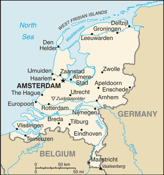
This is a list of airports in the Netherlands, grouped by type and sorted by location. The largest airport by far is Amsterdam Airport Schiphol, which is the third largest in Europe. Smaller airports with scheduled passenger service are Rotterdam The Hague Airport (formerly known as Zestienhoven), Groningen Airport Eelde, Eindhoven Airport and Maastricht Aachen Airport. De Peel, Valkenburg and Soesterberg have been closed as military airports and are now mainly used by gliders. The future of the former military airport, Twente, is uncertain. Rarely used helipads without an ICAO indicator, offshore oilrigs and small glider fields are not included in this list. Medical helipads have been assigned the identification codes EH0001 to EH0031 by the Dutch authorities, but these are not official ICAO indicators and thus these helipads are not included in this list. The Maasvlakte and IJmuiden helipads are restricted to maritime piloting services and are not connected to the AFTN net ... [...More Info...] [...Related Items...] OR: [Wikipedia] [Google] [Baidu] |
ICAO
The International Civil Aviation Organization (ICAO ) is a specialized agency of the United Nations that coordinates the principles and techniques of international air navigation, and fosters the planning and development of international scheduled air transport, air transport to ensure safe and orderly growth. The ICAO headquarters are located in the Quartier international de Montréal of Montreal, Quebec, Canada. The ICAO Council adopts standards and recommended practices concerning air navigation, its infrastructure, flight inspection, prevention of unlawful interference, and facilitation of border-crossing procedures for international civil aviation. ICAO defines the protocols for Aviation accidents and incidents, air accident investigation that are followed by :Organizations investigating aviation accidents and incidents, transport safety authorities in countries signatory to the Convention on International Civil Aviation. The Air Navigation Commission (ANC) is the techn ... [...More Info...] [...Related Items...] OR: [Wikipedia] [Google] [Baidu] |
North Holland
North Holland (, ) is a Provinces of the Netherlands, province of the Netherlands in the northwestern part of the country. It is located on the North Sea, north of South Holland and Utrecht (province), Utrecht, and west of Friesland and Flevoland. As of January 2023, it had a population of about 2,952,000 and a total area of , of which is water. From the 9th to the 16th century, the area was an integral part of the County of Holland. During this period West Friesland (region), West Friesland was incorporated. In the 17th and 18th centuries, the area was part of the province of Holland and commonly known as the Noorderkwartier (English: "Northern Quarter"). In 1840, the province of Holland was split into the two provinces of North Holland and South Holland. In 1855, the Haarlemmermeer was drained and turned into land. The provincial capital is Haarlem (pop. 161,265). The province's largest city and also the largest city in the Netherlands is the Dutch capital Amsterdam, with a ... [...More Info...] [...Related Items...] OR: [Wikipedia] [Google] [Baidu] |
Haarlemmermeer
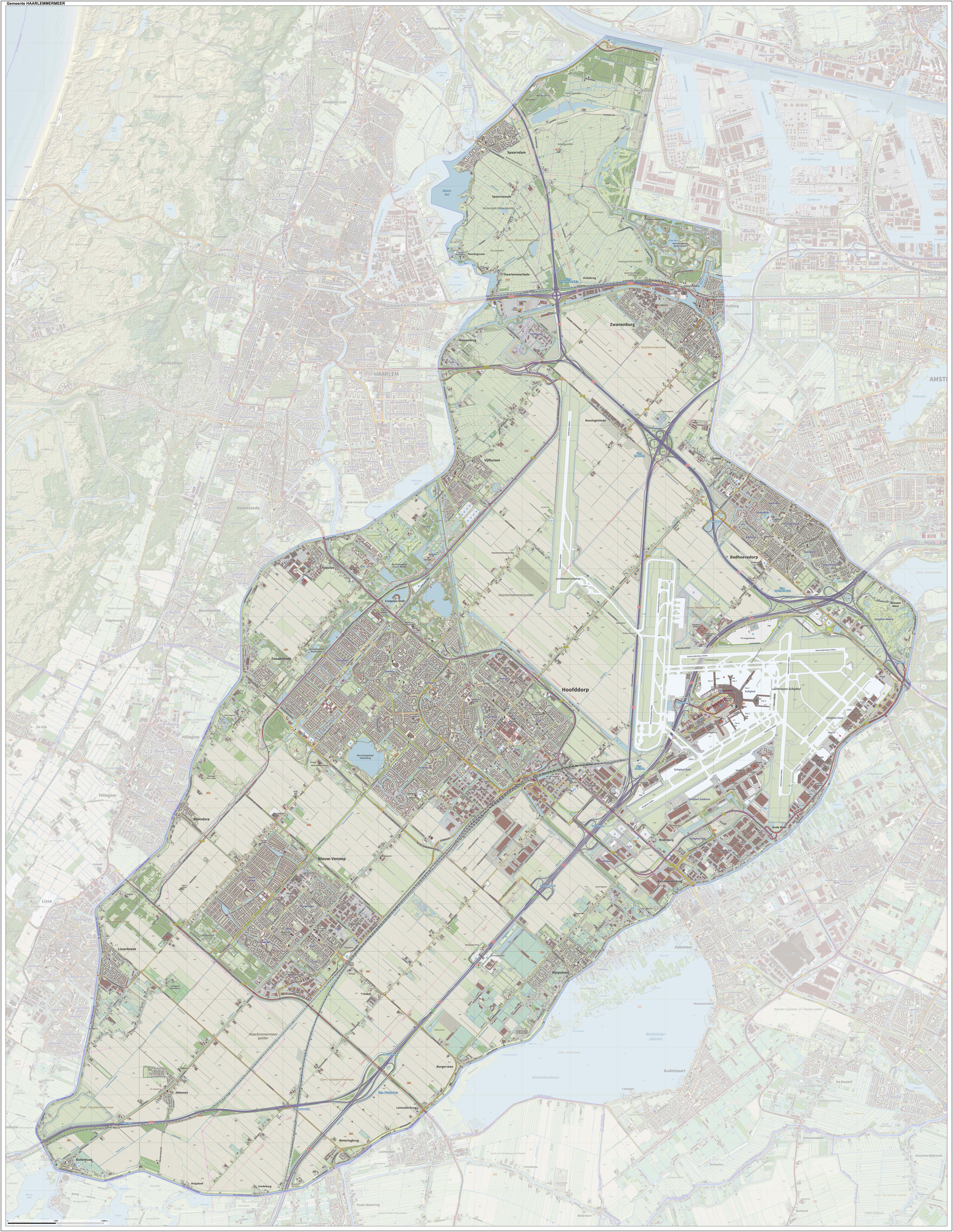
Haarlemmermeer () is a List of municipalities of the Netherlands, municipality in the west of the Netherlands, in the Provinces of the Netherlands, province of North Holland. Haarlemmermeer is a polder, consisting of land reclaimed from water. The name Haarlemmermeer means 'Haarlem's lake', referring to the body of water from which the region was reclaimed in the 19th century. Haarlemmermeer's main town is Hoofddorp, which has a population of 76,660. Hoofddorp, along with the rapidly growing towns of Nieuw-Vennep and Badhoevedorp, are part of the Randstad agglomeration. The main international airport of the Netherlands, Amsterdam Airport Schiphol, Schiphol, is located in Haarlemmermeer. History The original Haarlemmermeer lake is said to have been mostly a peat bog, a relic of a northern arm of the Rhine which passed through the district in Ancient Rome, Roman times. In 1531, the original Haarlemmermeer had an area of , and near it were three smaller lakes: the Leidsche Meer (Leid ... [...More Info...] [...Related Items...] OR: [Wikipedia] [Google] [Baidu] |
Amsterdam
Amsterdam ( , ; ; ) is the capital of the Netherlands, capital and Municipalities of the Netherlands, largest city of the Kingdom of the Netherlands. It has a population of 933,680 in June 2024 within the city proper, 1,457,018 in the City Region of Amsterdam, urban area and 2,480,394 in the Amsterdam metropolitan area, metropolitan area. Located in the Provinces of the Netherlands, Dutch province of North Holland, Amsterdam is colloquially referred to as the "Venice of the North", for its canals of Amsterdam, large number of canals, now a World Heritage Site, UNESCO World Heritage Site. Amsterdam was founded at the mouth of the Amstel River, which was dammed to control flooding. Originally a small fishing village in the 12th century, Amsterdam became a major world port during the Dutch Golden Age of the 17th century, when the Netherlands was an economic powerhouse. Amsterdam was the leading centre for finance and trade, as well as a hub of secular art production. In the 19th ... [...More Info...] [...Related Items...] OR: [Wikipedia] [Google] [Baidu] |
Ameland Airport
Ameland Airport () , also known as Ameland Airport Ballum, is a small general aviation airport located near the town of Ballum on the western part of the island of Ameland, one of the West Frisian Islands in the Netherlands. It is located in the province of Friesland and is the northernmost airport in the country. The airport has a single short grass runway and a helipad, the latter being mainly used for search and rescue (SAR) flights. Customs services are not available, so no international flights are allowed except for those from other Schengen countries. The airport is used mainly for recreational purposes, so it is not open in winter (October 1 through the last day of March) unless prior arrangements are made. About 5,500 airplane movements (takeoff or landing) are made at the airport a year. OFD Ostfriesischer-Flug-Dienst offers an on-demand service to Borkum and Emden Emden () is an Independent city (Germany), independent town and seaport in Lower Saxony in the north ... [...More Info...] [...Related Items...] OR: [Wikipedia] [Google] [Baidu] |
Friesland
Friesland ( ; ; official ), historically and traditionally known as Frisia (), named after the Frisians, is a Provinces of the Netherlands, province of the Netherlands located in the country's northern part. It is situated west of Groningen (province), Groningen, northwest of Drenthe and Overijssel, north of Flevoland, northeast of North Holland, and south of the Wadden Sea. As of January 2023, the province had a population of about 660,000, and a total area of . The province is divided into 18 municipalities. The Capital city, capital and seat of the provincial government is the city of Leeuwarden (West Frisian: ''Ljouwert'', Liwwaddes: ''Liwwadde''), a city with 123,107 inhabitants. Other large municipalities in Friesland are Sneek (pop. 33,512), Heerenveen (pop. 50,257), and Smallingerland (includes town of Drachten, pop. 55,938). Since 2017, Arno Brok is the King's Commissioner in the province. A coalition of the Christian Democratic Appeal, the People's Party for Freedom a ... [...More Info...] [...Related Items...] OR: [Wikipedia] [Google] [Baidu] |
Ballum (Ameland)
Ballum is a village on the western half of the island of Ameland and the smallest of the total of four villages on the island, one of the West Frisian Islands and part of the Netherlands. History The village was first mentioned in 1473 as "jn balnera lees: balmera buren", and means "settlement of Balle (person)". Ballum is an ''esdorp'' with a triangular village square which developed in the Late Middle Ages. In the early 15th century, the castle Jelmera State was built in Ballum which later became known as Camminghaslot after the Cammingha family became owners of the island. The castle started to deteriorate and transporting stones to the island was too expensive, therefore, the island was sold to John William Friso, the Prince of Orange. Willem-Alexander of the Netherlands, the current King, still uses the title "Vrijheer of Ameland" as one of his titles. In 1795, the island was confiscated, and the castle became the residence of the '' grietman'' of Ameland. In 1829, the cast ... [...More Info...] [...Related Items...] OR: [Wikipedia] [Google] [Baidu] |
Ameland
Ameland (; ) is a municipality and one of the West Frisian Islands off the north coast of the Netherlands. It consists mostly of sand dunes and is the third major island of the West Frisians. It neighbours islands Terschelling to the west and Schiermonnikoog to the east. This includes the small Engelsmanplaat and Rif (sandbank), Rif sandbanks to the east. Ameland is, counted from the west, the fourth inhabited Dutch Wadden island and belongs to the Friesland (''Fryslân'') province. The whole island falls under one municipality, which carries the same name. The Wadden islands form the border between the North Sea and the Wadden Sea, which lies on the south side of the island file. The municipality of Ameland had a population of in . The inhabitants are called Amelanders. Places The island has four villages, and one small part-village. There were two other villages: Oerd and Sier, Ameland, Sier, but these were flooded and now lie in the sea. The name of these villages li ... [...More Info...] [...Related Items...] OR: [Wikipedia] [Google] [Baidu] |
IATA Airport Code
An IATA airport code, also known as an IATA location identifier, IATA station code, or simply a location identifier, is a unique three-letter geocode designating many airports, cities (with one or more airports) and metropolitan areas (cities with more than one airport) around the world, defined by the International Air Transport Association (IATA). The characters prominently displayed on bag tag, baggage tags attached at airport check-in desks are an example of a way these codes are used. The assignment of these codes is governed by IATA Resolution 763, and it is administered by the IATA's headquarters in Montreal, Canada. The codes are published semi-annually in the IATA Airline Coding Directory. IATA provides codes for airport handling entities, and for certain railway stations. Lists of airports by IATA and ICAO code, Alphabetical lists of airports sorted by IATA code are available. A List of IATA-indexed railway stations, list of railway station codes, shared in agreem ... [...More Info...] [...Related Items...] OR: [Wikipedia] [Google] [Baidu] |
ICAO Airport Code
The ICAO airport code or location indicator is a four-letter code designating aerodromes around the world. These codes, as defined by the International Civil Aviation Organization and published quarterly in ICAO Document 7910: ''Location Indicators'', are used by air traffic control and airline operations such as flight planning. ICAO codes are also used to identify other aviation facilities such as weather stations, international flight service stations, or area control centers (and by extension their flight information regions), regardless of whether they are located at airports. History The recommendations for ICAO airport codes were adopted on 24 March 1959, and came into force on 1 October the same year. ICAO codes versus IATA codes ICAO codes are separate and different from IATA airport code, IATA codes, the latter of which have three letters and are generally used for airline timetables, reservations, and baggage tags. For example, the IATA code for London's London H ... [...More Info...] [...Related Items...] OR: [Wikipedia] [Google] [Baidu] |
Provinces Of The Netherlands
There are twelve provinces ( or ; Grammatical number#Overview, sing. ) of the Netherlands representing the administrative layer between the cabinet of the Netherlands, national government and the municipalities of the Netherlands, local governments, with responsibility for matters of subnational or regional importance. The most populous province is South Holland, with just over 3.8 million inhabitants , and also the most densely populated province with . With 391,124 inhabitants, Zeeland has the smallest population. However Drenthe is the least densely populated province with . In terms of area, Friesland is the largest province with a total area of . If water is excluded, Gelderland is the largest province by land area at . The province of Utrecht (province), Utrecht is the smallest with a total area of , while Flevoland is the smallest by land area at . In total about 10,000 people were employed by the provincial administrations in 2018. The provinces of the Netherlan ... [...More Info...] [...Related Items...] OR: [Wikipedia] [Google] [Baidu] |


