|
List Of Protected Areas Of Afghanistan
This is a list of protected areas of Afghanistan.UNEP-WCMC (2021). Protected Area Profile for Afghanistan from the World Database of Protected Areas. Accessed 15 August 2021/ref> * Ab-i Istada, Ab-i-Estada Nature Reserve, Ghazni Province * Ajar Valley Nature Reserve, Bamyan Province * Bamiyan National Heritage Park, Bamyan Province * Bamiyan Plateau Protected Landscape, Bamyan Province * Band-e Amir National Park, Bamyan Province * Darqad (Takhar) Wildlife Reserve, Takhar Province * Dasht-i-Nawar Waterfowl Sanctuary, Ghazni Province * Hamun-i-Puzak Waterfowl Sanctuary, Farah and Nimruz provinces * Imam Sahib (Kunduz) Wildlife Reserve, Kunduz Province * Khulm Landmark Protected Area, Balkh Province * Koh-e Baba (Shah Foladi) Protected Landscape, Bamyan province * Kol-i-Hashmat Khan Waterfowl Sanctuary, Kabul Province * Northwest Afghanistan Game Managed Reserve, Herat Province * Nuristan National Park and Wildlife Reserve, Nuristan Province * Pamir-i-Buzurg Wildlife Reserve, Bada ... [...More Info...] [...Related Items...] OR: [Wikipedia] [Google] [Baidu] |
Protected Area
Protected areas or conservation areas are locations which receive protection because of their recognized natural or cultural values. Protected areas are those areas in which human presence or the exploitation of natural resources (e.g. firewood, non-timber forest products, water, ...) is limited. The term "protected area" also includes marine protected areas and transboundary protected areas across multiple borders. As of 2016, there are over 161,000 protected areas representing about 17 percent of the world's land surface area (excluding Antarctica). For waters under national jurisdiction beyond inland waters, there are 14,688 Marine Protected Areas (MPAs), covering approximately 10.2% of coastal and marine areas and 4.12% of global ocean areas. In contrast, only 0.25% of the world's oceans beyond national jurisdiction are covered by MPAs. In recent years, the 30 by 30 initiative has targeted to protect 30% of ocean territory and 30% of land territory worldwide by 2030; this ... [...More Info...] [...Related Items...] OR: [Wikipedia] [Google] [Baidu] |
Khulm Landmark Protected Area
Kholm or Khulm (Dari/Pashto: خلم), formerly known as Tashqurghan (Dari/Uzbek: تاشقرغان), is a town in Samangan Province of northern Afghanistan, 60 km east of Mazar-i-Sharif one-third of the way to Kunduz. Kholm is an ancient town located on the fertile, inland delta fan of the Khulm River (Darya-i- Tashqurghan). As such, it is an agriculturally rich locale and densely populated. It is famous for its covered market, and is a centre for trading in sheep and wood. Etymology The original name Tashqurghan (also romanized ''Tashkorghan'') is Uzbeki word for "stone mausoleum/kurgan". The town's name was changed to Kholm (also romanized ''Khulm'') during the Pashtunisation of northern Afghanistan by the central government headed by Minister of the Interior, Wazir Mohammad Gul Khan. History and background For many centuries Afghanistan was located on the old serais (along the Silk Road) between Europe and China and India. Many important cultural centres developed alo ... [...More Info...] [...Related Items...] OR: [Wikipedia] [Google] [Baidu] |
Wakhan National Park
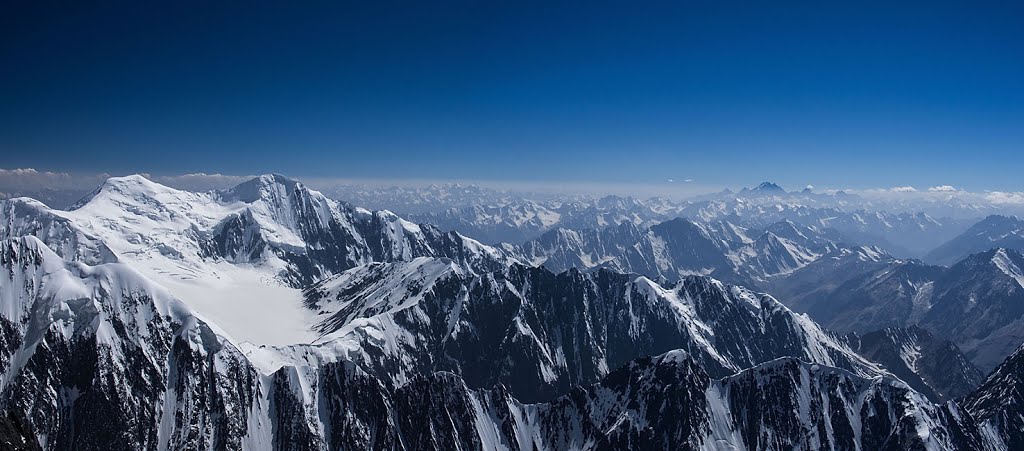
__NOTOC__ Wakhan National Park is a national park in northeastern Afghanistan. Established in 2014, the park encompasses the entire Wakhan District of Badakhshan Province, extending along the Wakhan Corridor between the Pamir Mountains and the Hindu Kush, bordering the Gorno-Badakhshan autonomous region of Tajikistan to the north, Khyber Pakhtunkhwa and Gilgit-Baltistan in Pakistan to the south, and the Xinjiang autonomous region of China to the east. Flora and fauna in the Wakhan National Park include some 600 plant species, the snow leopard, lynx, wolf, brown bear, stone marten, red fox, Pallas's cat, ibex, Marco Polo sheep, and urial. Remote and largely above the tree line, poaching and overgrazing, rather than mining and logging, currently pose the main threats. Around 15,000 Afghans of ethnic Wakhi and Kyrgyz background reside in the area. Foreigners must have an Afghan visa to tour the area. See also * List of protected areas of Afghanistan * Wildlife of Afghanista ... [...More Info...] [...Related Items...] OR: [Wikipedia] [Google] [Baidu] |
Registan Desert Wildlife Managed Reserve
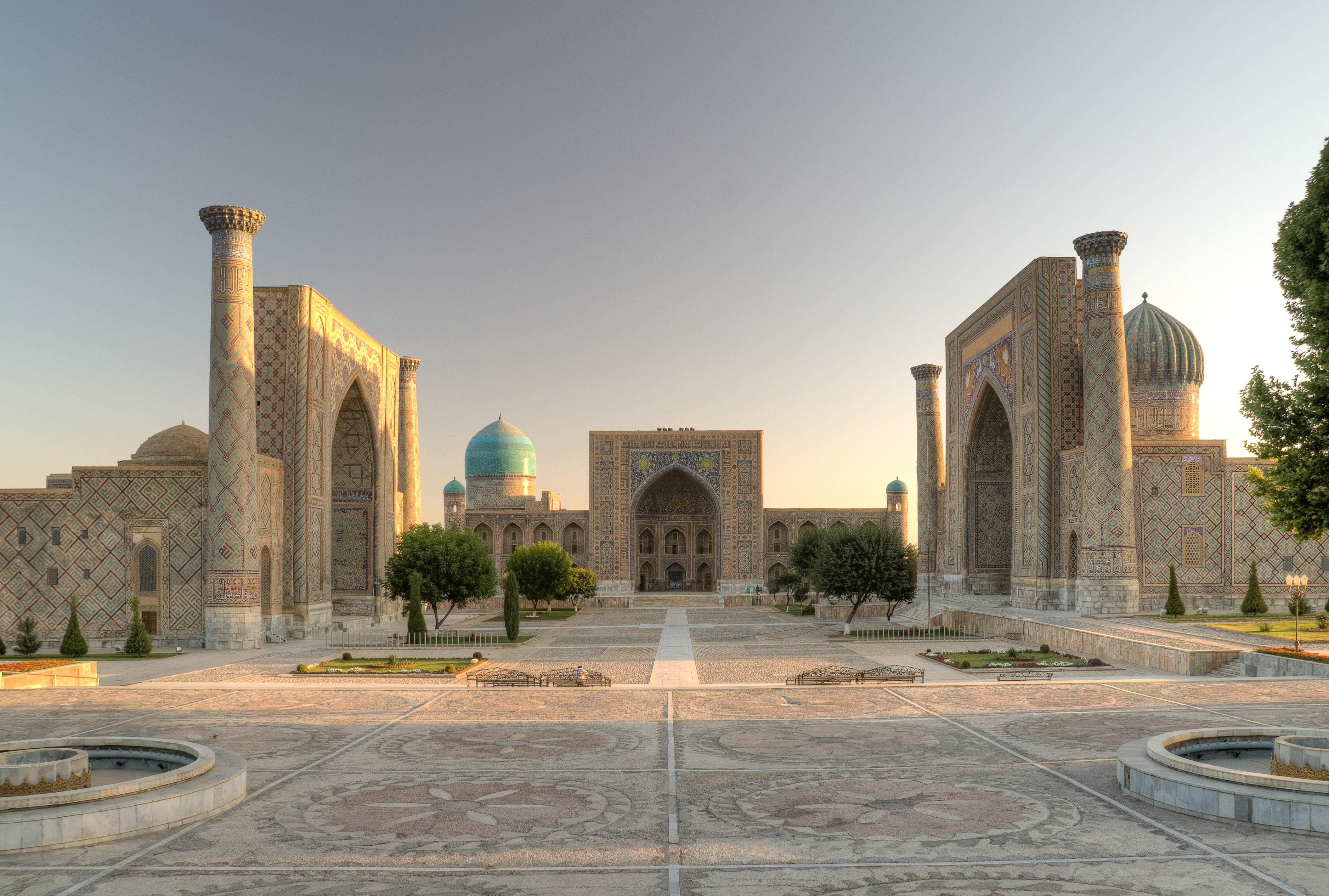
The Registan () was the heart of the city of Samarkand of the Timurid Empire, now in Uzbekistan. The name ''Rēgistan'' () means "sandy place" or "desert" in Persian. The Registan was a public square, where people gathered to hear royal proclamations, heralded by blasts on enormous copper pipes called ''dzharchis'' — and a place of public executions. It is framed by three madrasahs (Islamic schools) of distinctive Persian architecture. The square was regarded as the hub of the Timurid Renaissance. Madrasahs The three madrasahs of the Registan are the Ulugh Beg Madrasah (1417–1420), the Sher-Dor Madrasah (1619–1636), and the Tilya-Kori Madrasah (1646–1660). ''Madrasah'' is an Arabic term meaning school. Ulugh Beg Madrasah (1417–1420) The Ulugh Beg Madrasah, built by Ulugh Beg during the Timurid Empire era of Timur, has an imposing iwan with a lancet-arch pishtaq or portal facing the square. The corners are flanked by high minarets. The mosaic panel over the iwan's ... [...More Info...] [...Related Items...] OR: [Wikipedia] [Google] [Baidu] |
Badakhshan Province
Badakhshan Province (Dari: بدخشان) is one of the 34 provinces of Afghanistan, located in the northeastern part of the country. It is bordered by Tajikistan's Gorno-Badakhshan in the north and the Pakistani regions of Lower and Upper Chitral and Gilgit-Baltistan in the southeast. The province also has Afghanistan's only border with China spanning 91 kilometers (57 miles) in the eastern side of the province via its Wakhan District. It is part of a broader historical Badakhshan region, parts of which now also lie in Tajikistan and China. The province contains 22 districts, over 1,200 villages and approximately 1,055,000 people. Fayzabad serves as the provincial capital. Resistance activity has been reported in the province since the 2021 Taliban takeover of Afghanistan. Etymology During the Sassanids' reign it was called "bidix", and in Parthian times "bthšy". In Sassanid manuscripts found in Ka'ba-ye Zartosht it was called "Bałasakan". In Chinese sources fro ... [...More Info...] [...Related Items...] OR: [Wikipedia] [Google] [Baidu] |
Nuristan Province
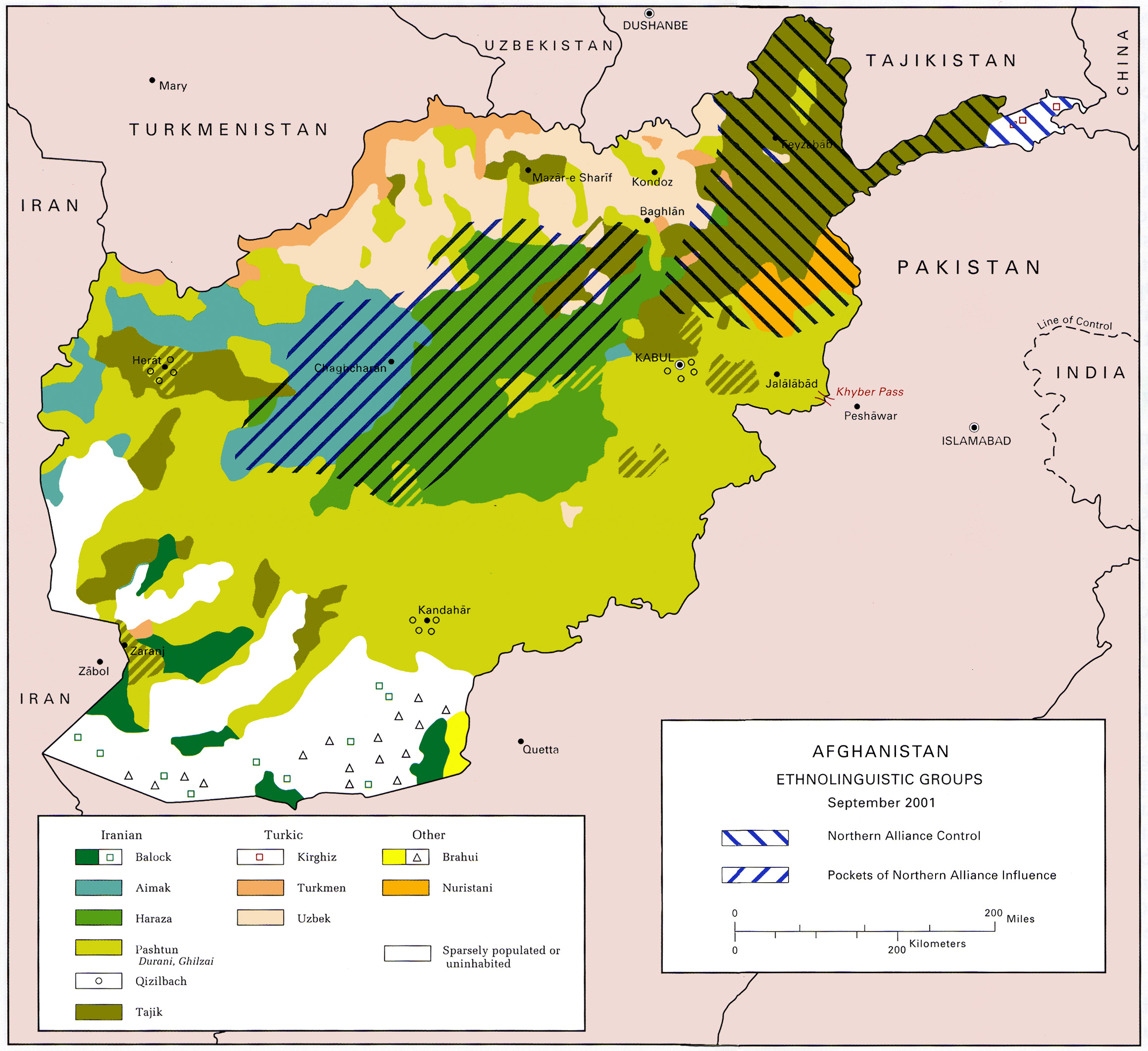
Nuristan, also spelled as Nurestan or Nooristan (Pashto: ; Katë: ), is one of the 34 provinces of Afghanistan, located in the eastern part of the country. It is divided into seven districts and is Afghanistan's least populous province, with a population of around 167,000. Parun serves as the provincial capital. Nuristan is bordered on the south by Laghman and Kunar provinces, on the north by Badakhshan province, on the west by Panjshir province, and on the east by Pakistan. The origin of the local Nuristani people has been disputed, ranging from being the indigenous inhabitants forced to flee to this region after refusing to surrender to invaders, to being linked to various ancient groups of people and the Turk Shahi kings. Some Nuristanis claim being descendants of the Greek occupying forces of Alexander the Great. It was formerly called Kafiristan () ("Land of the Infidels") until the inhabitants were forcibly converted from an animist religion with elements from In ... [...More Info...] [...Related Items...] OR: [Wikipedia] [Google] [Baidu] |
Nuristan National Park
__NOTOC__ Nuristan National Park is a national park in Afghanistan announced by the Government of Afghanistan on 5 June 2020 (coinciding with World Environment Day), making it the third in the country after Band-e Amir National Park and Wakhan National Park. The Park comprises the entire mountainous eastern Province of Nuristan, which borders Pakistan. According to the FAO, a detailed management plan - and " gazettement" - is still forthcoming. History An initial proposal was drafted in 1981, with Nuristan National Park to be formed in what was then Laghman Province and Kunar Province (Nuristan Province was not created, by carving out areas of these two provinces, until July 1988); the report highlighted what were then the "largely undisturbed monsoon-influenced forests", as well as the assemblage of species living therein, including the leopard, snow leopard, Himalayan black bear, and markhor, combined with the traditional way of life of the local communities. Although a 2003 U ... [...More Info...] [...Related Items...] OR: [Wikipedia] [Google] [Baidu] |
Herat Province
Herat ( Dari: هرات) is one of the thirty-four provinces of Afghanistan, located in the western part of the country. Together with Badghis, Farah, and Ghor provinces, it makes up the north-western region of Afghanistan. Its primary city and administrative capital is Herat City. The province of Herat is divided into about 17 districts and contains over 2,000 villages. It has a population of about 3,780,000, making it the second most populated province in Afghanistan behind Kabul Province. The population is multi-ethnic but largely Persian-speaking. Herat dates back to the Avestan times and was traditionally known for its wine. The city has a number of historic sites, including the Herat Citadel and the Musalla Complex. During the Middle Ages Herat became one of the important cities of Khorasan, as it was known as the Pearl of Khorasan. The province of Herat shares a border with Iran in the west and Turkmenistan in the north, making it an important trading region. The ... [...More Info...] [...Related Items...] OR: [Wikipedia] [Google] [Baidu] |
Northwest Afghanistan Game Managed Reserve
The points of the compass are a set of horizontal, radially arrayed compass directions (or azimuths) used in navigation and cartography. A ''compass rose'' is primarily composed of four cardinal directions—north, east, south, and west—each separated by 90 degrees, and secondarily divided by four ordinal (intercardinal) directions—northeast, southeast, southwest, and northwest—each located halfway between two cardinal directions. Some disciplines such as meteorology and navigation further divide the compass with additional azimuths. Within European tradition, a fully defined compass has 32 "points" (and any finer subdivisions are described in fractions of points). Compass points or compass directions are valuable in that they allow a user to refer to a specific azimuth in a colloquial fashion, without having to compute or remember degrees. Designations The names of the compass point directions follow these rules: 8-wind compass rose * The four cardinal direction ... [...More Info...] [...Related Items...] OR: [Wikipedia] [Google] [Baidu] |
Kabul Province
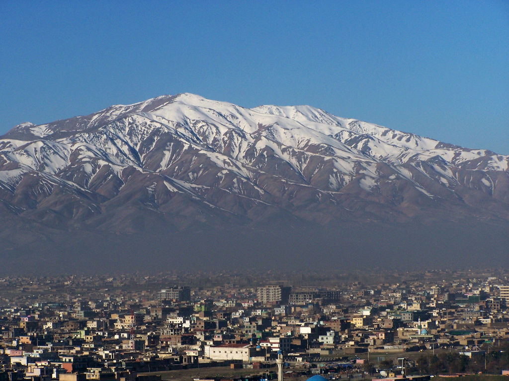
Kabul (Dari/Pashto: ), situated in the east of the country, is one of the thirty-four provinces of Afghanistan. The capital of the province is Kabul city, which is Afghanistan's capital and largest city. The population of the Kabul Province is over 5.5 million people as of 2022, of which over 85 percent live in urban areas. The current governor of the province is Mohammad Aman Obaid. It borders the provinces of Parwan to the north, Kapisa to the north-east, Laghman to the east, Nangarhar to the south-east, Logar to the south, and Wardak to the west. Geography Kabul is located between Latitude 34-31' North and Longitude 69-12' East at an altitude of 1800 m (6000 feet) above sea level, which makes it one of the world's highest capital cities. Kabul is strategically situated in a valley surrounded by high mountains at crossroads of north-south and east-west trade routes. One million years ago the Kabul region was surrounded from south-east between Lowgar and Paghm ... [...More Info...] [...Related Items...] OR: [Wikipedia] [Google] [Baidu] |


