|
List Of Crossings Of The River Swale
This is a list of current bridges and other crossings of the River Swale in North Yorkshire, and are listed downstream to the river's mouth. The River Swale is listed on mapping as starting where Birkdale Beck meets Great Sleddale Beck. (). The river flows for about before joining the River Ure near Myton-on-Swale, and then later, the Ure becomes the River Ouse. The list below includes permanent bridges and crossings; structures such as the conveyor belt linking the different areas of Killerby Quarry east of Catterick village are not included. Several bridges have been removed, notably railway bridges, such as the one which used to carry the Leeds & Thirsk Railway over the river just to the north of Topcliffe. Hoggarth's Bridge was a two-arched structure which crossed the River Swale above Wain Wath Force, and it was swept away in 1899; its replacement, High Bridge, was built slightly downstream of the predecessor. The bridge at Gunnerside was swept away in a flood in 1890, an ... [...More Info...] [...Related Items...] OR: [Wikipedia] [Google] [Baidu] |
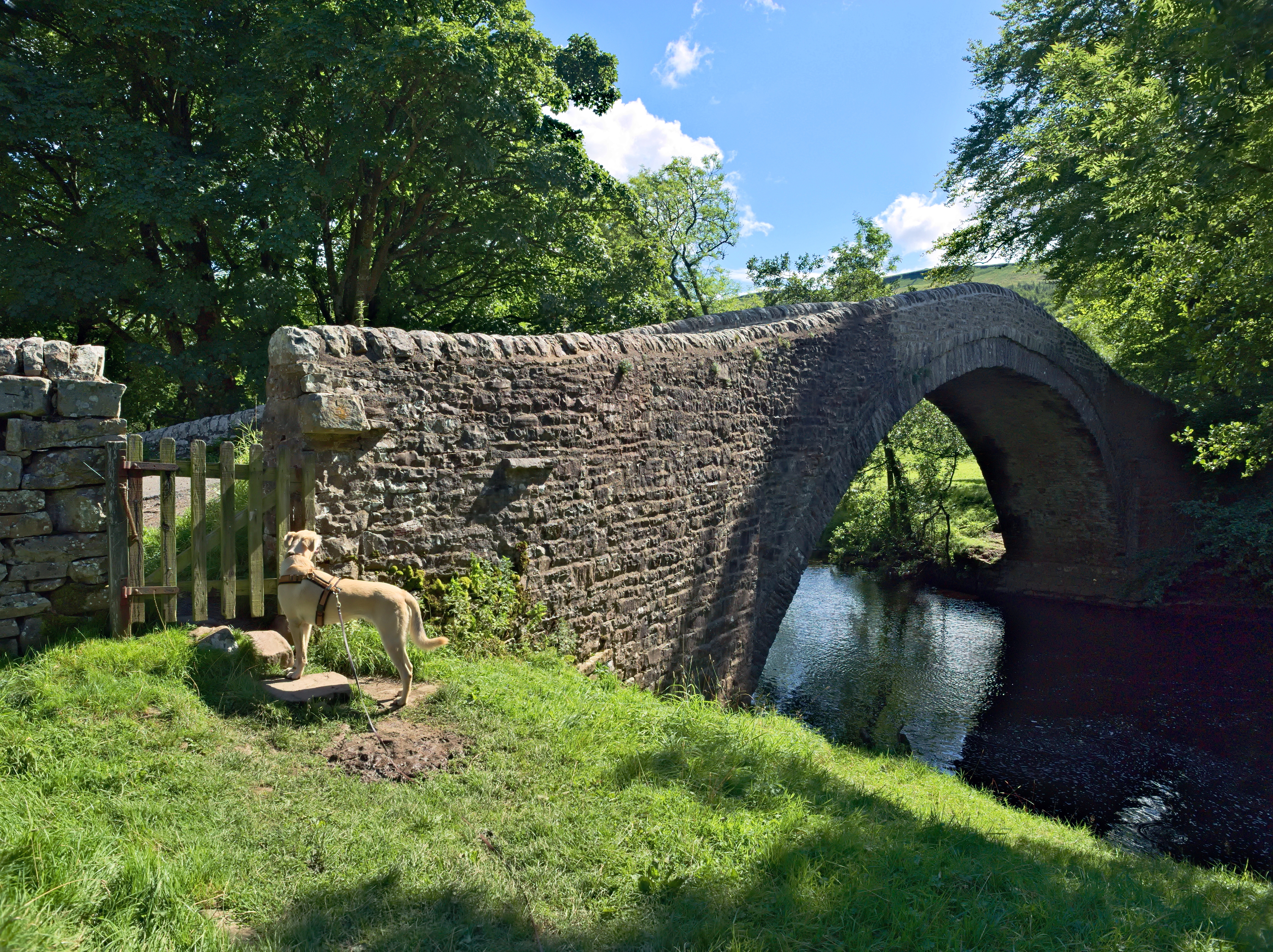
Ivelet Bridge 03
Ivelet is a hamlet in the Yorkshire Dales, North Yorkshire, England about a mile west of Gunnerside in Swaledale. Toponymy The ''Survey of English Place-Names'' claims Ivelet derives from "Ifa's slope", similar to Ivinghoe. However, it is also speculated the name may derive from "idhe" and "læghe" in Old Swedish, meaning "timber from yew" and "camp" respectively. Ivelet Bridge Ivelet Bridge crosses the River Swale near Ivelet. Dating from the late 16th century, the bridge has been designated a Grade II* listed structure. A coffin stone is set into the verge on the north side of the bridge for pall bearers to rest with a coffin on their way from Muker to the church at Grinton. The coffin stone is itself a Grade II In the United Kingdom, a listed building is a structure of particular architectural or historic interest deserving of special protection. Such buildings are placed on one of the four statutory lists maintained by Historic England in England, Hi ... structure ... [...More Info...] [...Related Items...] OR: [Wikipedia] [Google] [Baidu] |
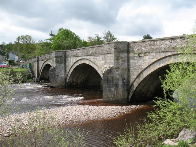
Grinton Bridge
Grinton Bridge is a historic bridge over the River Swale in Grinton, North Yorkshire, a village in England. There is a record of a bequest left in 1547, to fund the reconstruction of the bridge, and it is possible that the northern arch survives from this period. However, by 1631 the bridge was in poor repair, and in 1659 £40 was allocated for its repair, followed by a further £30 in 1675, with the remainder of the upstream side dating from this period. In 1797, John Carr widened the bridge to the downstream side, and added voussoirs and cutwaters on the upstream side. The parapets were replaced in the 19th century. The 2014 Tour de France crossed the bridge, but in July 2019 it was largely destroyed in a flood. It was rebuilt, and remains grade II listed. The bridge carries the B6270 road over the River Swale. It is built of stone and consists of three semicircular arches, the northernmost being more pointed on the upstream side. The bridge has triangular cutwaters rising to ... [...More Info...] [...Related Items...] OR: [Wikipedia] [Google] [Baidu] |
Catterick Military Railway
The Catterick Military Railway was a railway line in North Yorkshire, England, that connected Catterick Camp (now Catterick Garrison), with the Eryholme–Richmond line at railway station. The line was built in 1915 as a light railway to bring materials in for the building of Catterick Camp, but later became the supply route in and out of Catterick Garrison. It also had a semi-regular passenger service for military personnel, but this ceased in 1964. The line was closed and removed in 1970. History The line was opened in 1915 and extended from Catterick Bridge railway station, Catterick Bridge station to a railway station in the middle of the garrison called ''Camp Centre'', climbing steeply in its first at a gradient of 1-in-50, then 1-in-46. This first railway was deemed to be a 'light railway' to facilitate building the camp, and was of a gauge, but was converted to standard gauge by 1915. The line was single track throughout with some passing loops and a myriad of sidi ... [...More Info...] [...Related Items...] OR: [Wikipedia] [Google] [Baidu] |


