|
List Of Countries By Easternmost Point
This is a list of countries by easternmost point on land (dependent territories included). The order does not always reflect how close a country's territory is to the 180th meridian The 180th meridian or antimeridian is the meridian (geography), meridian 180° both east and west of the prime meridian in a Geographic coordinate system, geographical coordinate system. The longitude at this line can be given as either east .... Russia, Fiji, and Antarctica are notable exceptions because the 180th meridian passes through them. Therefore, they each have both very westernmost and very easternmost points. For countries like Russia, New Zealand, Fiji, the United States, and Kiribati, which have territories on both sides of the 180th meridian, the easternmost point is defined as the easternmost point in the direction of travel. The United States and Kiribati have most of their territory east of the 180th meridian, in the Western Hemisphere, so they are considered to belong to the w ... [...More Info...] [...Related Items...] OR: [Wikipedia] [Google] [Baidu] |
180th Meridian
The 180th meridian or antimeridian is the meridian (geography), meridian 180° both east and west of the prime meridian in a Geographic coordinate system, geographical coordinate system. The longitude at this line can be given as either east or west. On Earth, the prime and 180th meridians form a great ellipse that divides the planet into the Western Hemisphere, Western and Eastern Hemispheres. Locations The antimeridian passes mostly through the open waters of the Pacific Ocean but also runs across land in Russia, Fiji, and Antarctica. An important function of this meridian is its use as the basis for the International Date Line, which snakes around national borders to maintain date consistency within the territories of Russia, the United States, Kiribati, Fiji and New Zealand. Starting at the North Pole of the Earth and heading south to the South Pole, the 180th meridian passes through: The meridian also passes between (but not particularly close to): *through the Aleu ... [...More Info...] [...Related Items...] OR: [Wikipedia] [Google] [Baidu] |
Fatutaka
Fatutaka, Fatu Taka or Patu Taka (also known as Fataka and Mitre Island) is a small volcanic island in Temotu Province, in the nation of Solomon Islands, south-west Pacific Ocean. The easternmost island in Solomon Islands, Fatutaka is located southeast of Anuta and can be seen from there in clear weather. Fatutaka and Anuta were discovered for Europeans by Admiral Edward Edwards in 1791. The island, located at , is a small rocky outcropping, rising to an elevation of . The total land area of the island is . Human activities The island's soil is rocky, and not especially fertile, although it has in the past been used as a gardening location for the people of Anuta. The population of Anuta, the closest inhabited island, regularly sail to Fatutaka to eat and collect sea-birds and their eggs. The birds of Fatukaka have never been surveyed although the presence of Frigatebird, Eastern Reef Egret, Pacific Imperial Pigeon, and Emerald Dove have been reported. Geology Fatutaka ... [...More Info...] [...Related Items...] OR: [Wikipedia] [Google] [Baidu] |
Fuyuan, Heilongjiang
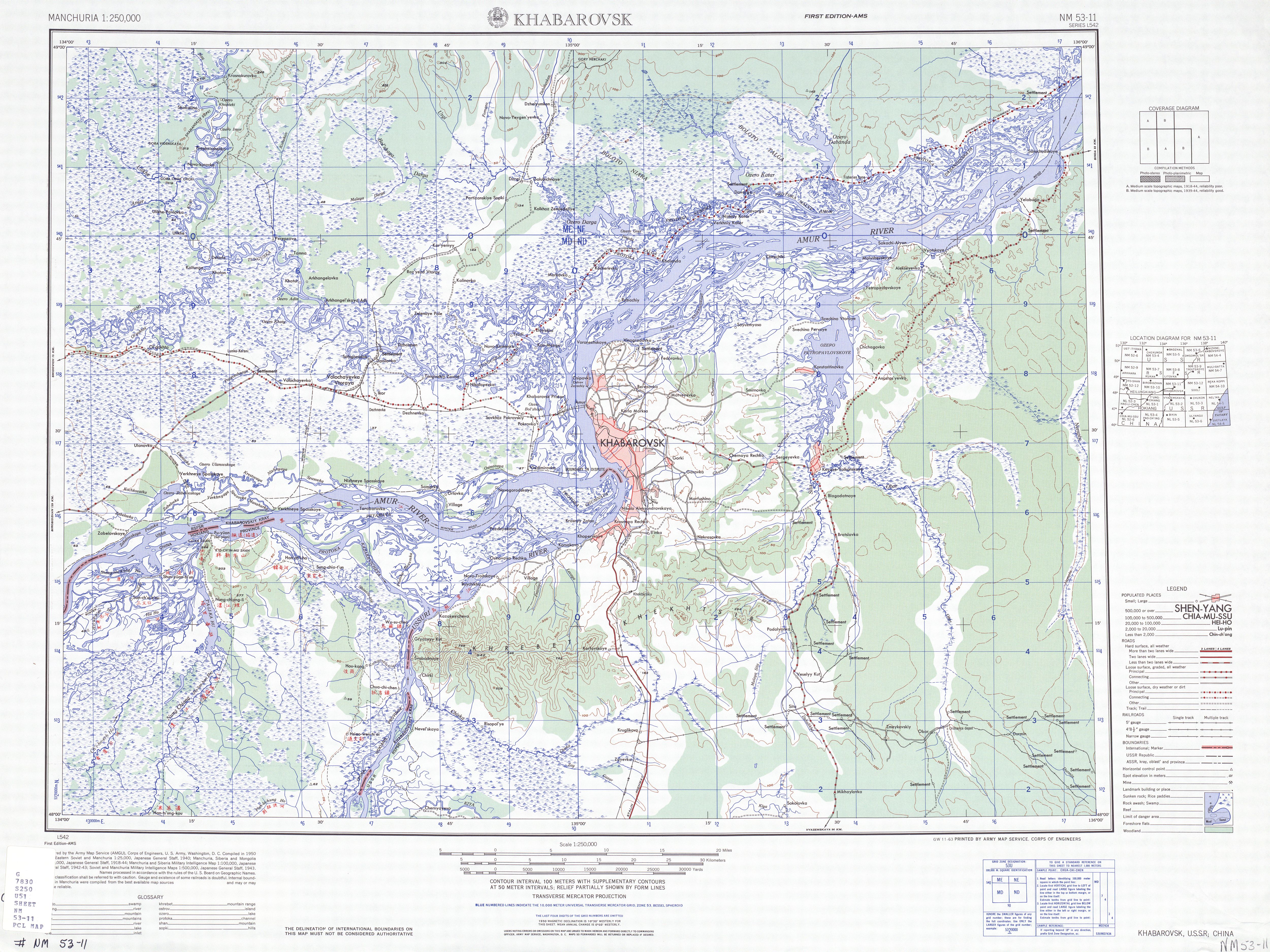
Fuyuan (; ) is a county-level city of the province of Heilongjiang, China. It is under the jurisdiction of the prefecture-level city of Jiamusi. History The area of present-day Fuyuan was inhabited by the Sushen dating back to approximately 4000 BCE. By the early 11th century BCE, local Sushen people began paying tribute to a dynasty hailing from the Central Plains. In 1909, the area was incorporated into the newly-established . In 1913, Suiyuan Prefecture was changed to a county. In 1929, Suiyuan County was renamed to Fuyuan County. The area was brought under control of the Japanese puppet state of Manchukuo in 1934, which placed the area under the administration of . The People's Liberation Army took control the area in 1945. In June 1947, they abolished Sanjiang Province, and merged it into the newly-created Hejiang Province. In April 1951, Fuyuan County was abolished, and replaced with the Fuyuan Fishing Special District, and part of its area was transferred to adjace ... [...More Info...] [...Related Items...] OR: [Wikipedia] [Google] [Baidu] |
Merauke Regency
Merauke Regency is a Regencies of Indonesia, regency in the far south of the Indonesian province of South Papua. It covers an area of 45,013.35 km2, and had a population of 195,716 at the 2010 CensusBiro Pusat Statistik, Jakarta, 2011. and 230,932 at the 2020 Census;Badan Pusat Statistik, Jakarta, 2021. the official estimate as at mid 2024 was 255,168, comprising 132,601 males and 122,567 females.Badan Pusat Statistik, Jakarta, 28 February 2025, ''Kabupaten Merauke Dalam Angka 2025'' (Katalog-BPS 1102001.9401) The administrative centre is the town of Merauke; the town was projected since 2013 to become an independent city (''kota'') separate from Merauke Regency, but the alteration has been deferred subsequently by the Indonesian Government's moratorium on the creation of new cities and regencies. It is also the provincial capital of the province of South Papua, although this is to be moved to a specially-built new location in Salor (city), Salor located in Kurik District to t ... [...More Info...] [...Related Items...] OR: [Wikipedia] [Google] [Baidu] |
Hokkaido
is the list of islands of Japan by area, second-largest island of Japan and comprises the largest and northernmost prefectures of Japan, prefecture, making up its own list of regions of Japan, region. The Tsugaru Strait separates Hokkaidō from Honshu; the two islands are connected by railway via the Seikan Tunnel. The largest city on Hokkaido is its capital, Sapporo, which is also its only cities designated by government ordinance of Japan, ordinance-designated city. Sakhalin lies about to the north of Hokkaidō, and to the east and northeast are the Kuril Islands, which are administered by Russia, though the four most southerly are Kuril Islands dispute, claimed by Japan. The position of the island on the northern end of the archipelago results in a colder climate, with the island seeing significant snowfall each winter. Despite the harsher climate, it serves as an agricultural breadbasket for many crops. Hokkaido was formerly known as ''Ezo'', ''Yezo'', ''Yeso'', or ''Yes ... [...More Info...] [...Related Items...] OR: [Wikipedia] [Google] [Baidu] |
Bonin Islands
The Bonin Islands, also known as the , is a list of islands of Japan, Japanese archipelago of over 30 subtropical and Island#Tropical islands, tropical islands located around SSE of Tokyo and northwest of Guam. The group as a whole has a total area of but only two of the islands are permanently inhabited, Chichijima and Hahajima. Together, their population was 2,560 as of 2021. Administratively, Tokyo Metropolitan Government, Tokyo's Ogasawara Subprefecture also includes the settlements on the Volcano Islands and the Japan Maritime Self-Defense Force, Self-Defense Force post on Iwo Jima. The seat of government is Chichijima. Because of the Bonins' isolation, many of their animals and plants have undergone unique evolutionary processes. It has been called "the Galápagos Islands, Galápagos of the Orient" and was named a natural World Heritage Site in 2011. When first reached during the early modern period, the islands were entirely uninhabited. Subsequent research has found ev ... [...More Info...] [...Related Items...] OR: [Wikipedia] [Google] [Baidu] |
Minami Torishima
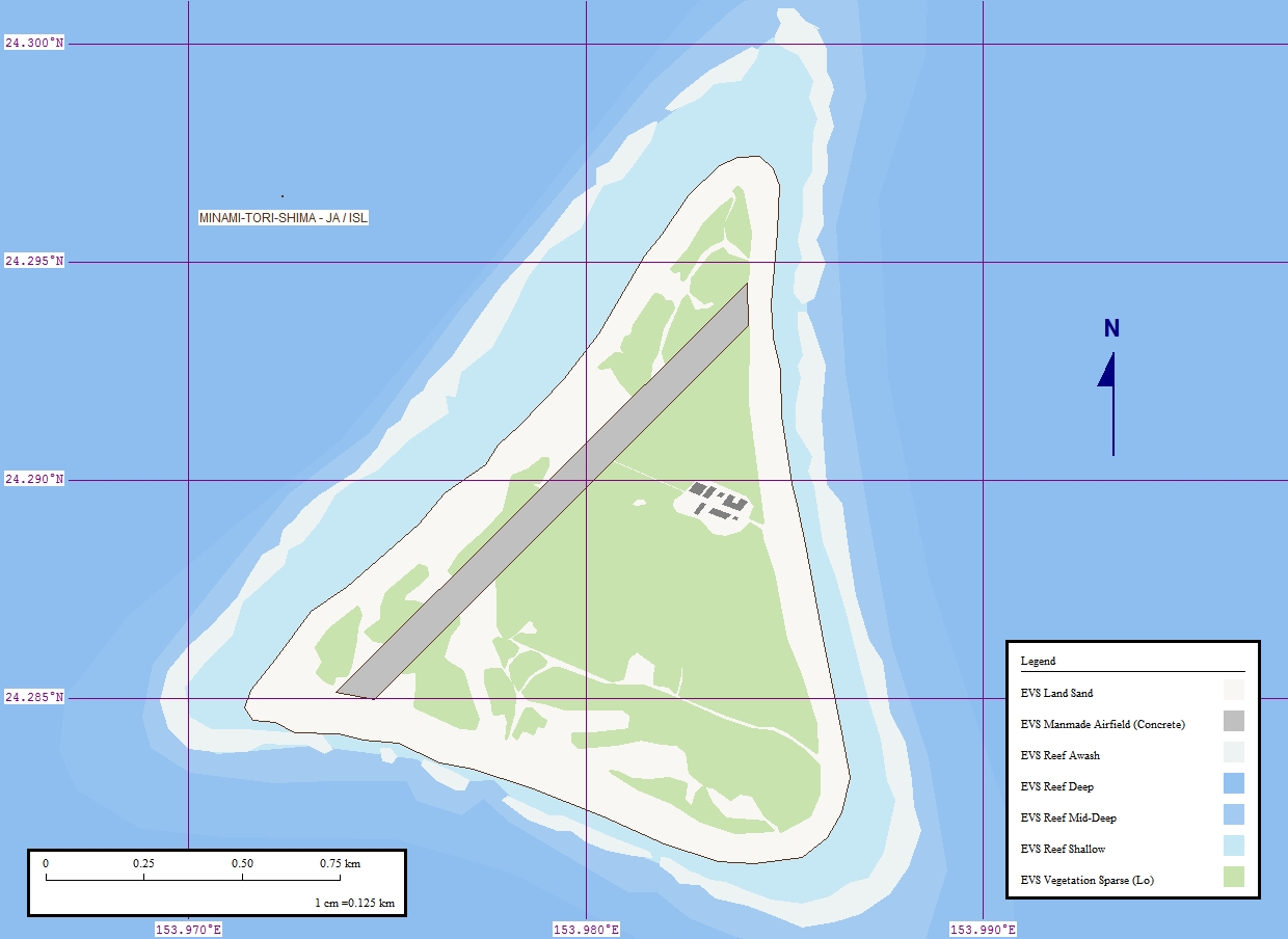
sometimes Minami-Tori-shima or Minami-Torishima, also known as Marcus Island, is an isolated Japanese coral atoll in the northwestern Pacific Ocean, located some southeast of Tokyo and east of the closest Japanese island, South Iwo Jima of the Volcano Islands, and nearly on a straight line between mainland Tokyo and Wake Island, further to the east-southeast. The closest island to Minamitorishima is East Island in the Mariana Islands, which is to the west-southwest. It is the easternmost territory belonging to Japan, and the only Japanese territory on the Pacific Plate, past the Japan Trench. Although small (), it is of strategic importance, as it enables Japan to claim a exclusive economic zone in the surrounding waters. It is also the easternmost territory of Tokyo, being administratively part of Ogasawara Subprefecture. No civilians live there, except personnel of the Japan Meteorological Agency, Japan Self-Defense Forces (JSDF), and Japan Coast Guard serving te ... [...More Info...] [...Related Items...] OR: [Wikipedia] [Google] [Baidu] |
Milne Bay
Milne Bay is a large bay in Milne Bay Province, south-eastern Papua New Guinea. More than long and over wide, Milne Bay is a sheltered deep-water harbor accessible via Ward Hunt Strait. It is surrounded by the heavily wooded Stirling Range (Papua New Guinea), Stirling Range to the north and south, and on the northern shore, a narrow coastal strip, soggy with sago and mangrove swamps. The bay is named after Sir Alexander Milne, 1st Baronet, Sir Alexander Milne. History * Surveyed by Luis Vaez de Torres in July 1606. * Surveyed by Captain Owen Stanley, R.N. F.R.S. in 1850. World War II During World War II, the area was the site of the Battle of Milne Bay in 1942 and by late 1943 it became the major support base, Naval Base Milne Bay, for the New Guinea campaign through the development of Finschhafen as an advanced base after that area was secured in the Huon Peninsula campaign. By January 1944 about 140 vessels were in harbor due to congestion at the facilities. Congestion was r ... [...More Info...] [...Related Items...] OR: [Wikipedia] [Google] [Baidu] |
Autonomous Region Of Bougainville
In developmental psychology and morality, moral, political, and bioethics, bioethical philosophy, autonomy is the capacity to make an informed, uncoerced decision. Autonomous organizations or institutions are independent or self-governing. Autonomy can also be defined from a human resources perspective, where it denotes a (relatively high) level of discretion granted to an employee in his or her work. In such cases, autonomy is known to generally increase job satisfaction. Self-actualization, Self-actualized individuals are thought to operate autonomously of external expectations. In a Medicine, medical context, respect for a patient's personal autonomy is considered one of many fundamental Medical ethics, ethical principles in medicine. Sociology In the sociology of knowledge, a controversy over the boundaries of autonomy inhibited analysis of any concept beyond relative autonomy, until a typology of autonomy was created and developed within science and technology studies. Acco ... [...More Info...] [...Related Items...] OR: [Wikipedia] [Google] [Baidu] |
Nukumanu Islands
The Nukumanu Islands, formerly the Tasman Islands, is an atoll of Papua New Guinea, located in the south-western Pacific Ocean, 4 degrees south of the Equator. Description Comprising a ring of more than twenty islets on a reef surrounding a large lagoon, Nukumanu's sandy islands are located on a strip of coral rising no more than above sea level. The main inhabited islands of Nukumanu are located on the eastern end of the atoll. Administratively Nukumanu is part of the Autonomous Region of Bougainville in Papua New Guinea, but it lies quite far away from the closest territory of Papua New Guinea proper, which is the coast of New Ireland island at to the west. The nearest land is Ontong Java Atoll, located only to the south of Nukumanu. The border between Papua New Guinea and the Solomon Islands runs between these neighboring atolls, which form a small geographic group together with the wholly submerged Roncador Reef at the southern end. History In Polynesian history, th ... [...More Info...] [...Related Items...] OR: [Wikipedia] [Google] [Baidu] |
Kosrae
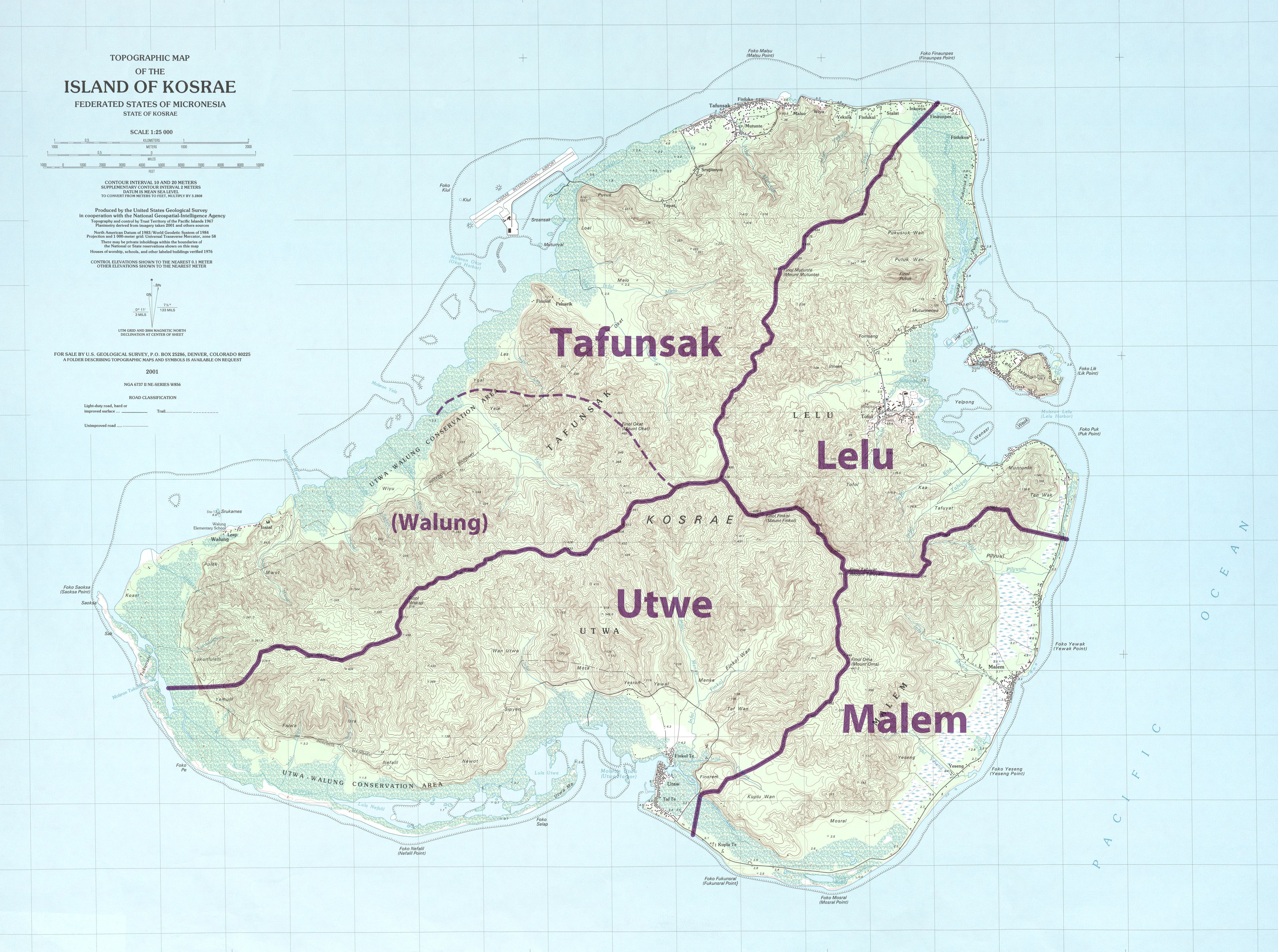
Kosrae ( ), formerly known as Kusaie or Strong's Island, is an island in the Caroline Islands archipelago, and States of Micronesia, state within the Federated States of Micronesia. It includes the main island of Kosrae, traditionally known as Ualung (which means the "high island"), and a few intercoastal islands and islets, the most significant of which (Lelu Island) is inhabited by 1,500 people. Kosrae's land area is , making it the smallest state by area. Sustaining 6,600 people, it is also the smallest by population. Tofol is the state capital, and Mount Finkol is the highest point at . History Archaeological evidence shows that the island was settled at least by the early years of the first millennium AD. This includes the city of Leluh archaeological site, Leluh that existed from about 1250 to 1850 AD, and in its heyday had a population of about 1,500 and covered some . It featured burial pyramids for the nobility. French visitors The French corvette (ship), corvette ... [...More Info...] [...Related Items...] OR: [Wikipedia] [Google] [Baidu] |
Nauru
Nauru, officially the Republic of Nauru, formerly known as Pleasant Island, is an island country and microstate in the South Pacific Ocean. It lies within the Micronesia subregion of Oceania, with its nearest neighbour being Banaba (part of Kiribati) about to the east. With an area of only , Nauru is the List of countries and dependencies by area, third-smallest country in the world, larger than only Vatican City and Monaco, making it the smallest republic and island nation, as well as the smallest member state of the Commonwealth of Nations by area. Demographics of Nauru, Its population of about 10,800 is the world's List of countries and dependencies by population, third-smallest (not including colonies or overseas territories). Nauru is a member of the United Nations, the Commonwealth of Nations, and the Organisation of African, Caribbean and Pacific States. Settled by Micronesians circa 1000 Common Era, BCE, Nauru was annexation, annexed and claimed as a colony by the G ... [...More Info...] [...Related Items...] OR: [Wikipedia] [Google] [Baidu] |


