|
Lisec, Tolmin
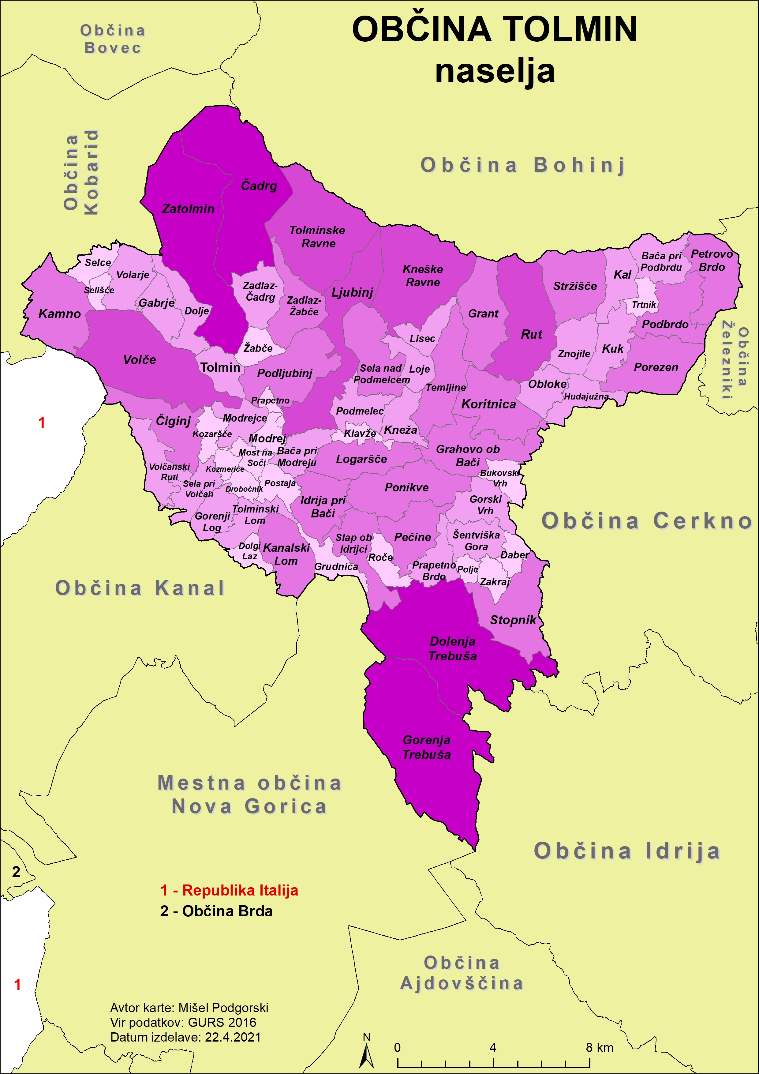
Lisec () is a small dispersed settlement in the hills north of Kneža in the Municipality of Tolmin in the Littoral region of Slovenia. References External linksLisec on Geopedia Populated places in the Municipality of Tolmin {{Tolmin-geo-stub ... [...More Info...] [...Related Items...] OR: [Wikipedia] [Google] [Baidu] |
Slovenia
Slovenia ( ; sl, Slovenija ), officially the Republic of Slovenia (Slovene: , abbr.: ''RS''), is a country in Central Europe. It is bordered by Italy to the west, Austria to the north, Hungary to the northeast, Croatia to the southeast, and the Adriatic Sea to the southwest. Slovenia is mostly mountainous and forested, covers , and has a population of 2.1 million (2,108,708 people). Slovenes constitute over 80% of the country's population. Slovene, a South Slavic language, is the official language. Slovenia has a predominantly temperate continental climate, with the exception of the Slovene Littoral and the Julian Alps. A sub-mediterranean climate reaches to the northern extensions of the Dinaric Alps that traverse the country in a northwest–southeast direction. The Julian Alps in the northwest have an alpine climate. Toward the northeastern Pannonian Basin, a continental climate is more pronounced. Ljubljana, the capital and largest city of Slovenia, is geogra ... [...More Info...] [...Related Items...] OR: [Wikipedia] [Google] [Baidu] |
Slovenian Littoral
The Slovene Littoral ( sl, Primorska, ; it, Litorale; german: Küstenland) is one of the five traditional regions of Slovenia. Its name recalls the former Austrian Littoral (''Avstrijsko Primorje''), the Habsburg possessions on the upper Adriatic coast, of which the Slovene Littoral was part. Geography The region forms the westernmost part of Slovenia, bordering the intermunicipal union of Giuliana in the region of Friuli Venezia Giulia of Italy. It stretches from the Adriatic Sea in the south up to the Julian Alps in the north. The Slovene Littoral comprises two traditional provinces: Goriška and Slovene Istria. The Goriška region takes its name from the town of Gorizia () now in Italy; the neighbouring conurbation of Nova Gorica and Šempeter-Vrtojba today is the urban centre of the Slovene Littoral. Slovene Istria comprises the northern part of the Istria peninsula and provides, on the Slovene Riviera coastline with the ports of Koper, Izola, and Piran, the coun ... [...More Info...] [...Related Items...] OR: [Wikipedia] [Google] [Baidu] |
Statistical Regions Of Slovenia
The statistical regions of Slovenia are 12 administrative entities created in 2000 for legal and statistical purposes. Division By a decree in 2000, Slovenia has been divided into 12 statistical regions (NUTS-3 level), which are grouped in two cohesion regions (NUTS-2 level). which replace the historical regions of the country. The statistical regions have been grouped into two cohesion regions are: * Eastern Slovenia (''Vzhodna Slovenija'' – SI01), which groups the Mura, Drava, Carinthia, Savinja, Central Sava, Lower Sava, Southeast Slovenia, and Littoral–Inner Carniola regions. *Western Slovenia Western Slovenia (''Zahodna Slovenija'') is one of the two NUTS-2 Regions of Slovenia. The region forms the western part of the country and includes the cities of Ljubljana, Koper, Kranj and Nova Gorica. It is the wealthier of the two regions o ... (''Zahodna Slovenija'' – SI02), which groups the Central Slovenia, Upper Carniola, Gorizia, and Coastal–Karst regions. Sou ... [...More Info...] [...Related Items...] OR: [Wikipedia] [Google] [Baidu] |
Gorizia Statistical Region
The Gorizia Statistical Region ( sl, Goriška statistična regija) is a statistical region in western Slovenia, along the border with Italy. It is named after the Italian town of Gorizia (the feminine adjective ''goriška'' comes from the Slovenian name for Gorizia: ''Gorica''). The Julian Alps, the Soča River, and the Vipava Valley are the most prominent natural features of this region. It contributed just over 5% to total national GDP in 2012, but in terms of GDP per capita it ranked fourth in the country. In the same year, disposable income per capita in the region the highest, in second place behind the Central Slovenia Statistical Region. Housing stock estimates indicate that at the end of 2013 the region had the highest share of dwellings with three or more rooms (around 70%). The share of single-room dwellings was less than 10%. Dwellings here are larger than the Slovenian average, with 37 m² of usable floor space per person on average. The number of cars per 1,000 pop ... [...More Info...] [...Related Items...] OR: [Wikipedia] [Google] [Baidu] |
Municipalities Of Slovenia
Slovenia is divided into 212 municipalities ( Slovene: ''občine'', singular'' občina''), of which 12 have urban (metropolitan) status. Municipalities are further divided into local communities and districts. Slovene is an official language of all the municipalities. Hungarian is a second official language of three municipalities in Prekmurje: Dobrovnik/Dobronak, Hodoš/Hodos, and Lendava/Lendva. Italian is a second official language of four municipalities (of which one has urban status) in the Slovene Littoral: Ankaran/Ancarano, Izola/Isola, Koper/Capodistria, and Piran/Pirano. In the EU statistics, the municipalities of Slovenia are classified as "local administrative unit 2" (LAU 2), below 58 administrative units ('), which are LAU 1. Names The Slovene names of the municipalities have the word ''Občina'' 'municipality' followed by a nominative In grammar, the nominative case (abbreviated ), subjective case, straight case or upright case is one of the grammatical cas ... [...More Info...] [...Related Items...] OR: [Wikipedia] [Google] [Baidu] |
Municipality Of Tolmin
The Municipality of Tolmin (; sl, Občina Tolmin) is a municipality in northwestern Slovenia. Its seat and largest settlement is Tolmin. History In ancient times the area was inhabited by the Illyrians and then by the Romans. In the 6th century the Slavs, ancestors of present-day Slovenes, settled the area. Until 1420 it belonged to the Patriarchate of Aquileia, when it was acquired by the Republic of Venice. In 1514 it became a possession of the Habsburgs, who gave it as fief to the Coronini-Cronberg family. Medieval documents testify to a long series of uprisings, culminating in the Tolmin peasant revolt of 1713. That particular insurgence spread from Tolmin County to the Vipava Valley, Karst, and Brda, and further on to northern Istria. The uprising was mercilessly crushed by the imperial army and its eleven leaders were beheaded. In the 16th century, the area became part of the County of Gorizia and Gradisca. During the World War I, Tolmin served as a base for the victo ... [...More Info...] [...Related Items...] OR: [Wikipedia] [Google] [Baidu] |
Dispersed Settlement
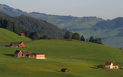
A dispersed settlement, also known as a scattered settlement, is one of the main types of settlement patterns used by landscape historians to classify rural settlements found in England and other parts of the world. Typically, there are a number of separate farmsteads scattered throughout the area. A dispersed settlement contrasts with a nucleated village. It can be known as main human settlements. The French term ''bocage'' is sometimes used to describe the type of landscape found where dispersed settlements are common. In addition to Western Europe, dispersed patterns of settlement are found in parts of Papua New Guinea, as among the Gainj, Ankave, and Baining tribes. It is also frequently met with in nomadic pastoral societies. In Ghana, Kumbyili in the northern region is also an example of a dispersed settlement England In England, dispersed settlements are often found in the areas of ancient enclosure outside the central region—for example, Essex, Kent and the West Co ... [...More Info...] [...Related Items...] OR: [Wikipedia] [Google] [Baidu] |
Kneža
Kneža () is a village in the Bača Valley in the Municipality of Tolmin in the Littoral region of Slovenia. The Bohinj Railway line runs through the settlement. Name Kneža was attested in written sources in 1377 as ''villa de Chinessa'', and the corresponding hydronym (today Knežica Creek) was attested as ''Knesaha'' in 891. The name is derived from ''*Kъnędz′a (vьsь/voda/rěka)'' 'prince's (village/creek/river)', indicating that the territory was owned by a prince. Church The parish church in the settlement is dedicated to Saint George and belongs to the Koper Koper (; it, Capodistria, hr, Kopar) is the fifth largest city in Slovenia. Located in the Istrian region in the southwestern part of the country, approximately five kilometres () south of the border with Italy and 20 kilometres () from Triest ... Diocese. References External links *Kneža on Geopedia Populated places in the Municipality of Tolmin {{Tolmin-geo-stub ... [...More Info...] [...Related Items...] OR: [Wikipedia] [Google] [Baidu] |


