|
Limbang District
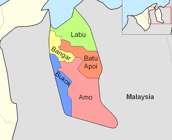
The Limbang District is one of the two districts of Limbang Division, Malaysia. It has a total area of 3,978.10 square kilometres. The major town is Limbang. It has one sub-district, which is Nanga Medamit Sub-District. It borders Brunei Darussalam to the west and east, Lawas District to the southeast and Miri District at the south and southwest. Due to being squeezed in between Brunei at its north and coastal areas, Limbang is accessible by road only by going through immigration posts. History The area was annexed by Charles Anthoni Johnson Brooke, the second Rajah of Sarawak in 1890 from Brunei to become the fifth division of Sarawak. The annexation was strongly disputed by Brunei. The de facto boundary ran along the watershed between the Brunei River and Limbang River basins on the western side of the district, and along the length of the Pandaruan River on the eastern side. Boundary agreements have delineated a stretch of the western border and the Pandaruan Ri ... [...More Info...] [...Related Items...] OR: [Wikipedia] [Google] [Baidu] |
List Of Districts In Malaysia
Districts (; '' Jajahan'' in Kelantan) are a type of subdivision below the state level in Malaysia. An administrative district is administered by a lands and district office () which is headed by district officer (). Classification In Peninsular Malaysia, a district is a subdivision of a state. A ''mukim'' ( commune, sub-district or parish) is a subdivision of a district. The National Land Code assigns land matters, including the delineation of districts, to the purview of state governments. These states operate a Torrens system, with districts administered by the respective state’s land and district office, and coordinated by the land and mines office. The state of Perlis is not divided into districts due to its size, but straight to the mukim level. The three Federal Territories are also not divided into districts; however Kuala Lumpur is divided into several mukim for land administration purposes. Putrajaya is divided into ''precincts''. In East Malaysia, a district is ... [...More Info...] [...Related Items...] OR: [Wikipedia] [Google] [Baidu] |
Pandaruan River
The Pandaruan River () is a river that forms an international border on the island of Borneo, between Temburong, Brunei and Limbang, Malaysia. It is located at the river mouth of the Brunei Bay. History On 4 May 1968, the 67 Gurkha Independent Field Squadron of the Queen's Gurkha Engineers built the first road alongside the river. Soil erosion destroyed the road connecting Kampong Belais and Buda-Buda in the early 2000s. The Pandaruan Bridge which is also known as the Brunei–Malaysia Friendship Bridge, crosses the river linking Pandaruan in Sarawak, Malaysia, and Kampong Puni in Temburong, Brunei. The opening of the bridge on 8 December 2013 enabled the vehicular ferry service, which was then the only means for vehicles to cross the river, to be discontinued. Brunei and Malaysia have border crossing checkpoints at these locations. Vacation lodges were scheduled to be completed by the end of 2019. See also * Brunei–Malaysia relations * List of rivers of Brune ... [...More Info...] [...Related Items...] OR: [Wikipedia] [Google] [Baidu] |
Temburong District
Temburong District (; Jawi script, Jawi: دائيره تمبوروڠ) or simply known as Temburong ('; ), is the second largest and least populated districts of Brunei, district in Brunei. It has an area of and the population of 9,444 as of 2021. The district is also home to its administrative centre, Bangar Town (), as well as the Temburong River and Ulu Temburong National Park, the country's List of rivers of Brunei, third longest river and a national parkUNEP-WCMC (2023)Protected Area Profile for Ulu Temburongfrom the World Database on Protected Areas. Accessed 18 March 2023. in Brunei respectively. Geography The Malaysian district of Limbang divided the Temburong District, an exclave, from the rest of Brunei. It is a location for ecotourism and is home to a large portion of the Sultanate's virgin rainforests. Nestled between the Limbang River, Limbang and Trusan Rivers on all sides, Bukit Pagon (1,850 m) dominates the eastern region of Brunei. The Royal Geographical Soci ... [...More Info...] [...Related Items...] OR: [Wikipedia] [Google] [Baidu] |
Border Checkpoint
A border checkpoint is a location on an international border where travelers or goods are inspected and allowed (or denied) passage through. Authorization often is required to enter a country through its borders. Access-controlled borders often have a limited number of checkpoints where they can be crossed without legal sanctions. Arrangements or treaties may be formed to allow or mandate less restrained crossings (e.g. the Schengen Agreement). Land border checkpoints (land ports of entry) can be contrasted with the customs and immigration facilities at seaports, international airports, and other ports of entry. Checkpoints generally serve two purposes: * To prevent entrance of individuals who are either undesirable (e.g. criminals or others who pose threats) or simply unauthorized to enter. * To prevent entrance of goods that are illegal or subject to restriction, or to collect tariffs. Checkpoints are usually staffed by a uniformed service (sometimes referred to as ... [...More Info...] [...Related Items...] OR: [Wikipedia] [Google] [Baidu] |
Black Pepper
Black pepper (''Piper nigrum'') is a flowering vine in the family Piperaceae, cultivated for its fruit (the peppercorn), which is usually dried and used as a spice and seasoning. The fruit is a drupe (stonefruit) which is about in diameter (fresh and fully mature), dark red, and contains a stone which encloses a single pepper seed. Peppercorns and the ground pepper derived from them may be described simply as ''pepper'', or more precisely as ''black pepper'' (cooked and dried unripe fruit), ''green pepper'' (dried unripe fruit), or ''white pepper'' (ripe fruit seeds). Black pepper is native to the Malabar Coast of India, and the Malabar pepper is extensively cultivated there and in other tropical regions. Ground, dried, and cooked peppercorns have been used since antiquity, both for flavour and as a traditional medicine. Black pepper is the world's most traded spice, and is one of the most common spices added to cuisines around the world. Its spiciness is due to the che ... [...More Info...] [...Related Items...] OR: [Wikipedia] [Google] [Baidu] |
Rattan
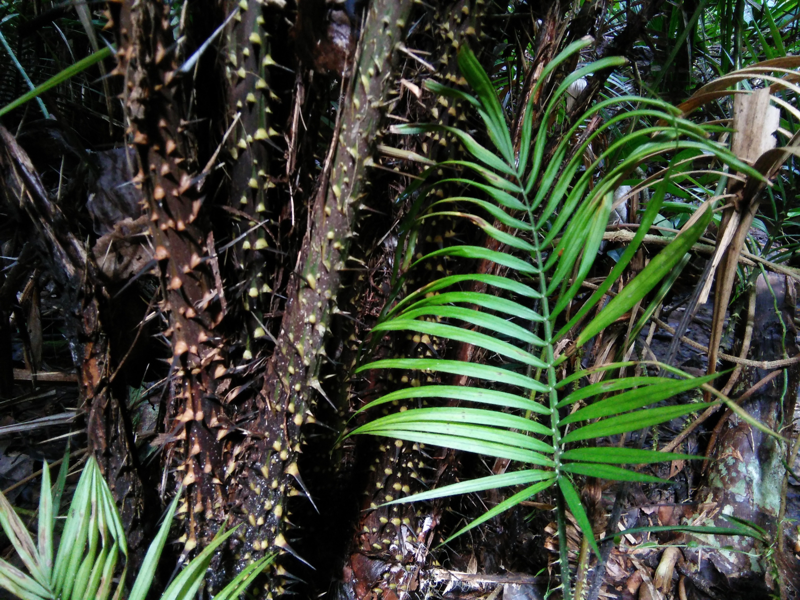
Rattan, also spelled ratan (from Malay language, Malay: ''rotan''), is the name for roughly 600 species of Old World climbing palms belonging to subfamily Calamoideae. The greatest diversity of rattan palm species and genera are in the closed-Canopy (biology), canopy Old-growth forest, old-growth tropical forests of Southeast Asia, though they can also be found in other parts of tropical Asia and Africa. Most rattan palms are ecologically considered lianas due to their climbing habits, unlike other palm species. A few species also have tree-like or shrub-like habits. Around 20% of rattan palm species are economically important and are traditionally used in Southeast Asia in producing wickerwork furniture, baskets, Walking stick, canes, woven mats, Rope, cordage, and other handicrafts. Rattan canes are one of the world's most valuable non-timber forest products. Some species of rattan also have edible scaly fruit and heart of palm. Despite increasing attempts in the last 30 y ... [...More Info...] [...Related Items...] OR: [Wikipedia] [Google] [Baidu] |
Oil Palm
''Elaeis'' () is a genus of palms, called oil palms, containing two species, native to Africa and the Americas. They are used in commercial agriculture in the production of palm oil. Description Mature palms are single-stemmed, and can grow well over tall. The leaves are pinnate, and reach between long. The flowers are produced in dense clusters; each individual flower is small, with three sepals and three petals. The palm fruit is reddish, about the size of a large plum, and grows in large bunches. Each fruit is made up of an oily, fleshy outer layer (the pericarp), with a single seed (the palm kernel), also rich in oil. Species The two species, '' E. guineensis'' (Africa) and '' E. oleifera'' (Americas) can produce fertile hybrids. The genome of ''E. guineensis'' has been sequenced, which has important implications for breeding improved strains of the crop plants. Distribution and habitat ''E. guineensis'' is native to west and southwest Africa, occurr ... [...More Info...] [...Related Items...] OR: [Wikipedia] [Google] [Baidu] |
Sarawak
Sarawak ( , ) is a States and federal territories of Malaysia, state of Malaysia. It is the largest among the 13 states, with an area almost equal to that of Peninsular Malaysia. Sarawak is located in East Malaysia in northwest Borneo, and is bordered by the Malaysian state of Sabah to the northeast, Kalimantan (the Indonesian portion of Borneo) to the south, and Brunei in the north. The state capital, Kuching, is the largest city in Sarawak, the economic centre of the state, and the seat of the Sarawak state government. Other cities and towns in Sarawak include Miri, Malaysia, Miri, Sibu, and Bintulu. As of 2020 Malaysia census, the population of Sarawak was 2.453 million. Sarawak has an equatorial climate with tropical rainforests and abundant animal and plant species. It has several prominent cave systems at Gunung Mulu National Park. Rajang River is the longest river in Malaysia; Bakun Dam, one of the largest dams in Southeast Asia, is located on one of its tributaries, the ... [...More Info...] [...Related Items...] OR: [Wikipedia] [Google] [Baidu] |
Orang Ulu
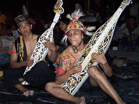
Orang Ulu ("people of the interior" in Malay) is an ethnic designation politically coined to group together roughly 27 very small but ethnically diverse tribal groups in northeastern Sarawak, Malaysia with populations ranging from less than 300 persons to over 25,000 persons. ''Orang Ulu'' is not a legal term, and no such racial group exists or is listed in the Malaysian Constitution. The term was popularised by the Orang Ulu National Association (OUNA), which was formed in 1969. Orang Ulu is totalling 180 000 people which is 6.2% from 2.8millions of Sarawak people. The Orang Ulu tribal groups are diverse, they typically live in longhouses elaborately decorated with murals and woodcarvings. They are also well known for their intricate beadwork detailed tattoos, rattan weaving, and other tribal crafts. The Orang Ulu tribes can also be identified by their unique music - distinctive sounds from their sapes, a plucked boat-shaped lute, formerly with two strings, nowadays usually ... [...More Info...] [...Related Items...] OR: [Wikipedia] [Google] [Baidu] |
Lun Bawang
The Lun Bawang (formerly known as Trusan Murut and Mengalong Murut or Southern Murut) is an ethnic group found in Central Northern Borneo. They are indigenous to the southwest of Sabah (Interior Division including Labuan) and the northern region of Sarawak (Limbang Division), highlands of North Kalimantan (Long Bawan , Krayan, Malinau Regency, Malinau, Kayan Mentarang National Park, Mentarang ) and Brunei (Temburong District). In the Malaysian state of Sarawak, the Lun Bawang (through the term ''Murut'') are officially recognised by the Constitution as a native of Sarawak and are categorised under the Orang Ulu people; whilst in the neighbouring state of Sabah and Krayan, Krayan highland in Kalimantan, they are sometimes named ''Lundayeh'' or ''Lun Daye''. In Brunei, they are also identified by law as one of the 7 natives (Indigenous peoples of Brunei, indigenous people) of Brunei, through the term ''Murut''. Nevertheless, in Sabah, Kalimantan, and Brunei, the term Lun Baw ... [...More Info...] [...Related Items...] OR: [Wikipedia] [Google] [Baidu] |
People's Daily
The ''People's Daily'' ( zh, s=人民日报, p=Rénmín Rìbào) is the official newspaper of the Central Committee of the Chinese Communist Party (CCP). It provides direct information on the policies and viewpoints of the CCP in multiple languages. It is the largest newspaper in the China, People's Republic of China (PRC). History The paper was established on 15 June 1948 and was published in Pingshan County, Hebei. It was formed from the merger of the ''Jin-Cha-Ji Daily'' and the newspapers of the Jin-Ji-Lu-Yu base area. On 15 March 1949, its office was moved to Beijing, and the original People's Daily Beijing edition was renamed ''Beijing Liberation Daily''. The newspaper ceased publication on 31 July 1949, with a total of 406 issues published. Since the newspaper was the official newspaper of the North China Central Bureau of the CCP, it was historically known as the ''North China People's Daily'' or the ''People's Daily North China Edition''. At the same time, in order ... [...More Info...] [...Related Items...] OR: [Wikipedia] [Google] [Baidu] |


