|
Lents
The Lents neighborhood in the Southeast section of Portland, Oregon is bordered by SE Powell Blvd. on the north, the Clackamas County line or City of Portland line on the south (whichever is farther south), SE 82nd Ave. to the west, and roughly SE 112th on the east. The NE corner overlaps with the Powellhurst-Gilbert neighborhood. In addition to Powellhurst-Gilbert on the north and east, Lents also borders Foster-Powell, Mt. Scott-Arleta, and Brentwood-Darlington on the west and Pleasant Valley on the east. The neighborhood is one of the larger in the city at and one of its oldest. Since the late 20th century, it has become more diverse, the home of many Asian, Russian/Eastern European, and Latino immigrants. Lents is six miles (10 km) southeast of downtown Portland and lies within the 97266 ZIP code. History Lents was originally platted as the Town of Lent by Oliver P. Lent (1830–1899) in 1892. The original town was bounded by SE Foster Rd., SE Duke St., SE 9 ... [...More Info...] [...Related Items...] OR: [Wikipedia] [Google] [Baidu] |
Interstate 205 (Oregon–Washington)
Interstate 205 (I-205) is an auxiliary Interstate Highway in the Portland metropolitan area of Oregon and Washington, United States. The north–south freeway serves as a bypass route of I-5 along the east side of Portland, Oregon, and Vancouver, Washington. It intersects several major highways and serves Portland International Airport. The freeway is long and connects to I-5 at both of its termini; to the south in Tualatin, Oregon, and to the north in Salmon Creek, Washington. I-205 is named the Veterans Memorial Highway and East Portland Freeway No. 64 in Oregon (see Oregon highways and routes). From Oregon City to Vancouver, the corridor is paralleled by a multi-use bicycle and pedestrian trail, as well as portions of the MAX Light Rail system between Clackamas and northeastern Portland. A freeway to serve as an eastern bypass of Portland and Vancouver was conceived in a 1943 plan for the area, and in the 1950s was included in the federal government's preliminar ... [...More Info...] [...Related Items...] OR: [Wikipedia] [Google] [Baidu] |
Metropolitan Area Express (Portland, Oregon)
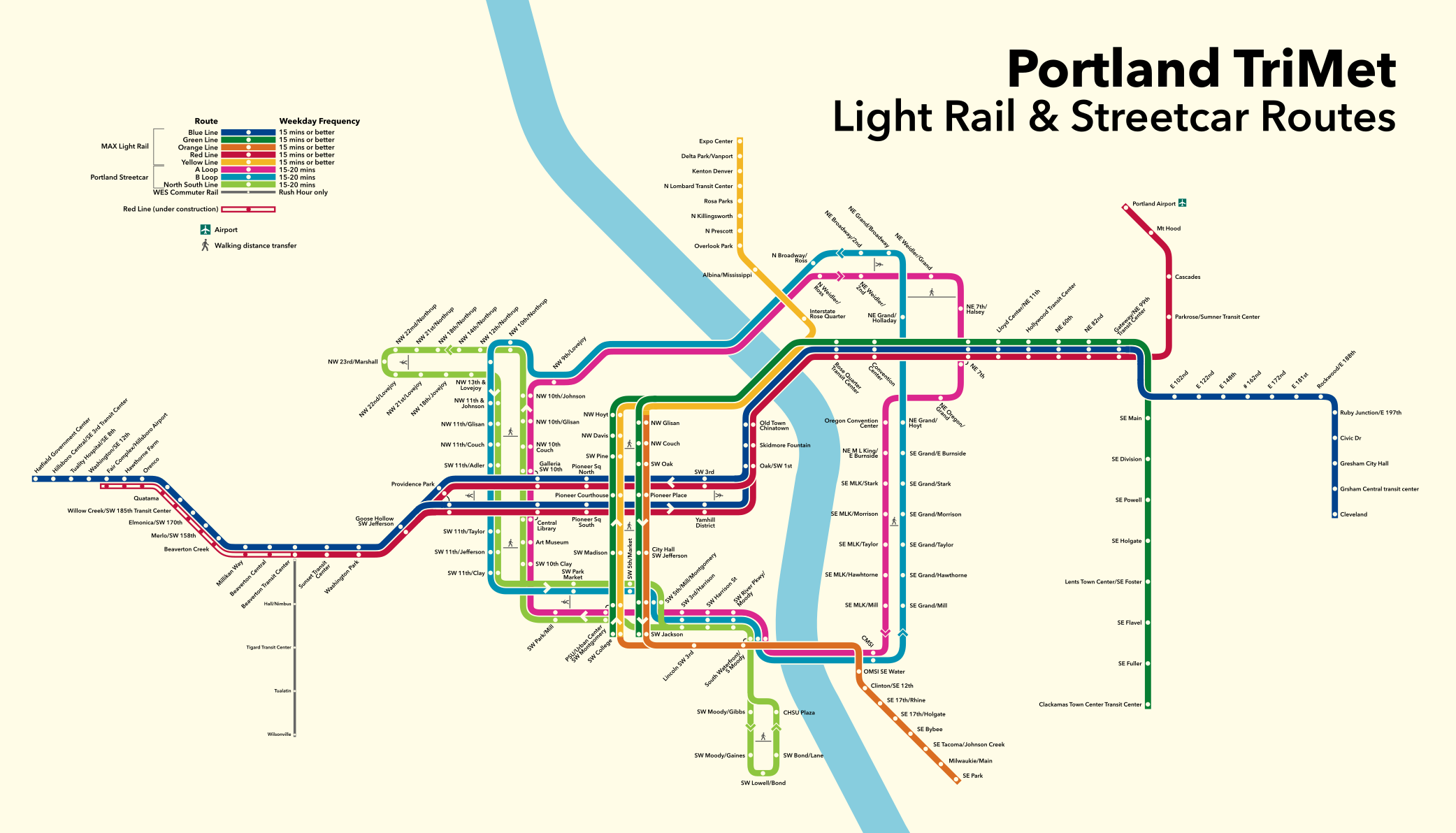
The Metropolitan Area Express (MAX) is a light rail system serving the Portland metropolitan area in the U.S. state of Oregon. Owned and operated by TriMet, it consists of five color-designated lines that altogether connect the six sections of Portland; the communities of Beaverton, Clackamas, Gresham, Hillsboro, Milwaukie, and Oak Grove; and Portland International Airport to Portland City Center. Service runs seven days a week with headways of between 30 minutes off-peak and three minutes during rush hours. In 2019, MAX had an average daily ridership of 120,900, or 38.8 million annually. Due to the COVID-19 pandemic, which impacted public transit use globally, annual ridership plummeted, with only 14.8 million riders recorded in 2021. MAX was among the first second-generation American light rail systems to be built, conceived from freeway revolts that took place in Portland in the early 1970s. Planning for the network's inaugural eastside segment, then re ... [...More Info...] [...Related Items...] OR: [Wikipedia] [Google] [Baidu] |
Pleasant Valley, Portland, Oregon
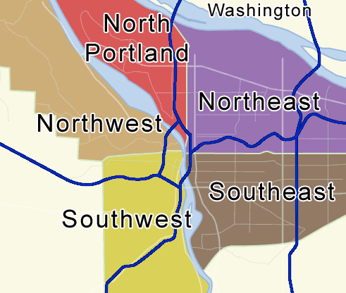
Portland, Oregon is divided into six sections: North Portland, Northeast Portland, Northwest Portland, South Portland, Southeast Portland, and Southwest Portland. There are 95 officially recognized neighborhoods, each of which is represented by a volunteer-based neighborhood association. No neighborhood associations overlap the Willamette River, but a few overlap the addressing sextants. For example, most addresses in the South Portland Neighborhood Association are South, but a portion of the neighborhood is west of SW View Point Terrace where addresses have a SW prefix. Similarly the Buckman Neighborhood Association spans both NE and SE Portland. Neighborhood associations serve as the liaison between residents and the city government, as coordinated by the city's Office of Community & Civic Life, which was created in 1974 and known as the Office of Neighborhood Involvement until July 2018. The city subsequently provides funding to this "network of neighborhoods" through distr ... [...More Info...] [...Related Items...] OR: [Wikipedia] [Google] [Baidu] |
MAX Green Line
The MAX Green Line is a light rail service in Portland, Oregon, United States, operated by TriMet as part of the MAX Light Rail system. It is long and serves 30 stations from the PSU South stations to Clackamas Town Center Transit Center; it connects Portland State University (PSU), Portland City Center, Northeast Portland, Southeast Portland, and Clackamas. The Green Line is the only service that shares parts of its route with the four other MAX services, sharing the Portland Transit Mall with the Orange and Yellow lines and the Banfield segment of the Eastside MAX with the Blue and Red lines. Southbound from Gateway/Northeast 99th Avenue Transit Center, it operates the Interstate 205 (I-205) segment through to Clackamas Town Center. Service runs for approximately 21 hours daily with a headway of 15 minutes during most of the day. It is the third-busiest line in the system, carrying an average of 19,160 riders per day on weekdays in September 2019. Planning for ligh ... [...More Info...] [...Related Items...] OR: [Wikipedia] [Google] [Baidu] |
Woody Guthrie
Woodrow Wilson Guthrie (; July 14, 1912 – October 3, 1967) was an American singer-songwriter, one of the most significant figures in American folk music. His work focused on themes of American Left, American socialism and anti-fascism. He has inspired several generations both politically and musically with songs such as "This Land Is Your Land", written in response to the American exceptionalism, American exceptionalist song "God Bless America". Guthrie wrote hundreds of Country music, country, Folk music, folk, and Children's music, children's songs, along with ballads and improvised works. ''Dust Bowl Ballads'', Guthrie's album of songs about the Dust Bowl period, was included on ''Mojo (magazine), Mojo'' magazine's list of 100 Records That Changed The World, and many of his recorded songs are archived in the Library of Congress. Songwriters who have acknowledged Guthrie as a major influence on their work include Bob Dylan, Phil Ochs, Johnny Cash, Bruce Springsteen, Robe ... [...More Info...] [...Related Items...] OR: [Wikipedia] [Google] [Baidu] |
Springwater Corridor
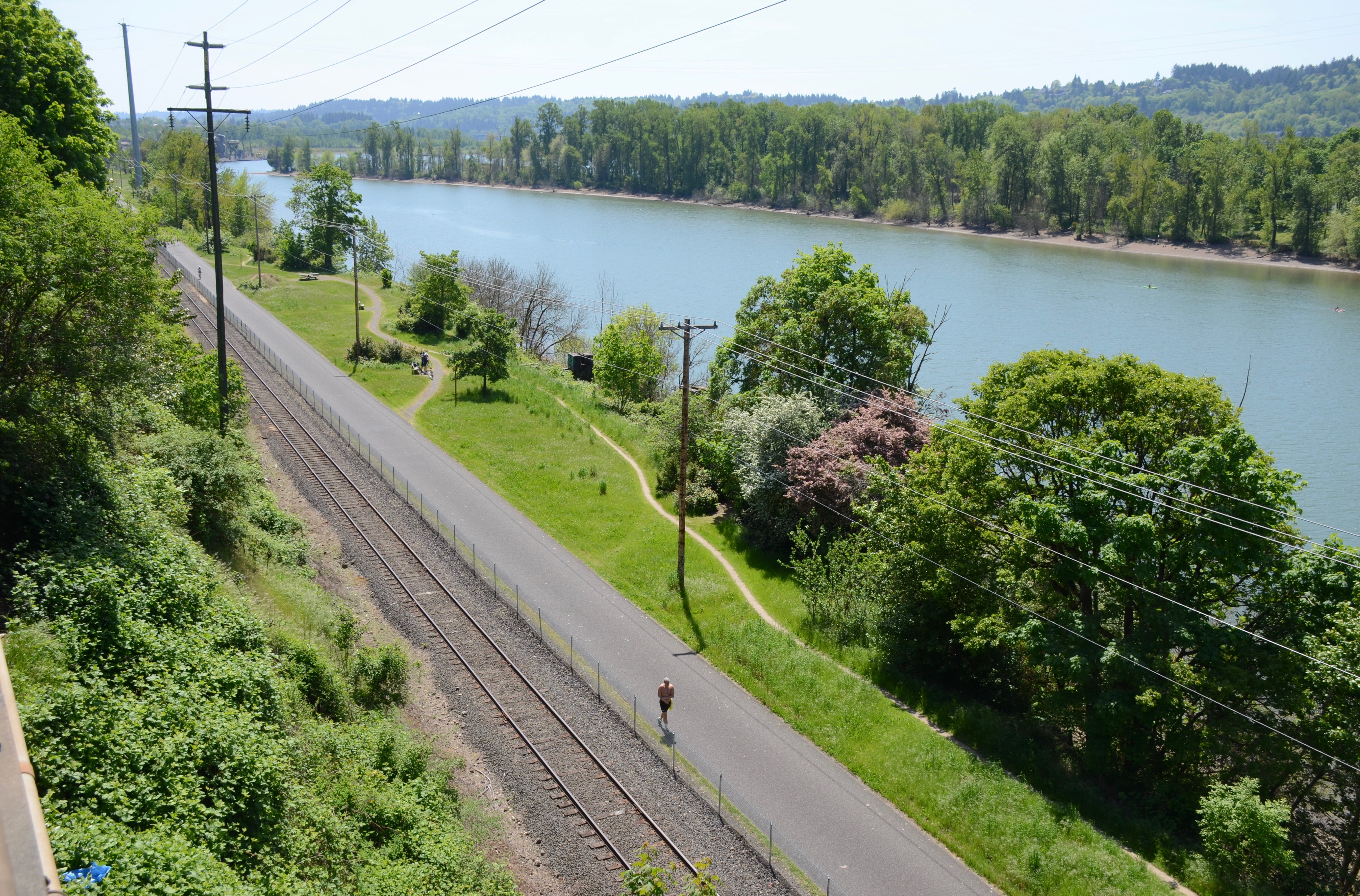
The Springwater Corridor Trail is a bicycle and pedestrian rail trail in the Portland metropolitan area in Oregon, United States. It follows a former railway line from Boring through Gresham to Portland, where it ends south of the Eastbank Esplanade. Most of the corridor, about long, consists of paved, off-street trail, though about overlaps city streets in Portland's Sellwood neighborhood. A large segment roughly follows the course of Johnson Creek and crosses it on bridges many times. Much of the corridor was acquired by the City of Portland in 1990; remaining segments were acquired by Metro thereafter. The trail is part of the Portland area's 40-Mile Loop trail system. It connects to many adjacent or nearby parks, including Tideman Johnson Natural Area, Powell Butte, and others. History The Springwater Division rail line was named for a planned connection to Springwater, Oregon. The Portland Traction Company operated rail service from Portland to Boring from 1903 un ... [...More Info...] [...Related Items...] OR: [Wikipedia] [Google] [Baidu] |
Powellhurst-Gilbert, Portland, Oregon
Powellhurst-Gilbert is a neighborhood in the Southeast section of Portland, Oregon. It borders the neighborhoods of Montavilla, Hazelwood, and Mill Park on the north, Centennial on the east, Pleasant Valley on the east and south, and Lents and South Tabor on the west. According to the Neighborhood Plan, the neighborhood is named after two of its schools: Powellhurst (named in the 1920s after 1850s settler Jackson Powell) and Gilbert (named after William M. Gilbert, an Indiana emigrant who settled in the area c. 1890). Settlement of the community by farmers via the Donation Land Claim Act began in the middle of the 19th century. Rail service to Portland began in 1892, spurring residential development. The resulting suburb was gradually annexed by Portland beginning in the 1960s and completing in 1994. The neighborhood includes the Jade District commercial and cultural center. Powellhurst-Gilbert contains Portland's largest Asian population, making up 17.89% of the city's pop ... [...More Info...] [...Related Items...] OR: [Wikipedia] [Google] [Baidu] |
Portland, Oregon
Portland (, ) is a port city in the Pacific Northwest and the largest city in the U.S. state of Oregon. Situated at the confluence of the Willamette and Columbia rivers, Portland is the county seat of Multnomah County, the most populous county in Oregon. Portland had a population of 652,503, making it the 26th-most populated city in the United States, the sixth-most populous on the West Coast, and the second-most populous in the Pacific Northwest, after Seattle. Approximately 2.5 million people live in the Portland metropolitan statistical area (MSA), making it the 25th most populous in the United States. About half of Oregon's population resides within the Portland metropolitan area. Named after Portland, Maine, the Oregon settlement began to be populated in the 1840s, near the end of the Oregon Trail. Its water access provided convenient transportation of goods, and the timber industry was a major force in the city's early economy. At the turn of the 20th centu ... [...More Info...] [...Related Items...] OR: [Wikipedia] [Google] [Baidu] |
Brentwood-Darlington, Portland, Oregon
Brentwood-Darlington is a neighborhood on the southern edge of Portland, Oregon, bordering SE 45th Avenue to the west, SE Duke Street to the north, and SE 82nd Avenue to the east. The county line separating Multnomah County from Clackamas County forms most of the neighborhood's (and the city's) southern boundary, though small portions of the neighborhood and the city extend into Clackamas County. (Conversely, some areas in the neighborhood in Multnomah County are outside Portland city limits.) Roughly, the southern boundary is SE Harney Drive on the eastern one-fourth, and SE Clatsop Street on the other three-quarters. ThBrentwood-Darlington Neighborhood Associationdates to 1974 when it was founded as the Errol Heights Improvement Association, serving the neighborhoods of Errol Heights, Brentwood, Darlington, Harney Park, Woodmere, and Crystal Springs. In 2013, the Brentwood-Darlington Neighborhood Association held a 'visioning' process to determine future plans for the neighbo ... [...More Info...] [...Related Items...] OR: [Wikipedia] [Google] [Baidu] |
Hawthorne Bridge
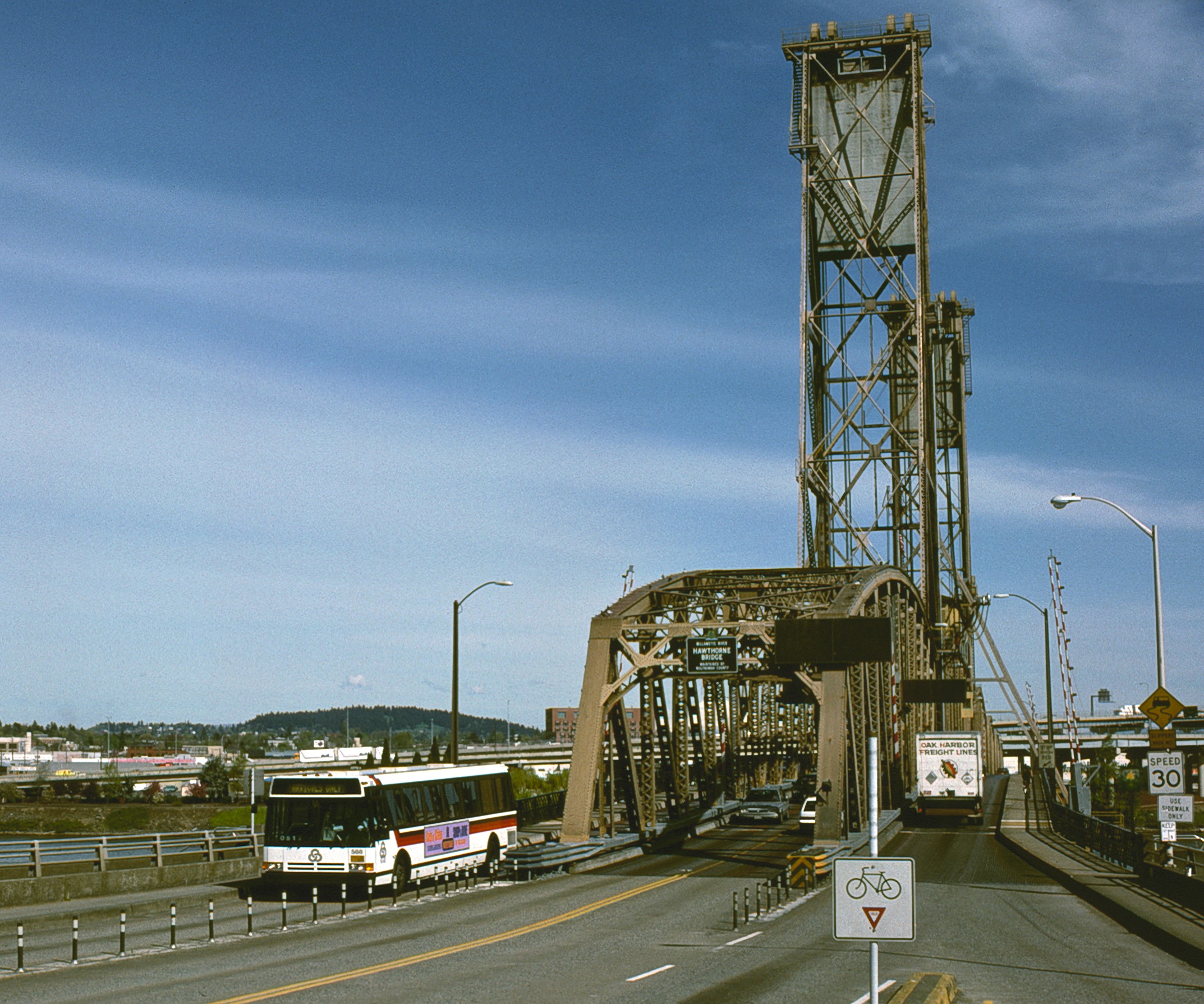
The Hawthorne Bridge is a truss bridge with a vertical lift that spans the Willamette River in Portland, Oregon, joining Hawthorne Boulevard and Madison Street. It is the oldest vertical-lift bridge in operation in the United States and the oldest highway bridge in Portland. It is also the busiest bicycle and transit bridge in Oregon, with over 8,000 cyclists and 800 TriMet buses (carrying about 17,400 riders) daily. It was added to the National Register of Historic Places in November 2012. Statistics The bridge consists of five fixed spans and one vertical-lift span. It is in total length. The bridge was originally wide, including two five-foot sidewalks, but the sidewalks were widened to 10 feet in 1998, increasing the structure's overall width to . The counterweights are suspended from the two towers. It is operated by a pair of 150-horsepower motors. On average, the lift span is raised for river traffic 120 times per month. While the river is at low level, th ... [...More Info...] [...Related Items...] OR: [Wikipedia] [Google] [Baidu] |
Lucia H
Lucia may refer to: Arts and culture * '' Lucía'', a 1968 Cuban film by Humberto Solás * ''Lucia'' (film), a 2013 Kannada-language film * ''Lucia & The Best Boys'', a Scottish indie rock band formerly known as ''LUCIA'' * "Lucia", a Swedish children's song published in '' Barnens svenska sångbok'' * Lucia Ashton, the title character of '' Lucia di Lammermoor'', a 1836 opera by Gaetano Donizetti * one of the title characters of '' Mapp and Lucia'', a series of novels by E. F. Benson * Saint Lucy's Day, a Christian feast day observed on 13 December Places * Lucia, California, a hamlet in Big Sur, California * La Lucia, a suburb in Umhlanga, KwaZulu-Natal, South Africa Other uses * ''Lucia'' (butterfly), a butterfly genus from the tribe Luciini * ''Lucia'' (moth), a synonym of the moth genus ''Adrapsa'' * Lucia (name), a feminine given name and a surname, including a list of people and fictional characters with the name Lucia or Lucía * 222 Lucia, an asteroid See also * ... [...More Info...] [...Related Items...] OR: [Wikipedia] [Google] [Baidu] |


