|
Leirvassbu
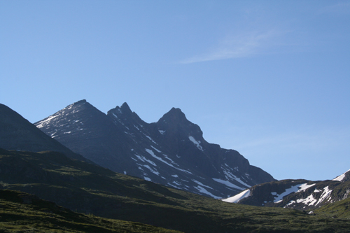
Leirvassbu is a staffed lodge with hut of the Norwegian Trekking Association (In Norwegian, Den Norske Turistforening – DNT) located in the Leirdal in the county Oppland in the middle of Norway. The hut is located about 1400 meters above sea level in the high mountains Jotunheimen. Several walks are possible. It is located at the end of a side road off Norwegian County Road 55, the Sognefjellsvegen, just before Lake Bøvertunvatnet. Surrounding places are Bøvertun, Krossbu and Elveseter. External links LeirvassbuLeirvassbu* Norwegian Trekking Association The Norwegian Trekking Association ( no, Den norske turistforening, DNT) is a Norwegian association which maintains mountain trails and cabins in Norway. The association was founded on 21 January 1868 with the scope "to help and develop tourism i ...br>''Leirvassbu'' {{Coord, 61, 32, 56, N, 8, 14, 49, E, region:NO, display=title Tourist huts in Norway Jotunheimen ... [...More Info...] [...Related Items...] OR: [Wikipedia] [Google] [Baidu] |
Leirdal
Leirdal or Leirdalen is a U-shaped valley in Lom Municipality in Innlandet county, Norway. The long valley lies on the south side of the larger Bøverdalen valley. The Leirdalen valley begins at the mountain Kyrkja, just north of the Høgvagltindene mountains and it then follows the river Leira to the northwest and then northeast to the village of Elvesæter where the valley ends and the river joins the river Bøvra and it becomes part of the Bøverdalen valley heading to the northeast. The valley goes into the Jotunheimen mountains and it lies just west of Galdhøpiggen, the tallest mountain in Norway. There are two tourist cabins located in the valley. The Jotunheimen Fjellstue is located about half-way into the valley and Leirvassbu Leirvassbu is a staffed lodge with hut of the Norwegian Trekking Association (In Norwegian, Den Norske Turistforening – DNT) located in the Leirdal in the county Oppland in the middle of Norway. The hut is located about 1400 meters above ... [...More Info...] [...Related Items...] OR: [Wikipedia] [Google] [Baidu] |
Oppland
Oppland is a former county in Norway which existed from 1781 until its dissolution on 1 January 2020. The old Oppland county bordered the counties of Trøndelag, Møre og Romsdal, Sogn og Fjordane, Buskerud, Akershus, Oslo and Hedmark. The county administration was located in the town of Lillehammer. Merger On 1 January 2020, the neighboring counties of Oppland and Hedmark were merged to form the new Innlandet county. Both Oppland and Hedmark were the only landlocked counties of Norway, and the new Innlandet county is the only landlocked county in Norway. The two counties had historically been one county that was divided in 1781. Historically, the region was commonly known as " Opplandene". In 1781, the government split the area into two: Hedemarkens amt and Kristians amt (later renamed Hedmark and Oppland. In 2017, the government approved the merger of the two counties. There were several names debated, but the government settled on '' Innlandet''. Geography Oppland ... [...More Info...] [...Related Items...] OR: [Wikipedia] [Google] [Baidu] |
Jotunheimen National Park
Jotunheimen National Park ( no, Jotunheimen nasjonalpark, "Home of the Giants") is a national park in Norway, recognized as one of the country's premier hiking and fishing regions. The national park covers and is part of the larger area Jotunheimen. More than 250 peaks rise above an elevation of , including Northern Europe's two highest peaks: Galdhøpiggen at , and Glittertind at . The national park covers most of the mountainous region of Jotunheimen, including Hurrungane, but Utladalen and its surroundings are within Utladalen Landscape Protection Area. Geographically, it lies in both Innlandet and Vestland counties. Geologically the Jotunheimen is a Precambrian province. Glaciers have carved the hard gabbro rock massifs of the Jotunheimen, leaving numerous valleys and the many peaks. Wildlife in the park include the reindeer, moose, deer, wolverines and lynx. Most lakes and rivers hold trout. History Jotunheimen has been the site of hunting since before recorde ... [...More Info...] [...Related Items...] OR: [Wikipedia] [Google] [Baidu] |
Norwegian Trekking Association
The Norwegian Trekking Association ( no, Den norske turistforening, DNT) is a Norwegian association which maintains mountain trails and cabins in Norway. The association was founded on 21 January 1868 with the scope "to help and develop tourism in this country". Today the goal is to work for simple, secure and environmentally friendly outdoor activities. DNT has currently more than 300,000 individual members, and 57 local chapters. It also has several "honorary members", prominent people who have shown a keen interest in Norwegian nature and given the country publicity as a tourist destination, among them Kofi Annan and Katie Melua. The secretary-general of the association is Dag Terje Klarp Solvang. The mountains of Norway have always been utilised by the Norwegian people since the first Norwegians followed the reindeer when the ice cap retracted ten thousand years ago. DNT's first hut was Krokan by the Rjukan waterfall. The waterfall was later harnessed for hydropower produc ... [...More Info...] [...Related Items...] OR: [Wikipedia] [Google] [Baidu] |
Norway
Norway, officially the Kingdom of Norway, is a Nordic country in Northern Europe, the mainland territory of which comprises the western and northernmost portion of the Scandinavian Peninsula. The remote Arctic island of Jan Mayen and the archipelago of Svalbard also form part of Norway. Bouvet Island, located in the Subantarctic, is a dependency of Norway; it also lays claims to the Antarctic territories of Peter I Island and Queen Maud Land. The capital and largest city in Norway is Oslo. Norway has a total area of and had a population of 5,425,270 in January 2022. The country shares a long eastern border with Sweden at a length of . It is bordered by Finland and Russia to the northeast and the Skagerrak strait to the south, on the other side of which are Denmark and the United Kingdom. Norway has an extensive coastline, facing the North Atlantic Ocean and the Barents Sea. The maritime influence dominates Norway's climate, with mild lowland temperatures on the ... [...More Info...] [...Related Items...] OR: [Wikipedia] [Google] [Baidu] |
Jotunheimen
Jotunheimen (; "the home of the Jötunn") is a mountainous area of roughly in southern Norway and is part of the long range known as the Scandinavian Mountains. The 29 highest mountains in Norway are all located in the Jotunheimen mountains, including the tall mountain Galdhøpiggen (the highest point in Norway). The Jotunheimen mountains straddle the border between Innlandet and Vestland counties (historically part of the old Oppland and Sogn og Fjordane counties). Tourism Jotunheimen is very popular with hikers and climbers, and the Norwegian Mountain Touring Association maintains a number of mountain lodges in the area, as well as marked trails that run between the lodges and others that run up to some of the peaks. The area has more than 50 marked trails, ranging from shorter hikes to multi day trails. The image from Gjende shows a cliff trailing down into the lake. At its base there is a popular guest house called Memurubu. The picture is taken from Gjendesheim, ... [...More Info...] [...Related Items...] OR: [Wikipedia] [Google] [Baidu] |
Norwegian County Road 55
County Road 55 ( no, Fylkesvei 55) is a highway which runs between the municipalities of Lom and Høyanger in Norway. The section across Sognefjellet, known as Sognefjellsvegen, is designated a National Tourist Route. Also a short section at Balestrand is a National Tourist Route. The road reaches the highest elevation on the public road network in Norway, , and it is closed every winter. Prior to 2010, the road was part of National Road 55 ( no, Riksvei 55). The road has importance as part of the shortest route between Trondheim and Bergen, , including a ferry. Usually a faster route is used, like those including Road 51 (663 km, also closed in winter, no ferry), road 15 (701 km, one ferry, used by express buses), or European route E39 European route E39 is the designation of a north–south road in Norway and Denmark from Klett, just south of Trondheim, to Aalborg via Bergen, Stavanger and Kristiansand. In total, there are nine ferries, more than any other ... [...More Info...] [...Related Items...] OR: [Wikipedia] [Google] [Baidu] |
Sognefjellsvegen
The Sognefjellsvegen or Sognefjellsveien is the highest mountain pass road in Northern Europe. Part of County Road 55, it is located in Innlandet and Vestland counties in Norway. It is a national tourist road and starts in the village of Lom in the municipality of Lom, it then travels over the Sognefjell mountain area, and it ends in the village of Gaupne in the municipality of Luster. The road was opened on 16 July 1938. The road passes through the Jotunheimen, Hurrungane, and Breheimen mountains. The highest point is Fantesteinen at . During the winters there is a lot of snow, and so the road is closed from November through May. The road passes between Jotunheimen National Park and Breheimen National Park. Route The road passes the villages of Galdesanden, Spiterstulen, and Elveseter, then the mountain Galdhøpiggen, lake Bøvertunvatnet, and then the Bøvertun rest area. The rest areas of Krossbu and Sognefjellshytta are located beside the road high up in the mount ... [...More Info...] [...Related Items...] OR: [Wikipedia] [Google] [Baidu] |
Tourist Huts In Norway
Tourism is travel for pleasure or business; also the theory and practice of touring, the business of attracting, accommodating, and entertaining tourists, and the business of operating tours. The World Tourism Organization defines tourism more generally, in terms which go "beyond the common perception of tourism as being limited to holiday activity only", as people "travelling to and staying in places outside their usual environment for not more than one consecutive year for leisure and not less than 24 hours, business and other purposes". Tourism can be domestic (within the traveller's own country) or international, and international tourism has both incoming and outgoing implications on a country's balance of payments. Tourism numbers declined as a result of a strong economic slowdown (the late-2000s recession) between the second half of 2008 and the end of 2009, and in consequence of the outbreak of the 2009 H1N1 influenza virus, but slowly recovered until the COVI ... [...More Info...] [...Related Items...] OR: [Wikipedia] [Google] [Baidu] |


