|
Legship
Legship is a small town in Gyalshing district of the Indian State of Sikkim. Legship is the gateway to Gyalshing City. It is located on the main road connecting Gyalshing with the rest of the state, on the banks of the river Rangit. The place is in fact a main crossing point of roads from Yuksam, Tashiding, Kewzing, Rabangla, Gangtok, Jorethang, Pelling, Gyalshing and other places. Legship is also the spot for a large hydro-electric dam. The Rangit Dam lies up stream, a dam which the people of Legship were partly responsible for. The large lake formed by the Rangit Dam is also the spot where locals visit for day outing or picnic. The place is known as Rangit Water World and rafting facility is available here. A place of interest is the Kirateshwar Mahadev Temple which is believed to be one of the holiest and oldest Shiv temples in Sikkim. Another place of interest is ''Lho Khando Sang Pho'' is one of the four famous caves in Sikkim which is six kilometers away from Legship. ... [...More Info...] [...Related Items...] OR: [Wikipedia] [Google] [Baidu] |
Rangit Dam
Rangit Dam (Hindi: रन्गीत् बाँध Bāndh), which forms the headworks of the Rangit Hydroelectric Power Project Stage III, is a Run-of-the-river hydroelectricity, run-of-the-river Hydroelectricity, hydroelectric power project on the Rangeet River, Ranjit River, a major tributary of the Tista River, Teesta River in the South Sikkim district of the Northeastern Indian state of Sikkim. The project's construction was completed in 1999. The project is fully functional since 2000. The project was built at a cost of Rs 4922.6 million (Rs 492.26 crores) (at US$1 = Rs 45, this is US$109.39 million). The average annual power generation from the 60 MW (3x20 MW) project is 340 GWh with firm power of 39 MW. Topography The Ranjit River on which the Rangit Dam is located, is a major right bank tributary of the Teesta River in Sikkim. The river arises from the Talung glacier and it meets the Teesta river at Melli after a travel of from its source. At the dam site, the catchm ... [...More Info...] [...Related Items...] OR: [Wikipedia] [Google] [Baidu] |
Sikkim
Sikkim ( ; ) is a States and union territories of India, state in northeastern India. It borders the Tibet Autonomous Region of China in the north and northeast, Bhutan in the east, Koshi Province of Nepal in the west, and West Bengal in the south. Sikkim is also close to the Siliguri Corridor, which borders Bangladesh. Sikkim is the List of states and union territories of India by population, least populous and List of states and union territories of India by area, second-smallest among the Indian states. Situated in the Eastern Himalaya, Sikkim is notable for its biodiversity, including Alpine climate, alpine and subtropical climates, as well as being a host to Kangchenjunga, the List of mountains in India, highest peak in India and List of highest mountains on Earth, third-highest on Earth. Sikkim's Capital (political), capital and largest city is Gangtok. Almost 35% of the state is covered by Khangchendzonga National Park – a UNESCO World Heritage Site. The Kingdom of Si ... [...More Info...] [...Related Items...] OR: [Wikipedia] [Google] [Baidu] |
Gyalshing District
Gyalshing District or Geyzing District is a district of the Indian state of Sikkim. Its headquarter is Geyzing, also known as Gyalshing. The district is a favourite among trekkers due to the high elevations. Other important towns include Pelling and Yuksom. Local people also call it as ''Pallo-Sikkim'' and ''Sano-Sikkim'' commonly. History Gyalshing district is the site of the ancient state capital Yuksom. It served as Sikkim's capital beginning in 1642 for almost 50 years until it was shifted to Rabdentse. The district was under the occupation of the Nepalese for 30 years in the eighteenth and nineteenth centuries. After Anglo-Nepalese War (1814–16), the district was returned to Sikkim. Geography Gyalshing district covers an area of . Attractions include the Khecheopalri Lake, where, according to legend, not a leaf is allowed to fall on the surface of the lake and the Dubdi Monastery, the first monastery of the state. Assembly constituencies The district was previously ... [...More Info...] [...Related Items...] OR: [Wikipedia] [Google] [Baidu] |
Rangeet River
The Rangeet or Rangit is a tributary of the Teesta river, which is the largest river in the Indian state of Sikkim. The Rangeet originates in the Himalayan mountains in West Sikkim district. The river also forms the boundary between Sikkim and Darjeeling district. A perennial river, it is fed by the melting snow of the Himalayas in early summer and the monsoon rains in June–September. It is popular among rafting enthusiasts owing to its turbulent waters. The river flows past the towns of Jorethang, Pelling and Legship. During its final few kilometres, it joins the Teesta River at a confluence known as Tribeni, which is a popular picnic spot. The Rangeet river has an NHPC hydropower Hydropower (from Ancient Greek -, "water"), also known as water power or water energy, is the use of falling or fast-running water to Electricity generation, produce electricity or to power machines. This is achieved by energy transformation, ... plant with a capacity of in Sikkim., Ra ... [...More Info...] [...Related Items...] OR: [Wikipedia] [Google] [Baidu] |
Tamang Language
Tamangic language is spoken mainly in Tamangsaling Land in Nepal, Sikkim, West Bengal (Darjeeling) and North-Eastern India. It comprises Eastern Tamang, Northwestern Tamang, Southwestern Tamang, Eastern Gorkha Tamang, and Western Tamang. Lexical similarity between Eastern Tamang (which is regarded as the most prominent) and other Tamang languages varies between 81% and 63%. For comparison, the lexical similarity between Spanish and Portuguese is estimated at 89%. Ethnologue report for Spanish Dialects ''Ethnologue'' divides Tamang into the following varieties due to mutual unintelligibility. *Eastern Tamang: 759,000 in Nepal (2000 WCD). Population total all countries: 773,000. Sub-dialects are as follows. **Outer-Eastern Tamang (Sailung Tamang) **Central-Eastern Tamang (Temal Tamang) **Southwestern Tamang (Kath-Bhotiya, Lama Bhote, Murmi, Rongba, Sain, Tamang Gyoi, Tamang Gyot, Tamang Lengmo, Tamang Tam) *Western Tamang: 323,000 (2000 WCD). Sub-dialects are as follows. ** ... [...More Info...] [...Related Items...] OR: [Wikipedia] [Google] [Baidu] |
Pelling
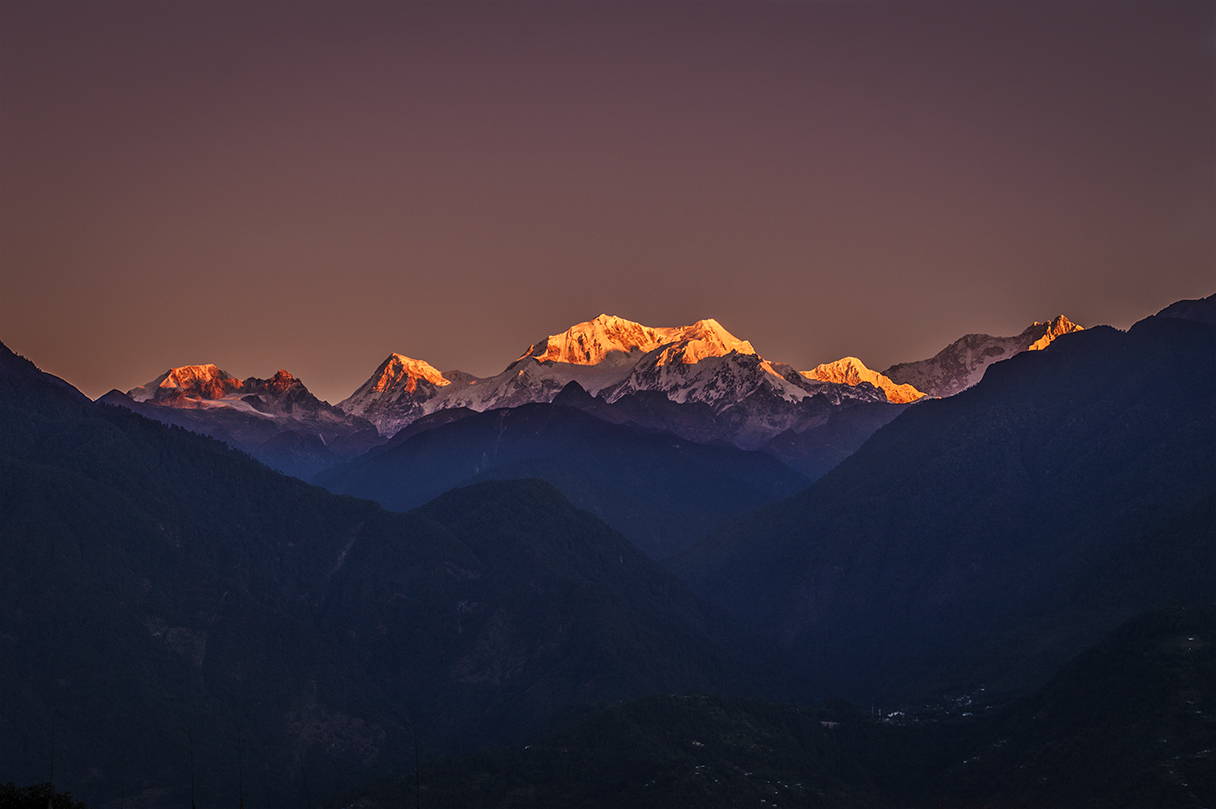
Pelling (པད་གླིང་། ) is a hill station in ( རྒྱལ་ཤིང་རྫོང་།) Gyalshing district of Sikkim, India. Pelling is nestled at an altitude of . The town is located at a distance of 10 km from Gyalshing city, the district headquarters and 131 km from Gangtok. A regular bus service connects the two towns. However, with the influx of tourists, the region is undergoing a metamorphosis, with the roads being repaired and hotels being set up. Location and surroundings The Himalayas and the Kanchenjanga may be viewed at close quarters from Pelling. Pelling also forms the base from where trekkers and other peripatetic adventurers undertake the strenuous and arduous treks in West Sikkim. The land around Pelling is still a virgin territory and is bathed with alpine vegetation, with numerous waterfalls lining the hillside. In the months of winter, Pelling is sometimes covered with a blanket of snow. Pelling is 115 km from the ... [...More Info...] [...Related Items...] OR: [Wikipedia] [Google] [Baidu] |
Jorethang
Jorethang is a major town in Namchi district in the Indian state of Sikkim. Jorethang lies on the bank of Rangeet River, which is a tributary of the Teesta River, on the way to Pelling from Darjeeling, Siliguri and Kalimpong. Jorethang is and has been a major connecting route towards the western part of Sikkim where people from various districts of West Sikkim visit here for consumption of various goods and services. Demographics As of the 2011 Census of India, Jorethang had a population of 9,009. Males constitute 52% of the population and females 48%. Jorethang has an average literacy rate of 88.85%, higher than the state average of 81.42%: male literacy is 93.36%, and female literacy is 84.20%. In Jorethang, 10.63% of the population is under 6 years of age. Religion Languages Education Schools in Jorethang offer primary, secondary and senior secondary education. There are various school like New Buds Academy, St. Francis' School, Little Angles Academy, Mt.Olive Ac ... [...More Info...] [...Related Items...] OR: [Wikipedia] [Google] [Baidu] |
Gangtok
Gangtok (, ) is the capital and the most populous city of the Indian state of Sikkim. The seat of East Sikkim district, eponymous district, Gangtok is in the eastern Himalayas, Himalayan range, at an elevation of . The city's population of 100,000 consists of the three Sikkimese people, Sikkimese ethnicities: the Bhutias, Lepcha people, Lepchas, Nepalis as well as plainsmen from other states of India. Within the higher peaks of the Himalayas and with a year-round mild temperate climate, Gangtok is at the centre of Sikkim's tourism industry. Gangtok rose to prominence as a popular Buddhist pilgrimage sites, Buddhist pilgrimage site after the construction of the Enchey Monastery in 1840. In 1894, the ruling Sikkimese Chogyal, Thutob Namgyal, transferred the capital to Gangtok. In the early 20th century, Gangtok became a major stopover on the trade route between Lhasa in Tibet and cities such as Kolkata (then Calcutta) in British India. After India won its independence from the Br ... [...More Info...] [...Related Items...] OR: [Wikipedia] [Google] [Baidu] |
Rabangla
Rabong or Ravangla is a small town with an elevation of 8000 feet located, near Namchi City in the Namchi district of the Indian state of Sikkim. It is connected by state highway to other major towns in the state and lies between Namchi, Pelling and Gangtok. It is the starting point for the trek to Maenam Wildlife Sanctuary. It is approximately 65 km from the state capital, Gangtok, and 120 km from Siliguri, West Bengal. The name is derived from the Sikkimese language. ‘Ra’ means wild sheep, 'vong' translates to a rearing place, and ‘la’ means a pass. Geography Mt. Kanchenjunga, Mt. Pandim, Mt. Siniolchu, Mt. Kabru are some of the major peaks visible from Ravangla. Flora Upper parts of Ravangla sometimes experience snowfall during winter. During the months of April–May, the area is surrounded by many flowers including orchids and rhododendrons. Fauna Ravangla attracts many Himalayan birds. Verditer flycatchers, blue-fronted redstarts, grey bush chats ... [...More Info...] [...Related Items...] OR: [Wikipedia] [Google] [Baidu] |
Tashiding
Tashiding is a small town on a hilltop at about 27 km from Gyalshing city in Gyalshing district of Sikkim in the Eastern Himalaya of India. Tashiding means "The Devoted Central Glory". This village is about 250 m above sea level with a sub-tropical climate. It is around 40 kilometer far away from district headquarter of Gyalshing Gyalshing (also Geyzing, ) is a city, located in Gyalshing district, in the Indian state of Sikkim. It is administrative headquarter of district. The town is connected to the capital Gangtok by a metalled road. Geyzing is also connected to the .... In electoral roll of 2011, Tashiding comes under the Assembly Constituency of Yuksom-Tashiding. Etymology The legends of the village says that the name Tashiding means "The Devoted Central Glory". It represents the Nyingmapa order of Tibetan Buddhism and has been a center of worship in the Kingdom of Sikkim since the 1700s. Population composition In Tashiding village, most of the village population is ... [...More Info...] [...Related Items...] OR: [Wikipedia] [Google] [Baidu] |
Yuksom
Yuksom () is a historical town 40 km north of Gyalshing in the Gyalshing district in the northeast Indian state of Sikkim. It was the first capital of Kingdom of Sikkim established in 1642 AD by Phuntsog Namgyal, the first Chogyal of Sikkim. The coronation site of the first monarch of Sikkim is known as the "Throne of Norbugang". Yuksom is home to the Norbugang Chorten, the place Namgyal was crowned. The dynastic rule of the Chogyal lasted for 333 years. The Chogyal established the first monastery at Yuksom in Sikkim known as the Dubdi Monastery in 1701, which is part of Buddhist religious pilgrimage circuit involving the Norbugang Chorten, Pemayangtse Monastery, the Rabdentse ruins, the Sanga Choeling Monastery, the Khecheopalri Lake, and the Tashiding Monastery. For the Bhutia community of Sikkim, Yuksom has special religious and cultural significance. It has a number of famous Buddhist monasteries and historical monuments as well as ancient Gurkha villages. Being ... [...More Info...] [...Related Items...] OR: [Wikipedia] [Google] [Baidu] |
Gyalshing
Gyalshing (also Geyzing, ) is a city, located in Gyalshing district, in the Indian state of Sikkim. It is administrative headquarter of district. The town is connected to the capital Gangtok by a metalled road. Geyzing is also connected to the West Bengal towns of Darjeeling and Kalimpong via Jorethang. A few kilometres north is the town of Pelling. The town has a large Nepali population, and the Nepali language is the predominant language of the region. The town is situated at an altitude of about 6,500 feet (1,900 m). The town enjoys a temperate climate for most of the year and snow sometimes falls in the vicinity. Near Geyzing is the ancient town of Yuksom, the ancient capital of Sikkim built in 1642. Other attractions include Pemyangtse Monastery built in 1640, reputed to be Sikkim's oldest and Khecheopalri Lake which as legend has it not a leaf is allowed to float on the surface. The town is the base for trekking in the Himalayas and professional expeditions ... [...More Info...] [...Related Items...] OR: [Wikipedia] [Google] [Baidu] |


