|
Langley Mill (other)
Langley Mill is a village in the civil parish of Aldercar and Langley Mill in the Amber Valley district of Derbyshire, England. History Originally named ''Long Lea'', the village of Langley Mill was a major employer throughout the mid 1900s with many companies including The Flour Mill, Langley Mill Pottery, Aristoc & Co Ltd, G.R. Turner Ltd., and Vic Hallam Limited. Aristoc, originally on North Street, manufactured silk stockings within the village. During the Second World War, when its manufacturing included parachutes and inflatable dinghies for the war effort, it became a target for German bombers. The buildings have been replaced with housing. The now closed Victory greyhound racing track was opened on ground adjoining the New Inn on 19 April 1930. As a flapping (independent) track it was not affiliated to the sports governing body, the National Greyhound Racing Club. The principal distances for greyhound racing was 330 and 500 yards; the track also held whippet races ... [...More Info...] [...Related Items...] OR: [Wikipedia] [Google] [Baidu] |
St Andrew's Church, Langley Mill
St Andrew's Church is the parish church of Langley Mill in Derbyshire, England. It was built in 1911 by J S Brocklesby and was dedicated to Saint Andrew in 1912 by the Bishop of Southwell. In 1926, the church became part of the Diocese of Derby. The church is an active place of worship and community hub. It was designated a Grade II listed building in 1988 by Historic England. History The church was built between 1911 and 1913, replacing an earlier place of worship above a builder's merchants on Elnor Street which had become too small for the congregation. The architect J S Brocklesby was engaged to build a new church at a cost of £8,000 (£780,056.08 in 2024 with inflation). The church was built in the Arts and Crafts style, which was quite unusual for the period when the Gothic Revival style was more commonly used. The church was completed in 1913, a year prior it had been consecrated by the Bishop of Southwell. In 1926 it became part of the Diocese of Derby, and assumed a joi ... [...More Info...] [...Related Items...] OR: [Wikipedia] [Google] [Baidu] |
Heanor
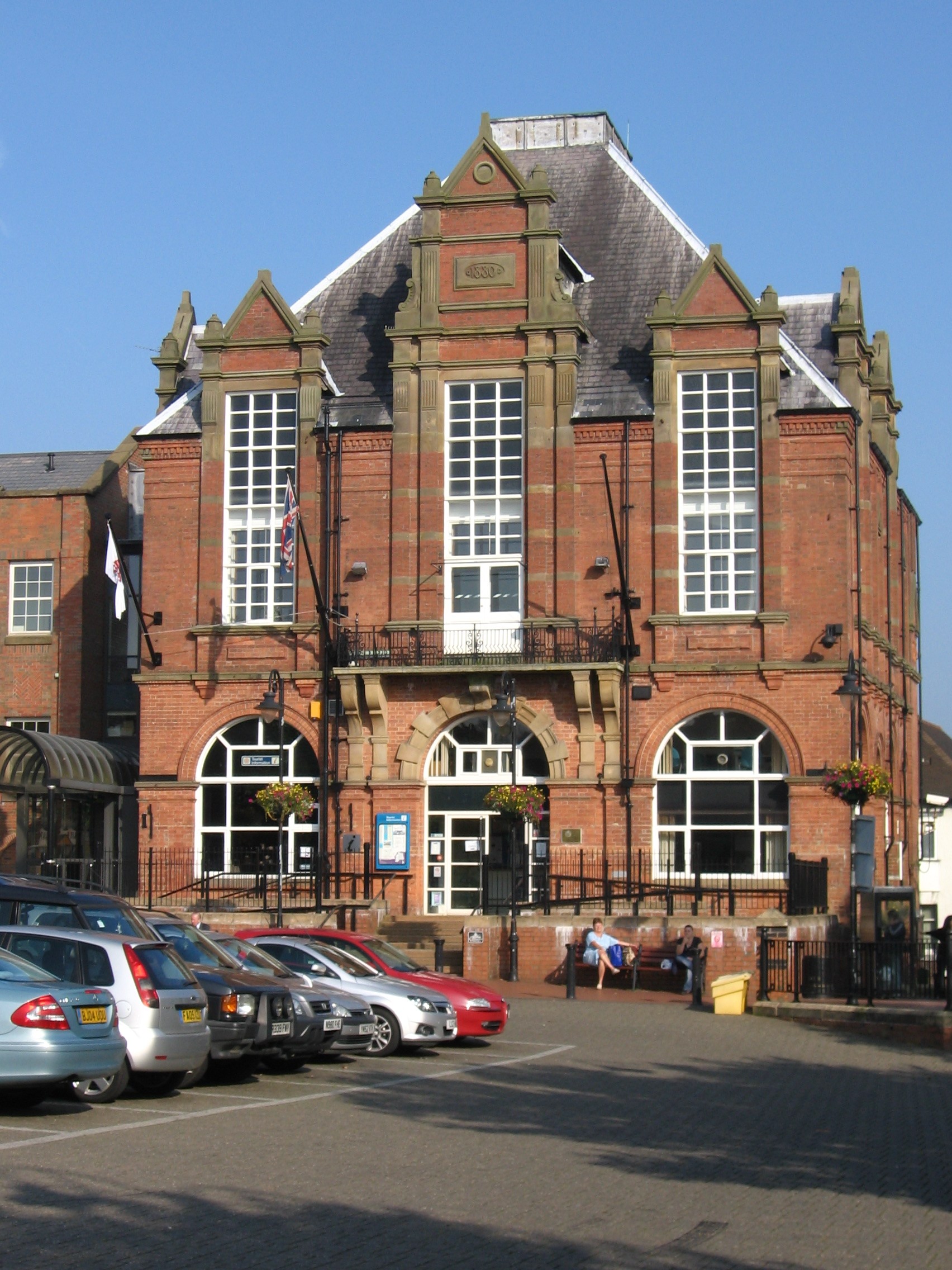
Heanor (/ˈhiːnə/) is a town in the Amber Valley district of Derbyshire, England. It lies north-east of Derby and forms, with the adjacent village of Loscoe, the civil parishes in England, civil parish and town council-administered area of Heanor and Loscoe, which had a population of 17,251 in the United Kingdom Census 2011, 2011 census. History The name Heanor derives from the Old English ''hēan'' (the dative form of ''hēah'') and ''ofer'', and means "[place at] the high ridge". In the Domesday Book of 1086 it was recorded as ''Hainoure'', with its entry stating: 6M In CODNOR and Heanor and Langley [in Heanor] and 'Smithycote' [in Codnor Park] 8 thegns had 7 wikt:carucate, carucates of land to the wikt:geld, geld [before 1066]. [There is] land for as many ploughs. There are now 3 ploughs in demesne, and 11 villains and 2 bordars and 3 sokemen having 5½ ploughs. There is a church and 1 mill [rendering] 12d and of meadow [and] woodland pasture 2 League (unit), leagues long ... [...More Info...] [...Related Items...] OR: [Wikipedia] [Google] [Baidu] |
Midland Railway Ripley Branch
The Midland Railway Ripley Branch connected Derby to Ripley, Derbyshire, Ripley in Derbyshire, England running from Little Eaton Junction on the Midland Railway line to Leeds. Origin In the late eighteenth century the valley running from the River Derwent, Derbyshire, Derwent Valley to Ripley, had been the site of a number of collieries and ironstone workings. They were situated around Denby particularly, and there were also busy pottery, potteries. Improved transport links widened their market.Improved transport links allowed the expansion of the Denby Pottery Company which was founded in 1809 Those workings to the north of Ripley were catered for, from 1794, by the Cromford Canal. When the Derby Canal was built, it extended northwards to Little Eaton from where was built the Little Eaton Gangway in 1795, to cater for the area to the south, particularly its trade with Derby. In 1830 the committee overseeing the gangway met to discuss the possibility of upgrading the line to ... [...More Info...] [...Related Items...] OR: [Wikipedia] [Google] [Baidu] |
Langley Mill Railway Station (Erewash Valley Line)
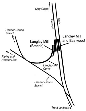
Langley Mill railway station was a railway station which served the village of Langley Mill in Derbyshire, England. It was opened in 1895 by the Midland Railway on its branch between Heanor Junction on the Erewash Valley Line and Ripley railway station, Ripley. There was already a station on the Erewash Line, known as Langley Mill railway station, Langley Mill and Eastwood, and a Great Northern Railway (Great Britain), Great Northern station called Eastwood and Langley Mill railway station, Eastwood and Langley Mill, which opened in 1847 and 1876 respectively. Because this branch station had no passenger connection to the earlier one, it was regarded by the railway as a separate station and was even shown as such on Ordnance Survey maps even though the platforms were adjacent. History The line came into being as competition for the GNR's branch. It was completed as far as Heanor by 1890. It took another five years to reach Langley Mill where it joined a line called the Heanor G ... [...More Info...] [...Related Items...] OR: [Wikipedia] [Google] [Baidu] |
Ripley, Derbyshire
Ripley is a market town and civil parish in the Amber Valley district of Derbyshire, England. It is northeast of Derby, northwest of Heanor, southwest of Alfreton and northeast of Belper. The town is continuous with Heanor, Eastwood, Nottinghamshire, Eastwood and Ilkeston as part of the wider Nottingham Urban Area. History Little information remains as to when Ripley was founded, but it appears in the 1086 Domesday Book, when it was held by a man called Levenot. In 1251 Henry III granted a charter for "one market one day a week, on Wednesday, at [the] manor of Ryppeleg: and one fair each year lasting three days, on the Vigil Day and Morrow of St Helen". Ripley Fair antedates Nottingham Goose Fair. The market day was later altered to Saturdays, with an extra market on Fridays. Medieval Ripley was just a few stone cottages and farms around a village green, with a few dwellings further afield. Corn was ground at a mill owned by the Abbot of Darley Abbey, Darley. In 1291, Ripley had ... [...More Info...] [...Related Items...] OR: [Wikipedia] [Google] [Baidu] |
Long Eaton
Long Eaton is a town in the Borough of Erewash, Erewash district of Derbyshire, England, just north of the River Trent, about south-west of Nottingham and south-east of Derby. The town population was 37,760 at the 2011 census. It has been part of Borough of Erewash, Erewash borough since 1 April 1974, when Long Eaton Urban District was disbanded. Geography Long Eaton lies in Derbyshire, adjoining the border with Nottinghamshire and close to Leicestershire. It is covered by the Nottingham post town, and has a Nottingham telephone area code (0115). Long Eaton sits on the banks of the River Trent. Long Eaton is part of the Greater Nottingham urban area. History Long Eaton is referred to as ''Aitone'', in the ''Domesday Book''. Several origins have been suggested, for example "farm between streams" and "low-lying land". It was a farming settlement that grew up close to the lowest bridging point of the River Erewash. The "Great Fire" of Long Eaton in 1694 destroyed 14 houses and s ... [...More Info...] [...Related Items...] OR: [Wikipedia] [Google] [Baidu] |
Ilkeston
Ilkeston ( ) is a town located in the Borough of Erewash in Derbyshire, England, with a population of 40,953 at the 2021 census. Its major industries, coal mining, iron working and lace making/textiles, have now all but disappeared. Part of the Nottingham Urban Area, the town is located between the cities Derby and Nottingham, near the M1 motorway, and on the River Erewash. Its eastern boundary borders Nottinghamshire to the east and is only two miles from Nottingham's western edge. History and culture Ilkeston was likely founded during the 6th century, and gets its name from its supposed founder Elch or Elcha, who was an Anglian chieftain. The town appears as Tilchestune in the Domesday Book of 1086, when it was owned principally by Gilbert de Ghent. Gilbert also controlled nearby Shipley, West Hallam and Stanton by Dale.''Domesday Book: A Complete Translation''. London: Penguin, 2003. pp. 753–4 Ilkeston was created a borough by Queen Victoria in 1887. Ilkeston is on ... [...More Info...] [...Related Items...] OR: [Wikipedia] [Google] [Baidu] |
Nottingham
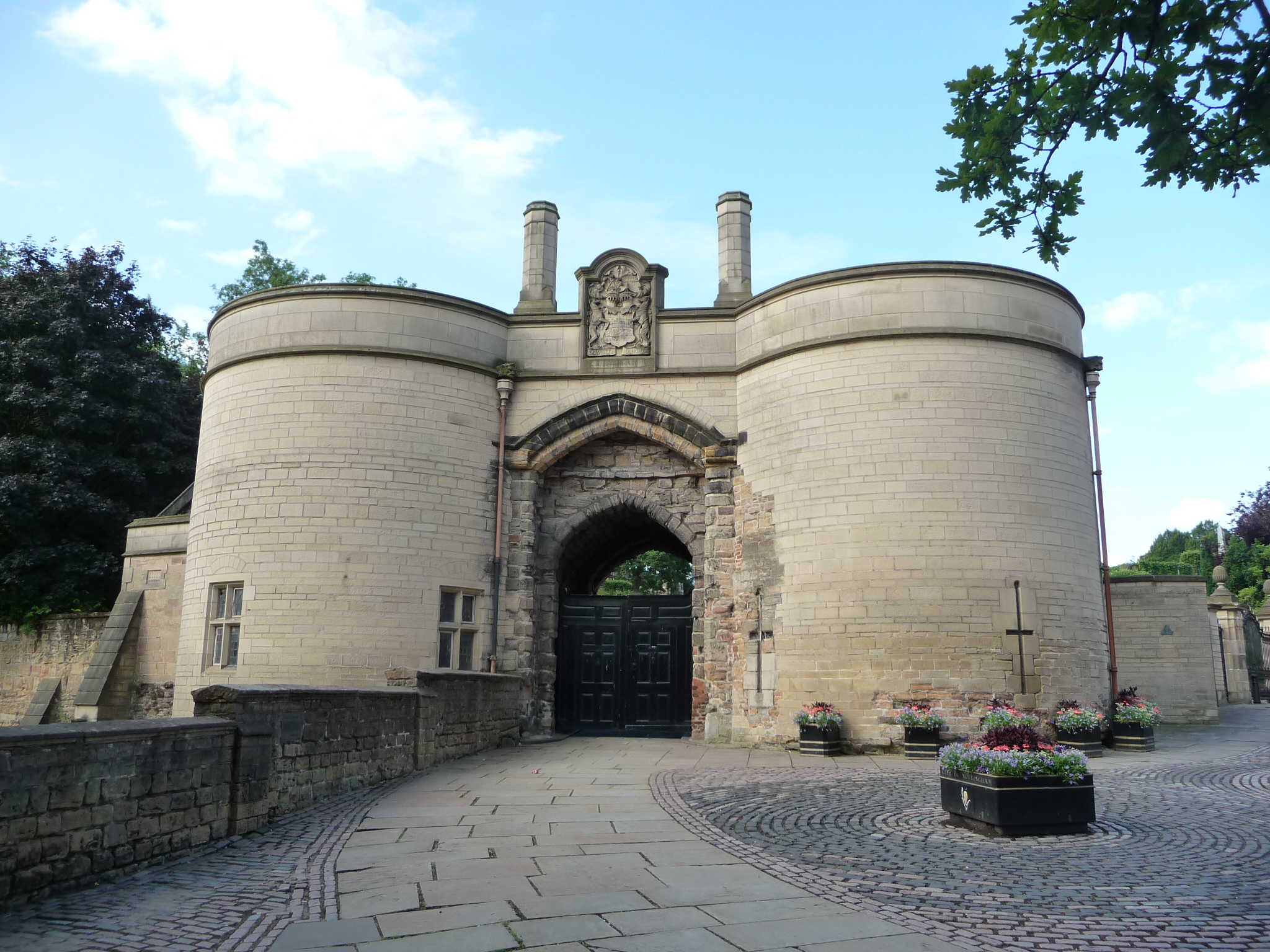
Nottingham ( , East Midlands English, locally ) is a City status in the United Kingdom, city and Unitary authorities of England, unitary authority area in Nottinghamshire, East Midlands, England. It is located south-east of Sheffield and north-east of Birmingham. Nottingham is the legendary home of Robin Hood and to the lace-making, bicycle and Smoking in the United Kingdom, tobacco industries. The city is also the county town of Nottinghamshire and the settlement was granted its city charter in 1897, as part of Queen Victoria's Diamond Jubilee celebrations. In the 2021 United Kingdom census, 2021 Census, Nottingham had a reported population of 323,632. The wider conurbation, which includes many of the city's suburbs, has a population of 768,638. It is the largest urban area in the East Midlands and the second-largest in the Midlands. Its Functional Urban Area, the largest in the East Midlands, has a population of 919,484. The population of the Nottingham/Derby metropolitan a ... [...More Info...] [...Related Items...] OR: [Wikipedia] [Google] [Baidu] |
Derby
Derby ( ) is a City status in the United Kingdom, city and Unitary authorities of England, unitary authority area on the River Derwent, Derbyshire, River Derwent in Derbyshire, England. Derbyshire is named after Derby, which was its original county town. As a unitary authority, Derby is administratively independent from Derbyshire County Council. The population of Derby is (). The Romans established the town of Derventio Coritanorum, Derventio, which was later captured by the Anglo-Saxons and then by the Vikings who made one of the Five Boroughs of the Danelaw. Initially a market town, Derby grew rapidly in the industrial era and was home to Lombe's Mill, an early British factory and it contains the southern part of the Derwent Valley Mills World Heritage Site. With the arrival of the railways in the 19th century, Derby became a centre of the Rail transport in Great Britain, British rail industry. Despite having a Derby Cathedral, cathedral since 1927, Derby did not gain City ... [...More Info...] [...Related Items...] OR: [Wikipedia] [Google] [Baidu] |
Erewash Valley Line
The Erewash Valley Line is a railway line in England, running from Long Eaton, between Nottingham and Derby, and Clay Cross, near Chesterfield. The southern part was opened by the Midland Railway in 1847 as far as Codnor Park, where it connected to established ironworks, and soon after, a line to Pinxton and Mansfield. It linked numerous collieries and ironstone pits, and encouraged the development of the so-called "concealed" Nottinghamshire coalfield, where the coal measures were below a thick limestone stratum. The line was extended north to Clay Cross, on the way to Chesterfield, in 1861, and in doing so formed an alternative through southward route. Congestion on the Midland Railway was a grave problem, and the line enabled diversion of some goods and mineral traffic. Large marshalling yards were developed at Toton, at the southern end of the line, to handle the huge volume of coal traffic. The Erewash Valley Line continues in use at the present day. Background Dominance ... [...More Info...] [...Related Items...] OR: [Wikipedia] [Google] [Baidu] |
Langley Mill Railway Station
Langley Mill railway station (formerly known as Langley Mill for Heanor and Langley Mill and Eastwood) on the Erewash Valley Line serves the large village of Langley Mill and the towns of Heanor in Derbyshire and Eastwood in Nottinghamshire, England. The station is north of Nottingham. The station lies between Nottingham and Sheffield and is managed by East Midlands Railway. Services Northern Trains run an hourly service between Nottingham and via that stops at Langley Mill. This service started from the December 2008 timetable change. East Midlands Railway operate a few services per day from Langley Mill southbound to Nottingham and beyond (usually Norwich) and northbound to Sheffield (usually continuing to Liverpool Lime Street). Buses that serve Langley Mill are Rainbow 1, 33, 34 and others that can be found on the Trent Barton website. Facilities The station is unstaffed and has two offset platforms (linked by underpass), with platform 1 (for Chesterfield and Sh ... [...More Info...] [...Related Items...] OR: [Wikipedia] [Google] [Baidu] |
Eastwood, Nottinghamshire
Eastwood is a former coal mining Town#United Kingdom, town and civil parish in the Borough of Broxtowe, Broxtowe district of Nottinghamshire, England, northwest of Nottingham. Mentioned in Domesday Book, it expanded rapidly during the Industrial Revolution. The Midland Railway was formed here and it is the birthplace of D. H. Lawrence. History "Eastwood" is a wikt:hybrid, hybrid place-name, formed from Old English language, Old English ''Est'', for "East", and Old Norse ''Þveit'' , for "meadow", "cleared meadow", or "clearing in a wood." This is a common element in English place-names, often found as "Thwaite (placename element), Thwaite". "Eastwood" might mean ''eastern clearing'', possibly originating as a Viking Age, Viking-age clearing in Sherwood Forest. There is some evidence to suggest that the land around Eastwood was occupied in the Middle and Late Palǣolithic periods. The location of the settlement is due primarily to the availability of rich agricultural land, ... [...More Info...] [...Related Items...] OR: [Wikipedia] [Google] [Baidu] |


