|
Lanca Birda
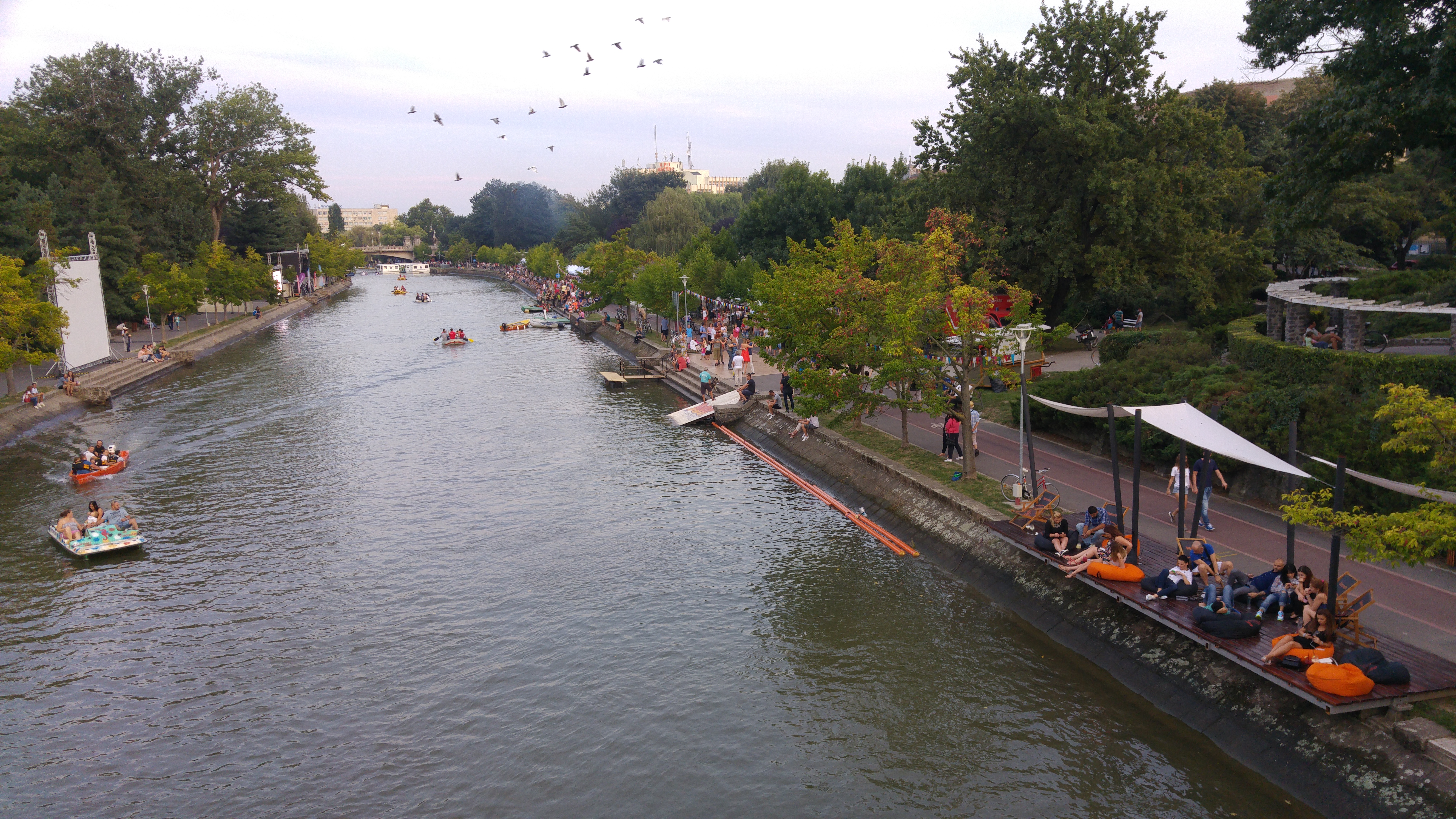
The Lanca Birda is a left tributary of the river Timiș in Romania. It discharges into the Timiș in Gad. Its length is and its basin size is . The river was canalized downstream of Ghilad and at present plays the role of drainage canal Canals or artificial waterways are waterways or engineered channels built for drainage management (e.g. flood control and irrigation) or for conveyancing water transport vehicles (e.g. water taxi). They carry free, calm surface ... of the lowlands on the left bank of the Timiș. References Rivers of Timiș County Rivers of Romania {{Timiș-river-stub ... [...More Info...] [...Related Items...] OR: [Wikipedia] [Google] [Baidu] |
Romania
Romania is a country located at the crossroads of Central Europe, Central, Eastern Europe, Eastern and Southeast Europe. It borders Ukraine to the north and east, Hungary to the west, Serbia to the southwest, Bulgaria to the south, Moldova to the east, and the Black Sea to the southeast. It has a mainly continental climate, and an area of with a population of 19 million people. Romania is the List of European countries by area, twelfth-largest country in Europe and the List of European Union member states by population, sixth-most populous member state of the European Union. Europe's second-longest river, the Danube, empties into the Danube Delta in the southeast of the country. The Carpathian Mountains cross Romania from the north to the southwest and include Moldoveanu Peak, at an altitude of . Bucharest is the country's Bucharest metropolitan area, largest urban area and Economy of Romania, financial centre. Other major urban centers, urban areas include Cluj-Napoca, Timiș ... [...More Info...] [...Related Items...] OR: [Wikipedia] [Google] [Baidu] |
Timiș County
Timiș () is a county (''județ'') of western Romania on the border with Hungary and Serbia, in the historical regions of Romania, historical region of Banat, with the county seat at Timișoara. It is the westernmost and the largest county in Romania in terms of land area. The county is also part of the Danube–Criș–Mureș–Tisa Euroregion. Name The name of the county comes from the Timiș (river), Timiș River, known in Roman antiquity as ''Tibisis'' or ''Tibiscus''. According to Lajos Kiss' etymological dictionary, the name of the river probably comes from the Dacian language: ''thibh-isjo'' ("marshy"). In Hungarian language, Hungarian, Timiș County is known as ''Temes megye'', in German language, German as ''Kreis Temesch'', in Serbian language, Serbian as Тамишки округ/''Tamiški okrug'', in Ukrainian language, Ukrainian as Тімішський повіт, and in Banat Bulgarian dialect, Banat Bulgarian as ''okrug Timiš''. Geography Timiș is the lar ... [...More Info...] [...Related Items...] OR: [Wikipedia] [Google] [Baidu] |
Liebling, Timiș
Liebling (formerly Brist; ; or ''Kedvenc'') is a commune in Timiș County, Romania. It is composed of three villages: Cerna, Iosif and Liebling (commune seat). Geography Liebling is located in the southwest of Timiș County, from Timișoara and from Ciacova, the nearest town. Hydrography Liebling belongs to the Timiș river basin. Tofoaia Valley crosses Liebling to the north, flowing into the Timiș River through the Birda-Lanca Canal. Climate The influence of the Mediterranean and oceanic air masses makes the winters shorter and milder with a positive average temperature of , the coldest month being January. Springs are earlier and warmer, but short and with large temperature variations caused by the activity of cyclones in the Mediterranean and the Atlantic. Summers are long and hot. Autumns are also long, conducive to harvesting. History The first recorded mention of a settlement on present-day Liebling dates from 1332. The medieval village was called ''Beesd'' ... [...More Info...] [...Related Items...] OR: [Wikipedia] [Google] [Baidu] |
Jebel, Timiș
Jebel (; ) is a commune in Timiș County, Romania. It is composed of a single village, Jebel, and also included the village of Pădureni until 2004, when it was split off to form a separate commune. History Jebel was first mentioned in papal tithes in 1334 under the name ''Zephel''. In 1401, the local nobleman Nicolae Trentul had a fortress here, which had to be demolished later, and in 1425 the fortress was rebuilt in the nearby forest. At that time it had the right to organize fairs and owned several floating mills on Timiș River. In 1479 it was sold to Miklós and Jakab Bánffy. Turkish traveler Evliya Çelebi, who has passed through Asia, Africa and Europe, noted various information related to the journeys he had made, describing it in ten volumes. In 1660, he, together with Ali, the Turk in charge of Timișoara region, visits Jebel and describes the village as being inhabited by Christian Romanians, as all the villages of Banat. The Jebel area, under the Turkish occupat ... [...More Info...] [...Related Items...] OR: [Wikipedia] [Google] [Baidu] |
Ghilad
Ghilad (; Banat Swabian: ''Kilatt''; ) is a commune in Timiș County, Romania. It is composed of two villages, Gad and Ghilad (commune seat). These were part of the commune of Ciacova until 2004, when they were split off. History The first recorded mention of Ghilad dates from 1212, when Andrew II of Hungary donated ''Gyad'' to '' Terra Sebus'', responsible for the transfer of possession being the prefect of Csanád, Nicolae Csáky. It was not mentioned in documents until the second half of the 16th century, then it is said that it was inhabited by Romanians, brought from Transylvania by Rami Pasha. In 1717, when the Austrians conquered Banat from the Turks, they conducted a census showing that the locality then called ''Donji Gilad''/Доњи Гилад in Serbian had 100 houses, and a few kilometers away, the locality of ''Gornji Gilad''/Горњи Гилад had 80 houses. Under Empress Maria Theresa, the population of the smaller Ghilad was moved to the larger village. ... [...More Info...] [...Related Items...] OR: [Wikipedia] [Google] [Baidu] |
Timiș (river)
The Timiș or Tamiš (, , , ) is a river that flows through the Banat region of Romania and Serbia and joins the Danube near Pančevo, in northern Serbia. Due to its position in the region, it has been labeled as the "spine of the Banat". Name In Classical antiquity, antiquity, the river was known as ''Tibiscus'' (in Latin) and ''Tibisis'' (Θίβισις in ancient Greek), and as ''Timisis'' in De Administrando Imperio; in addition, Edward Gibbon referred to it as the ''Teyss''. ''The Romans, who traversed the plains of Hungary, suppose that they passed several navigable rivers, either in canoes or portable boats; but there is reason to suspect that the winding stream of the Teyss, or Tibiscus, might present itself in different places under different names.'' Geography The Drainage basin, drainage area covers , of which in Romania. With the Danube, the Timis belongs to the Black Sea drainage basin. The river flows through Romania for , and through Serbia. Its average di ... [...More Info...] [...Related Items...] OR: [Wikipedia] [Google] [Baidu] |
Folea (river)
The Folea is a left tributary A tributary, or an ''affluent'', is a stream or river that flows into a larger stream (''main stem'' or ''"parent"''), river, or a lake. A tributary does not flow directly into a sea or ocean. Tributaries, and the main stem river into which they ... of the river Lanca Birda in Romania. It flows into the Lanca Birda near Jebel. Its length is and its basin size is . References Rivers of Timiș County Rivers of Romania {{Timiș-river-stub ... [...More Info...] [...Related Items...] OR: [Wikipedia] [Google] [Baidu] |
Vâna Mare (Lanca Birda)
The Vâna Mare is a right tributary of the river Lanca Birda in Romania. It flows into the Lanca Birda near Jebel Jabal, Jabel, Jebel or Jibal may refer to: People * Jabal (name), a male Arabic given name * Jabal (Bible), mentioned in the Hebrew Bible Places In Arabic, ''jabal'' or ''jebel'' (spelling variants of the same word) means 'mountain'. * Dzhebel, .... Its length is and its basin size is . References Rivers of Timiș County Rivers of Romania {{Timiș-river-stub ... [...More Info...] [...Related Items...] OR: [Wikipedia] [Google] [Baidu] |
Tributary
A tributary, or an ''affluent'', is a stream or river that flows into a larger stream (''main stem'' or ''"parent"''), river, or a lake. A tributary does not flow directly into a sea or ocean. Tributaries, and the main stem river into which they flow, drain the surrounding drainage basin of its surface water and groundwater, leading the water out into an ocean, another river, or into an endorheic basin. The Irtysh is a chief tributary of the Ob (river), Ob river and is also the longest tributary river in the world with a length of . The Madeira River is the largest tributary river by volume in the world with an average discharge of . A confluence, where two or more bodies of water meet, usually refers to the joining of tributaries. The opposite to a tributary is a distributary, a river or stream that branches off from and flows away from the main stream. [...More Info...] [...Related Items...] OR: [Wikipedia] [Google] [Baidu] |
Drainage
Drainage is the natural or artificial removal of a surface's water and sub-surface water from an area with excess water. The internal drainage of most agricultural soils can prevent severe waterlogging (anaerobic conditions that harm root growth), but many soils need artificial drainage to improve production or to manage water supplies. History Early history The Indus Valley Civilization had sewerage and drainage systems. All houses in the major cities of Harappa and Mohenjo-daro had access to water and drainage facilities. Waste water was directed to covered gravity sewers, which lined the major streets. 18th and 19th century The invention of hollow-pipe drainage is credited to Sir Hugh Dalrymple, who died in 1753. Current practices Simple infrastructure such as open drains, pipes, and berms are still common. In modern times, more complex structures involving substantial earthworks and new technologies have been common as well. Geotextiles New storm water drainag ... [...More Info...] [...Related Items...] OR: [Wikipedia] [Google] [Baidu] |
Canal
Canals or artificial waterways are waterways or engineered channels built for drainage management (e.g. flood control and irrigation) or for conveyancing water transport vehicles (e.g. water taxi). They carry free, calm surface flow under atmospheric pressure, and can be thought of as artificial rivers. In most cases, a canal has a series of dams and locks that create reservoirs of low speed current flow. These reservoirs are referred to as ''slack water levels'', often just called ''levels''. A canal can be called a navigation canal when it parallels a natural river and shares part of the latter's discharges and drainage basin, and leverages its resources by building dams and locks to increase and lengthen its stretches of slack water levels while staying in its valley. A canal can cut across a drainage divide atop a ridge, generally requiring an external water source above the highest elevation. The best-known example of such a canal is the Panama Can ... [...More Info...] [...Related Items...] OR: [Wikipedia] [Google] [Baidu] |
Rivers Of Timiș County
A river is a natural stream of fresh water that flows on land or inside caves towards another body of water at a lower elevation, such as an ocean, lake, or another river. A river may run dry before reaching the end of its course if it runs out of water, or only flow during certain seasons. Rivers are regulated by the water cycle, the processes by which water moves around the Earth. Water first enters rivers through precipitation, whether from rainfall, the runoff of water down a slope, the melting of glaciers or snow, or seepage from aquifers beneath the surface of the Earth. Rivers flow in channeled watercourses and merge in confluences to form drainage basins, or catchments, areas where surface water eventually flows to a common outlet. Rivers have a great effect on the landscape around them. They may regularly overflow their banks and flood the surrounding area, spreading nutrients to the surrounding area. Sediment or alluvium carried by rivers shapes the landscape aro ... [...More Info...] [...Related Items...] OR: [Wikipedia] [Google] [Baidu] |


