|
Lake Zengena
Zengena Lake () is a crater lake located at in the Awi Zone of the Amhara Region in Ethiopia. It is situated between the towns of Injibara and Kessa, only 200 m from the Addis Ababa-Bahir Dar highway at an elevation of 2500 m. The diameter of the lake is roughly 1 km. With a maximum depth of 166 m, it is the second deepest lake in Ethiopia after Lake Shala. Its rim is made of unconsolidated ash deposits. Zengena Lake is most likely a maar A maar is a broad, low-relief volcanic crater caused by a phreatomagmatic eruption (an explosion which occurs when groundwater comes into contact with hot lava or magma). A maar characteristically fills with water to form a relatively shallow ... lake formed by volcanic explosion and collapse.Tenalem 2009, p. 65 Notes References *Tenalem Ayenew (2009). ''Natural Lakes of Ethiopia.'' Addis Ababa University Press. Addis Ababa. Volcanic crater lakes Lakes of Ethiopia Amhara Region Maars of Ethiopia {{Amhara-geo-stub ... [...More Info...] [...Related Items...] OR: [Wikipedia] [Google] [Baidu] |
Amhara Region
The Amhara Region (), officially the Amhara National Regional State (), is a Regions of Ethiopia, regional state in northern Ethiopia and the homeland of the Amhara people, Amhara, Awi people, Awi, Xamir people, Xamir, Argobba people, Argobba, and Qemant people, Qemant people. Its capital is Bahir Dar which is the seat of the Government of Amhara Region, Regional Government of Amhara. Amhara is the site of the largest inland body of water in Ethiopia, Lake Tana (which is the source of the Blue Nile), and Semien Mountains National Park (which includes Ras Dashan, the highest point in Ethiopia). Amhara is bordered by Sudan to the west and northwest and by other the regions of Ethiopia: Tigray Region, Tigray to the north, Afar Region, Afar to the east, Benishangul-Gumuz Region, Benishangul-Gumuz to the west and southwest, and Oromia to the south. Towns and cities in Amhara include: Bahir Dar, Dessie, Gondar, Gonder, Debre Birhan, Debre Tabor, Kombolcha, Weldiya, Debre Markos, Soqota, ... [...More Info...] [...Related Items...] OR: [Wikipedia] [Google] [Baidu] |
Volcanic Crater Lake
A volcanic crater lake is a lake in a volcanic crater, crater that was formed by explosive eruption, explosive activity or a caldera, collapse during a types of volcanic eruptions, volcanic eruption. Formation Lakes in calderas fill large craters formed by the collapse of a volcano during an eruption. Lakes in maars fill medium-sized craters where an eruption deposited debris around a vent. Crater lakes form as the created depression, within the Rim (craters), crater rim, is filled by water. The water may come from Precipitation (meteorology), precipitation, groundwater circulation (often Hot Spring, hydrothermal fluids in the case of volcanic craters) or melted ice. Its level rises until an equilibrium is reached between the rates of incoming and outgoing water. Sources of water loss singly or together may include evaporation, subsurface seepage, and, in places, surface leakage or overflow when the lake level reaches the lowest point on its rim. At such a saddle location, the u ... [...More Info...] [...Related Items...] OR: [Wikipedia] [Google] [Baidu] |
Agew Awi Zone
Agew Awi () is a zone in the Amhara Region of Ethiopia. It is named for the Awi sub-group of the Agaw people, some of whom live in this Zone. Agew Awi Zone is bordered on the west by Benishangul-Gumuz Region, on the north by North Gondar Zone and on the east by West Gojjam. The administrative centre of Agew Awi is Injibara; other towns include Chagni, Agew Gimjabet, Tilili, Adis Kidame, Azena, Zigem, Jawi and Dangila. Topographically speaking, Agaw Awi is relatively flat and fertile, whose elevations vary from 1,800 to 3,100 m above sea level, with an average altitude of about 2,300 m. The Zone is crossed by about nine permanent rivers which drain into the Abay (or Blue Nile); other water features include two crater lakes, Zengena and Tirba, and Zimbiri marsh which is located 5 km south-west of Addis Kidam. Local forests include Dukma and Apini, which are located on either side of the town of Kidamaja, Zengena forest around Lake Zengena and Goobil forest whic ... [...More Info...] [...Related Items...] OR: [Wikipedia] [Google] [Baidu] |
Ethiopia
Ethiopia, officially the Federal Democratic Republic of Ethiopia, is a landlocked country located in the Horn of Africa region of East Africa. It shares borders with Eritrea to the north, Djibouti to the northeast, Somalia to the east, Kenya to the south, South Sudan to the west, and Sudan to the northwest. Ethiopia covers a land area of . , it has around 128 million inhabitants, making it the List of countries and dependencies by population, thirteenth-most populous country in the world, the List of African countries by population, second-most populous in Africa after Nigeria, and the most populous landlocked country on Earth. The national capital and largest city, Addis Ababa, lies several kilometres west of the East African Rift that splits the country into the African Plate, African and Somali Plate, Somali tectonic plates. Early modern human, Anatomically modern humans emerged from modern-day Ethiopia and set out for the Near East and elsewhere in the Middle Paleolithi ... [...More Info...] [...Related Items...] OR: [Wikipedia] [Google] [Baidu] |
Injibara
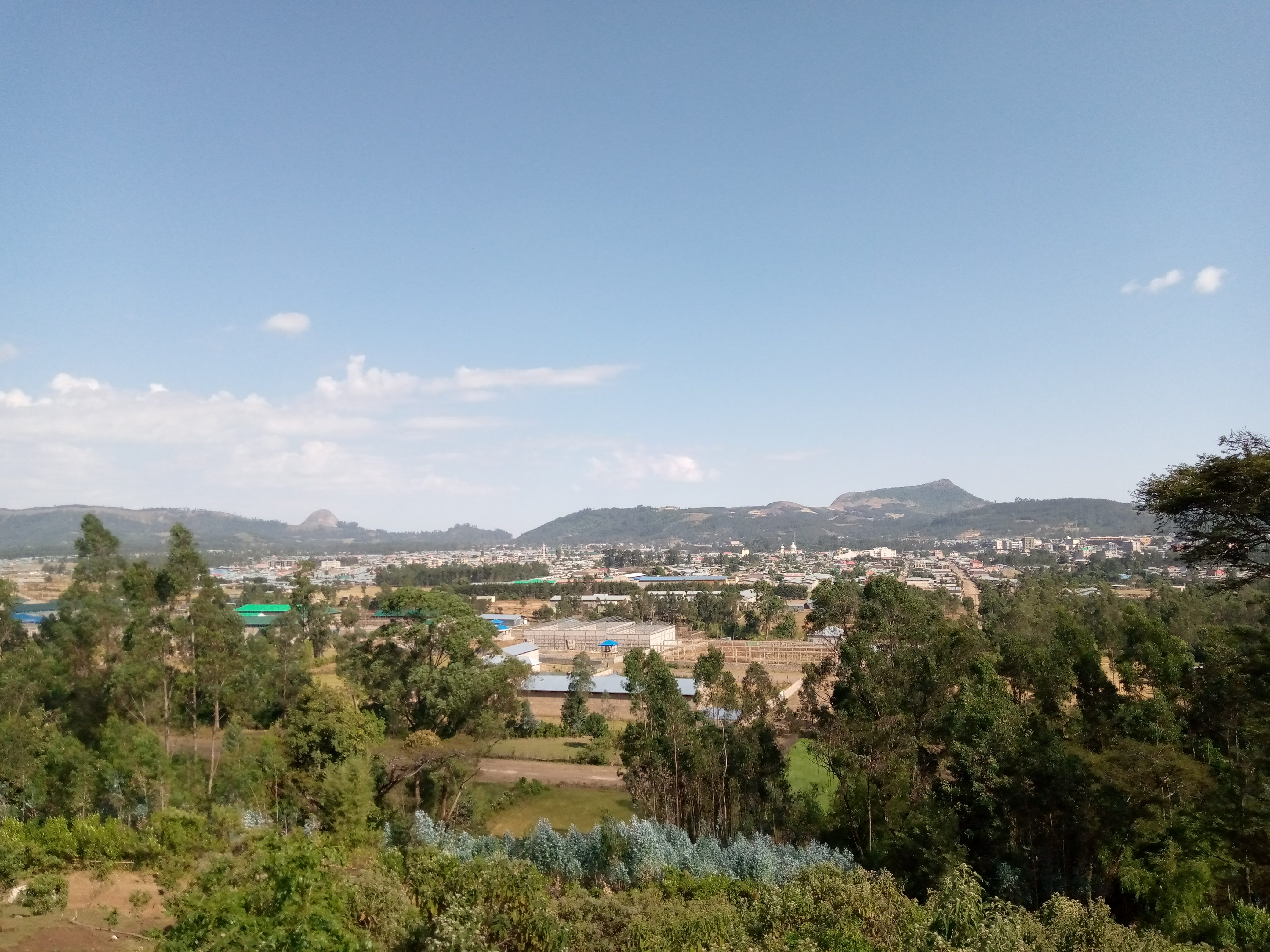
Injibara (Amharic: እንጅባራ) is a town in Ethiopia. It is the administrative center of the Agew Awi Zone in the Amhara Region. Injibara is located at , in Banja Shekudad woreda at an elevation of above sea level. Injibara is situated in a predominantly mountainous location. Mount Zerehi, one of many massive stone monoliths found in the area, is to the west of the Bahir Dar road as it enters the town. Another geographical feature of the area is the Zengena Lake, Zengena crater lake just south of the town. The hills and valleys receive high amounts of rain, especially in the rainy season. This high rainfall permits farmers to grow multiple crops a year. With this rainy weather comes hail, however, which is a major problem for the local farmers. Based on figures from th2007 census, Injibara has an estimated total population of 21,065, of whom 10,596 are males and 10,469 are females. History Injibara was the scene of (in the words of Sven Rubenson) "one of the most blood ... [...More Info...] [...Related Items...] OR: [Wikipedia] [Google] [Baidu] |
Addis Ababa
Addis Ababa (; ,) is the capital city of Ethiopia, as well as the regional state of Oromia. With an estimated population of 2,739,551 inhabitants as of the 2007 census, it is the largest city in the country and the List of cities in Africa by population, eleventh-largest in Africa. Addis Ababa is a highly developed and important cultural, artistic, financial and administrative center of Ethiopia. It is widely known as one of Africa's major capitals. The founding history of Addis Ababa dates back to the late 19th century by Menelik II, Negus of Shewa, in 1886 after finding Mount Entoto unpleasant two years prior. At the time, the city was a resort town; its large mineral spring abundance attracted nobilities of the empire and led them to establish permanent settlement. It also attracted many members of the working classes – including artisans and merchants – and foreign visitors. Menelik II then formed his Menelik Palace, imperial palace in 1887. Addis Ababa became the em ... [...More Info...] [...Related Items...] OR: [Wikipedia] [Google] [Baidu] |
Bahir Dar
Bahir Dar () is the capital city of Amhara Region, Ethiopia. Bahir Dar is one of the leading tourist destinations in Ethiopia, with a variety of attractions in the nearby Lake Tana and Blue Nile river. The city is known for its wide avenues lined with palm trees and a variety of colorful flowers. In 2002, it was awarded the UNESCO Cities for Peace Prize for addressing the challenges of rapid urbanization. History Origins Originally the settlement was called Bahir Giyorgis. Between 1810 and 1900, Bahir Dar had 1,200 to 2,000 inhabitants.Crummey, D. (1987) Towns in Ethiopia: The eighteenth and nineteenth centuries. In: Ahmed Zekaria, B. Z. T. B. (ed.) Proceedings of the International Symposium of the Centenary of Addis Abeba, November 24–25, 1986., pp. 130–144.Seltene Seyoum (2000Land Alienation and the Urban Growth of Bahir Dar 1935-74. In: Anderson, D. M. & Rathborne, R. (eds.) Africa's urban past. James Currey, Oxford./ref> It was developed in situ as a monastery and f ... [...More Info...] [...Related Items...] OR: [Wikipedia] [Google] [Baidu] |
Lake Shala
Lake Shala (also spelled Shalla) is an alkaline lake located in the Ethiopian Rift Valley, in the Abijatta-Shalla National Park. Overview The lake is 28 kilometers long and 12 wide,''Statistical Abstract of Ethiopia for 1967/68'' with a surface area of 329 square kilometers.Baxter, R. M. "Lake Morphology and Chemistry", in Taylor, W.D. and Tudorancea, C., eds. ''Ethiopian Rift Valley Lakes'' (Leiden: Backhuys Publishers, 2002) It has a maximum depth of 266 meters and is at an elevation of 1,558 meters. As such, it is the deepest of Ethiopia's Rift Valley lakes. Known for the sulphur springs on the lake bed, its islands are inhabited by great white pelicans, one being known as Pelican Island. Lake Shala is surrounded by hot springs filled with boiling water, and the earth surrounding the lake is filled with cracks due to erosion and earthquakes. Due to steam rising from the boiling water in the springs, the atmosphere around the lake is relatively foggy. Various species ... [...More Info...] [...Related Items...] OR: [Wikipedia] [Google] [Baidu] |
Maar
A maar is a broad, low-relief volcanic crater caused by a phreatomagmatic eruption (an explosion which occurs when groundwater comes into contact with hot lava or magma). A maar characteristically fills with water to form a relatively shallow crater lake, which may also be called a maar.David S.G. Thomas and Andrew Goudie (eds.), ''The Dictionary of Physical Geography'' (Oxford: Blackwell, 2000), 301. . Maars range in size from across and from deep. Most maars fill with water to form natural lakes. Most maars have low rims composed of a mixture of loose fragments of volcanic rocks and rocks torn from the walls of the diatreme. Etymology The name ''maar'' comes from a Moselle Franconian dialect word used for the circular lakes of the Daun area of Germany. The word evolved from its first use in German in the modern geological sense in 1819 and is now used in English and in the geological sciences as the term for the explosion crater, even if water from rainfall might alway ... [...More Info...] [...Related Items...] OR: [Wikipedia] [Google] [Baidu] |
Volcanic Crater Lakes
A volcano is commonly defined as a vent or fissure in the crust of a planetary-mass object, such as Earth, that allows hot lava, volcanic ash, and gases to escape from a magma chamber below the surface. On Earth, volcanoes are most often found where tectonic plates are diverging or converging, and because most of Earth's plate boundaries are underwater, most volcanoes are found underwater. For example, a mid-ocean ridge, such as the Mid-Atlantic Ridge, has volcanoes caused by divergent tectonic plates whereas the Pacific Ring of Fire has volcanoes caused by convergent tectonic plates. Volcanoes resulting from divergent tectonic activity are usually non-explosive whereas those resulting from convergent tectonic activity cause violent eruptions."Mid-ocean ridge tectonics, volcanism and geomorphology." Geology 26, no. 455 (2001): 458. https://macdonald.faculty.geol.ucsb.edu/papers/Macdonald%20Mid-Ocean%20Ridge%20Tectonics.pdf Volcanoes can also form where there is stretching an ... [...More Info...] [...Related Items...] OR: [Wikipedia] [Google] [Baidu] |
Lakes Of Ethiopia
This is a list of lakes of Ethiopia, located completely or partially within the country's borders. Lakes Lakes not confirmed with coordinates * Lake Chelelektu * Lake Gargori * Lake Laitali See also * Rift Valley lakes {{Ethiopia topics Ethiopia Ethiopia, officially the Federal Democratic Republic of Ethiopia, is a landlocked country located in the Horn of Africa region of East Africa. It shares borders with Eritrea to the north, Djibouti to the northeast, Somalia to the east, Ken ... Lakes * ... [...More Info...] [...Related Items...] OR: [Wikipedia] [Google] [Baidu] |


