|
Lake Okutama
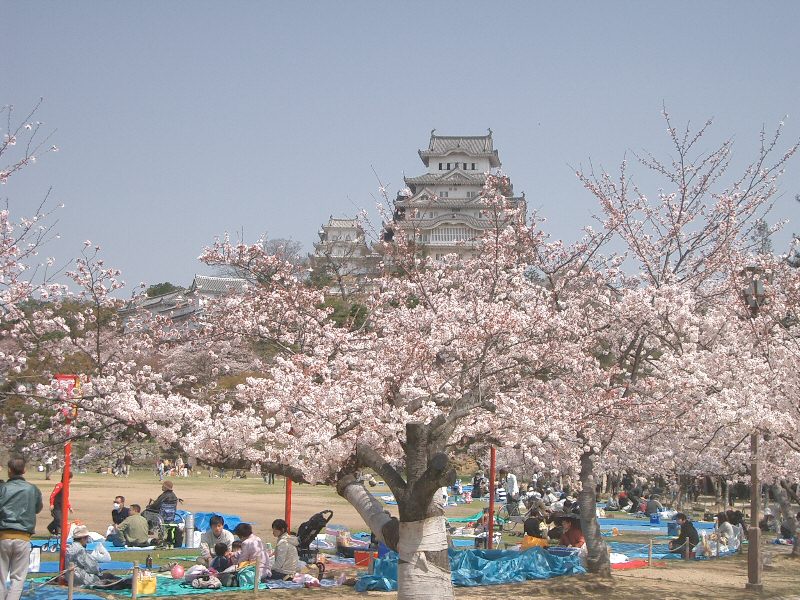
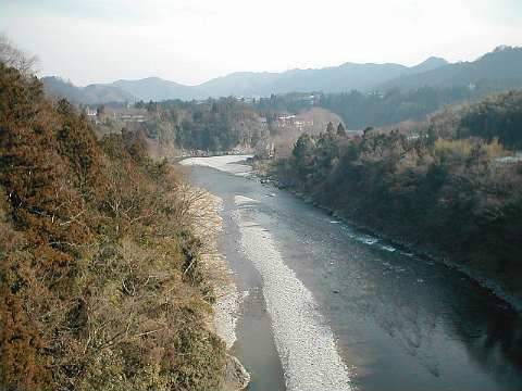
is in Tokyo and Yamanashi Prefectures in Japan. Lying above the Ogōchi Dam, it is also known as the Ogōchi Reservoir. Lake Okutama is an important source of drinking water for Tokyo. Description The lake occupies part of the town of Okutama in Nishitama District, Tokyo and the village of Tabayama in Kitatsuru District, Yamanashi. The Taba ( Tama) River feeds Lake Okutama at its western end. From the southwest, the Kosuge River also flows into the lake. The Tama River drains the lake at the eastern end. The surroundings are famous for cherry blossoms in the spring.Cook, Chris,Under the lonesome trees, ''Japan Times ''The Japan Times'' is Japan's largest and oldest English-language daily newspaper. It is published by , a subsidiary of News2u Holdings, Inc. It is headquartered in the in Kioicho, Chiyoda, Tokyo. History ''The Japan Times'' was launched by ...'', 27 April 2007, p. 24. Ogōchi Dam * Dam height: 148 m * Dam length: 353 m * Greatest depth: 142 ... [...More Info...] [...Related Items...] OR: [Wikipedia] [Google] [Baidu] |
Reservoir
A reservoir (; ) is an enlarged lake behind a dam, usually built to water storage, store fresh water, often doubling for hydroelectric power generation. Reservoirs are created by controlling a watercourse that drains an existing body of water, interrupting a watercourse to form an Bay, embayment within it, excavating, or building any number of retaining walls or levees to enclose any area to store water. Types Dammed valleys Dammed reservoirs are artificial lakes created and controlled by a dam constructed across a valley and rely on the natural topography to provide most of the basin of the reservoir. These reservoirs can either be ''on-stream reservoirs'', which are located on the original streambed of the downstream river and are filled by stream, creeks, rivers or rainwater that surface runoff, runs off the surrounding forested catchments, or ''off-stream reservoirs'', which receive water diversion, diverted water from a nearby stream or aqueduct (water supply), aq ... [...More Info...] [...Related Items...] OR: [Wikipedia] [Google] [Baidu] |
Villages Of Japan
A is a Local government, local administrative unit in Japan. Tokyo Metropolitan Government It is a local public body along with , , and . Geographically, a village's extent is contained within a prefecture. Villages are larger than a local settlement; each is a subdivision of rural , which are subdivided into towns and villages with no overlap and no uncovered area. As a result of merger and dissolution of municipalities of Japan, mergers and elevation to higher statuses, the number of villages in Japan is decreasing. As of 2006, 13 prefectures no longer have any villages: Tochigi Prefecture, Tochigi (since March 20, 2006), Fukui Prefecture, Fukui (since March 3, 2006), Ishikawa Prefecture, Ishikawa (since March 1, 2005), Shizuoka Prefecture, Shizuoka (since July 1, 20 ... [...More Info...] [...Related Items...] OR: [Wikipedia] [Google] [Baidu] |
Lakes Of Yamanashi Prefecture
A lake is often a naturally occurring, relatively large and fixed body of water on or near the Earth's surface. It is localized in a basin or interconnected basins surrounded by dry land. Lakes lie completely on land and are separate from the ocean, although they may be connected with the ocean by rivers. Lakes, as with other bodies of water, are part of the water cycle, the processes by which water moves around the Earth. Most lakes are fresh water and account for almost all the world's surface freshwater, but some are salt lakes with salinities even higher than that of seawater. Lakes vary significantly in surface area and volume of water. Lakes are typically larger and deeper than ponds, which are also water-filled basins on land, although there are no official definitions or scientific criteria distinguishing the two. Lakes are also distinct from lagoons, which are generally shallow tidal pools dammed by sandbars or other material at coastal regions of oceans or large la ... [...More Info...] [...Related Items...] OR: [Wikipedia] [Google] [Baidu] |
Japan Times
''The Japan Times'' is Japan's largest and oldest English-language daily newspaper. It is published by , a subsidiary of News2u Holdings, Inc. It is headquartered in the in Kioicho, Chiyoda, Tokyo. History ''The Japan Times'' was launched by on 22 March 1897, with the goal of giving Japanese people an opportunity to read and discuss news and current events in English language, English to help Japan participate in the international community. In 1906, Zumoto was asked by Japanese Resident-General of Korea Itō Hirobumi to lead the English-language newspaper ''The Seoul Press''. Zumoto closely tied the operations of the two newspapers, with subscriptions of ''The Seoul Press'' being sold in Japan by ''The Japan Times'', and vice versa for Korea. Both papers wrote critically of Korean culture and civilization, and advocated for Korea under Japanese rule, Japan's colonial control over the peninsula in order to civilize the Koreans. The newspaper was independent of government ... [...More Info...] [...Related Items...] OR: [Wikipedia] [Google] [Baidu] |
Hanami
is the Japanese traditional custom of enjoying the transient beauty of flowers; in this case almost always mean those of the or, less frequently, trees. From the end of March to early May, cherry trees bloom all over Japan, and around the second week of January on the island of Okinawa. The is announced each year by the Japan Meteorological Agency and watched carefully by those planning ''hanami,'' as the blossoms only last a week or two. In modern-day Japan, ''hanami'' mostly consists of having an outdoor party beneath the sakura during daytime or at night. In some contexts the Sino-Japanese term is used instead, particularly for festivals. ''Hanami'' at night is called . In many places such as Ueno Park temporary paper lanterns are hung for the purpose of ''yozakura''. On the island of Okinawa, decorative electric lanterns are hung in the trees for evening enjoyment, such as on the trees ascending Mt. Yae, near Motobu Town, or at the Nakijin Castle. A more ancient f ... [...More Info...] [...Related Items...] OR: [Wikipedia] [Google] [Baidu] |
Kitatsuru District, Yamanashi
is a rural district located in northeastern Yamanashi Prefecture, Japan. As of October 2020, the district had an estimated population of 1,214 with a density of 7.879 persons per km2. The total area was 154.1 km2. Municipalities Prior to its dissolution, the district consisted of only two villages: * Kosuge * Tabayama ;Notes: History The district formerly included the city of Ōtsuki and a portion of the city of Uenohara. District Timeline Kitatsuru District was founded during the early Meiji period The was an era of Japanese history that extended from October 23, 1868, to July 30, 1912. The Meiji era was the first half of the Empire of Japan, when the Japanese people moved from being an isolated feudal society at risk of colonizatio ... establishment of the municipalities system on July 22, 1878 and initially consisted of 18 villages. Uenohara was elevated to town status on December 27, 1897, followed by Ōtsuki on April 1, 1933. Saruhashi became a t ... [...More Info...] [...Related Items...] OR: [Wikipedia] [Google] [Baidu] |
Tabayama, Yamanashi
is a village located in Yamanashi Prefecture, Japan. , the village had an estimated population of 530, and a population density of 5.79 persons per km2. The total area of the village is . Geography Located in the northeastern corner of Yamanashi Prefecture, the village is very mountainous. An estimated 97% of the village is covered by forests. The village is located within the borders of Chichibu Tama Kai National Park. * Mountains: Mount Kumotori, Mount Daibosatsu, Mount Hiryū, Mount Nanatsuishi, Iwadake * Rivers: Taba River, Kaizawa River, Atoyama River * Lakes: Lake Okutama Surrounding municipalities * Saitama Prefecture ** Chichibu * Tokyo ** Okutama * Yamanashi Prefecture ** Kōshū ** Kosuge Climate The village has a climate characterized by characterized by hot and humid summers, and relatively mild winters (Köppen climate classification ''Cfa''). The average annual temperature in Tabayama is 10.9 °C. The average annual rainfall is 1408 mm with Septem ... [...More Info...] [...Related Items...] OR: [Wikipedia] [Google] [Baidu] |
Nishitama, Tokyo
is a district located in Tokyo Metropolis, Japan. It comprises the village of Hinohara and the following three towns: * Hinode * Mizuho *Okutama * Historically, the cities of Ōme, Fussa, Hamura, and Akiruno were parts of Nishitama District but these were broken off from the district after they were elevated to city status. Education Each of the towns and villages operates separate public elementary and junior high school systems. Tokyo Metropolitan Government Board of Education operates Mizuho Nougei High School in Mizuho. The school district also operates the following high schools in nearby Ōme: * Norin High School * Ome Sogo High School * Tama High School The district operates the following high schools in Fussa: * Fussa High School * Tama Technical High School The district operates Hamura High School in Hamura. The district operates the following schools in Akiruno: * Akirudai High School * Itsukaichi High School District timeline * July 22, 1878: Tama ... [...More Info...] [...Related Items...] OR: [Wikipedia] [Google] [Baidu] |
Tama River
The is a major river in Yamanashi Prefecture, Yamanashi, Kanagawa Prefecture, Kanagawa and Tokyo Prefectures on Honshū, Japan. It is officially classified as a Class 1 river by the Government of Japan, Japanese government. It is long, and has a basin. The river flows through the Greater Tokyo Area, on the dividing line between Tokyo and Kanagawa Prefectures. In Tokyo, its banks are lined with parks and sports fields, making the river a popular picnic spot. Course The Tama's source is on Mt. Kasatori in Koshu, Yamanashi, Koshu in Yamanashi Prefecture. From there, it flows eastward into mountainous western Tokyo, where the Ogōchi Dam forms Lake Okutama. Below the dam, it takes the name Tama and flows eastwards through Chichibu Tama Kai National Park to the city of Ōme, Tokyo, Ōme. It then flows southeast between Tama Hills and Musashino Terrace. At Hamura, Tokyo, Hamura is the source of the historic Tamagawa Aqueduct built by the Tamagawa brothers in 1653 to supply w ... [...More Info...] [...Related Items...] OR: [Wikipedia] [Google] [Baidu] |
Okutama, Tokyo
is a Towns of Japan, town located in the western portion of Tokyo Metropolis, Tokyo Prefecture, Japan, at a distance of roughly west-northwest of Tokyo Imperial Palace. , the town had an estimated population of 4,949, and a population density of 22 persons per km2. The total area of the town is . Geography Okutama is located in the Okutama Mountains of far western Tokyo. It is geographically the largest municipality in Tokyo. Mount Kumotori, Tokyo's highest peak at 2017 m, divides Okutama from the Okuchichibu Mountains, Okuchichibu region of the neighboring Saitama Prefecture, Saitama and Yamanashi Prefectures. Tokyo's northernmost and westernmost points lie in Okutama, as does Lake Okutama, an important source of water for Tokyo, situated above the Ogōchi Dam in the town. Mountains *Mount Kumotori *:Mount Kumotori, at 2017 m is the highest mountain in Tokyo and the westernmost place of Tokyo. Many plants grow here during the summer, most notably the tsuga. From the ... [...More Info...] [...Related Items...] OR: [Wikipedia] [Google] [Baidu] |
Towns Of Japan
A town (町; ''chō'' or ''machi'') is a Local government, local administrative unit in Japan. It is a local public body along with Prefectures of Japan, prefecture (''ken'' or other equivalents), Cities of Japan, city (''shi''), and Villages of Japan, village (''mura''). Geographically, a town is contained within a Districts of Japan, district. The same word (町; ''machi'' or ''chō'') is also used in names of smaller regions, usually a part of a Wards of Japan, ward in a city. This is a legacy of when smaller towns were formed on the outskirts of a city, only to eventually merge into it. Towns See also * Municipalities of Japan * List of villages in Japan * List of cities in Japan * Japanese addressing system References External links "Large City System of Japan"; graphic shows towns compared with other Japanese city types at p. 1 [PDF 7 of 40 /nowiki>] {{Asia topic, List of towns in Towns in Japan, * ... [...More Info...] [...Related Items...] OR: [Wikipedia] [Google] [Baidu] |


