|
Lake Nam-tso
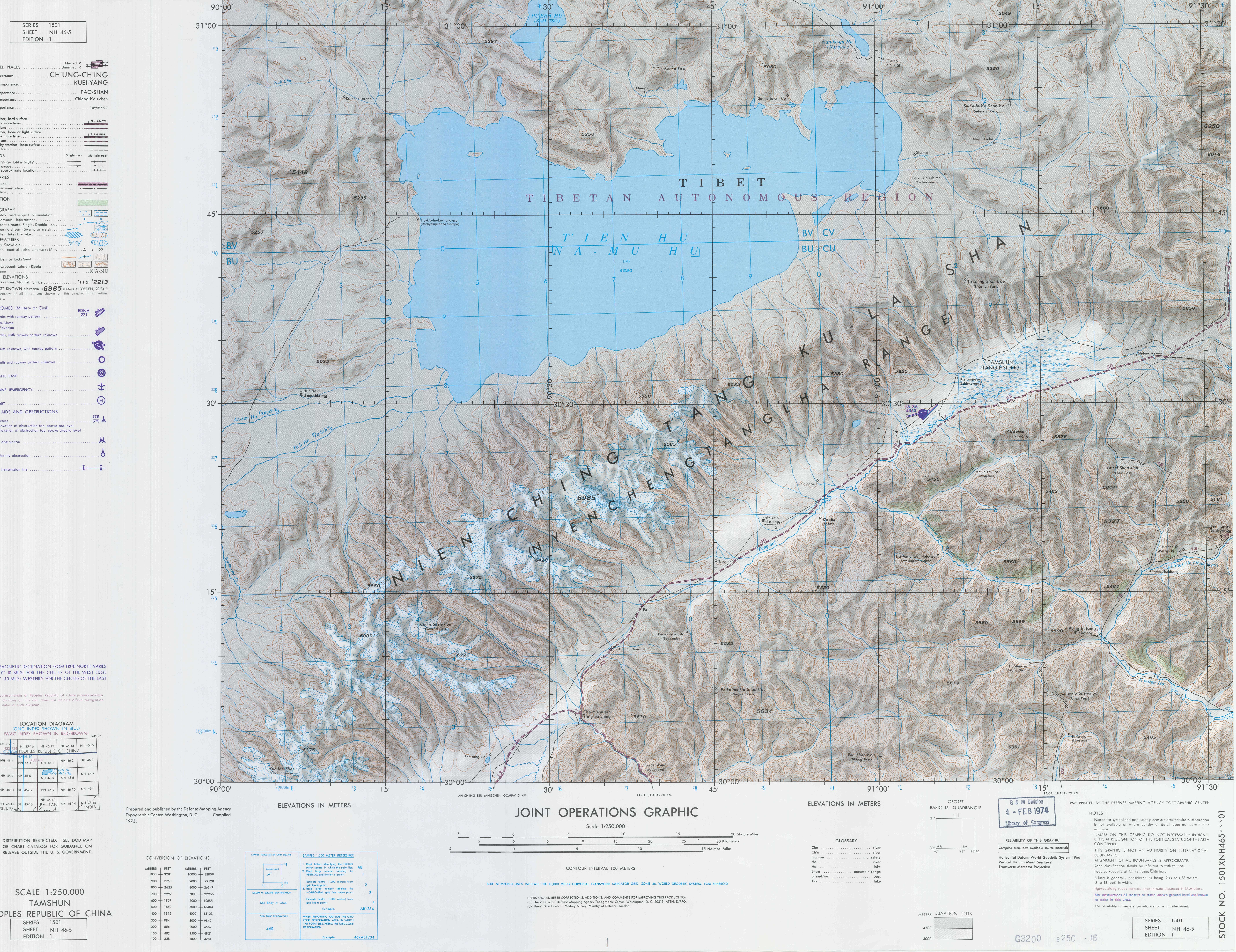
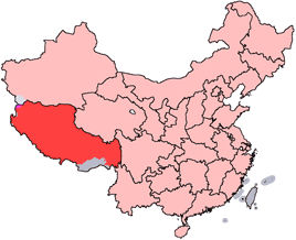
Namtso or Lake Nam (officially: Namco; ; ; ; “Heavenly Lake” in European literature: Tengri Nor, ) is a mountain lake on the border between Damxung County of Lhasa prefecture-level city and Baingoin County of Nagqu Prefecture in the Tibet Autonomous Region of China, approximately NNW of Lhasa. Geography Namtso (Namco) is a lake that first formed during the Paleogene age, as a result of Himalayan tectonic plate movements. The lake lies at an elevation of , and has a surface area of . This salt lake is the largest lake in the Tibet Autonomous Region. However, it is not the largest lake on the Qinghai-Tibet Plateau. That title belongs to Qinghai Lake (more than twice the size of Namtso); which lies more than to the north-east in Qinghai. Namtso has five uninhabited islands of reasonable size, in addition to one or two rocky outcrops. The islands have been used for spiritual retreat by pilgrims who walk over the lake's frozen surface at the end of winter, carrying their fo ... [...More Info...] [...Related Items...] OR: [Wikipedia] [Google] [Baidu] |
Tashi Dor
Tashi Dor () is a peninsula protruding into Namtso Lake from its south-eastern corner, in the Tibetan Region of China. On the peninsula is a small monastery and several hermit caves. Nomad Nomads are communities without fixed habitation who regularly move to and from areas. Such groups include hunter-gatherers, pastoral nomads (owning livestock), tinkers and trader nomads. In the twentieth century, the population of nomadic pa ...ic herders frequently camp on the peninsula, and many species of migratory birds make their home there. The 2005 completion of a paved road linking Tashi Dor with Lhasa, to the south, has facilitated the rapid expansion of tourist-oriented facilities on the peninsula. Landforms of Tibet Peninsulas of China {{Tibet-geo-stub ... [...More Info...] [...Related Items...] OR: [Wikipedia] [Google] [Baidu] |
Köppen Climate Classification
The Köppen climate classification divides Earth climates into five main climate groups, with each group being divided based on patterns of seasonal precipitation and temperature. The five main groups are ''A'' (tropical), ''B'' (arid), ''C'' (temperate), ''D'' (continental), and ''E'' (polar). Each group and subgroup is represented by a letter. All climates are assigned a main group (the first letter). All climates except for those in the ''E'' group are assigned a seasonal precipitation subgroup (the second letter). For example, ''Af'' indicates a tropical rainforest climate. The system assigns a temperature subgroup for all groups other than those in the ''A'' group, indicated by the third letter for climates in ''B'', ''C'', ''D'', and the second letter for climates in ''E''. Other examples include: ''Cfb'' indicating an oceanic climate with warm summers as indicated by the ending ''b.'', while ''Dwb'' indicates a semi-Monsoon continental climate, monsoonal continental climate ... [...More Info...] [...Related Items...] OR: [Wikipedia] [Google] [Baidu] |
Nomad
Nomads are communities without fixed habitation who regularly move to and from areas. Such groups include hunter-gatherers, pastoral nomads (owning livestock), tinkers and trader nomads. In the twentieth century, the population of nomadic pastoral tribes slowly decreased, reaching an estimated 30–40 million nomads in the world . Nomadic hunting and gathering—following seasonally available wild plants and game—is by far the oldest human subsistence method known. Pastoralists raise herds of domesticated livestock, driving or accompanying them in patterns that normally avoid depleting pastures beyond their ability to recover. Nomadism is also a lifestyle adapted to infertile regions such as steppe, tundra, or ice and sand, where mobility is the most efficient strategy for exploiting scarce resources. For example, many groups living in the tundra are reindeer herders and are semi-nomadic, following forage for their animals. Sometimes also described as "nomadic" are vari ... [...More Info...] [...Related Items...] OR: [Wikipedia] [Google] [Baidu] |
Himalaya With Michael Palin
''Himalaya with Michael Palin'' is a 2004 BBC television series presented by comedian and travel presenter Michael Palin. It records his six-month trip around the Himalaya The Himalayas, or Himalaya ( ), is a mountain range in Asia, separating the plains of the Indian subcontinent from the Tibetan Plateau. The range has some of the Earth's highest peaks, including the highest, Mount Everest. More than 100 pea ... mountain range area. The trip covered only 4,800 km (3,000 miles) horizontally, but involved a lot of vertical travelling, including several treks into the mountains. The highest point attained by Palin was Everest Base Camp at 5,300 metres (17,500 feet). A book by the same name written by Palin was published to accompany the series. This book contained both Palin's text and many pictures by Basil Pao, the stills photographer on the team. Basil Pao also produced a separate book of the photographs he took during the journey, '' Inside Himalaya'', a large ... [...More Info...] [...Related Items...] OR: [Wikipedia] [Google] [Baidu] |
The Touch (2002 Film)
''The Touch'' () is a 2002 martial arts film directed by ''Crouching Tiger, Hidden Dragon'' cinematographer Peter Pau and starring Michelle Yeoh, Ben Chaplin and Richard Roxburgh. A Hong Kong-Chinese-Taiwanese co-production, the film was created by China Film Co-production Corporation, Han Entertainment, Mythical Films, Aruze, Pandasia Entertainment and Tianjan Studios. Apart from special effects sequences shot in sound stages, the film was shot on-location in Tibet, Nepal and China. Some of the mountain ranges in which the film was shot were not open to filmmakers earlier. More than two years before its release, it was reported that Lee Chi-Ngai had been chosen to direct the film, starring Michelle Yeoh and produced by Media Asia Group managing director Thomas Chung. Miramax also bought the rights to the film in 2001, removing 20 minutes of footage for a 83-minute version and completed the special effects CGI scenes. Miramax eventually premiered the film on United States ... [...More Info...] [...Related Items...] OR: [Wikipedia] [Google] [Baidu] |
Hu Ge
Hu Ge ( zh, c=胡歌, born 20 September 1982), also known as Hugh Hu or Hugo Hu, is a Chinese actor and singer. He rose to fame for his role as Li Xiaoyao in '' Chinese Paladin'' (2005), and has since starred in a succession of popular television series, such as '' The Little Fairy'' (2006), '' The Legend of the Condor Heroes'' (2008), '' Chinese Paladin 3'' (2009), '' The Myth'' (2010), '' Sound of the Desert'' (2014),'' The Disguiser'' (2015), '' Nirvana in Fire'' (2015), and '' Blossoms Shanghai'' (2023). He also starred in films '' The Wild Goose Lake'' (2019), '' All Ears'' (2023), and '' G for Gap'' (2024). Hu has received multiple accolades for his performances, including the Best Actor Awards at the 22nd Magnolia Awards and the Golden Eagle Awards for his role in ''Nirvana in Fire'', as well as another Best Actor Award at the 29th Magnolia Awards for ''Blossoms Shanghai'' (2023). Hu ranked 63rd on the Forbes China Celebrity List in 2015, 18th in 2017, 3rd in 2019, ... [...More Info...] [...Related Items...] OR: [Wikipedia] [Google] [Baidu] |
Shangri-La
Shangri-La is a fictional place in Tibet's Kunlun Mountains, Uses the spelling 'Kuen-Lun'. described in the 1933 novel '' Lost Horizon'' by the British author James Hilton. Hilton portrays Shangri-La as a mystical, harmonious valley, gently guided from a lamasery, enclosed in the western end of the Kunlun Mountains. In the novel, the people who live in Shangri-La are almost immortal, living hundreds of years beyond the normal lifespan and only very slowly ageing in appearance. Shangri-La has become synonymous with any earthly paradise, particularly a mythical Himalayan utopia – an enduringly happy land, isolated from the world. Ancient Tibetan scriptures mention ''Nghe-Beyul Khembalung,'' one of seven utopian '' beyuls'' which Tibetan Buddhists believe were established in the 9th century CE by Padmasambhava as hidden, sacred places of refuge for Buddhists during times of strife. Possible sources for Hilton In an interview in 1936 for ''The New York Times'', Hi ... [...More Info...] [...Related Items...] OR: [Wikipedia] [Google] [Baidu] |
Cha'gyungoinba
An alphabetical list of populated places, including cities, towns, and villages, in the Tibet Autonomous Region of western China. A *Alamdo *Alhar *Arza *Asog B * Baga *Bagar * Baidi *Baima * Baimai *Baixoi *Bamda *Banag *Banbar *Banggaidoi *Bangkor *Bangru *Bangxing * Baqên *Bar * Bêba *Bei *Bênqungdo *Bilung *Birba * Biru *Bogkamba *Boindoi * Bolo *Bongba * Boqê *Bumgyê *Bungona’og *Bünsum * Burang *Bushêngcaka C * Caina *Cakaxiang *Camco *Cawarong * Cazê *Cêgnê *Cêngdo *Cêri *Cêrwai *Chabug *Chacang *Chagla *Chagna *Chagyoi *Cha’gyüngoinba *Chalükong *Chamco *Chamda *Chamoling *Changgo *Changlung *Changmar *Charing *Chatang *Chawola *Chêcang *Chênggo *Chepzi *Chibma *Chido *Chigu *Chongkü *Chongsar *Chowa *Chubalung *Chubarong *Chuka *Chumba *Chumbu *Chunduixiang *Co Nyi *Cocholung * Codoi * Cogo * Coka *Comai *Cona (Tsona) *Co’nga * Congdü *Conggo * Coqên *Coyang * Cuoma * Cuozheqiangma D *Dagdong *Dagmo *Dagri *Dagring *Dagzhuka *Dakyun ... [...More Info...] [...Related Items...] OR: [Wikipedia] [Google] [Baidu] |
Donggar
Donggar (; ) is a subdistrict in Doilungdêqên District in the Tibet Autonomous Region of China, northwest of Lhasa. It lies at an altitude of 3,828 metres (12,562 feet). The subdistrict has a population of about 4,000 people with 9,359 people in the township. It lies approximately 17.8 miles south of Dobjoi and is near Cha'gyungoinba. In 1962 Donggar became an administrative township, covering an area of 85 square kilometers. Donggar Township has three village committees and 17 villages. The economy is dominated by agriculture, animal husbandry with an area of of cultivated land, including barley, wheat, rapeseed and vegetables. Livestock breeding includes yaks, sheep, goats, etc. China National Highway 318 runs through this territory. See also *List of towns and villages in Tibet An alphabetical list of populated places, including cities, towns, and villages, in the Tibet Autonomous Region of western China. A *Alamdo *Alhar *Arza *Asog B *Baga, Tibet, Baga * ... [...More Info...] [...Related Items...] OR: [Wikipedia] [Google] [Baidu] |
Dobjoi
Dobjoi or Doqoi is a village and township in the Tibet Autonomous Region, in China China, officially the People's Republic of China (PRC), is a country in East Asia. With population of China, a population exceeding 1.4 billion, it is the list of countries by population (United Nations), second-most populous country after .... Populated places in Shigatse Township-level divisions of Tibet {{Tibet-geo-stub ... [...More Info...] [...Related Items...] OR: [Wikipedia] [Google] [Baidu] |
Laken Pass
Laken La (; ) is a mountain pass at Damxung, north-west of Lhasa Lhasa, officially the Chengguan District of Lhasa City, is the inner urban district of Lhasa (city), Lhasa City, Tibet Autonomous Region, Southwestern China. Lhasa is the second most populous urban area on the Tibetan Plateau after Xining ... near the second-largest salt lake in Qinghai-Tibetan Plateau, Namtso Lake. It has an elevation of . Mountain passes of Tibet Mountain passes of China Transhimalayas {{Tibet-geo-stub ... [...More Info...] [...Related Items...] OR: [Wikipedia] [Google] [Baidu] |
Pilgrim
The asterisk ( ), from Late Latin , from Ancient Greek , , "little star", is a typographical symbol. It is so called because it resembles a conventional image of a heraldic star. Computer scientists and mathematicians often vocalize it as star (as, for example, in ''the A* search algorithm'' or '' C*-algebra''). An asterisk is usually five- or six-pointed in print and six- or eight-pointed when handwritten, though more complex forms exist. Its most common use is to call out a footnote. It is also often used to censor offensive words. In computer science, the asterisk is commonly used as a wildcard character, or to denote pointers, repetition, or multiplication. History The asterisk was already in use as a symbol in ice age cave paintings. There is also a two-thousand-year-old character used by Aristarchus of Samothrace called the , , which he used when proofreading Homeric poetry to mark lines that were duplicated. Origen is known to have also used the ast ... [...More Info...] [...Related Items...] OR: [Wikipedia] [Google] [Baidu] |


