|
Lake Monroe (Florida)
Lake Monroe is one of the lakes that make up the St. Johns River system. The port city of Sanford is situated along the southern shore, while DeBary and Deltona are located along the northern shore. Two major central Florida roadways that run near the lake are State Road 415 and Interstate 4. It forms the border of Seminole County and Volusia County It is the 8th largest lake in the Orlando metropolitan area, after Lake Jesup Lake Jesup is the largest lake in Seminole County, Florida, United States and is one of many that make up the St. Johns River. Located along the middle basin of the St. Johns, the lake encompasses an area of approximately , including open wate ..., 7 miles (11 km) to the south. See also * Green Springs Park * List of lakes of the St. Johns River * St. Johns River References External links * {{authority control Monroe Monroe Monroe St. Johns River ... [...More Info...] [...Related Items...] OR: [Wikipedia] [Google] [Baidu] |
Volusia County, Florida
Volusia County (, ) is located in the east-central part of the U.S. state of Florida, stretching between the St. Johns River and the Atlantic Ocean. As of the 2020 census, the county was home to 553,543 people, an increase of 11.9% from the 2010 census. It was founded on December 29, 1854, from part of Orange County, and was named for the community of Volusia, located in northwestern Volusia County. Its first county seat was Enterprise. Since 1887, its county seat has been DeLand. Volusia County is part of the Deltona–Daytona Beach–Ormond Beach metropolitan statistical area, as well as part of the larger Orlando–Deltona–Daytona Beach Combined statistical area. History Volusia County was named after its largest community, Volusia, when the Florida Legislature created it by dividing Orange County on December 29, 1854. At the time, Volusia County had about 600 residents. The origins of the word "Volusia" are unclear, though several theories exist: # The name cam ... [...More Info...] [...Related Items...] OR: [Wikipedia] [Google] [Baidu] |
Interstate 4 (Florida)
Interstate 4 (I-4) is an Interstate Highway located entirely within the U.S. state of Florida, maintained by the Florida Department of Transportation (FDOT). Spanning along a generally southwest–northeast axis, I-4 is entirely concurrent with State Road 400 (SR 400). In the west, I-4 begins at an interchange with I-275 in Tampa. I-4 intersects with several major expressways as it traverses Central Florida, including U.S. Route 41 (US 41) in Tampa; US 301 near Riverview; I-75 near Brandon; US 98 in Lakeland; US 27 in unincorporated Davenport; US 192 in Celebration; Florida's Turnpike in Orlando; and US 17 and US 92 in multiple junctions. In the east, I-4 ends at an interchange with I-95 in Daytona Beach, while SR 400 continues for roughly another and ends at an intersection with US 1 on the city line of Daytona Beach and South Daytona. Construction on I-4 began in 1958; the first segment opened in 1959, and th ... [...More Info...] [...Related Items...] OR: [Wikipedia] [Google] [Baidu] |
Lakes Of Seminole County, Florida
A lake is an area filled with water, localized in a basin, surrounded by land, and distinct from any river or other outlet that serves to feed or drain the lake. Lakes lie on land and are not part of the ocean, although, like the much larger oceans, they do form part of the Earth's water cycle. Lakes are distinct from lagoons, which are generally coastal parts of the ocean. Lakes are typically larger and deeper than ponds, which also lie on land, though there are no official or scientific definitions. Lakes can be contrasted with rivers or streams, which usually flow in a channel on land. Most lakes are fed and drained by rivers and streams. Natural lakes are generally found in mountainous areas, rift zones, and areas with ongoing glaciation. Other lakes are found in endorheic basins or along the courses of mature rivers, where a river channel has widened into a basin. Some parts of the world have many lakes formed by the chaotic drainage patterns left over from the last ic ... [...More Info...] [...Related Items...] OR: [Wikipedia] [Google] [Baidu] |
List Of Lakes Of The St
A ''list'' is any set of items in a row. List or lists may also refer to: People * List (surname) Organizations * List College, an undergraduate division of the Jewish Theological Seminary of America * SC Germania List, German rugby union club Other uses * Angle of list, the leaning to either port or starboard of a ship * List (information), an ordered collection of pieces of information ** List (abstract data type), a method to organize data in computer science * List on Sylt, previously called List, the northernmost village in Germany, on the island of Sylt * ''List'', an alternative term for ''roll'' in flight dynamics * To ''list'' a building, etc., in the UK it means to designate it a listed building that may not be altered without permission * Lists (jousting), the barriers used to designate the tournament area where medieval knights jousted * ''The Book of Lists'', an American series of books with unusual lists See also * The List (other) * Listing (di ... [...More Info...] [...Related Items...] OR: [Wikipedia] [Google] [Baidu] |
Green Springs Park
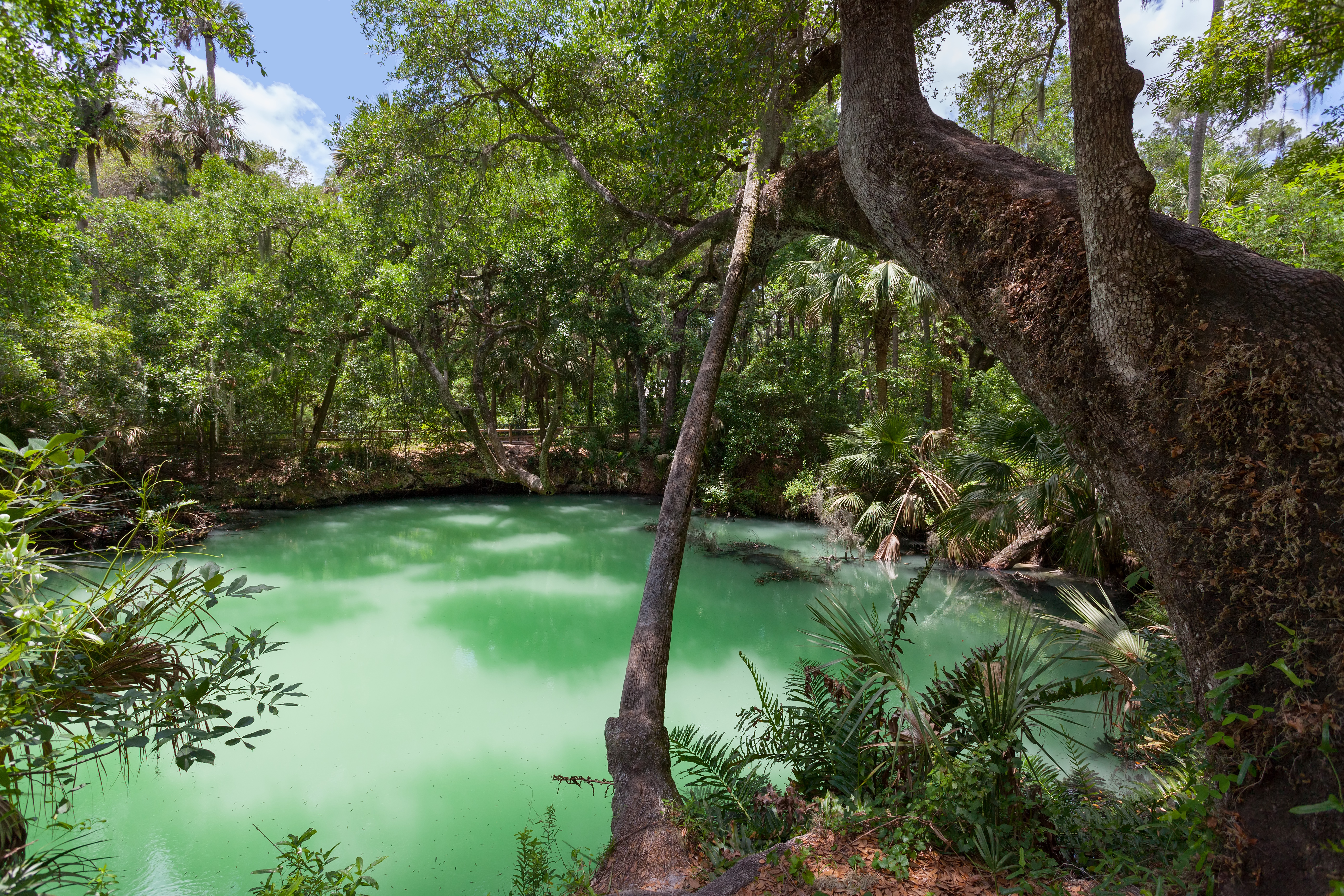
Green Springs Park is public park in Enterprise, Florida featuring a green-hued sulfur spring. The spring was once part of a 19th-century health resort and the surrounding area is a notable archeological site. After more than 20 years of effort to acquire and develop the site, the park finally opened in September 2008. Description Green Springs Park is located near the north shore of Lake Monroe, approximately east of Interstate 4 in Enterprise, Florida. The spring supplies fresh water to Lake Monroe from the Florida aquifer. The spring basin is about wide by about deep. The water varies in color depending on the time of year, changing from green in the spring to more of a turquoise color in summer, back to green in the fall and finally to jade in the winter. The park's ecosystem is primarily a hardwood hammock, host to several rare species of plant life, including ''Epidendrum magnoliae'', or Green-fly orchid. A paved path and numerous primitive paths cross and loop thou ... [...More Info...] [...Related Items...] OR: [Wikipedia] [Google] [Baidu] |
Lake Jesup
Lake Jesup is the largest lake in Seminole County, Florida, United States and is one of many that make up the St. Johns River. Located along the middle basin of the St. Johns, the lake encompasses an area of approximately , including open water and floodplain. It is named in honor of Brigadier General Thomas Jesup, an American military officer who served in the Second Seminole War. The lake is bisected by one of the state's longest free-standing bridges, part of the Seminole County Expressway (SR 417). The lake is home to a wide variety of species and is considered to support one of the state's densest populations of alligators. Drivers on the bridge across the lake are likely to see eagles (osprey and bald eagles) perched on the light posts watching for fish. During the 1960s, the toll of decades of abuse and neglect was very apparent. Wastewater discharged directly into the lake, stormwater discharges from surrounding communities, the construction of berms that segregated t ... [...More Info...] [...Related Items...] OR: [Wikipedia] [Google] [Baidu] |
Orlando-Kissimmee, Florida, Metropolitan Statistical Area
The Orlando metropolitan area, commonly referred to as Greater Orlando, Metro Orlando, Central Florida as well as for U.S. Census purposes as the Orlando–Kissimmee–Sanford, Florida Metropolitan Statistical Area, is a metropolitan area in the central region of the U.S. state of Florida. Its principal cities are Orlando, Kissimmee and Sanford. The U.S. Office of Management and Budget defines it as consisting of the counties of Lake, Orange (including Orlando), Osceola, and Seminole. According to the 2020 U.S. Census, the population of Greater Orlando is 2,673,376, an increase of nearly 540,000 new residents between 2010 and 2020. By population, it is the third-largest metropolitan area in Florida, the seventh-largest in the southeastern United States, and the 23rd largest in the United States. The MSA encompasses of total area (both land and water areas). The Orlando–Kissimmee–Sanford MSA is further listed by the U.S. Office of Management and Budget as part of the Orla ... [...More Info...] [...Related Items...] OR: [Wikipedia] [Google] [Baidu] |
Border
Borders are usually defined as geographical boundaries, imposed either by features such as oceans and terrain, or by political entities such as governments, sovereign states, federated states, and other subnational entities. Political borders can be established through warfare, colonization, or mutual agreements between the political entities that reside in those areas; the creation of these agreements is called boundary delimitation. Some borders—such as most states' internal administrative borders, or inter-state borders within the Schengen Area—are open and completely unguarded. Most external political borders are partially or fully controlled, and may be crossed legally only at designated border checkpoints; adjacent border zones may also be controlled. Buffer zones may be setup on borders between belligerent entities to lower the risk of escalation. While ''border'' refers to the boundary itself, the area around the border is called the frontier. Histo ... [...More Info...] [...Related Items...] OR: [Wikipedia] [Google] [Baidu] |
Florida State Road 415
State Road 415 (SR 415) is a north–south route in Central Florida running between State Road 44 in Volusia County and SR 46 in Seminole County. The road continues north of State Road 44 to U.S. Route 92 (US 92) as County Road 415 (CR 415), Tomoka Farms Road. Also SR 415 connects with the eastern terminus of Lake Mary Boulevard at the intersection of SR 415 and SR 46. Route description State Road 415 begins in Seminole County at State Road 46 just east of the Orlando-Sanford International Airport and heads straight north. The only intersection of any importance within the county is CR 415(Celery Avenue), a county connecting spur which leads to downtown Sanford at US 17/92. Here the road shifts to the northeast and crosses the St. Johns River over the Osteen Bridge, where it enters Volusia County and runs through the Lake Monroe Conservation Area, which it leaves at the intersection of Reed Ellis Road. In Osteen SR 415 serves as the terminus for three s ... [...More Info...] [...Related Items...] OR: [Wikipedia] [Google] [Baidu] |
Seminole County, Florida
Seminole County (, ) is a county located in the central portion of the U.S. state of Florida. As of the 2020 census, the population was 470,856. Its county seat and largest city is Sanford. Seminole County is part of the Orlando-Kissimmee-Sanford, Florida Metropolitan Statistical Area. History On July 21, 1821, two counties formed Florida: Escambia to the west and St. Johns to the east. In 1824, the area to the south of St. Johns County was designated Mosquito County, with its seat at Enterprise. The county's name was changed to Orange County in 1845 when Florida became a state, and over the next 70 years several other counties were created. Seminole County was one of the last to split. Seminole County was created on April 25, 1913, out of the northern portion of Orange County by the Florida Legislature. It was named for the Seminole people who historically lived throughout the area. The name "Seminole" is thought to be derived from the Spanish word ''cimarron,'' meaning ... [...More Info...] [...Related Items...] OR: [Wikipedia] [Google] [Baidu] |


