|
Lake Hodgson
Hodgson Lake is a perennially ice-covered freshwater lake, which is about 2 km (1.2 mi) long by about 1.5 km (0.93 mi) wide. It is located within the southern part of Alexander Island, west of Palmer Land in Antarctica, at approximately 72°S latitude and 68°W longitude. This lake has a 93.4 m (306 ft) deep water column that lies sealed beneath a 3.6 to 4.0 m (12 to 13 ft) thick perennial lake ice. The lake is an ultra- oligotrophic lake with very low nutrient content and very low productivity. There is no detectable life living in Hodgson Lake. The lake extends eastward into George VI Sound and the George VI Ice Shelf making it adjacent to the sound. The northern side of this lake is bounded by the Saturn Glacier, which flows east into George VI Sound. The lake lies next to and southeast of Citadel Bastion, a pre-eminent mountain on Alexander Island.Stewart, J. (2011) ''Antarctic An Encyclopedia'' McFarland & Company Inc, New York. 1776 pp. . ... [...More Info...] [...Related Items...] OR: [Wikipedia] [Google] [Baidu] |
Alexander Island
Alexander Island, which is also known as Alexander I Island, Alexander I Land, Alexander Land, Alexander I Archipelago, and Zemlja Alexandra I, is the largest island of Antarctica. It lies in the Bellingshausen Sea west of Palmer Land, Antarctic Peninsula from which it is separated by Marguerite Bay and George VI Sound. The George VI Ice Shelf entirely fills George VI Sound and connects Alexander Island to Palmer Land. The island partly surrounds Wilkins Sound, which lies to its west.Stewart, J. (2011) ''Antarctic An Encyclopedia'' McFarland & Company Inc, New York. 1776 pp. . Alexander Island is about long in a north–south direction, wide in the north, and wide in the south. Alexander Island is the second-largest uninhabited island in the world, after Devon Island. History Alexander Island was discovered on January 28, 1821, by a Russian expedition under Fabian Gottlieb von Bellingshausen, who named it Alexander I Land for the reigning Tsar Alexander I of Russia. ... [...More Info...] [...Related Items...] OR: [Wikipedia] [Google] [Baidu] |
Last Glacial Maximum
The Last Glacial Maximum (LGM), also referred to as the Late Glacial Maximum, was the most recent time during the Last Glacial Period that ice sheets were at their greatest extent. Ice sheets covered much of Northern North America, Northern Europe, and Asia and profoundly affected Earth's climate by causing drought, desertification, and a large drop in sea levels. Based on changes in position of ice sheet margins dated via terrestrial cosmogenic nuclides and radiocarbon dating, growth of ice sheets commenced 33,000 years ago and maximum coverage was between 26,500 years and 19–20,000 years ago, when deglaciation commenced in the Northern Hemisphere, causing an abrupt rise in sea level. Decline of the West Antarctica ice sheet occurred between 14,000 and 15,000 years ago, consistent with evidence for another abrupt rise in the sea level about 14,500 years ago. Glacier fluctuations around the Strait of Magellan suggest the peak in glacial surface area was constrained to betw ... [...More Info...] [...Related Items...] OR: [Wikipedia] [Google] [Baidu] |
Lakes Of Antarctica
A lake is an area filled with water, localized in a basin, surrounded by land, and distinct from any river or other outlet that serves to feed or drain the lake. Lakes lie on land and are not part of the ocean, although, like the much larger oceans, they do form part of the Earth's water cycle. Lakes are distinct from lagoons, which are generally coastal parts of the ocean. Lakes are typically larger and deeper than ponds, which also lie on land, though there are no official or scientific definitions. Lakes can be contrasted with rivers or streams, which usually flow in a channel on land. Most lakes are fed and drained by rivers and streams. Natural lakes are generally found in mountainous areas, rift zones, and areas with ongoing glaciation. Other lakes are found in endorheic basins or along the courses of mature rivers, where a river channel has widened into a basin. Some parts of the world have many lakes formed by the chaotic drainage patterns left over from the last ic ... [...More Info...] [...Related Items...] OR: [Wikipedia] [Google] [Baidu] |
:Category:Lakes Of Antarctica ...
* of . {{GeoGroupTemplate Bodies of water of Antarctica Antarctica Antarctica () is Earth's southernmost and least-populated continent. Situated almost entirely south of the Antarctic Circle and surrounded by the Southern Ocean, it contains the geographic South Pole. Antarctica is the fifth-largest co ... [...More Info...] [...Related Items...] OR: [Wikipedia] [Google] [Baidu] |
Lake Vostok
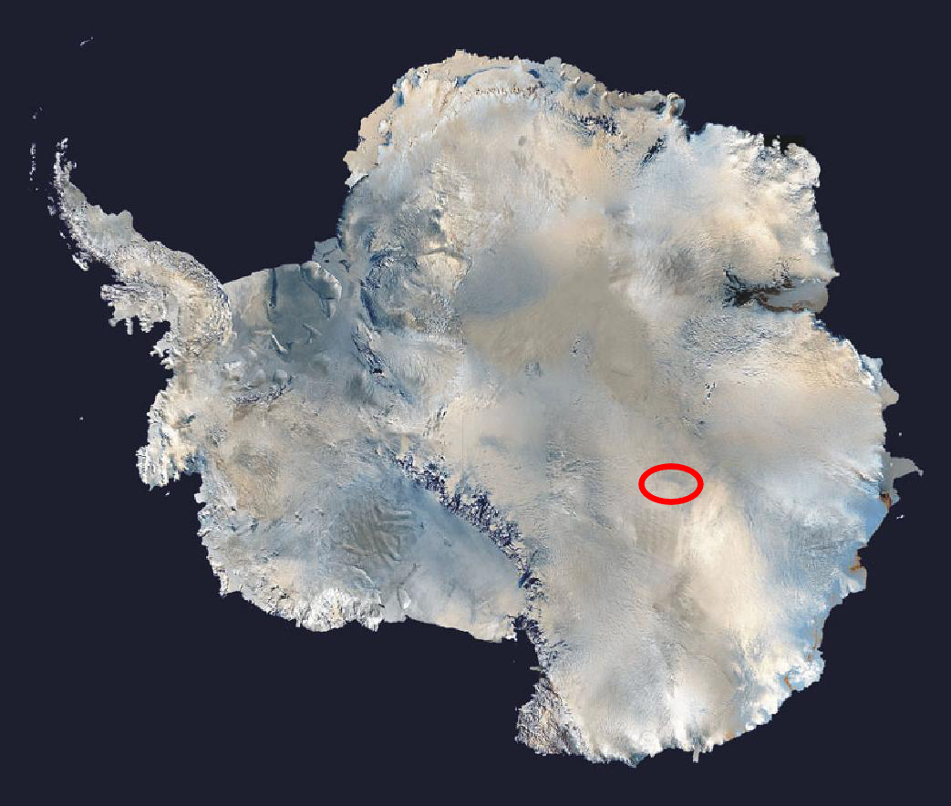
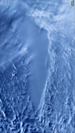
Lake Vostok (russian: озеро Восток, ''ozero Vostok'') is the largest of Antarctica's almost 400 known subglacial lakes. Lake Vostok is located at the southern Pole of Cold, beneath Russia's Vostok Station under the surface of the central East Antarctic Ice Sheet, which is at above mean sea level. The surface of this fresh water lake is approximately under the surface of the ice, which places it at approximately below sea level. Measuring long by wide at its widest point, it covers an area of making it the 16th largest lake by surface area. With an average depth of , it has an estimated volume of , making it the 6th largest lake by volume. The lake is divided into two deep basins by a ridge. The liquid water depth over the ridge is about , compared to roughly deep in the northern basin and deep in the southern. The lake is named after Vostok Station, which in turn is named after the '' Vostok'' (Восток), a sloop-of-war, which means "East" in Russian ... [...More Info...] [...Related Items...] OR: [Wikipedia] [Google] [Baidu] |
Lake Ellsworth (Antarctica)
Lake Ellsworth is a natural freshwater liquid subglacial lake located in West Antarctica under approximately of ice. It is approximately 10 km long and is estimated to be in depth. The lake is named after the American explorer Lincoln Ellsworth. The surface of the lake itself is located over below sea level. Exploration Lake Ellsworth was discovered in 1996 by British scientist Professor Martin Siegert of the University of Bristol; it is one of 387 known subglacial Antarctic lakes and it is a target site for exploration due to the speculation that new forms of microbial life could have evolved in the unique habitats of Antarctica’s sub-glacial lakes after half a million years of isolation.Siegert, Martin J. and the Lake Ellsworth Consortium, "Exploration of Subglacial Lake Ellsworth", Poster, University of Bristol, September 2004 Life in subglacial lakes would have to adapt to total darkness, low nutrient levels, high water pressure, and isolation from the atmosphere ... [...More Info...] [...Related Items...] OR: [Wikipedia] [Google] [Baidu] |
Paleolimnology
Paleolimnology (from Greek: παλαιός, ''palaios'', "ancient", λίμνη, ''limne'', "lake", and λόγος, ''logos'', "study") is a scientific sub-discipline closely related to both limnology and paleoecology. Paleolimnological studies focus on reconstructing the past environments of inland waters (e.g., lakes and streams) using the geologic record, especially with regard to events such as climatic change, eutrophication, acidification, and internal ontogenic processes. Paleolimnological studies are mostly conducted using analyses of the physical, chemical, and mineralogical properties of sediments, or of biological records such as fossil pollen, diatoms, or chironomids. History Lake ontogeny Most early paleolimnological studies focused on the biological productivity of lakes, and the role of internal lake processes in lake development. Although Einar Naumann had speculated that the productivity of lakes should gradually decrease due to leaching of catchment soils, A ... [...More Info...] [...Related Items...] OR: [Wikipedia] [Google] [Baidu] |
Limnology
Limnology ( ; from Greek λίμνη, ''limne'', "lake" and λόγος, ''logos'', "knowledge") is the study of inland aquatic ecosystems. The study of limnology includes aspects of the biological, chemical, physical, and geological characteristics of fresh and saline, natural and man-made bodies of water. This includes the study of lakes, reservoirs, ponds, rivers, springs, streams, wetlands, and groundwater.Wetzel, R.G. 2001. Limnology: Lake and River Ecosystems, 3rd ed. Academic Press () Water systems are often categorized as either running (lotic) or standing (lentic). Limnology includes the study of the drainage basin, movement of water through the basin and biogeochemical changes that occur en route. A more recent sub-discipline of limnology, termed landscape limnology, studies, manages, and seeks to conserve these ecosystems using a landscape perspective, by explicitly examining connections between an aquatic ecosystem and its drainage basin. Recently, the need to un ... [...More Info...] [...Related Items...] OR: [Wikipedia] [Google] [Baidu] |
British Antarctic Survey
The British Antarctic Survey (BAS) is the United Kingdom's national polar research institute. It has a dual purpose, to conduct polar science, enabling better understanding of global issues, and to provide an active presence in the Antarctic on behalf of the UK. It is part of the Natural Environment Research Council (NERC). With over 400 staff, BAS takes an active role in Antarctic affairs, operating five research stations, one ship and five aircraft in both polar regions, as well as addressing key global and regional issues. This involves joint research projects with over 40 UK universities and more than 120 national and international collaborations. Having taken shape from activities during World War II, it was known as the Falkland Islands Dependencies Survey until 1962. History Operation Tabarin was a small British expedition in 1943 to establish permanently occupied bases in the Antarctic. It was a joint undertaking by the British Admiralty, Admiralty and the Secretary of ... [...More Info...] [...Related Items...] OR: [Wikipedia] [Google] [Baidu] |
UK Antarctic Place-Names Committee
The UK Antarctic Place-Names Committee (or UK-APC) is a United Kingdom government committee, part of the Foreign and Commonwealth Office, responsible for recommending names of geographical locations within the British Antarctic Territory (BAT) and the South Georgia and the South Sandwich Islands (SGSSI). Such names are formally approved by the Commissioners of the BAT and SGSSI respectively, and published in the BAT Gazetteer and the SGSSI Gazetteer maintained by the Committee. The BAT names are also published in the international Composite Gazetteer of Antarctica maintained by SCAR. The Committee may also consider proposals for new place names for geographical features in areas of Antarctica outside BAT and SGSSI, which are referred to other Antarctic place-naming authorities, or decided by the Committee itself if situated in the unclaimed sector of Antarctica. Names attributed by the committee * Anvil Crag, named for descriptive features *Anckorn Nunataks, named after J. F. Anc ... [...More Info...] [...Related Items...] OR: [Wikipedia] [Google] [Baidu] |
Subglacial Lake
A subglacial lake is a lake that is found under a glacier, typically beneath an ice cap or ice sheet. Subglacial lakes form at the boundary between ice and the underlying bedrock, where gravitational pressure decreases the pressure melting point of ice. Over time, the overlying ice gradually melts at a rate of a few millimeters per year. Meltwater flows from regions of high to low hydraulic pressure under the ice and pools, creating a body of liquid water that can be isolated from the external environment for millions of years. Since the first discoveries of subglacial lakes under the Antarctic Ice Sheet, more than 400 subglacial lakes have been discovered in Antarctica, beneath the Greenland Ice Sheet, and under Iceland's Vatnajökull ice cap. Subglacial lakes contain a substantial proportion of Earth's liquid freshwater, with the volume of Antarctic subglacial lakes alone estimated to be about 10,000 km3, or about 15% of all liquid freshwater on Earth. As ecosystems iso ... [...More Info...] [...Related Items...] OR: [Wikipedia] [Google] [Baidu] |
Oligotrophic Lake
The Trophic State Index (TSI) is a classification system designed to rate water bodies based on the amount of biological productivity they sustain. Although the term "trophic index" is commonly applied to lakes, any surface water body may be indexed. The TSI of a water body is rated on a scale from zero to one hundred. Under the TSI scale, water bodies may be defined as: * oligotrophic (TSI 0–40, having the least amount of biological productivity, "good" water quality); * mesotrophic (TSI 40–60, having a moderate level of biological productivity, "fair" water quality); or * eutrophic to hypereutrophic (TSI 60–100, having the highest amount of biological productivity, "poor" water quality). The quantities of nitrogen, phosphorus, and other biologically useful nutrients are the primary determinants of a water body's TSI. Nutrients such as nitrogen and phosphorus tend to be limiting resources in standing water bodies, so increased concentrations tend to result in increased ... [...More Info...] [...Related Items...] OR: [Wikipedia] [Google] [Baidu] |


.jpg)

