|
Lake Cerrillos
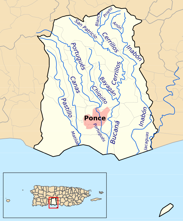
Lake Cerrillos (Spanish: Lago Cerrillos) is a human-made lake located in barrio Maragüez, Ponce, Puerto Rico. The lake was finished in 1992 by the U.S. Army Corps of Engineers. The main purposes of the reservoir are flood control, water supply, and recreation. There is a variety of fish available for fishing such as largemouth bass, bluegills, catfish and tilapias. The 1993 Central American and Caribbean Games that were held in Ponce staged the canoeing competitions in this lake. It was used in the 2010 Central American and Caribbean Games for the sports of Canoeing at the 2010 Central American and Caribbean Games, Canoeing, Rowing at the 2010 Central American and Caribbean Games, Rowing. The lake is the main drinking water source for the city of Ponce. Dam The Lake Cerrillos Dam is located about four miles (6 km) northeast of Ponce. Construction of the dam started in 1984. After its completion in 1992, it still took a few more years for the initial filling of the res ... [...More Info...] [...Related Items...] OR: [Wikipedia] [Google] [Baidu] |
Maragüez
Maragüez (''Barrio Maragüez'') is one of the 31 barrios of the municipality of Ponce, Puerto Rico. Along with Magueyes, Ponce, Puerto Rico, Magueyes, Tibes, Portugués (Ponce), Portugués, Montes Llanos, Machuelo Arriba, Sabanetas, Ponce, Puerto Rico, Sabanetas, and Cerrillos, Ponce, Puerto Rico, Cerrillos, Maragüez is one of the municipality's eight rural interior barrios. The name of this barrio is of native Indian origin. It was created in 1878. Location Maragüez is a rural barrio located in the northeastern section of the municipality, northeast of the city of Ponce at latitude 18.106178 N, and longitude -66.595986 W. Boundaries It is bounded on the North by barrios Anón and San Patricio (Ponce), San Patricio, in the South by barrio Cerrillos (Ponce), Cerrillos, in the West by barrios Monte Llano and Machuelo Arriba, and in the East by barrios Anón and Real (Ponce), Real. Río Cerrillos runs a large stretch of its course through barrio Maragüez, and is known locally ... [...More Info...] [...Related Items...] OR: [Wikipedia] [Google] [Baidu] |
Cerrillos State Forest
Cerrillos State Forest is one of the 21 state forests in Puerto Rico. It is located in barrio Maragüez, in the municipality of Ponce, and covers of valleys and mountains in the foothills of the Cordillera Central mountain range. The forest has several trails, observation areas, several picnic areas, complete with gazeebos and a man-made reservoir, Lake Cerrillos and the Lake Cerrillos dam. Location The forest is located at 18.08842 N, 66.58058 W (), in barrio Maragüez, which is located northeast of the city of Ponce, Puerto Rico. It can be reached via PR-139 Km 3.4. Its elevation varies from 400 to 1,000 feet above sea level. Recreation Recreational activities permitted in this forest include fishing, hiking, kayaking, photography, picnicking, scientific research, and bird watching. [...More Info...] [...Related Items...] OR: [Wikipedia] [Google] [Baidu] |
Tourist Attractions In Ponce, Puerto Rico
Ponce, Puerto Rico, Ponce, Puerto Rico's second-largest city outside the San Juan, Puerto Rico metropolitan area, San Juan metropolitan area, receives over 100,000 visitors annually. Ponce's sights include monuments and architecture, such as its Monumento a la abolición de la esclavitud, Monumento a la Abolición de la Esclavitud and Residencia Armstrong-Poventud, and pink marble curbs and chamfered streets corners, as well as historic houses, castles and concert halls. There are also more modern attractions such as its seafront Tablado La Guancha as well as attractions that date back some 1500 years, like the Tibes Indigenous Ceremonial Center. The city has been called "the most Puerto Rican city in Puerto Rico."Aida Belen Rivera Ruiz, Certifying Official, and Juan Llanes Santos, Preparer, Puerto Rico Historic Preservation Office. (San Juan, Puerto Rico) 26 February 2008. In ''National Register of Historic Places Registration Form''. United States Department of the Interior. ... [...More Info...] [...Related Items...] OR: [Wikipedia] [Google] [Baidu] |
2010 Central American And Caribbean Games Venues
1 (one, unit, unity) is a number, numeral, and glyph. It is the first and smallest positive integer of the infinite sequence of natural numbers. This fundamental property has led to its unique uses in other fields, ranging from science to sports, where it commonly denotes the first, leading, or top thing in a group. 1 is the unit of counting or measurement, a determiner for singular nouns, and a gender-neutral pronoun. Historically, the representation of 1 evolved from ancient Sumerian and Babylonian symbols to the modern Arabic numeral. In mathematics, 1 is the multiplicative identity, meaning that any number multiplied by 1 equals the same number. 1 is by convention not considered a prime number. In digital technology, 1 represents the "on" state in binary code, the foundation of computing. Philosophically, 1 symbolizes the ultimate reality or source of existence in various traditions. In mathematics The number 1 is the first natural number after 0. Each natural number, ... [...More Info...] [...Related Items...] OR: [Wikipedia] [Google] [Baidu] |
Geography Of Ponce, Puerto Rico
Geography (from Ancient Greek ; combining 'Earth' and 'write', literally 'Earth writing') is the study of the lands, features, inhabitants, and phenomena of Earth. Geography is an all-encompassing discipline that seeks an understanding of Earth and its human and natural complexities—not merely where objects are, but also how they have changed and come to be. While geography is specific to Earth, many concepts can be applied more broadly to other celestial bodies in the field of planetary science. Geography has been called "a bridge between natural science and social science disciplines." Origins of many of the concepts in geography can be traced to Greek Eratosthenes of Cyrene, who may have coined the term "geographia" (). The first recorded use of the word γεωγραφία was as the title of a book by Greek scholar Claudius Ptolemy (100 – 170 AD). This work created the so-called "Ptolemaic tradition" of geography, which included "Ptolemaic cartographic theory." ... [...More Info...] [...Related Items...] OR: [Wikipedia] [Google] [Baidu] |
Reservoirs In Puerto Rico
A reservoir (; ) is an enlarged lake behind a dam, usually built to store fresh water, often doubling for hydroelectric power generation. Reservoirs are created by controlling a watercourse that drains an existing body of water, interrupting a watercourse to form an embayment within it, excavating, or building any number of retaining walls or levees to enclose any area to store water. Types Dammed valleys Dammed reservoirs are artificial lakes created and controlled by a dam constructed across a valley and rely on the natural topography to provide most of the basin of the reservoir. These reservoirs can either be ''on-stream reservoirs'', which are located on the original streambed of the downstream river and are filled by creeks, rivers or rainwater that runs off the surrounding forested catchments, or ''off-stream reservoirs'', which receive diverted water from a nearby stream or aqueduct or pipeline water from other on-stream reservoirs. Dams are typically loc ... [...More Info...] [...Related Items...] OR: [Wikipedia] [Google] [Baidu] |
Río Cerrillos
Cerrillos River (Spanish language, Spanish: Río Cerrillos) is a river in the municipality of Ponce, Puerto Rico. Río Cerrillos has its origin in barrio Anón and runs south until it feeds into Bucaná River. Río Cerrillos is commonly known by the locals as Maragüez River, because most of its course runs through Barrio Maragüez. This river is one of the 14 List of rivers of Ponce, rivers in the municipality. The river has a discharge of 24,000 cubic feet per second, making it the second most affluent river in the municipality after Río Jacaguas. Course From its origin about 1 kilometer south of the intersection of Puerto Rico Highway 139, PR-139 and Puerto Rico Highway 143, PR-143, Río Cerrillos runs south for 1.8 kilometers where it is fed by Río Prieto (Ponce, Puerto Rico), Río Prieto west of PR-139. From this point on, Rio Cerrillos runs parallel to PR-139 for 2 kilometers in barrio Anón before reaching barrio Maragüez. Continuing on its southernly course for abou ... [...More Info...] [...Related Items...] OR: [Wikipedia] [Google] [Baidu] |
Río Bucaná
Rio or Río is the Portuguese and Spanish word for "river". The word also exists in Italian, but is largely obsolete and used in a poetical or literary context to mean "stream". Rio, RIO or Río may also refer to: Places United States * Rio, Florida, a census-designated place * Rio, Georgia, an unincorporated community * Rio, Illinois, a village * Rio, a location in Deerpark, New York * Rio, Virginia, a community * Rio, West Virginia, a village * Rio, Wisconsin, a village * El Río, Las Piedras, Puerto Rico, a barrio Elsewhere * Rio de Janeiro, Brazil, often referred to as simply Rio * Rio, Italy, a municipality on the island of Elba in Tuscany * Rio, Greece, a community in suburban Patras People * Rio (given name) * Rio (surname) * Tina Yuzuki (born 1986), also known as Rio, Japanese AV idol Arts and entertainment Films * ''Rio'' (1939 film), starring Basil Rathbone * ''Rio'' (franchise), a film series and related media * ''Rio'' (2011 film), an animated film f ... [...More Info...] [...Related Items...] OR: [Wikipedia] [Google] [Baidu] |
Rowing At The Pan American Games
{{rowing-stub ...
Rowing has been a sport of the Pan American Games since the 1951 games. Medal table ''Updated after the 2023 Pan American Games''. See also * List of Pan American Games medalists in rowing References Sports at the Pan American Games Pan American Games Pan American Games Pan American Games The Pan American Games, known as the Pan Am Games, is a continental multi-sport event in the Americas. It features thousands of athletes participating in competitions to win different summer sports. It is held among athletes from nations of th ... [...More Info...] [...Related Items...] OR: [Wikipedia] [Google] [Baidu] |
Parque Luis A
Parque is the Galician, Portuguese and Spanish word for "park", and may refer to: * Parque (TransMilenio), a metro station in Bogotá, Colombia * Parque (Lisbon Metro), in Portugal * Parque (Santurce), a subbarrio in San Juan, Puerto Rico * Battle of Parque (1912), in Morelos, Mexico * Jim Parque (born 1975), American baseball player See also * Parquetry, a type of flooring * Park (other) * * {{dab, surname ... [...More Info...] [...Related Items...] OR: [Wikipedia] [Google] [Baidu] |
Kiosk
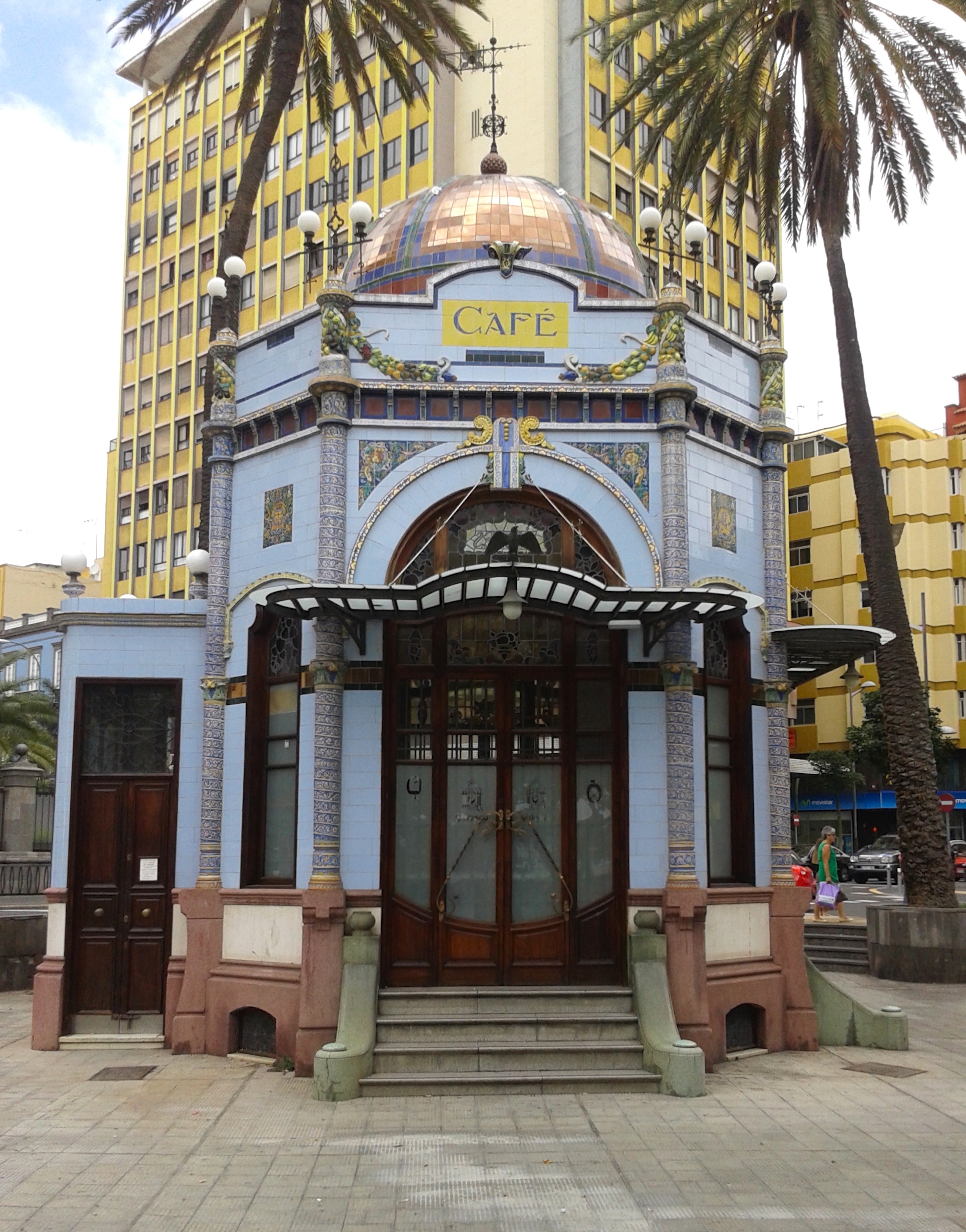
Historically, a kiosk () was a small garden pavilion open on some or all sides common in Iran, Persia, the Indian subcontinent, and in the Ottoman Empire from the 13th century onward. Today, several examples of this type of kiosk still exist in and around the Topkapı Palace in Istanbul, and they can be seen in Balkan countries. The word is used in English-speaking countries for small booths offering goods and services. In Australia they usually offer food service. Freestanding computer terminals dispensing information are called interactive kiosks. Etymology Etymological data points to the Middle Persian word ''kōšk'' 'palace, portico' as the origin, via Turkish language, Turkish ''köşk'' 'pavilion' and French ''kiosque'' or Italian ''chiosco''. History and origins A kiosk is an open summer-house or pavilion usually having its roof supported by pillars with screened or totally open walls. As a building type, it was first introduced by the Sasanian Empire, Sasanid and ... [...More Info...] [...Related Items...] OR: [Wikipedia] [Google] [Baidu] |


