|
Lake Afton
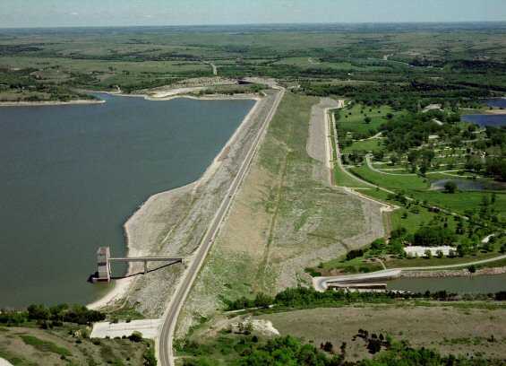
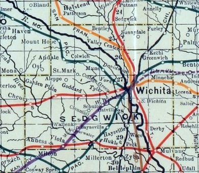
Lake Afton is a man-made recreational lake in Sedgwick County, Kansas, United States, and within the Lake Afton Park. It is located east of the intersection of Viola Rd (263rd St W) and MacArthur Rd (39th St S), between the communities of Goddard, Garden Plain, Schulte, Viola. History Ground breaking for the dam occurred on December 29, 1939. The dam was built by Works Progress Administration workers from 1939 to 1941. It opened to the public in 1945. The Sedgwick County Commission let a contract for the construction of the Segwick County Boys Detention Home within the Park in April 1960. Lake Afton Public Observatory was constructed within the Park in the late 1970s on the north side of MacArthur Rd. Directions Lake Afton is located at 24600 W 39th St S, which is east of the intersection of Viola Rd (263rd St W) and MacArthur Rd (39th St S) in rural western Sedgwick County. MacArthur Rd is located south of U.S. Route 54 / U.S. Route 400 highway. Directions: * from ... [...More Info...] [...Related Items...] OR: [Wikipedia] [Google] [Baidu] |
Kansas Department Of Transportation
The Kansas Department of Transportation (KDOT) is a state government organization in charge of maintaining public roadways of the U.S. state of Kansas. Funding issues Since 2012, over $2 billion has been diverted from its coffers to the Kansas general fund and state agencies, earning it the nickname "the bank of KDOT", and jeopardizing the agency's ability to maintain roads in the state. Organization * Secretary of Transportation ** Deputy Secretary of Transportation **State Transportation Engineer *** Planning and Development Division *** Aviation Division *** Engineering and Design Division *** Operations Division **** District 1 – Topeka **** District 2 – Salina **** District 3 – Norton **** District 4 – Chanute **** District 5 – Hutchinson **** District 6 – Garden City ** Deputy Secretary of Transportation for Finance and Administration *** Finance Division *** Administration Division ** Special Assistant to the Secretary and Director of Public Affairs ** Ch ... [...More Info...] [...Related Items...] OR: [Wikipedia] [Google] [Baidu] |
Lake Afton Public Observatory
Lake Afton Public Observatory (LAPO) is an astronomical observatory located southwest of Wichita, Kansas in a rural area of Sedgwick County on the north side of Lake Afton. At the heart of the observatory is a F/13 Ritchey–Chrétien telescope along with a piggyback mounted 6-inch (150 mm) F/8 apochromatic refractor. The facility also features an exhibit room filled with educational material on stargazing, the physics of light, and the history of Astronomy. There is also an observing area to the North of the building for local astronomers to set up their own telescopes. The observatory offers programs for the public every weekend throughout the year along with various private, and school programs throughout the week. History It was established in 1979 through the cooperation and support of Sedgwick County, the City of Wichita, and Wichita State University's Fairmount Center for Science and Mathematics Education. The Observatory was operated by Wichita State University's Fairmo ... [...More Info...] [...Related Items...] OR: [Wikipedia] [Google] [Baidu] |
Protected Areas Of Sedgwick County, Kansas
Protection is any measure taken to guard a thing against damage caused by outside forces. Protection can be provided to physical objects, including organisms, to systems, and to intangible things like civil and political rights. Although the mechanisms for providing protection vary widely, the basic meaning of the term remains the same. This is illustrated by an explanation found in a manual on electrical wiring: Some kind of protection is a characteristic of all life, as living things have evolved at least some protective mechanisms to counter damaging environmental phenomena, such as ultraviolet light. Biological membranes such as bark on trees and skin on animals offer protection from various threats, with skin playing a key role in protecting organisms against pathogens and excessive water loss. Additional structures like scales and hair offer further protection from the elements and from predators, with some animals having features such as spines or camouflage servin ... [...More Info...] [...Related Items...] OR: [Wikipedia] [Google] [Baidu] |
Parks In Kansas
A park is an area of natural, semi-natural or planted space set aside for human enjoyment and recreation or for the protection of wildlife or natural habitats. Urban parks are green spaces set aside for recreation inside towns and cities. National parks and country parks are green spaces used for recreation in the countryside. State parks and provincial parks are administered by sub-national government states and agencies. Parks may consist of grassy areas, rocks, soil and trees, but may also contain buildings and other artifacts such as monuments, fountains or playground structures. Many parks have fields for playing sports such as baseball and football, and paved areas for games such as basketball. Many parks have trails for walking, biking and other activities. Some parks are built adjacent to bodies of water or watercourses and may comprise a beach or boat dock area. Urban parks often have benches for sitting and may contain picnic tables and barbecue grills. The larg ... [...More Info...] [...Related Items...] OR: [Wikipedia] [Google] [Baidu] |
Reservoirs In Kansas
A reservoir (; from French ''réservoir'' ) is an enlarged lake behind a dam. Such a dam may be either artificial, built to store fresh water or it may be a natural formation. Reservoirs can be created in a number of ways, including controlling a watercourse that drains an existing body of water, interrupting a watercourse to form an embayment within it, through excavation, or building any number of retaining walls or levees. In other contexts, "reservoirs" may refer to storage spaces for various fluids; they may hold liquids or gasses, including hydrocarbons. ''Tank reservoirs'' store these in ground-level, elevated, or buried tanks. Tank reservoirs for water are also called cisterns. Most underground reservoirs are used to store liquids, principally either water or petroleum. Types Dammed valleys Dammed reservoirs are artificial lakes created and controlled by a dam constructed across a valley, and rely on the natural topography to provide most of the basin of the ... [...More Info...] [...Related Items...] OR: [Wikipedia] [Google] [Baidu] |
List Of Rivers Of Kansas
This is a list of rivers in Kansas ( U.S. state). By drainage basin This list is arranged by drainage basin, with respective tributaries indented under each larger stream's name. Mississippi River Basin Arkansas River Basin *Arkansas River ** Neosho River *** Spring River **** Shoal Creek *** Cottonwood River ** Verdigris River *** Caney River *** Elk River ***Fall River ** Cimarron River *** North Fork Cimarron River ** Salt Fork Arkansas River *** Chikaskia River *** Medicine Lodge River ** Grouse Creek ** Walnut River ***Little Walnut River *** Whitewater River ** Ninnescah River *** North Fork Ninnescah River *** South Fork Ninnescah River ** Little Arkansas River ** Cow Creek ** Rattlesnake Creek **Walnut Creek **Pawnee River ***Buckner Creek ** Bear Creek Missouri River Basin * Missouri River **''Osage River (MO)'' ***Little Osage River **** Marmaton River *** Marais des Cygnes River ** Blue River *** Brush Creek ** Kansas River *** Stranger Creek *** Wakarusa River ... [...More Info...] [...Related Items...] OR: [Wikipedia] [Google] [Baidu] |
List Of Lakes, Reservoirs, And Dams In Kansas
This is a listing of lakes, reservoirs, and dams located in the State of Kansas. Lakes and reservoirs by size The shorelines of Kansas Lakes are mostly in government ownership and open to the public for hunting, fishing, camping, and hiking. Large areas of public land surround most of the lakes. Sources: Army Corps of Engineers, Bureau of Reclamation, Kansas State Parks. Copan, Hulah, and Kaw lakes extend into Kansas but are mostly in Oklahoma. Natural lakes * Cheyenne Bottoms of wetland and marsh in lowland"Ramsur areas" http://www.whsrn.org/site-profile/cheyenne-bottoms, accessed 20 Sep 2012 * Lake Inman * Lake View Lake * Quivira National Wildlife Refuge of wetland and marsh in refuge Man-made lakes Lakes managed by the U.S. Army Corps of Engineers * Big Hill Lake * Clinton Lake * Council Grove Lake * El Dorado Lake * Elk City Lake * Fall River Lake * Hillsdale Lake * John Redmond Reservoir * Kanopolis Lake * Marion Reservoir * Melvern Lake * Milford ... [...More Info...] [...Related Items...] OR: [Wikipedia] [Google] [Baidu] |
List Of Kansas State Parks
List of state parks in the U.S. state of Kansas Kansas () is a state in the Midwestern United States. Its capital is Topeka, and its largest city is Wichita. Kansas is a landlocked state bordered by Nebraska to the north; Missouri to the east; Oklahoma to the south; and Colorado to ... operated by the Kansas Department of Wildlife and Parks: See also * List of U.S. national parks * Big Basin Prairie Preserve External linksKansas Department of Wildlife and Parks State Park Website {{Kansas, expanded Kansas state parks ... [...More Info...] [...Related Items...] OR: [Wikipedia] [Google] [Baidu] |
Cheney Reservoir
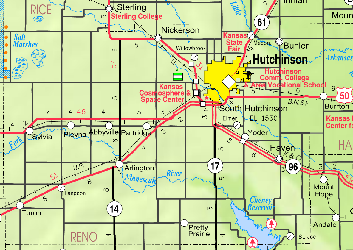
Cheney Reservoir is a reservoir on the North Fork Ninnescah River in Reno, Kingman, and Sedgwick counties of Kansas in the United States. Built and managed by the U.S. Bureau of Reclamation for local water supply, it is also used for flood control and recreation. Cheney State Park is located on its shore. History The U.S. Bureau of Reclamation, and later the Arkansas-Red-White Basin Interagency Committee established in 1950, conducted studies on the Ninnescah River basin as part of an investigation of the broader Arkansas River basin. The investigation resulted in a water-use and control plan including the construction of reservoirs and the use of available water as a regulated supply for the city of Wichita, Kansas. Wichita needed an additional water supply to supplement its existing supply wells. The water of the Arkansas River was of poor quality and too polluted to use, leaving the Ninnescah as the next closest potential source. The Bureau of Reclamation issued a report in 1 ... [...More Info...] [...Related Items...] OR: [Wikipedia] [Google] [Baidu] |
K-42 (Kansas Highway)
K-42 is a east–west state highway in the U.S. state of Kansas. Its western terminus is at U.S. Route 281 (US-281) in Sawyer and the eastern terminus is at Interstate 235 (I-235) in Wichita. Along the way K-42 intersects K-14, a major north–south highway, in Rago and K-2 east of Norwich. The highway is a two-lane highway for most of its length with the exception of the section within Wichita, which is a four-lane divided highway. K-42 was first designated as a state highway in 1926, and at that time extended from east of Coates east to US-81 west of Belle Plaine. By 1928, K-42 was realigned to turn north by Milton, then continue to slightly west of Clearwater where it turned northeast and ended in Wichita. Also by 1928, K-8 was realigned to the east to go through Sawyer instead of Coats, which truncated K-42's western terminus to Sawyer. By 1939, K-8 was renumbered as US-281. The entire length was paved by 1957. K-2 overlapped K-42 from east of Norwich to its ... [...More Info...] [...Related Items...] OR: [Wikipedia] [Google] [Baidu] |
Works Progress Administration
The Works Progress Administration (WPA; renamed in 1939 as the Work Projects Administration) was an American New Deal agency that employed millions of jobseekers (mostly men who were not formally educated) to carry out public works projects, including the construction of public buildings and roads. It was set up on May 6, 1935, by presidential order, as a key part of the Second New Deal. The WPA's first appropriation in 1935 was $4.9 billion (about $15 per person in the U.S., around 6.7 percent of the 1935 GDP). Headed by Harry Hopkins, the WPA supplied paid jobs to the unemployed during the Great Depression in the United States, while building up the public infrastructure of the US, such as parks, schools, and roads. Most of the jobs were in construction, building more than 620,000 miles (1,000,000 km) of streets and over 10,000 bridges, in addition to many airports and much housing. The largest single project of the WPA was the Tennessee Valley Authority. At its pea ... [...More Info...] [...Related Items...] OR: [Wikipedia] [Google] [Baidu] |
Sedgwick County, Kansas
Sedgwick County ( county code: SG) is located in the U.S. state of Kansas. As of the 2020 census, the population was 523,824, making it the second-most populous county in Kansas. Its county seat is Wichita, the most populous city in the state. History Early history For many millennia, the Great Plains of North America was inhabited by nomadic Native Americans. From the 16th century to 18th century, the Kingdom of France claimed ownership of large parts of North America. In 1762, after the French and Indian War, France secretly ceded New France to Spain, per the Treaty of Fontainebleau. In 1802, Spain returned most of the land to France. In 1803, most of the land for modern day Kansas was acquired by the United States from France as part of the 828,000 square mile Louisiana Purchase for 2.83 cents per acre. In 1848, after the Mexican–American War, the Treaty of Guadalupe Hidalgo with Spain brought into the United States all or part of land for ten future states, inclu ... [...More Info...] [...Related Items...] OR: [Wikipedia] [Google] [Baidu] |


