|
La Jana
La Jana is a Municipalities of Spain, municipality in the Comarques of the Valencian community, ''comarca'' of Baix Maestrat in the Valencian Community, Spain. The Cervera Mountains rise just east of the town extending southwards. It is an agricultural town located west of the Muntanyes de Cervera surrounded by cultivated plots, mainly almond, carob and olive trees, as well as some cereal fields. La Jana is part of the Taula del Sénia free association of municipalities. References External links Pàgina web del poble de la Jana* [https://web.archive.org/web/20100618120114/http://www.ive.es/pegv/start.jsp Institut Valencià d'Estadística] Portal de la Direcció General d'Administració Local de la Generalitat Municipalities in the Province of Castellón Baix Maestrat {{valencia-geo-stub ... [...More Info...] [...Related Items...] OR: [Wikipedia] [Google] [Baidu] |
Municipalities Of Spain
The municipality (, , , , , )In other languages of Spain: *Catalan language, Catalan/Valencian (), grammatical number, sing. . *Galician language, Galician () or (), grammatical number, sing. /. *Basque language, Basque (), grammatical number, sing. . *Asturian language, Asturian (), grammatical number, sing. . is one of the two fundamental territorial divisions in Spain, the other being the Provinces of Spain, provinces. Organisation Although provinces of Spain, provinces are groupings of municipality, municipalities, there is no implied hierarchy or primacy of one over the other. Instead the two entities are defined according to the authority or jurisdiction of each (). Some autonomous communities also group municipalities into entities known as ''comarcas of Spain, comarcas'' (districts) or ''mancomunidades'' (commonwealths). The governing body in most municipalities is called ''Ayuntamiento (Spain), ayuntamiento'' (municipal council or municipal corporation, corpora ... [...More Info...] [...Related Items...] OR: [Wikipedia] [Google] [Baidu] |
List Of Postal Codes In Spain
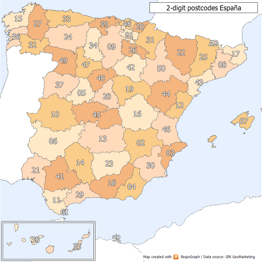
Spanish postal codes were introduced on 1 July 1984, when the introduced automated mail sorting. They consist of five numerical digits, where the first two digits, ranging 01 to 52, correspond either to one of the 50 provinces of Spain or to one of the two autonomous cities on the African coast. Two-digit prefixes The first two digits of a Spanish postal code identify the province or autonomous city it belongs to. The numbers were assigned to the 50 provinces of Spain ordered alphabetically at the time of implementation. The official names of some of the provinces have since changed, either to the regional language version of the name (e.g. from the Spanish to the Basque ) or to adopt the name of the autonomous community instead of the provincial capital (e.g. Santander to Cantabria). In these cases, the originally assigned code has been maintained, resulting in some exceptions to the alphabetical order. In addition, Ceuta and Melilla were originally included within the ... [...More Info...] [...Related Items...] OR: [Wikipedia] [Google] [Baidu] |
Taula Del Sénia
The Taula del Sénia () or Mancomunitat de la Taula del Sénia is a commonwealth or free association of municipalities made up of 22 towns, totalling up to 100,000 people, of some of the comarcas that make up the center of the historical region of Ilercavonia (present day southern Aragon and Catalonia, and northern Valencia), Spain. The origin of the name lies in the fact that all municipal terms involved are located within 15 km of the Sénia River, perceived as the centre of the region in its upper course. Goals The Taula del Sénia's main purpose is to alleviate the historical neglect of this greater comarca by managing its public municipal resources meaningfully. The organization of the municipalities in a mancomunidad may allow the region to achieve the necessary legal recognition for its administrative development. The main emphasis of the mancomunidad is the promotion of reindustrialization, as much industry fled the area during the last half of the 20th century and ... [...More Info...] [...Related Items...] OR: [Wikipedia] [Google] [Baidu] |
Olive
The olive, botanical name ''Olea europaea'' ("European olive"), is a species of Subtropics, subtropical evergreen tree in the Family (biology), family Oleaceae. Originating in Anatolia, Asia Minor, it is abundant throughout the Mediterranean Basin, with wild subspecies in Africa and western Asia; modern Cultivar, cultivars are traced primarily to the Near East, Aegean Sea, and Strait of Gibraltar. The olive is the type species for its genus, ''Olea'', and lends its name to the Oleaceae plant family, which includes species such as Syringa vulgaris, lilac, jasmine, forsythia, and Fraxinus, ash. The olive fruit is classed botanically as a drupe, similar to the cherry or peach. The term oil—now used to describe any Viscosity, viscous Hydrophobe, water-insoluble liquid—was virtually synonymous with olive oil, the Vegetable oil, liquid fat made from olives. The olive has deep historical, economic, and cultural significance in the Mediterranean; Georges Duhamel (author), George ... [...More Info...] [...Related Items...] OR: [Wikipedia] [Google] [Baidu] |
Carob
The carob ( ; ''Ceratonia siliqua'') is a flowering evergreen tree or shrub in the Caesalpinioideae sub-family of the legume family, Fabaceae. It is widely cultivated for its edible fruit, which takes the form of seed pods, and as an ornamental tree in gardens and landscapes. The carob tree is native to the Mediterranean region and the Middle East. Portugal is the largest producer of carob, followed by Italy and Morocco. In the Mediterranean Basin, extended to the southern Atlantic coast of Portugal (i.e., the Algarve region) and the Atlantic northwestern Moroccan coast, carob pods were often used as animal feed and in times of famine, as "the last source of umanfood in hard times". The ripe, dried and sometimes toasted pod is often ground into carob powder, which is used as a substitute for cocoa powder; this often occurred in the 1970s natural food movement. The powder and chips can be used as a chocolate alternative in most recipes. The plant's seeds are used to p ... [...More Info...] [...Related Items...] OR: [Wikipedia] [Google] [Baidu] |
Almond
The almond (''Prunus amygdalus'', Synonym (taxonomy)#Botany, syn. ''Prunus dulcis'') is a species of tree from the genus ''Prunus''. Along with the peach, it is classified in the subgenus ''Amygdalus'', distinguished from the other subgenera by corrugations on the shell (Fruit anatomy#Endocarp, endocarp) surrounding the seed. The fruit of the almond is a drupe, consisting of an outer hull and a Pyrena, hard shell with the seed, which is not a nut (fruit), true nut. ''Shelling'' almonds refers to removing the shell to reveal the seed. Almonds are sold shelled or unshelled. Blanching (cooking), Blanched almonds are shelled almonds that have been treated with hot water to soften the seedcoat, which is then removed to reveal the white embryo. Once almonds are cleaned and processed, they can be stored for around a year if kept refrigerated; at higher temperatures they will become rancidification, rancid more quickly. Almonds are used in many cuisines, often featuring prominently i ... [...More Info...] [...Related Items...] OR: [Wikipedia] [Google] [Baidu] |
Muntanyes De Cervera
The Cervera Mountains () is an long mountain range in the Baix Maestrat comarca, Valencian Community, Spain. In some ancient texts these mountains are known as Serra d'en Menor. Its highest point is Revoltons, . Other notable summits are Perdiguera, and Mola, . Location The Cervera Mountains rise north of the Cervera del Maestrat town, south of Traiguera and east of La Jana. They are located in the transitional zone between the Mediterranean and the continental climate. In the winter the weather is colder than in the coastal mountain ranges and the summits are often covered in snow for a few days after each snowstorm. The Our Lady of health shrine ''(Reial Santuari de Nostra Senyora de la Font de la Salut)'' which was first built in the 14th century is located on the eastern side of these mountains. The mountains are mostly covered with Mediterranean Maquis shrubland. There are some patches of pine forest. See also *Mountains of the Valencian Community *Maestrat/Maestrazgo ... [...More Info...] [...Related Items...] OR: [Wikipedia] [Google] [Baidu] |
Valencian Community
The Valencian Community is an Autonomous communities of Spain, autonomous community of Spain. It is the fourth most populous Spanish Autonomous communities of Spain, autonomous community after Andalusia, Catalonia and the Community of Madrid with more than five million inhabitants.Instituto Nacional de Estadística, Madrid, 2020. Its eponymous capital Valencia is the third largest city and metropolitan area in Spain. It is located along the Mediterranean Sea, Mediterranean coast on the east side of the Iberian Peninsula. It borders Catalonia to the north, Aragon and Castilla–La Mancha to the west, and Region of Murcia, Murcia to the south, and the Balearic Islands are to its east. The Valencian Community is divided into three Provinces of Spain, provinces: province of Castellón, Castellón, province of Valencia, Valencia and province of Alicante, Alicante. According to Valencia's Statute of Autonomy, the Valencian people are a ''nationalities and regions of Spain, "historical ... [...More Info...] [...Related Items...] OR: [Wikipedia] [Google] [Baidu] |
Comarques Of The Valencian Community
The ''Comarcas of Spain, comarques'' of the Valencian Community form an intermediate level of administrative subdivision between Municipalities of Spain, municipalities and Provinces of Spain, provinces. They are used as a basis for the provision of local services by the Generalitat Valenciana, but do not have any representative or executive bodies of their own. In 1987, the Generalitat Valenciana published an official proposal for Homologated Territorial Demarcations, ''Demarcacions Territorials Homologades'' (DTH), of three degrees, where the first degree largely coincides with the territorial concept of ''comarca''. Until now, the practice of these demarcations has been limited as a reference to the administrative decentralisation of the different services offered by the Generalitat, such as education, health, or agriculture. In fact, there is no legal provision for these DTHs to ultimately have the intended “territorial impact”, that is, comarca-level political or administ ... [...More Info...] [...Related Items...] OR: [Wikipedia] [Google] [Baidu] |
Telephone Numbers In Spain
The Spanish telephone numbering plan is the allocation of telephone numbers in Spain. It was previously regulated by the Comisión del Mercado de las Telecomunicaciones (CMT), but is now regulated by the Comisión Nacional de los Mercados y la Competencia (CNMC). History Before 1998, local telephone calls could be made using only the subscriber's number without the area code, while the trunk code '9' was omitted when calling from outside Spain, e.g.: xx xx xx (within the same province) 9xx xxx xxx (within Spain) +34 xx xxx xxx (outside Spain) International calls were made by dialling the international access code 07, waiting for a tone, and then dialling the country code. However, calls to Gibraltar were made using the prefix '956' for the province of Cádiz, followed by the digit '7', instead of the country code +350, e.g.: 7 xx xxx (from Cádiz) 956 7 xx xxx (from the rest of Spain) Similarly, calls to Andorra were made using the prefix '973' fo ... [...More Info...] [...Related Items...] OR: [Wikipedia] [Google] [Baidu] |


